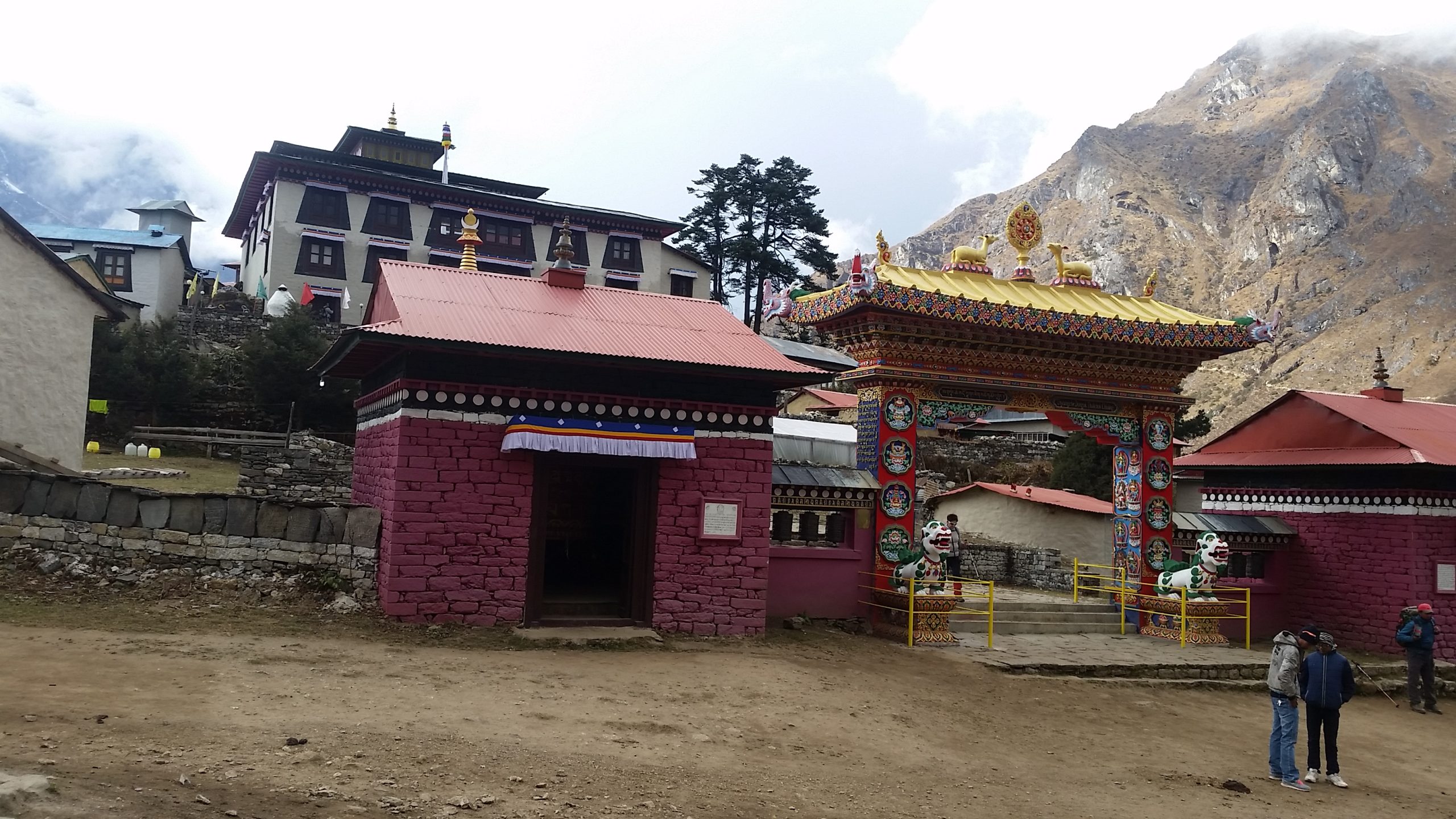
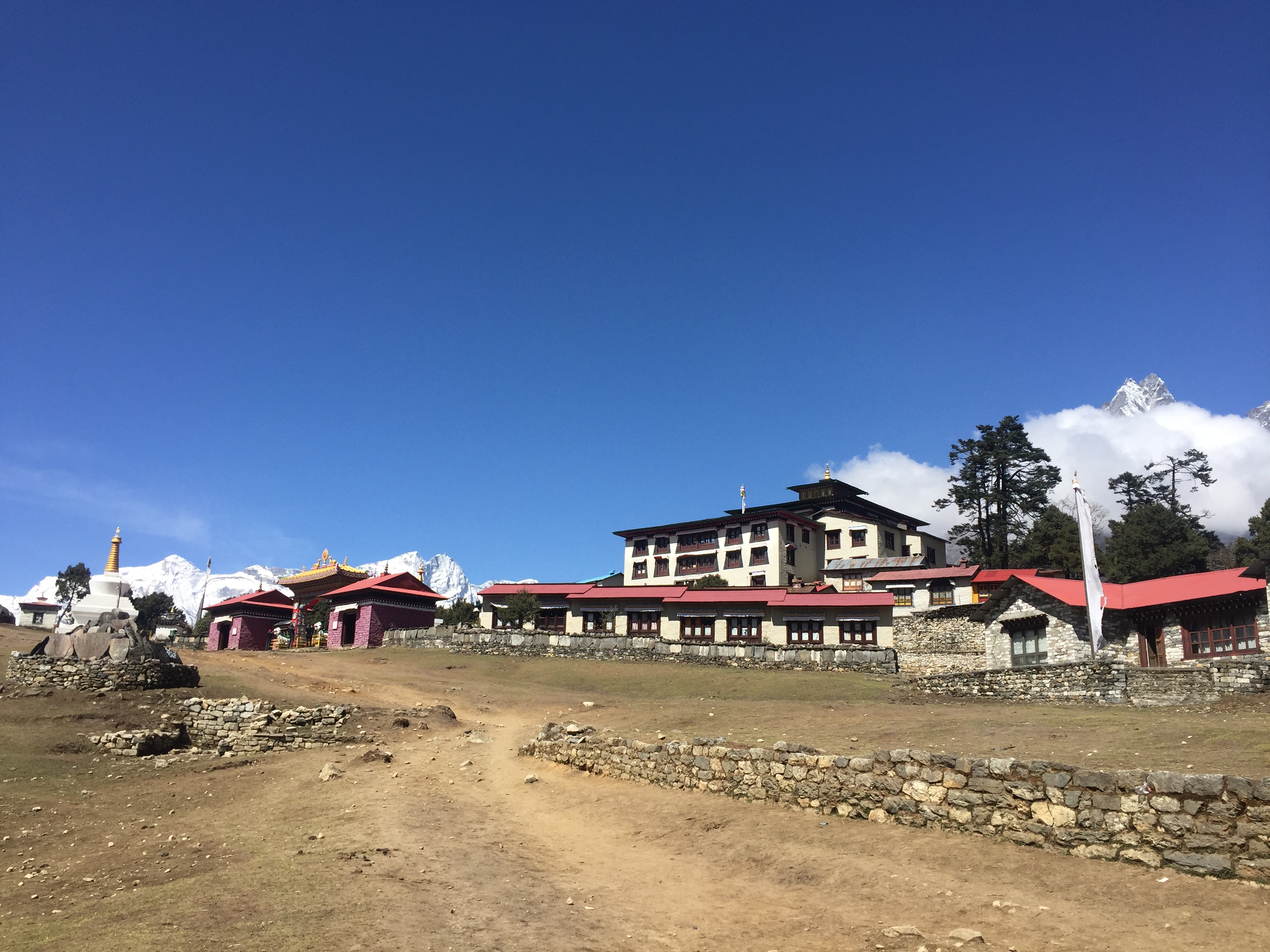
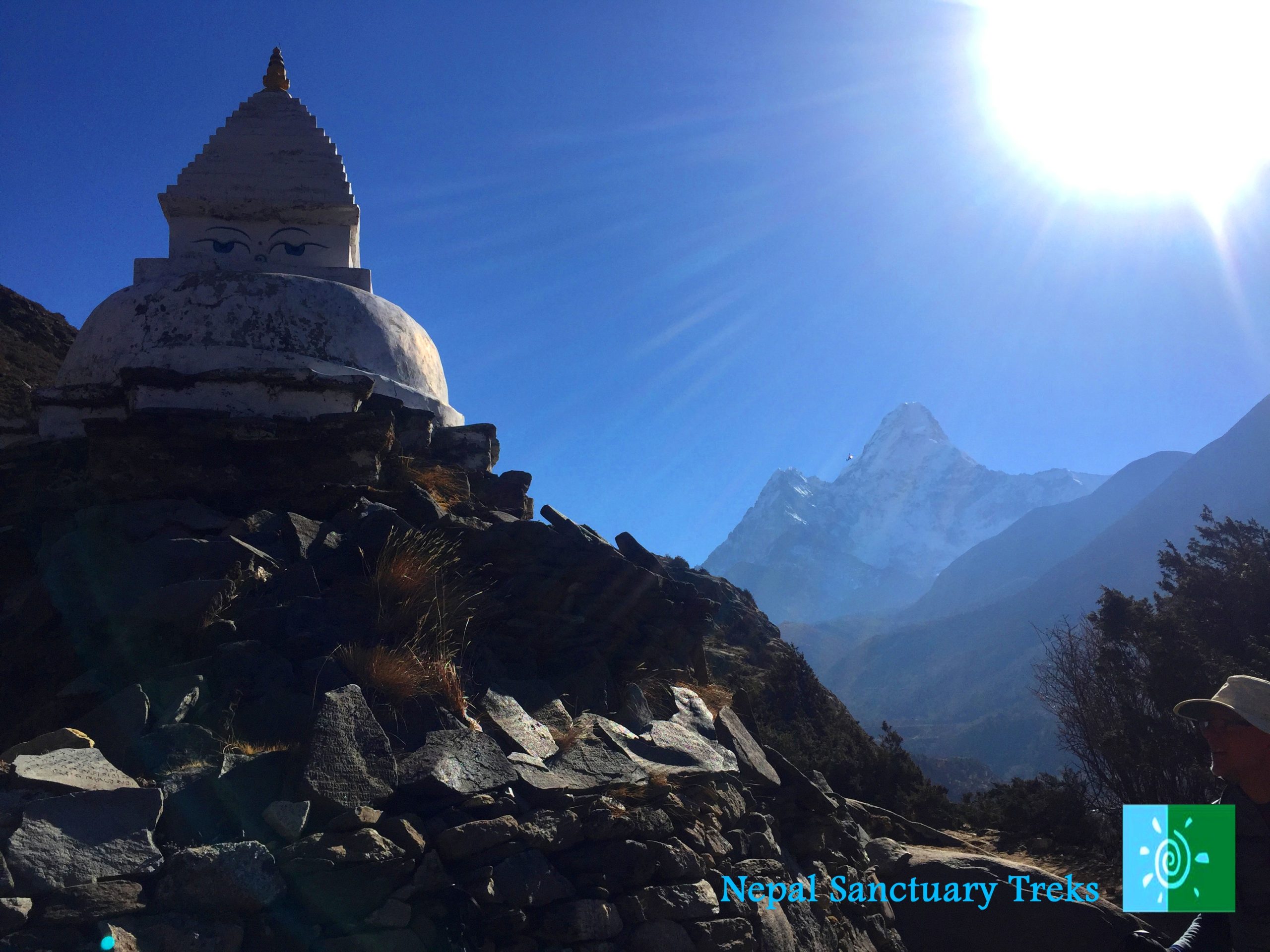
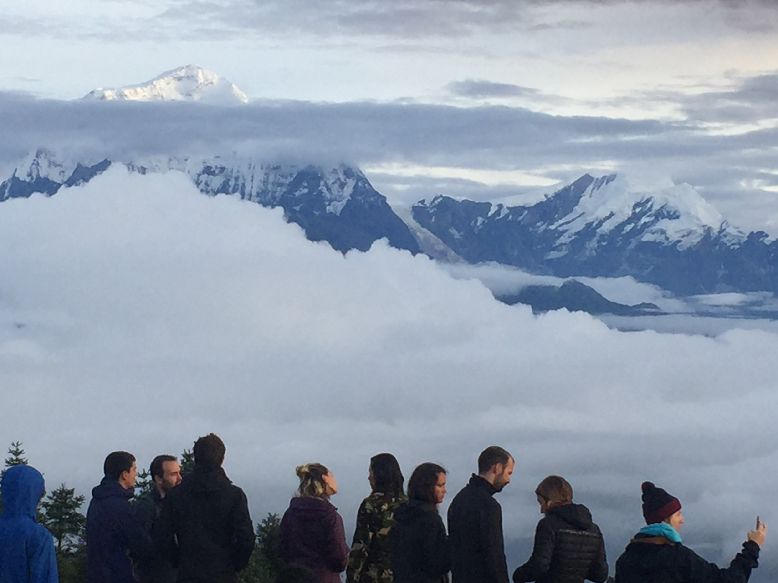
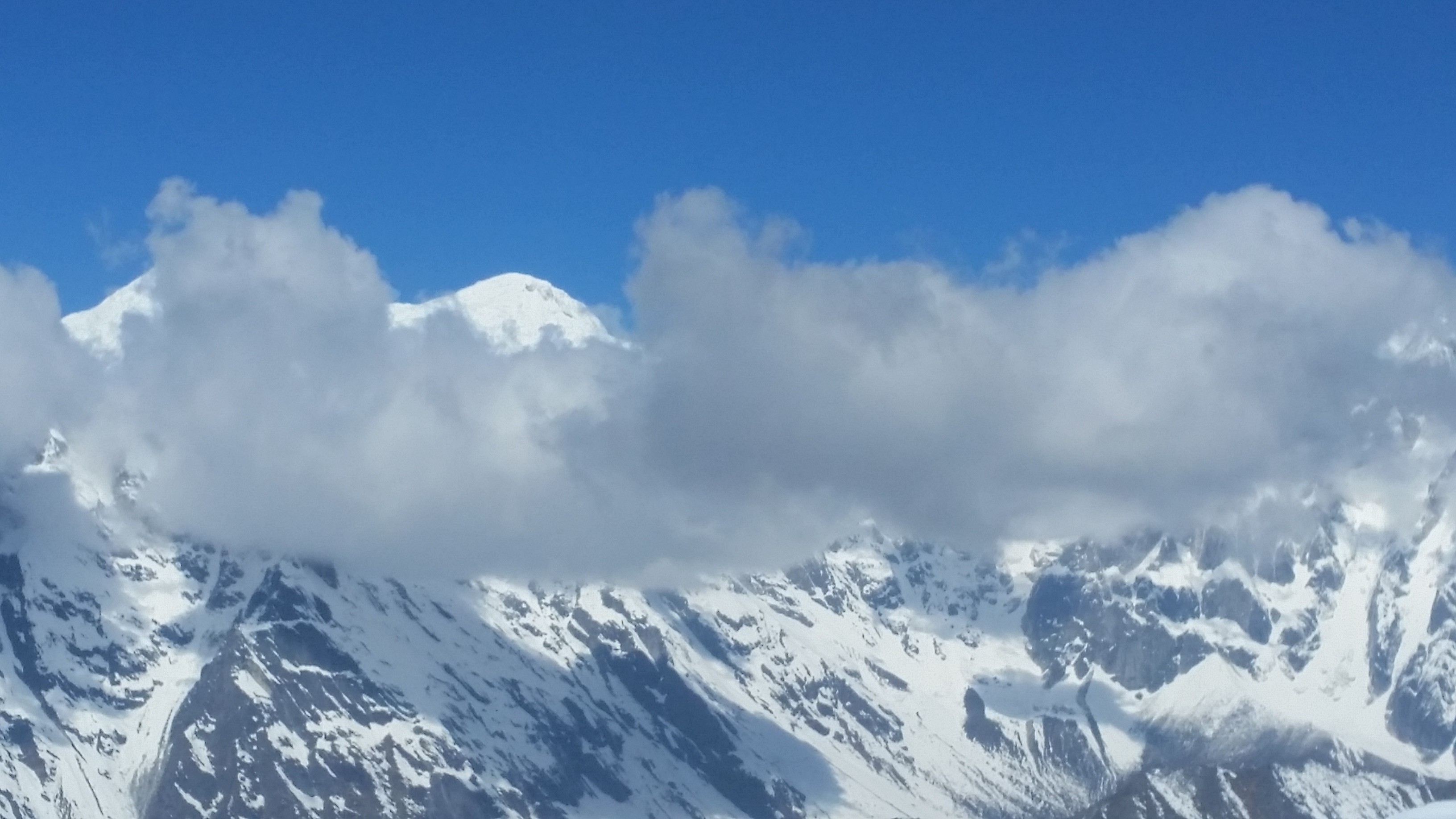
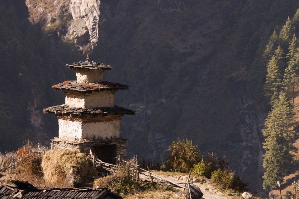
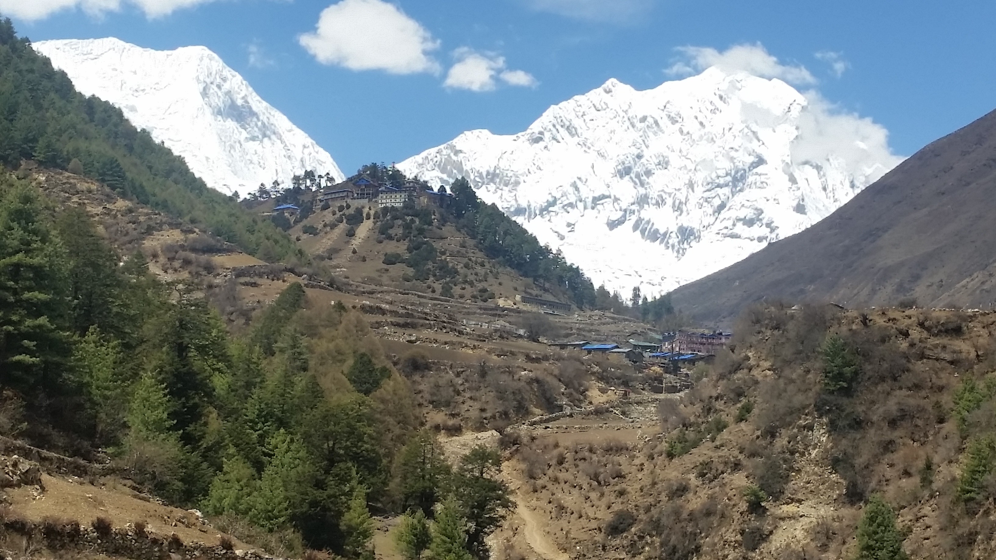
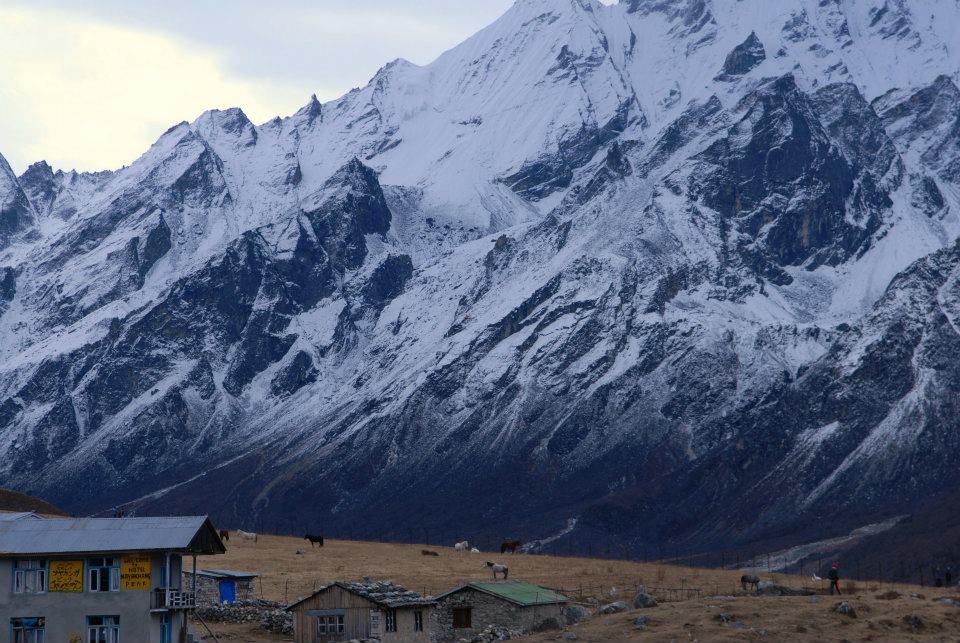
Tengboche Monastery is known as Thyangboche or Dawa Choling Gompa which is Tibetan Buddhist monastery. It is the largest monasteries in Everest region which located at 3,867 meters on the top of the hill and offers the magnificent views of mountain ranges including Mt. Everest, Mt. Nuptse. Mt. Lhoste, Ama Dablam, Tawache, and Thamserku. Tengboche Monastery lies in Tengboche and Sherpas inhabit it.
Tengboche Monastery History
This Monastery has a strong connection with its mother, Rongbuk Monastery in Tibet. It was built in 1916 by Lama Gulu. In 1934, the earthquake devasted the monastery and was rebuilt. Again the second time, it was destroyed by fire and restored in 1989. During the earthquake in 2015, it was partially damaged, but it was recovered later.
Tengboche Monastery came under the influence of Buddhism about 350 years ago in Khumbu Valley. Lama Gulu who was known as Chatang Chotar found the Tengboche monastery in Tengboche village and established at its present location in 1916. The monastery is the first celibate monastery under the Nyingmapa lineage of the Vajrayana Buddhism.
Vajrayana Buddhism does not distinguish between male and female while teaching Buddhism. Nuns studied and practiced Buddhism during the years of establishing the Tengboche monastery. Then some years later, the nunnery was established at Devoche for sisters. This small nunnery, administrated by Tengboche, named Debuche Nunnery (Ani).
The Tengboche monastery was destroyed in 1934 due to the earthquake. Lama Gulu, who built the monastery was already dead so his successor, Umze Gelden rebuilt it with strong support from Ngawang Tenzin Norbu. The exclusive murals were painted by the well-known artist Kappa Kalden.
Moreover, on 9 January 1989, the monastery was again rebuilt; the fire destroyed all the precious old scriptures, murals, statues and wood carvings caused by an electrical short circuit.
Tengboche Monastery is the last stop of the “Sacred Sites Trail Projects” of Sagarmatha National Park which attracts vast numbers of visitors. Tengboche Monastery is surrounded by ancient mani stones and prayers flag. The flags are in five colors denoting five Buddhist elements: earth, wind, fire, water, and consciousness. The monastery is a home for 60 monks. Every year many visitors and trekker visit the monastery to get blessed by Lama. It is said that very few numbers of boys join as monks as they prefer to work in mountaineering or trekking activities.
Tengboche is a beautiful place, and it is in midway on the route to Everest
Many trekkers or visitors visit the monastery to lights the butter candles and pray for their good health and safe trekking to mountains. There are many lodges; small houses are available for trekkers. It provides the finest view of snowcapped Himalayas range. During the spring season, the slopes hill covered by variety rhododendron, pines forest and azaleas even make this place more beautiful.
Tengboche is inhabited by the Sherpas who emigrated from the Tibet around six hundred years ago. Sherpas follow the Buddhism and visit the monastery each day.
The Climate of Tengboche Monastery
The climate of Tengboche is varied from temperature to artic which depends on the altitude. The low height is also results of less snowfall in this area. July is the warmest month of the year with an average temperature of 10.1 degree Celsius. In January, the temperature falls into – 2.2-degree Celsius which is the lowest temperature of the whole year.
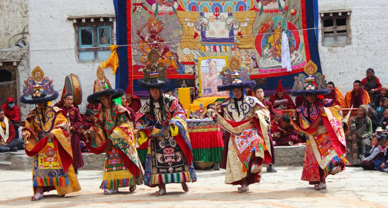
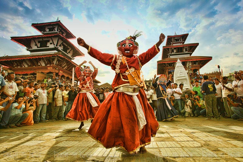
Mani Rimdu Festival
Mani Rimdu festival is the most important festival of Sherpa community in Tengboche Monastery. The festival falls in autumn season between mid-October and mid-November month. According to the Tibetan calendar, it is held on the tenth Lunar month.
It lasts for the nineteenth day of the month. Thus, it officially celebrated three days. The festival is celebrated on the full-moon day in autumn and starts after Kojragat Purnima.
The meaning of Mani Rimdu is that Mani means ‘part of the chant of Chenrezig and Rimdu means ‘small red pills’ . During the festival, rep pills are distributed to all those who have attended the festival. Mani Rimdu preparation is divided into six steps; construction of the sand mandala, the empowerment (Wong), the dances (Chham), Ser-kyem, the fire puja (Jinsak) and Chhingpa.
The Mandala made with colored sand. The Mani Rimdu Festival begins with a continuous puja (24 hours) are performed by the monks dressed up in a traditional way and masks to bless the Mandal, the Mani Rilwu (scared pills), the Tshereel (pills for long life) and the Torma. Monks worship in front of the Mandala for ten days.
The festival includes 16 dances. The dances symbolize the victory of Buddhist over the ancient ‘Bon’ religion. They believed that the dance performed during the Mani Rimdu is very scared and is not for the ordinary entertainment.
On the last day when all the devotees leave, the monks perform a fire rite to remove all the negativity from the world. At the end of the festival, the resident of Tengboche Rinpoche of the monastery blesses the public after mask dances performed by the monks. Apart from Tengboche, Mani Rimdu is also celebrated in the monasteries of Chiwang and Thame.
The trek to Tengboche Monastery
To reach Tengboche Monastery, take the flight from the Kathmandu airport to Lukla which takes 25-30 minutes. You can reach Phadking after 4-5 hours of trekking from Lukla. Phadking is a small village which lies in the Dudh Koshi river just north of Lukla.
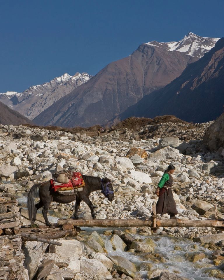
Then walk towards steep inclines uphill to Namche Bazaar. Along the way, there are pretty small huts, crossing the suspension bridge, small villages, and passes through the rhododendron forest.
About 4-5 hours of walk you will reach Namche Bazaar. Namche Bazaar is a small-town market with numerous little stores with local selling various items from souvenirs to trekking gears to groceries. There are also many hotels, pud, restaurants, and lodges.
The trail to Tengboche monastery from Namche Bazaar is descending to the hills along with the suspension bridges and fantastic views of the Himalayas range. The path to Tengboche monastery is gradually steep to uphill. After 5-6 hours of walk finally, you can reach the destination, Tengboche Monastery.
Things to do in Tengboche Monastery
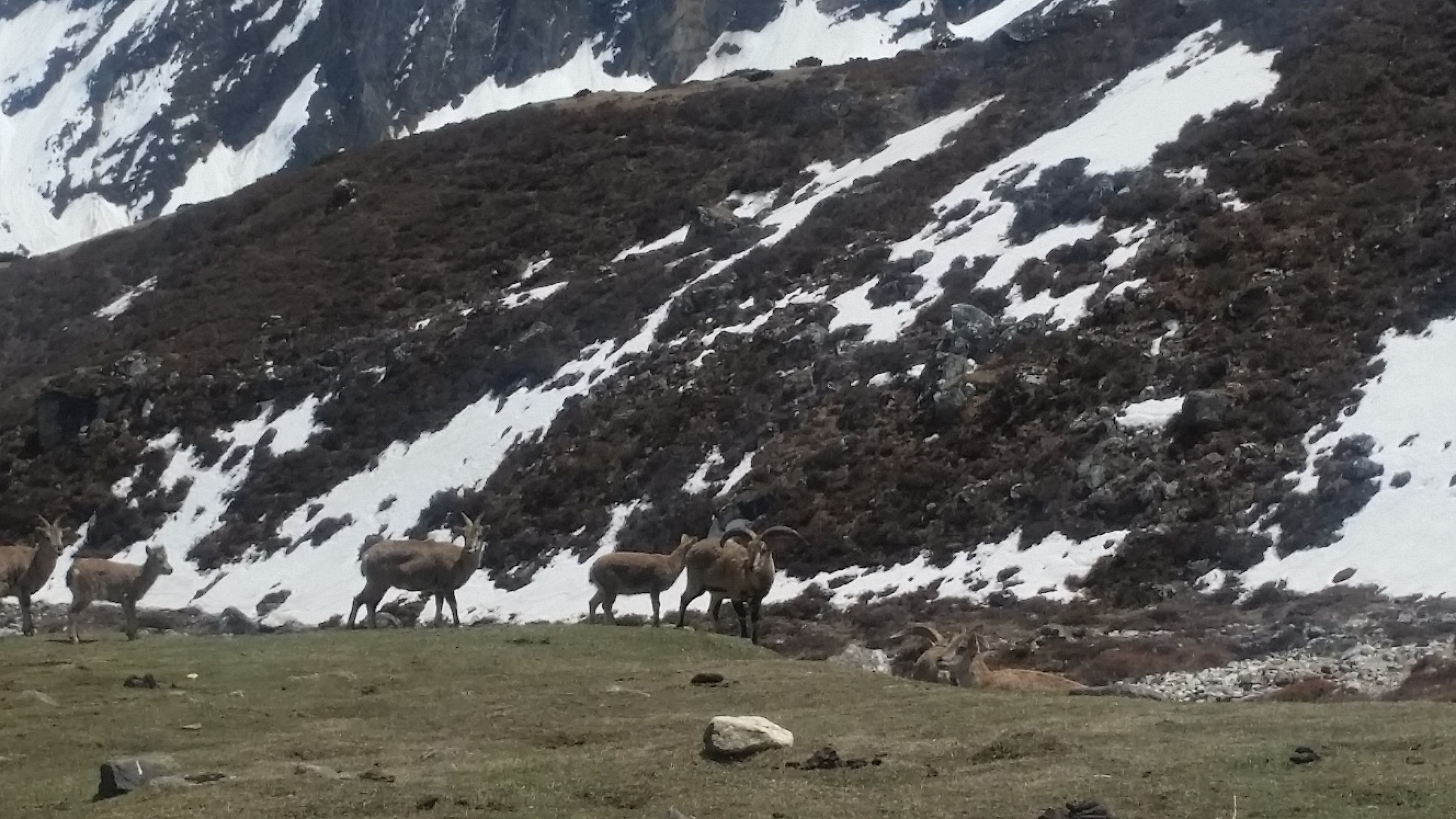
The forest and mountain ranges surround Tengboche Monastery. You can see Thar and yak as well as endangered musk deer along the way. Also, there are many medicinal plants and herbs in this area.
Tengboche Monastery is surrounded by the prayers flag and small stupas. Also, the lodges and hotels are available to stay. You can see the monks practicing the Buddhism and the beautiful paintings on the walls.
Great Himalaya Trail is not only about trekking and enjoying the beauty of Himalayas but also helping people who live there. The trail passes through many lush green forests, valleys, incredible landscapes, upside and downside hills terrains in the Himalaya region.
The trail is always changing, so it is impossible to fix a route for trekking and to expect it not to change. This is because of landslides affect the trails, ice and snow conditions and sometimes bridges are washed away. Therefore before embarking on any mountain trek, you should study the route and condition of the trail properly.
Great Himalaya Trail is for those who love adventure, Nepal’s Great Himalaya Trail presents once in a lifetime opportunity. Great Himalaya Trail is one of the longest and highest trekking trails in the world.
It takes you through Himalayas foothills, rocks, and ice, most of the times through the lesser-known routes exploring the something new in Nepal.
From the east to west of Nepal, the Great Himalaya Trail starts from eastern’s border Kanchenjunga to Humla on its western border with Tibet.
Here 9 incredible facts about the Great Himalaya Trail:
Longest and Highest Trail
GHT is called the holy grail of trails. The Great Himalaya Trail is longest, highest and the most challenging alpine path in the world, running through Bhutan, Tibet, India, Myanmar, Pakistan, and Nepal.
First Trip of GHT
Great Himalaya Trail walked first time in 2008 and 2009 by a team of Robin Boustead in Nepal after a lot of research, documentation, mapping. The first trip started from February to August 2011 and was completed successfully in 157 days.
Length of Great Himalaya Trail
Great Himalaya Trail, the 1,700 kilometers long trekking trail from the east end to the west end of Nepal. The trail stretch roughly more than 4,500 kilometers (2,800 mi) length of Great Himalaya Trail running through 6 countries.
Time to trek Great Himalaya Trail
GHT is divided into ten connecting treks. The Nepal section of GHT takes 60 to 160 days of walking. The treks can be done individually or in the group. Despite that Great Himalaya Trail features numerous treks of long duration and difficulty during the trail. Some of the trails require camping equipment and some other can done in teahouses or lodges.
Routes of Great Himalaya Trail
Trekkers can choose between two routes: The GHT’s High route stretches over a distance of about 1,700 meters km and passes through several remote villages on the where people still follow their traditional life and untouched by the modernity, the high altitude mountain landscapes which offer the adventurous trekking, alpine valleys. It is the extreme route of the Himalaya region, crosses above 3,000 to 5,000 meters and takes up to 150 days.
The low route is considered easy and is mainly popular as cultural trek. In both cases, you can either start from east part or the west part of Nepal.
Many areas of GHT especially high route cross through the restricted areas where you need to have permits.
Low Route GHT
The GHT low route is shorter than the high route. The low route stretches the distance of about 1,500 km which will take about 100 days to complete the trek. The low route crosses through Nepal’s mid-hills with an average altitude of 2,000 meters (6,600 ft). GHT low route treks walking through the beautiful jungle, green paddy fields, fertile agricultural land and local settlements of different cultures.
Easy but not so Easy
GHT is considered comparatively easy but it is not a direct route. No technical climbing is required. Trekking for more than 150 days is quite difficult that climbing a single mountain. There are numerous mountains with high elevation.
GHT connects 6 countries
GHT crosses through Myanmar, Tibet, Bhutan, Nepal, India, and Pakistan. The total length of GHT is roughly 4500 km. It would take you 150 plus days to complete the Nepal part of GHT.
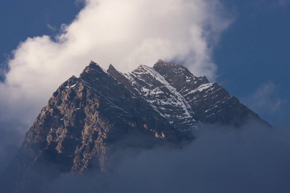
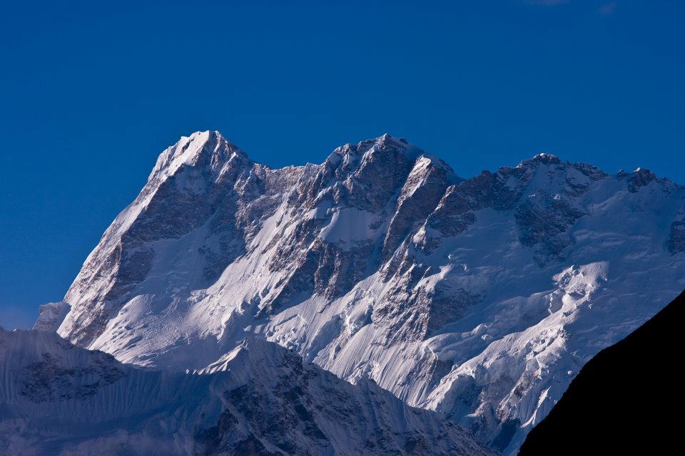
Island Peak is a beautiful mountain in the Everest region where most of the trekkers experience incredible climbing and mountaineering; also, enjoy the magnificent views of panoramic Himalayas.
Island Peak is also known as Imja Tse mountain tower at 6,189 meters above from the sea level which situated in Sagarmatha National Park of the Himalayas of eastern Nepal. The peak is a part of Mt. Lhoste (8,516 m), Mt. Nuptse (7,861 m), Mt. Buruntse (6,770 m ), Amphu Lapcha (5,245 m), and Ama Dablam (6,856 m).
Island Peak named by Eric Shipton in 1952 (some sources says 1951) when the view from Dingboche seen as an ice island. In 1953, a team of British Expedition climbed Island Peak as a training exercise which included Alf Gregory, Charles Wylie, Charles Evans and Tenzing Norgay with seven Sherpas. Later the team went on to summit Mount Everest.
Island Peak Trekking permit
A trekking permit is required before you start trekking in Island Peak. You would need Island peak climbing permit along with Sagarmatha National Park, TIMS (Trekking Information Management System) card.
Island Peak permit fee for a group of up to 4 climbers is USD 350 with an additional charge of USD 40 per person. Also, a deposit of USD 250 is required to ensure compliance with garbage regulations.
Best time to visit
Generally, Island Peak can be attempted throughout the year except during the monsoon and the winter. During Monsoon (June to August) rainfall makes it challenging to climb and in winter due to extreme cold.
During Spring (March to June) and Autumn (September to November) seasons are the best time to visit Island peak. The weather tends to be clean during autumn and spring season. This is the time when most trekkers want to trek in Island Peak and the Peak is crowded during this time.
Island Peak Trekking
Trekking to Island peak and returning from there is the same route. The total time to climb the Island Peak depends upon trekkers. Usually, it will not take more than 6-8 hours excluding lunch. You should start early in the morning so that you can reach the destination on time and spend enough time to enjoy the fantastic view of the place.
The trek starts from the Kathmandu airport to Lukla flight with the greats views all the way along with the hair-raising landing at the Lukla’s short runway. Flight from Kathmandu to Lukla usually takes 25-30 minutes.
The treks begin from Lukla heading towards Phakding. After 4-5 hours of walk-on the gradual downhill trail, you reach a small village of Phakding which lies on the bank of the beautiful Dudh Koshi river.
Phakding is one of the UNESCO World Heritage Site since 1979.
Then the trail starts from Phakding to Namche Bazaar which takes around 5-6 hours to arrive there. Crossing through several suspension bridges, uphill and downhill and also there are small teahouses are available on the trail.
Namche Bazaar lies in the Khumbu region. Namche Bazaar is a small-town village. There are many good hotels, lodges, pub, cyber cafe, restaurant and many shops. It is one of the most popular stops along the everest route. It is also called Sherpa villages and is famous for the Sherpa’s Cuisine. Every Saturday morning, Namche Bazaar is lighted up with the weekly market.
The next day is acclimatization day where you can rest whole day or visit the museum.
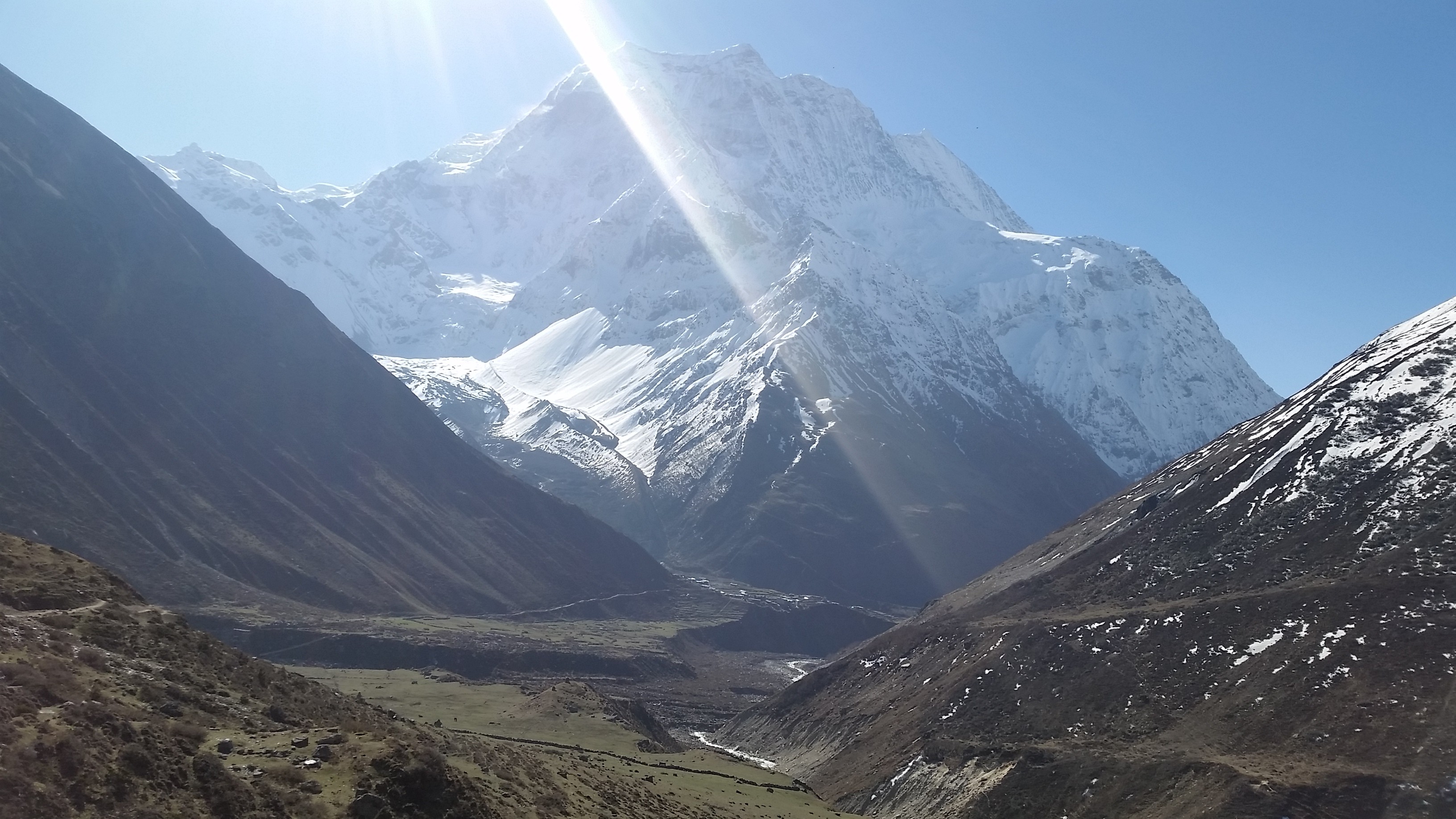
After that, the trail continues to Tengboche from Namche takes about 5-6 hours of walk. The walk to Tengboche is an uphill trail. Arriving at the Tengboche, you will discover the Buddhist Monastery and Tengboche Monastery which is the biggest gompas of the Khumbu region. Also, the fantastic panoramic views of Himalayas ranges.
Then walk ahead from Tengboche to Dingboche, the elevation at 4410 m. Passing through the rhododendron forest, small villages, bridge with roaring Imja Khola and a gradual climb takes to the lower village Pangboche with beautiful views across to Ama Dablam. Trek to Dingboche takes around 6-7 hours to reach. Trek to Dingboche takes 5-6 hours to arrive there. Dingboche is larger than Tengboche.
Dingboche to Chhukung walk takes 2-3 hours to reach the height of 4730 m. It’s a short walking. On the trail to Chhukung, you can see the Island peak. At Chhukung Valley the prayers flag surrounded the Buddhist stupa.
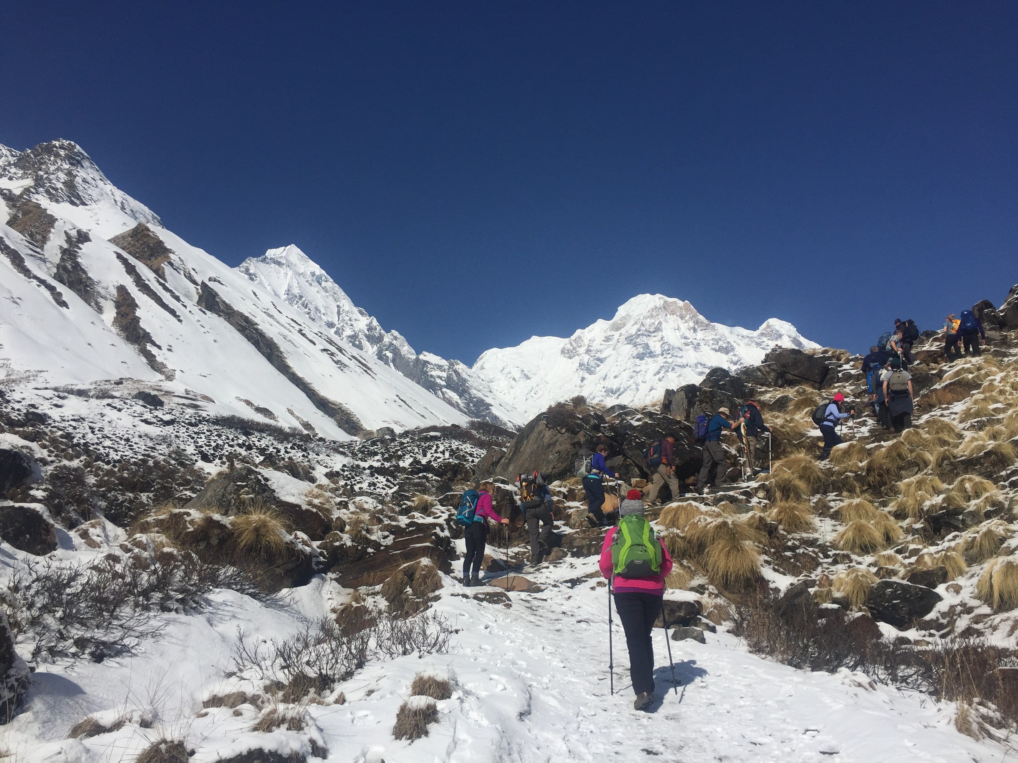
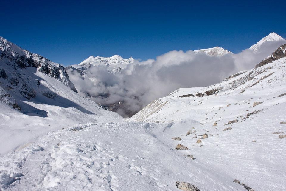
The walk to the Island Base Camp takes 3-4 hours, which is a steep climb and walk through the river basin, up and down rough terrains with beautiful scenic views along the glacier moraine. Take rest on that day and prepared for next day to the summit.
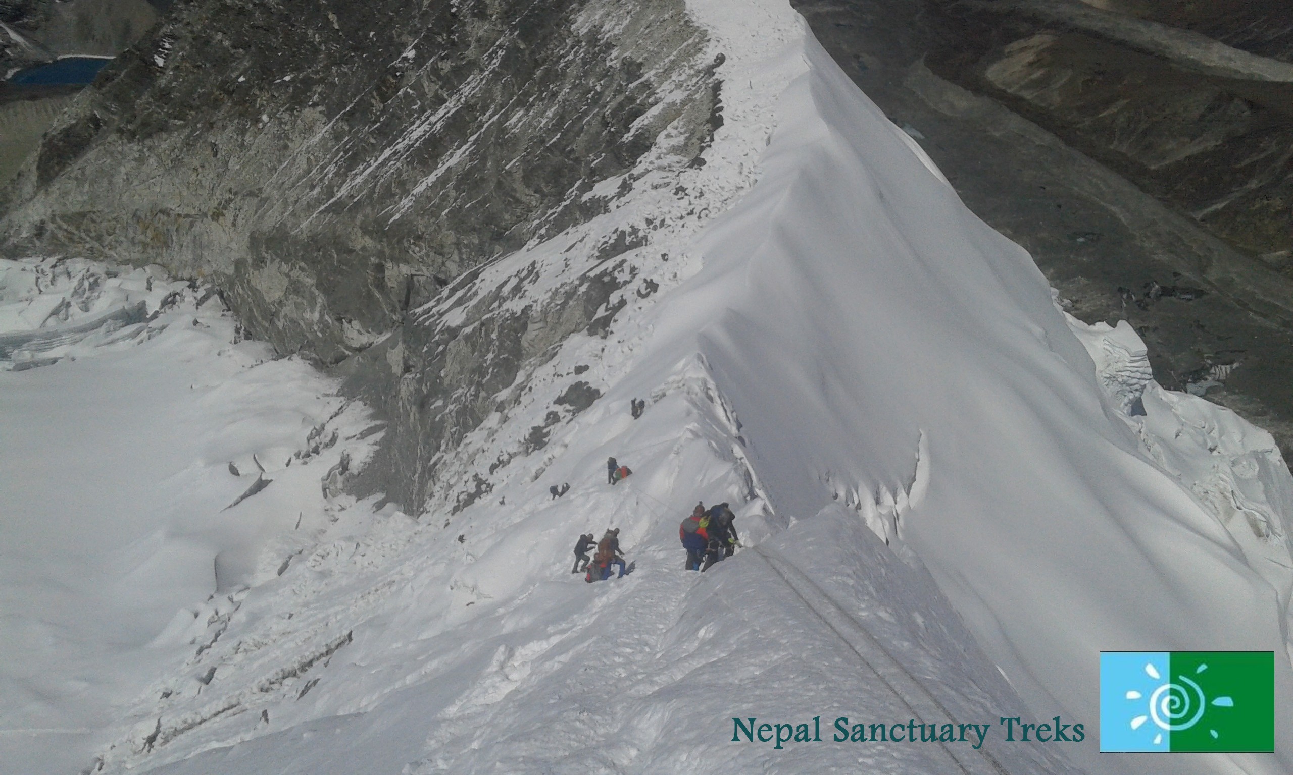
Finally, the big day comes to climb the Island Peak which is also called Imja Tse. The trail begins through the sandy, walk continuously through some grassy path. Then as you trail higher to Island peak, the narrow path turned into a snowy ridgeline and then lead to the summit glacier. The glacier is the challenging part of the climb as it has several crevasses. With the help of a rope, walk up to Island peak. After the strength effort finally, you will see the splendid view from the summit and spend some quality time and take a picture before going down to the base camp.
Then head back to Island Base Camp to Chhukung to Pangboche which takes about 6-7 hours. Leaving behind the Dingboche village descend towards Pangboche.
Again walk descending to Namche Bazaar for 5-6 hours. Then Namche Bazaar to Lukla is a long walk about 8-9 hours.
Things that you need for Island Peak
You should pack your luggage according to the number of days you will be trekking. The items that you need for climbing are; climbing helmet, a pair of boots, crampons, climbing harness, ascending and descending device, ice ax, carabiners, gloves, rope. Also, carry the warm clothes, sunglasses, water bottles, etc.
Island Peak Trekking Difficulty
Trekking to the Island peak is not technically challenging. Island Peak is the most famous trek and suitable for both beginners and experienced trekkers but always hire a professional guide with you which will be safe during the trek.
Physical Fitness
Trekking to the Himalaya region requires both Physical and mental fitness. If you don’t have climbing experience, then you should ask the company to organize a special climbing training and also a guide.
The person who has cardiovascular disease, high blood pressure, low blood pressure won’t be approved for the trekking. The health condition matters the most while going for the trek.
Nepal is a small country with dramatic landscapes, lush green forest, beautiful Himalayas, and rich in cultural heritage. Nepal is a paradise for those who love to travel. Nepal is one of the world’s great travel destination countries which offers heaven beauty. The citizens of Nepal are very kind and frank to foreigners.
In every country, there are some cultures and rules different from other parts of the world. It is always good to have knowledge of such norms before entering the country. Some Do’s or Don’t while hiking in Nepal are listed below.
Here is how to make friends of Nepali people and not foes on your trip.
Greeting
‘Namaste’ is the way to greet everyone in Nepal. Joined two palms together with bowing your heads, at the same time. This is how to show respect and gratitude by using your both hands rather than a handshake when taking or giving things or even money.
Leather Products
Always take off your shoes when you enter the temple or holy places. Don’t take the leather products such as a bag, belt, jacket, etc. inside any temples in Nepal.
You can buy different types of leather products all over Nepal, but using and carrying them into holy shrines is considered a sin. Most temples have got a locker system where you can place your belongings safely.
Get receipts
Do get a receipt of authenticity when buying an antique or something else otherwise, you will not be allowed to take things out of the country. Don’t purchase the items which are made of animals’ skin or fur. The goods aren’t allowed to take out of the state, and also you might have to face some problems.
There are plenty of cases when idols and antiques are stolen from temples, so to not get into any problem, get receipt for all the products you buy.
Take Photographs with Consent
Don’t take the photographs of locals, holy shrines, and temples unless you have given their consent. Taking pictures of museums, palaces, security office might be restricted. Ask a local personnel before taking pictures of such places.
There are many temples where no one is allowed to take photographs. In that case, respect their culture and do not take photographs.
Beef
Don’t ever talk or eat beef in front of Hindus and Buddhist because beef is strictly prohibited in both Buddhist and Hindu religions. Hindus and Buddhist worship the cow in Nepal.
Beef is not easily available in Nepal.
In temples
Do walk around the temple and stupas in clockwise so there will always be the walls on your right side. Don’t walk around in anti-clockwise.
Walking around the temples anti-clockwise is considered disrespectful. While worshiping the god inside the temple try not to disturb other people.
Changing Currency
Before traveling to Nepal, do change the Nepalese currency. There are plenty of money exchange stalls in the airport as well as in the market area of Kathmandu. You can also ask your Tour Operator to do it for you. You can not use foreign currency to buy things, so better get Nepalese Currency as soon as you land at the airport.
Also, prior to leaving Nepal exchange all the Nepalese currency because you are not allowed to take the Nepalese money with you.
Dresses
Nepal is quite a conservative country especially in rural areas and holds true in religious. However, in some places like Kathmandu and Pokhara you can see peoples wearing the western clothes.
Do well dress which cover most body part like long skirts, loose trousers, full sleeve clothes, etc. Don’t wear proactive garments which shows openness of sexual disrespect.
Hiring a Cab
When you hire a cab, you do need to ask the driver to use meter for your travel. Otherwise, most drivers will want to bargain with you but insist using a meter. Also, note that the charge of the cab during night time is double after 10 pm.
You should ask at least two or more cab drivers before you hire one. If you have to reach your hotel from the Tribhuwan International Airport, there is a fixed fare to different places of Kathmandu.
Drugs, Weed, and Alcohol
Don’t buy or use drugs here. It is illegal in Nepal. Nepal Government is strict with the abuse of drugs.
Buying and selling weed is also illegal in Nepal. In addition, smoking in public places is also prohibited. A fine of 100 rupees or more is charged if found smoking in public places.
Give Money to Beggars
Begging in Nepal is not as common as in India but still, you will see people and children begging in some places like temples and even in market areas in a different part of Nepal. Do not encourage them by giving money even a cute child ask for it. Instead, you can give charity to schools and other organizations that look after those street children if you really want to help.
Nepal Sanctuary Treks has 30 years of experience in Trekking Industry of Nepal. Send us a message with any query you have about Nepal Now.
Take an international charger with you. Most of the devices do not match this configuration so you might have to carry along with you.
You might want to carry a rechargeable battery for your camera and a power bank for your electronic devices like a phone. Powers cuts are still frequent and in hilly and rural areas you might not get electricity to charge your devices. So having a good quality power bank will definitely help you.
Carry a Torch or Flashlight
Carry a torch or flashlight with you all the times. Sometimes you might face the power cut during the night. This will make sure that you don,t have to stay or walk in the dark. The power backups are available in most decent hotels.
Be Eco-Friendly
Nepal suffers from the issues of plastic uses such as plastic water bottles, bags, etc. There is no proper waste disposal management of the plastics.
The problem mainly occurs in Himalayan regions. Himalayan region is a remote area of Nepal. Tourist going there with mineral water bottles which increases the plastic waste, so Tourists or foreigners can help them by using their own bottles and reusable bags during the trek.
Don’t Drink Tap Water
Don’t drink tap water directly whether you are staying the deluxe hotels or in a small tea house. However, most places provide you safe drinking water. Always carry a water bottle with you in case you are outside.
For your own safety, you can carry water purification tablets or drops to treat drinking water. You may also want to carry a SteriPEN water Purifier. SteriPEN UV water purifiers use ultraviolet light to destroy bacteria and protozoan cysts without the effort required by many pumps and filters.
Mostly Nepalese people are very kind, down to earth and cheerful. Nepal is also a diverse country with a different kind of religion, culture, and lifestyle. Try to respect their culture and not to offend them. You can make great friends when you start enjoying their culture.
What to do Before landing in Nepal
You can contact Nepal Sanctuary Treks and clear all doubts about Nepal before actually coming to Nepal. Our Experts will help you with all the queries.
CAS is a mandatory core component of the IB Diploma Programme. A programme designed to help students or who are working as volunteer develop their creativity, well-being, and commitment to serve the communities in which they live and beyond.
And Manaslu is a perfect destination for students to learn about society and nature. Manaslu is a challenging and excellent experience for students which helps them to engender teamwork. The sense of achievement after experiencing the remote villages and nature of Manaslu is a lifetime gift.
The most special thing about Manaslu and Nepal is its people. The humbleness and giving nature of people is the wow factor that will help you to make a positive impact in your life. The culture of considering the guest as the god, people of Nepal will try their best to feel you secure and fulfilled in their homeland. You can make good friends out of Nepali People.
Here we have tried to make a list of cas project ideas that you can consider doing in Manaslu.
CREATIVITY
Creativity is a way of living life that embraces originality and makes unique connections between seemingly disparate ideas. Creativity is about living life as a journey into seeing and communicating the extra-ordinariness of the simplest, most every day acts.
So in IB diploma program, it is considered in one of the most important factors for student’s all-round development. Here are some CAS project ideas that you can do in Nepal to enhance your creativity.
1. Create a Short movie
Although creating movies is a highly technical discipline, you can learn to create short movies a lot quicker. And when you are in the Himalayas, the job gets easier as you get to capture magnificent beauty of snow-capped mountains and rare Himalayan animals. The culture and living style of people there will add additional charm to your movie.
Okay, let’s say you want to create a movie, so what Manaslu has to offer? The Manaslu region has precarious bridges and stunning mountain scenery including Hindu and Buddhist culture, protected wildlife, rhododendrons and wildflowers, raging rivers.
You will need a script, a storyboard, a good camera and a video editing software. Having a GoPro and a drone will help you to capture the most beautiful images. You can create short movies on “People of Manaslu”, “The Magnificient Himalayas”, “Unknown Species in Manaslu”, Exploring the Unexplored” etc. You can get more ideas and tips on creating movies at this link.
If you have any queries regarding short movie creation in Nepal for your CAS project you can email our expert in this regard.
2. Write a story about a local Women
Women in hilly areas of Nepal have to go through a lot of hardships. Their stories can be a great inspiration for people like us living in the comfort of city areas. Women in Nepal and especially hilly areas of Nepal are facing different problems like gender inequality, girl trafficking, domestic violence, physical relation assault and many more. Girls are considered as “Paraya Dhan” meaning Others property in Nepal which results in no education and special care of girls in these areas.
So, you as a student can write their stories, interview them, and let the world know about the difficulties they are facing. Maybe you can advocate for them, which would eventually create a positive change in the society and the world would become a little happier place to live in.
Nepal Sanctuary Treks has helped students all over the world to create outstanding stories about Nepal. You can talk to our Expert Tulsi Gyawali if you want to do CAS in Nepal.
3. Write a song or a poem
There is no other place more peaceful and creativity uplifting than Manaslu, Nepal. You will get to see sky touching Himalayas, beautiful flora fauna and landscapes. These are the place where you can sit down and write a poem or songs. When writing environmental poems today, contemporary poets tend to write about nature more broadly than their predecessors, focusing more on the negative effects of human activity on the planet.
Here is a poem written by Anna Voelker that can inspire you
I want to tell you about the sunflower I found on the sidewalk yesterday. It is wilting and curled and gorgeous and knows it.
I want to age like that, never forgetting my own beauty, never forgetting how to say bloom.
By Anna Voelker
4. Arts and craft training in school
Arts and crafts training is the interesting project among other CAS activities. In the rural area, the schools are small, mismanaged and dirty due to the lack of equipment, technology, and teaching skills. Most of the school in rural area still follow the traditional teaching style.
The extracurricular activities such as sports, educational programme, learning arts and craft are not available. After the school off everybody go home since everybody’s homes are far from the school and walk for an hour or more than that.
You can conduct a creative art session in a local school and help students learn painting, clay art, paper works etc. You can use local resources for these activities like red clay for the color red. You will get to interact with local students and a sense of contributing the society will boost your self-esteem.
So, why wait, let’s plan your next field trip to Manaslu. Students are waiting to learn from you.
SERVICE
In a world filled with injustices and incredibly complex, pressing challenges, we need people who are committed to making a difference in the lives of people within their communities more than ever before, and that’s precisely where social workers come in.
Here are some ways you can give back to the society.
1. Conduct a Health Camp
Health Camp is the one of the most essential part that must have in the rural area. For the students and volunteer, it is the best platform to observe the different places and their lifestyle.
Most of the people of the rural area away from this service. As a result, people died from the small diseases because they are unaware of it. Also, the health check post and hospital are far away from there and do not have a lot of facilities too. This could be challenging for students because of the communication. The people are financial very poor and couldn’t afford the expensive treatment.
Health Camp provides both medical examinations and treatments to those people as well who are unable to afford care for themselves. This services provided at no charge to everybody, all age, gender and cultural background.
2. Awareness Programmes
Awareness plays a vital role in all sector such as education, health hygiene, and conservation area and other daily basis works. You can plan for any awareness program.
You can conduct programs on health hygiene awareness program, children safety programs, earthquake awareness. This job of your can change the way people are living in remote villages and help them to save themselves in life.
There are a lot of NGOs AND INGOs working already in that region with the same kind of goal, we can help you collaborate with these organizations for your CAS projects.
3. Reforestation
With the growth of mountaineering and, trekking tourism activities, the local forest of the mountains has faced the problem of deforestation. The woods are only sources of fire available on that region.
Non Profit Organisations are working in environment sector here in Manaslu, you can help them or organize your own program with the help of local forest office. We can also manage a nice memorable project like by naming a plant with your name or your college’s name and maybe when you come to visit Nepal after years, your plant would be big enough to give you shade.
Planting the small tree as tropical and sub-tropical in the forest will help to improve the ecosystem and wildlife.
4. Charity
Charity can be done in many areas such as educational charities, health charities, environment charities, animal charities and so on. Educational charity in remote village area for school can help poor children who are miles step away from the education. The proper and manageable schools aren’t available in the rural area.
INGOs like Read for Nepal are already working in rural education. They have been making significant changes in the society by upgrading education system in rural Government schools.
You can contribute educational materials such as note copy, pencils, colors, sports materials etc. Or also you can just go and teach them for some days, tell them stories of your country.
5. Library
Library project can be included in CAS activities for those who are traveling to Manaslu Region. Books can be collected from different publishers and you can help schools there to build a small library for children. Books are the source of world knowledge which children of rural areas seem to be lagging.
Many children are unable to buy books due to their financial condition.
6. Cleaning the trails
Cleaning the trails while trekking is something NST has taken initiate in. We encourage our guests not to litter while trekking. We have also conducted trekking where along with enjoying the charismatic view of mountains we collect plastic bottles, litter and clean the path.
The increasing number of trekkers and mountaineers create the environment problem likes garbage of the plastic cup, plate, etc.
7. Water awareness programme
Water awareness programme is the essential trekking project of CAS activities. Water awareness combines huge strategies and activities designed to keep safe your child and your life. Consumption of unsafe drinking water causes 80% disease in rural areas.
Low awareness of hygiene in many rural areas are the evidence of drinking water and making water pollution.
As a student, you can conduct a program, road show, home to home awareness program regarding consumption of clean water.
Activity
Life is supposed to be a series of adventures. It’s impossible to understand the meaning of life without understanding that. We’re all supposed to be explorers, pioneers, and treasure hunters of the soul.
We’re not supposed to be sleepwalking through the world, caught in a routine, heads down and eyes closed to the possibilities that lie waiting all around us. This world is a dramatic arena, and each of our lives is supposed to show that in the best possible way.
Some activities you can do in Nepal are:
1. Rafting
Nepal has got world class rivers which can provide you exciting and thrilling rafting adventures. Nepal’s mountains, rivers are a treasure for great opportunities for river rafting, kayaking, climbing, mountaineering, biking and many more. Nepal has got something to offer to every single person.
You can have a day of rafting with camping beside the river and enjoy the culture and beauty that surrounds you. Rafting is one of the most popular adventurous activity, that is why Nepal is considered a paradise for river runners.
2. Mountaineering
With eight of the highest mountains in the world, Nepal host numerous high mountain for you to the expedition. Being on the summit of high mountains is the result of hard work, discipline, training, and patience.
“The mountains are calling, and I must go”
John Muir
Nepal offers a plenty of mountaineering opportunities. Autumn and spring are the best times of year for Expeditions to the high mountain summits. Those inspired to join for our Expeditions should have previous mountaineering experience, courage, and should be in good physical fitness in order to have the safest and enjoyable adventure.
3. Bungee Jumping
A bridge above 160 meters above a river, and now you jump. If that is not breathtaking what is. And in Nepal it’s possible. Bungee jumping was banned in some part of Europe but now it has got a home in Nepal. Nepal first Bungy Jumping site is over wild Bhote Koshi river located close to Nepal-Tibet border. It takes 3 hours in a bus to get there. This jump at the height of 160 meters was designed by New Zealand’s leading bungee consultants and is opr=erated by most experienced people.
So this can one of the best activities you wanna do in Nepal.
So how do I know more about these CAS Activities?
NST is an expert trekking company in Nepal providing quality services to its clients all over the world. We are eager to provide safe and enjoyable experiences to our guests. Moreover we emphasis on quality, safety, and desires of the guests. We have highly trained trekking guides who understand your needs and help you accordingly.
Khopra Ridge trek is one of least explored and incredible trekking destinations in Nepal. It is located to the south of Annapurna ranges. Khopra danda trek is often compared to its neighboring destination Ghorepani Poon Hill trek. However, regarding altitude, Kopra danda rises to an elevation of 3,640 meters whereas Poon hill is located at 3,210 meters.
Hence, Khopra danda naturally offers better Himalayan vistas. It is arguably the best place to observe Mt. Dhaulagiri (8,167 meters), Annapurna I (8,091 meters), Nilgiri (7,061 meters), Bahrashikhar (7,647 meters), Annapurna South (7,219 meters), Annapurna II (7,937 meters) and many other mountains from a close distance. It has a concise history of being a trekking destination.
Though it is in the heart of Annapurna region trekkers, have often underrated this destination because it is hidden from the main trail of Annapurna circuit. Kopra ridge is one of the shortest trekking destinations, but it can be lengthened by adding Khayer lake to your itinerary.
This lake is located at the altitude of 4,660 meters. You can either spend a week-long period, or more depend on your final destination. One thing is sure that it is a beautiful destination for both nature lovers and adventure seekers. If you think out of the box and do what most people have been negligent of, the joy and adventure you gain will be worth the effort you put in.
The trail of Khopra ridge trek is partially moderate and partially strenuous. With enough preparations, any new trekker can accomplish the journey, though. The path to Kopra goes through dense and lush green forests of pine, oak, and rhododendron. In the meantime, you can observe the high Himalayan panoramas from various angles.
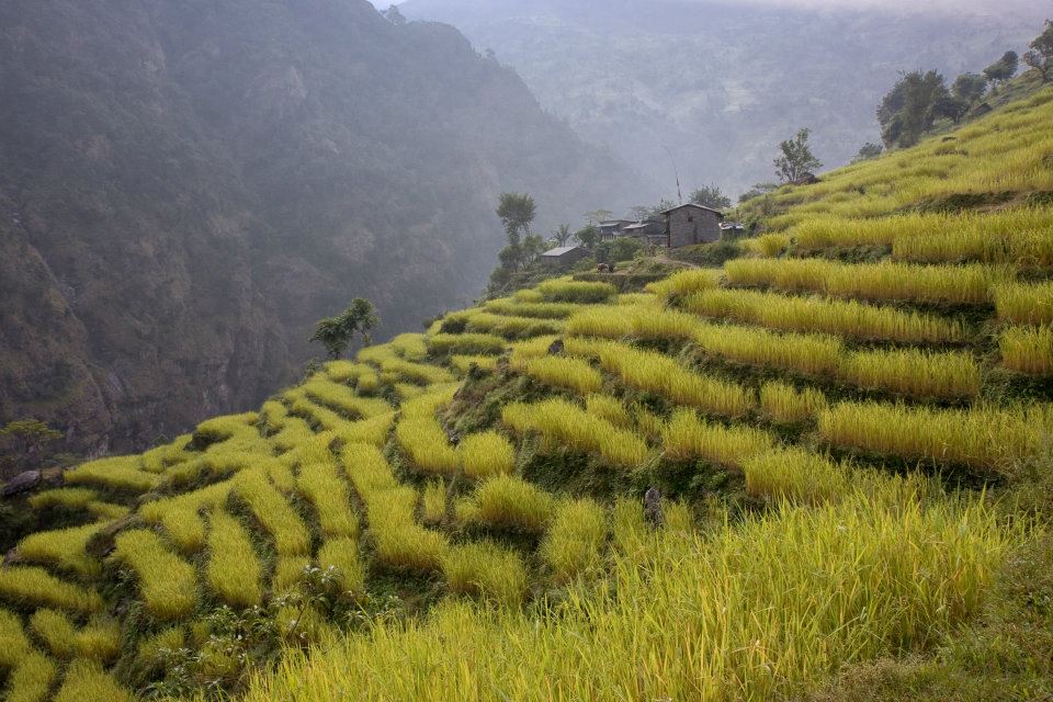
Moreover, the green terraced farming lands of the lower valleys play a significant role in decorating the trail. On the route, you will see especially the Magar and the Gurung communities who have developed for themselves the identity of successful hospitality providers.
You can find tea houses for some initial days, and after that, you have to spend remaining few days in community lodges. Staying especially at community lodges on Kopra ridge trek trail is a splendid opportunity to explore the exotic lifestyle and culture of local communities.
You can become a participant observer and feel what it means to live in secluded, high mountainous zones. You can exchange life experiences and gain life-changing motivations from them. Information mentioned above proves that you will not experience heavy traffic in this part of the world.
Hence, you will have a quiet, peaceful and fresh trekking experience. If you wish to add more challenging adventure, you can extend your destination further to Khayer lake. It is more challenging because once you leave Khopra danda, there is no lodging facility ahead.
Therefore, you have to manage full board camping trek. In addition to the lake, you will get to visit the Khayer Barah temple.
Take a short flight from Kathmandu to Pokhara as early as possible in the morning. It will take between 25 minutes to half an hour. Approximately 3 hours of further driving will take you to Kimche from where the Kopra ridge trek officially begins.
The vehicle will take you through some of the famous villages like Lumle and Nayapul. You can have lunch either in Pokhara or Kimche, depending upon the time. Once you disembark from the vehicle at Kimche, you will get to observe the rural life.
After one hour’s hike, a warm welcome awaits you at Ghandruk, arguably the most famous Gurung village in Nepal. From Ghandruk, located at the elevation of 1,940 meters, you can see the panorama of vast mountains like Annapurna South (7,219 meters), Hiunchuli (6,441 meters), Machhapuchhre (6,993 meters), etc.
Day 2: Trek from Ghandruk to Tadapani (2,630 meters)
You can stroll around the village for some time in the morning and observe the lifestyle of Gurung community. Watching the mountain ranges is an unavoidable part.
You can leave for your next destination, Tadapani, either after the breakfast or after the lunch because you will have an easy trekking day. After 3 hours’ hike through oak and rhododendron woods, you will reach Tadapani (2,630 meters).
The sound of waterfalls and chirping of birds will endlessly give you the pleasure of nature. There is no particular village on the route, but there is a huge buffalo pasture where you can stop and have some dairy snacks.
Tadapani is an excellent place to view the panoramic vistas of snow-capped mountains like Annapurna II (7,937 meters), Annapurna III (7,555 meters), Annapurna IV (7,525 meters), Lamjung Himal (6,931 meters), etc. Moreover, it is also an excellent place to have sunrise and sunset views over the top of those mountains.
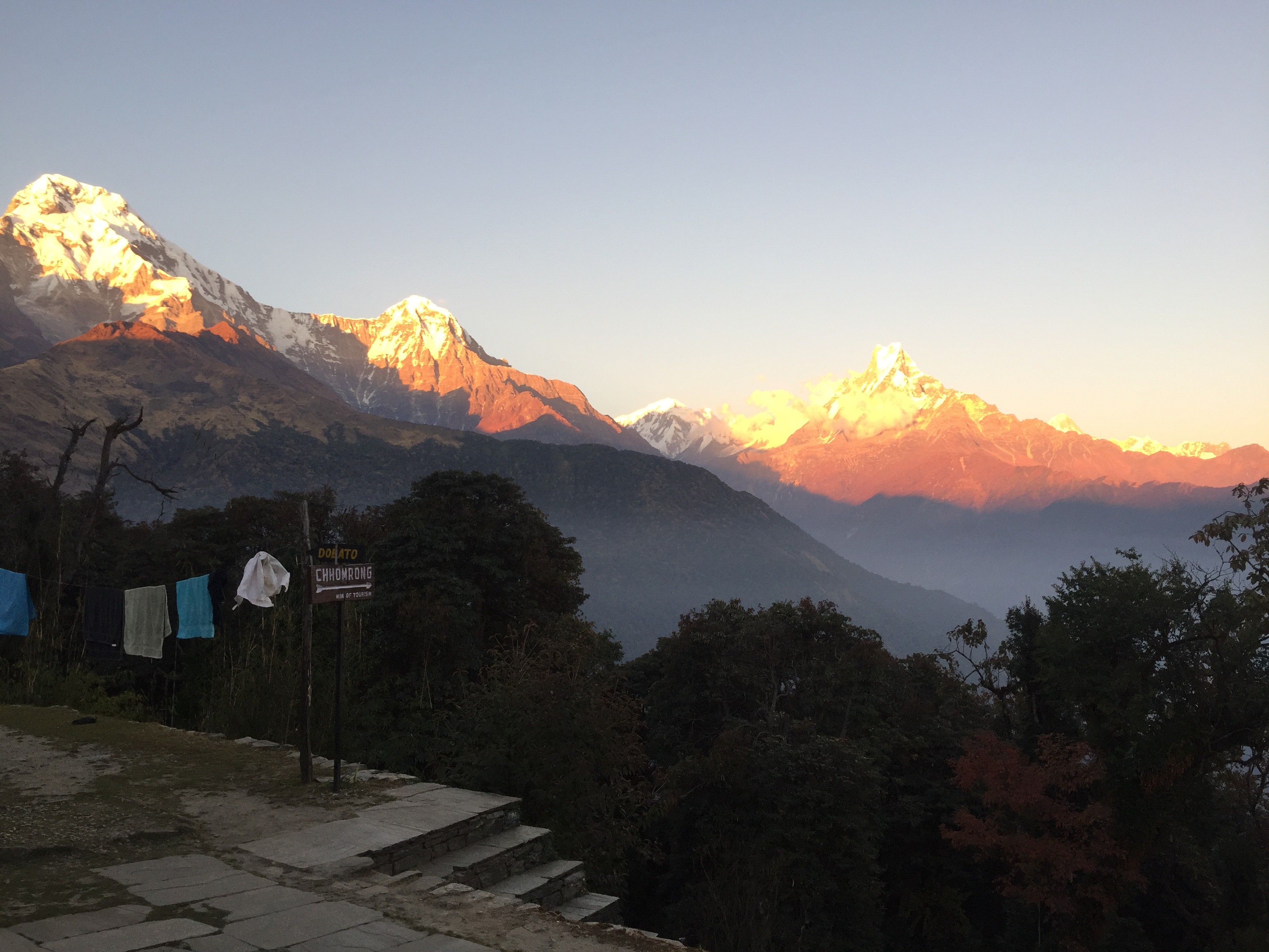
Day 3: Trek from Tadapani to Dobato (3,420 meters)
You should take breakfast before leaving Tadapani. On this day, you will divert from the Annapurna Base Camp Trekking trail to a less used path. Walking through rhododendron forests, you will come across buffalo pastures and small clearings.
Though you have to ascend hills, it will not be a tiring day. It takes approximately three hours to reach Isharu where you can have lunch. After that, you have to go through rhododendron forests again for about two and half hours to reach Dobato.
If you have spare time, you can visit Muldai View Point which is half an hour’s ascent away from Dobato. It is an excellent place to observe the panorama of Himalayan ranges like Machhapuchhre, Dhaulagiri, Annapurna, etc. Morning is the excellent time for sunrise view over those giant mountains.
Day 4: Trek from Dobato to Chistibung (3,026 meters)
It will be a fascinating thing to hike for 30 minutes uphill to Muldai View Point early in the morning for sunrise view. You have come back to your lodge in Dobato for breakfast before setting out for yet another incredible journey.
The trail will be now uphill and downhill in a moment through rhododendron forests again. It requires an hour’s walk to reach Bayli Kharka, a beautiful pasture, from where you can see the Dhaulagiri range at close distance.
From this day onward, you will start experiencing a real rustic Nepal. It takes approximately three more hours to reach Chistibung from Bayli Kharka.
There are a small community and private lodges in Chistibung which will provide you with a reasonably satisfactory accommodation.
Day 5: Trek from Chistibung to Khopra Ridge (3,640 meters)
On this day you will have a reasonably easy time trekking to the Khopra ridge, for it takes only 3 hours at most. It is advisable to take sufficient breakfast and to carry some in order not to lose your energy before reaching the destination.
Because it is an uphill trek, you might need to take rest very frequently. You can expect to see the Himalayan tahr (the wild goat) and the national bird of Nepal, Danfe. You will undoubtedly feel elated upon reaching the Kopra ridge for lunch. You cannot even describe how good a place it is to view the panoramic vistas.
Almost all members of Annapurna range, Dhaulagiri range, Nilgiri, Bahrasikhar, along with their foothills, are visible at a close distance from here.
Khopra community lodges have distinguished identities for the warm love they shower to their guests and their attempts to provide as much facility as possible.
Day 6: Trek from Khopra Ridge to Khayer Lake (4,660 meters)
It might be an exhausting journey from Khopra danda to Khayer lake. But the beauty of this high altitude lake and Brahma temple is worth more than your effort.
The problem, however, is that you will not find lodges there. Hence you have to manage staffs who will set up tents and do the kitchen works for you. It takes approximately five hours to reach this holy place.
Day 7: Trek from Khayer Lake to hRidge
You have to come back the same route that you had used while going up. Walking down through a highly remote area for more than four hours, you will reach Kopra danda where you can spend yet another night.
Day 8: Trek from Khopra Ridge to Swanta Village (2,214 meters)
After observing a 360 degree of panoramic vistas and having taken breakfast, you can descend the hill to Chistibung. Even a relaxed walk will take only two hours at most. You should take lunch at Kharka in an hour’s journey down from Chistibung.
Then the route goes instantly up and down again which continues till you reach Swanta, a beautiful but less known Magar habitation.
Altogether, you will have walked for five hours by the end of your trek on this day. You have the right to choose a lodge at a suitable location.
Day 9: Trek from Swanta to Ulleri (2,050 meters)
This day’s trail does not require much going up and down. It is mostly level which meanders at times. The joy of walking amidst the aroma of rhododendron is beyond explanation. You will not have any difficulty finding lodges there.
Day 10: Trek from Ulleri to Nayapul and drive to Pokhara
It is the last day of your trek. After trekking for 2 hours partially downhill, you will reach Nayapul from where you can catch a bus to Pokhara.
After one and half hours driving you will find yourself in Pokhara, the beautiful lake city. You will most probably have some spare hours during which you can visit different places of tourist attractions.
Or else if you wish to stay a whole day, you can think of spending two nights there so that you can visit most of the tourist destinations.
Day 11: Either Drive or Flight to Kathmandu
You can choose the means of transportation as per your preference. If you are in a hurry, it is better for you to choose a flight because it takes a whole day of driving to reach Kathmandu. But if you have sufficient time, it will be a pleasant experience riding a bus to Kathmandu for around eight hours.
Ghorepani Poon Hill is one of the shortest and most sought-after trekking destinations in Nepal. Poon hill is located at an elevation of 3,210 meters in Ghorepani village (2,874 meters) of Myagdi district in north-central Nepal. Ghorepani offers accommodation to the visitors who are Poon hill-bound.
Due to its rustic setting and being one of the best places to have the sunrise view, this hill is one of the major attractions inside the Annapurna Conservation Area. The primary purpose of reaching the top of Poon hill is to have a glimpse of and capture the sunrise view of Mount Annapurna.
Hence, a throng of tourists gather there at dawn and they could be seen extending their cameras to the Mt. Annapurna, hoping to capture the best possible sunrise glimpse. For this reason, the journey to Poon hill is often called the Annapurna sunrise trekking.
In order to secure the best seat for capturing the sunrise view, you are recommended to get up early and leave Ghorepani at dawn. By the time rays of the sun appear at the top of Mt. Annapurna and Mt. Dhaulagiri ranges, a crowd of people will be ready with their gadgets to take photographs.
When the sun finally appears in yellowish-red attire, it will attract more cameras than any leader of the world. Ghorepani has been a stopover since the ancient period when traders used to take a rest to feed their horses with water.
Hence, the place is christened Ghorepani which can be roughly translated as ‘water for horse.’
The serpentine trail to this destination takes you through villages of ethnic Magar and Gurung communities. Therefore, in addition to the inevitable adventure, it is a massive opportunity for any visitor to explore the conventional ethnic culture.
Another glorious aspect about this trail is that you will be passing through dense rhododendron forests which blossom between the late March and throughout the April, making the entire view more charming than a beautifully decorated bride.
Moreover, Ghorepani Poon Hill trekking will also let you walk along terraced slopes and beautiful paddy fields and observe the excellent culture and lifestyle of Magar and Gurung communities. Likewise, the route involves steep stone steps, suspension bridges and farms as well.
Due to its moderate elevation, people seldom suffer from high altitude sickness while trekking to Ghorepani Poon hill. However, the partial steepness en route demands of you a specific physical fitness.
Throughout the trekking duration, you will remain awestruck by the exquisite views of Mount Machhapuchhre (6,993 meters), Mt. Annapurna (8,091 meters) and Mt. Dhaulagiri (8,167 meters). Poon hill discloses the panoramic views of mountains like Mt. Dhaulagiri ranges, Mt. Annapurna ranges, Gangapurna, Lamjung Himal, Barasikhar, Nilgiri, Hiunchuli, to name a few.
For some trekkers, the steep ascent might turn out to be a hard-fought victory, but the pain of the ascent is nothing compared to the joy of ultimately inhaling the fresh air at the hill and grasping what nature has to offer.
A general overview of Ghorepani Poon Hill Trekking
Depending on the amount of time and your physical fitness, you can customize the itinerary for trekking to Ghorepani Poon Hill.
First of all, you have to make sure how many days you can invest. Based upon that, you can choose the route and prepare an itinerary accordingly.
According to your wish, you can either catch a flight or go by bus from Kathmandu to Pokhara. After one and half hour’s drive from Pokhara, you will reach Nayapul from where the trek begins. Followings are the options of itinerary you can choose from.
4 Days Ghorepani Poon Hill Trek from Kathmandu
Day 01: Kathmandu – Pokhara – Nayapul – Ulleri
To make it to Ulleri on the first day of your trek, you have to catch the first-hour flight from Kathmandu to Pokhara. It takes only 35 minutes to reach there. Because you have a tight schedule, you have to embark a bus that goes to Nayapul immediately. It does not take more than one and half hour to reach Nayapul which is also the bus terminus of Poon Hill trekking route. From Nayapul begins the Ghorepani Poon Hill trek. Approximately four hours’ hike will take you to Ulleri (1,960 meters), the first day’s destination.
Day 02: Ulleri – Ghorepani
Trek from Ulleri to Ghorepani gives you a pleasant experience of walking through rhododendron forests. Ghorepani is situated at an elevation of 2,874 meters which indicates that the journey from Ulleri to Ghorepani demands your perseverance in making an uphill ascent. The trip, however, is eased by the many stone stairs, mostly covered by dry leaves of rhododendron. All visitors, willing to observe the sunrise from Poon Hill, gather at Ghorepani.
Day 03: Ghorepani – Poon Hill – Tadapani – Ghandruk
The third day of the trek to Poon hill is the most joyous day for anyone. To record the best possible sunrise view of Mt. Annapurna and Mt. Dhaulagiri ranges, you should leave Ghorepani at dawn and choose the best possible seat. You have to consult your trekking guide to make sure that you won’t miss the chance to see the sunrise. Moreover, you should not forget that it takes an hour to reach the top of the hill from Ghorepani. You have to wear warm clothes to survive in the climate of 3,210 meters altitude. After that, you will come down to Ghorepani for breakfast and leave for Ghandruk. At first, you will be hiking up to Deurali pass at a similar elevation to Poon Hill. Then your downhill journey begins via Tadapani to Ghandruk. Ghandruk is one of the largest and most popular Gurung villages which operates world-famous home-stay hospitality. By the time you reach the third day’s destination, you will have walked approximately six to seven hours from early morning till late afternoon.
Day 04: Ghandruk – Nayapul – Pokhara – Kathmandu
On the fourth and final day of Ghorepani Poon Hill trek, you have to walk for about two hours from Ghorepani to Kimche and an additional two hours’ drive will take you to Pokhara. From Pokhara, you can take a Kathmandu-bound flight on the same day.
3 Days Trek from Pokhara to Ghorepani Poon Hill
If you are on an even tighter schedule, you can go according to the following itinerary with which you can complete your trek in just three days.
For that, instead of going to Ghandruk you will come down the same route that you took while hiking up. If you have spare time, you will have a fantastic option to spend a day or two in the beautiful city of Pokhara.
You can add more to the package of your joy by exploring the beauty of Phewa Lake, Begnas Lake, Mahendra cave, Chameri (bat) cave, Gupteshwori cave, Davi’s falls, Sarangkot hill, World Peace Pagoda, etc. while in Pokhara.
Day 01: Drive from Pokhara to Nayapul and trek to Ulleri
Day 02: Trek from Ulleri to Ghorepani
Day 03: Hike to Poon Hill – back to Nayapul – drive to Pokhara
5 Days Ghorepani Poon Hill Trek either from Kathmandu or Pokhara
You can make your trek even lengthier by following a slightly different and more luxurious itinerary. If you count the beginning of your trek from Kathmandu, you will have to take a flight to Pokhara and back to Kathmandu as well. It means you will not be spending any night in Pokhara.
Day 01: Pokhara – Tikhedhunga
Tikhdhunga is 42 kilometers away from Pokhara. On the first day, you have to ride a bus for about two hours from Pokhara to Nayapul, from where the Ghorepani Poon Hill trek begins. It will be an easy day because the route does not involve many ascents. You will somewhat follow the Modi river and go along rhododendron forests. Approximately two hours’ easy trek will take you to Tikhedunga.
Day 02: Tikhedhunga – Ghorepani
The second day of your trek will mostly consist in ascending steep uphill. You might be pushing yourself to the limit on this day because it is the most challenging day of the entire trekking duration.
Throughout the trail, you be stepping upon beautifully crafted artificial stone stairs. Moreover, the rhododendron forests cover a vast section of the trail.
Apart from that, you will get to observe the spectacular views of Mt. Macchapuchhre (6,997 meters), Mt. Hiunchuli (6,441 meters) and Mt. Annapurna South (7,219 meters).
Day 03: Ghorepani – Poon Hill – Tadapani
After observing the sunrise view of Annapurna and Dhaulagiri ranges, you have to come back to Ghorepani for breakfast. You have to make yet another ascent of Deurali hill before descending to Tadapani. This day, however, will be relatively more relaxed due to less ascent and less distance coverage.
Day 04: Tadapani – Ghandruk
Day 4 is the most comfortable day of the entire trek. Walking for just two to three hours will take you to the beautiful Gurung village of Ghandruk.
Day 05: Ghandruk – Pokhara
On the final day of your trek, you have a trek to Nayapul from where you can catch a bus and come to Pokhara.
Ghorepani Poon Hill Trek Difficulty
Ghorepani Poon Hill is a relatively easy trekking destination in Nepal. In spite of being low at elevation, i.e., 3,210 meters, the difficulty of this trail is graded as moderate.
It is because on the second day you will be making an ascent of around nine hundred meters on a single day without acclimatization. Otherwise, other days are counted among most comfortable trekking days of Nepal.
Poon Hill trail requires you to have a certain level of physical fitness so that you can persevere through the quite strenuous uphill ascent. The path has been made far more accessible by the stone stairs. Trekking to Poon hill does not require you to practice exercises for months.
If you have a regular habit of hiking, bicycling and or swimming, that will be enough preparation for this adventure. Nonetheless, you need to have a functional health status because you will be walking uphill for five to seven hours.
If you go trekking during the winter, you might face difficulty finding a suitable teahouse for accommodation because most of them remain close.
In the Poon Hill section of Annapurna Conservation Area, trekkers rarely suffer the altitude sickness, but still, you cannot be utterly negligent.
Manaslu Trek is least visited trekking region compared to other trekking regions and is in a very remote area, but Manaslu offers an ultimate adventure trek.
It is famous for small teahouses where trekkers can take rest and have a cup of tea with an amazing scenic view of snow-capped Himalayan ranges.
Manaslu: Eighth highest mountain in the world
Manaslu is the eighth highest mountain on the earth at 8,163 meters (26,781 ft) above from the sea level. Manaslu is located in the Mansiri Himal in the west-central part of Nepal.
The mountain name is first known as Kutan I. ‘tang’ being the Tibetan words used for the flat place, thereby describes the mountain’s general summit. Later the name of the mountain was changed to Manaslu.
Manaslu trek: Himalayas
‘Manaslu’ means ‘mountain of the spirit.’ Manaslu word comes from Sanskrit word Manasa; it means intellect or soul.
Manaslu is one of the adventurous trekking among other trekking in the Himalaya region. It is the highest peak of Gorkha district and is located about 40 miles east of Annapurna.
The Manaslu region was opened for trekking only in 1992.
The mountain’s long ridge and valley glaciers offer feasible approaches from all directions, and it culminates in a peak that towers steeply above its surrounding landscape and is a dominant feature when seen from far.
Beauty of Manaslu
Manaslu trek offers a jaw-dropping view of snow-capped mountain range and the ancient trail along with mix culture, heritage and hospitality of authentic Hindu and Tibetan-style Buddhist village.
The beauty of Manaslu is unbeatable. The trekking trail follows an ancient salt-trading route along the spectacular Burhi Gandaki River. The highest point in this trek is the ‘Larkya La Pass’ at an elevation of 5,106 meters (16,752 ft).
Manaslu Trek is famous for the beauty of the high Himalayas as well as local ethnic culture, traditional lifestyle, old monasteries and local people with unique houses.
Manaslu Trekking:
Manaslu is mainly inhabitant with two regions: Nubri and Tsum. Most people visited the Nubri valley after tourism board announced it as a touristic place in 1950.
And Tsum still out of touch with modernity. You will see traditional lifestyle, art, and culture. The local people are mostly of Tibet and speak their language. Different people with different cast live in a different place.
In the central part of the region, the large number of Gurung people are the main ethnic who have joined Brigade of Gurkha and closer to Tibet, the Bhutias, akin to Sherpa people who follow Buddhist.
Earlier climbers to Manaslu region
In 1956, 9 May, Toshio Imanishi and Gyalzen Norbu first climbed the Mount Manaslu. The Japanese team was lead by Maki Yuko, also known as Aritsune Maki. Next successful climb on 19 May 1971 by Kazuharu Kohara and Motoki, group of 11 Japanese teams.
While climbing Mt. Manaslu only a few make it happen, but most people fail to climb the highest peak. Many foreigners were failed to reach at 8000 meters. On November 9, 1986, Jerzy Kukuczka, Artur Hajzer climbed the eighth highest peak.
Carlos Carsolio, the youngest and being the fourth person of eight-wonderland in history reach the summit of Manaslu. During the climb, most people died due to the high altitude.
Manaslu trek forms section of the Great Himalaya Trek. Tourists are the important part of GHT which connects to the rural life, provides the essential commodities and school for children.
The trekking trail to Mount Manaslu has only one route which starts from the Gorkha district of Arughat Bazaar and ends in Syange.
The Manaslu trek is a challenging and strenuous trek. The trail can be shorter or longer depending upon your walking hour per day. Along the trek; there are many tea houses and the breath-taking scenery that will make your heart melt in each step.
Manaslu Trekking: Himalaya with cloud
Manaslu Trekking: An amazing tea-house experience
Manaslu is now popular for the tea houses trek. There are many teahouses available on the trail where you could stay overnight or take rest and have some tea during the trek.
Now, these tea houses developed into mountain lodges offering foods and accommodation in nominal price.
Local people manage most of the teahouses, and tourists love to stay in the tea-houses because they get chance to know the local people’s daily lifestyle, tradition, culture which are rarely seen in the rural area.
Trekking Permit
A trekking permit is required to trek any part of Nepal. But before you go there, you need trekking permits, cost, and other information.
There are two types of cost of permits according to the season. You should pay US$ 70 per week and after seven days US$ 10 per day per person. This applies only from September to November month.
Similarly, from December to August, the cost is US$ 50 per week and after seven days US$ 7 per day. If you want to trek more than one places, then you need more than one permits. Each permit requires details for the route and region.
The trekkers should pay entry fees including 13% Vat to trek Conservation Areas and Trekkers Information Management System (TIMS). Entry fees to trek Conservation Areas are following:
For SAARC countries: Nepali Rupees 200
For other countries: Nepali Rupees 2,000
Nepal Tourism Board which is located in the Kathmandu issues entry permits.
Choosing a trekking agency
There are many trekking agencies in Nepal. If you are looking for the best trekking agency, then Nepal Sanctuary Treks is the best agency in Kathmandu Valley.
Nepal Sanctuary Treks carefully plan and pay attention to detail and design trek itinerary just the way you want and deliver all information required for client’s safety, comfort, and pleasure.With the support and guidance of our trek specialist, you can co-create a trekking itinerary to suit your style, taste and physical fitness.
Manaslu Trek has one route to reach the peak and another route to return. The Manaslu Trekking is restricted area trek, so consequently, before organizing Manaslu trek, we must take permission for Manaslu region.
It is considered to be one of the challenging and finest trekking adventures of Nepal. The trek could make shorter or longer on the length of your walking days from the starting point to ending point.
Arughat
The trek for Arughat starts from Kathmandu and takes about 6-7 hours by jeep. You can also travel by local bus. However, it takes a long time.
Arughat is the small local bazaar, lies in the bank of the river and has some lodges to spend the night there. The necessary things that you need for the trip are; instant foods and others items can be bought there.
Soti Khola
Manaslu Trek begins from the Soti Khola. From Arughat to Soti Khola you can go by bus or private vehicle, but the road is not properly managed. Most people go there by local bus.
The road ends in Soti Khola, and then the walk continues to Manaslu from there. You need more effort to climb up the hills starting at a minimum elevation of 730 m. You can get a pretty nice view of beautiful green hills from the Soti Khola.
Lapubesi
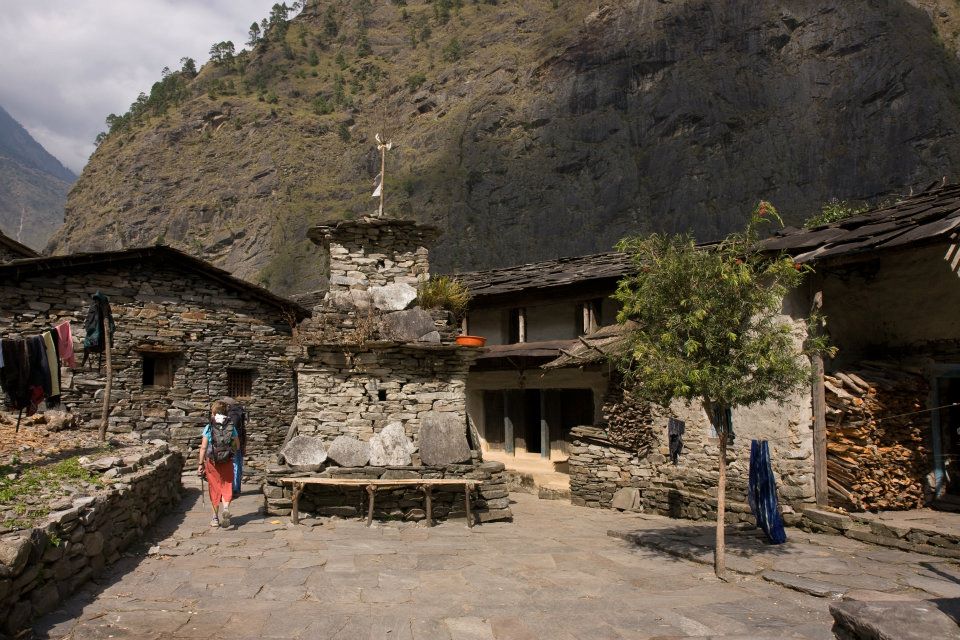
From Soti Khola to Lapubesi after about 6-7hours of the walk, through the Sal forest and some villages, green field you will reach villages of Lapubesi which is an inhabitant of Gurung people.
The Gurung people live in the central part of Nepal, of areas such as Gorkha, Baglung and the high slopes of Annapurna. They are Tibetan-Gurung people, farmers who grow rice, millet, maize which are daily works.
They follow both Hindu and Buddhist religions, although they have their religion, with certain rituals and ceremonies. The Gurungs still combine with the belief of the two dominant religions of Nepal.
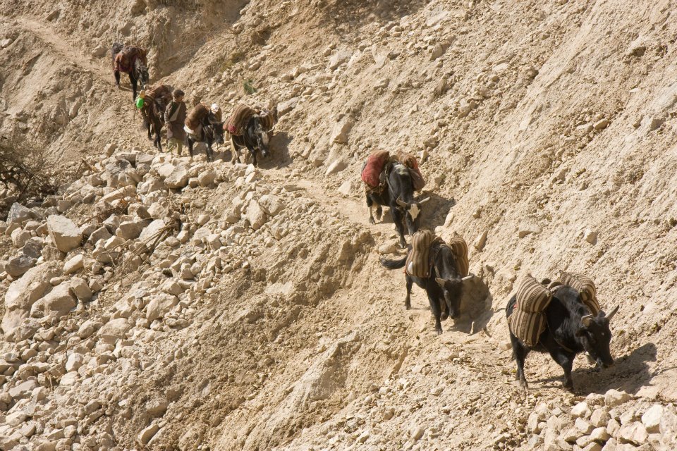
Khorlabesi
The trail continues to Khorlabesi for around 7-8 hours of walk from Lapubesi. Crossing the path of the jungle, sometimes up and sometimes steep downside of hills and reach Khorlabesi villages.
You can see pretty scenes of hills and villages then towards to Jagat.
Jagat
Around 6-7 hours of walk from Khorlabesi, you will reach your next point Jagat. To reach Jagat, you have to go through lots of ups and downs, hills and rock but it makes your mood much better than before.
Deng
Jagat to Deng takes about 5-6 hours of trekking which passes through the pine forest, Philim villages, and Ekle Bhatti. Ekle Bhatti is a small teahouse where you can take rest and have a cup of tea.
After some hours later you will reach to Deng, a silent valley with small hotels settlement.
Namrung
Trek to Namrung, after leaving Deng you walk continuously to Ghap to Namrung villages. Namrung is a small village inhabited by Bhote, Lama peoples.
Their main occupation is agriculture and animal husbandry. They raise maize, barely, potato as crop and oats, nut, as fruits. They have their own culture and religion.
The local people want to preserve their historical culture and religion, so they have open Historical Cultural Lakpa Dhundup Museum at Namrung prok VDC.
You will walk through villages, beautiful waters, rhododendron forest with white Langur monkey and also you can see beautiful views of Himalayas peak including Ganesh Himal and Himchuli.
Samagaon
The next trek to Samagaon takes 6-7 hours to arrive there. While walking towards Samagaon following Lihi, Sho, Lo, Shyale villages, hilly terrains and bushy forests.
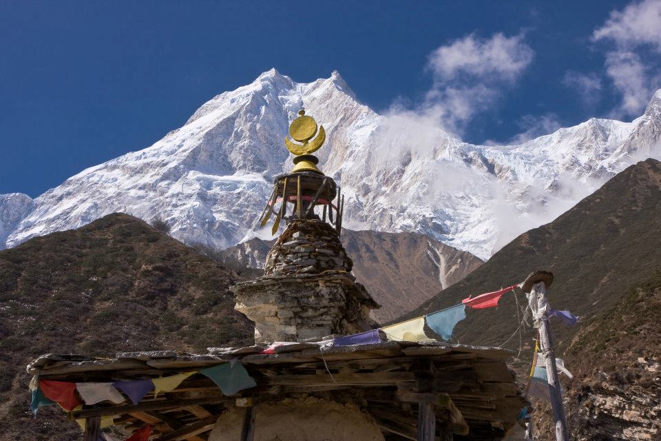
Samagaon is a beautiful village surrounded by prayers flag, and they follow Buddhist Religion. Also, it offers amazing views of Himalayas peaks including Manaslu, Himchuli and peak 29.
During the walk to Samagaon, you can also visit Birendra Tal, Phungen Gompa.
Samdo
It is a short walk of around 3-4 hours to Samdo after leaving Samagoan. Samdo, the most beautiful place of Manaslu. The places are especially known for yak herding.
This village has more animals and fodder shelter than human settlement. This place offers excellent views of Simrang Himal, Hiunchuli himal, Ngadi Himal, Larkhye Peak, Cheo and Kang Guru Himal.
Dharamsala
Next trek to Dharamsala, a hut made by the stone of three rooms and a roof but doesn’t have doors and windows. Everyone can go into Dharamsala, but there’s nothing inside.
Manaslu Trek: Crops
To reach Dharamsala from Samdo; it takes around 4-5 hours of walk passing through Larke Bazaar “a seasonal Tibetan Market.” Dharamsala is also known as Larkya Phedi which is a final part of Manaslu Circuit before Larke Pass.
Larkya Pass
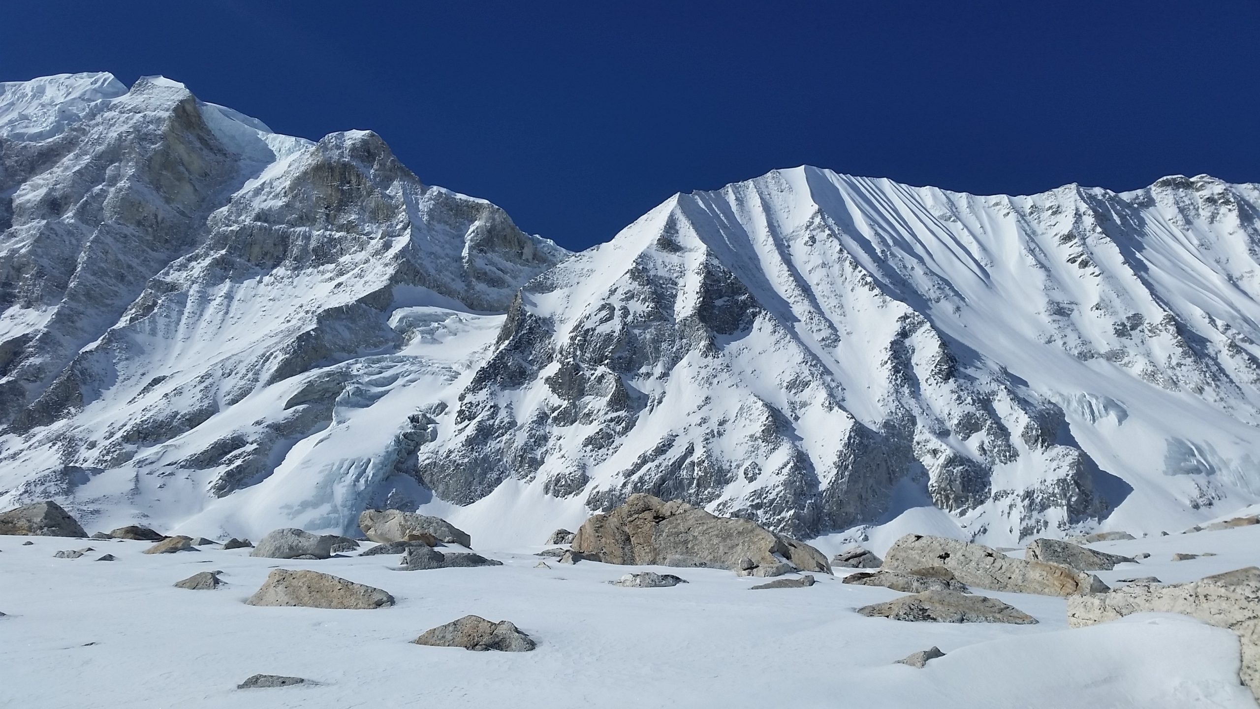
Larkya Pass is the maximum altitude of 5,106 meters.
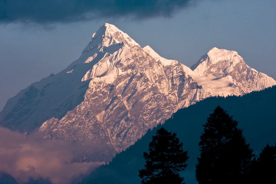
From Dharamsala, you will climb steadily up to reach the top of Pass. Finally, you will see breath-taking panoramic views of snow-capped Himalayas peak of Mount Manaslu, Annapurna II, Himlun Himal and other mountains.
You can snap the pictures of the beautiful Himalayas and videos too before descending to Bhitmag. Many trekkers become sick due to its maximum altitude.
Bimtang-Tilje-Dharapani
Leaving the beautiful Mount Manaslu behind and start descending to Bimtang takes 3-4 hours and trek to Tilje around 6-7 hours of walk. Passing the rhododendron forest take you to Karachi; one of the highest cultivated village of Nepal.
Then continue to walk to Gho villages where few lodges are available. After few hours of walk, you will reach Tilje village which has better lodges then Gho villages.
After a short walk from Tilje, crossing Marsyangdi Khola through on a long suspension bridge finally, you will reach Dharapani. Dharapani is a small village where small hotel and lodge are available.
Chamche-Besisahar
Chamche is the final trail of Manaslu Trek from Dharapani following Tal villages. Chamche is the most popular place for Annapurna Circuit Trek route with several lodges and accommodation facilities.
Then walk down to Besisahar, which is the headquarters of Lamjung district. Here different cast and religion of people live in one community and have a different culture.
From here, you can get vehicles such as a jeep or local bus and drive to Kathmandu about 7-9 hours.
Manaslu Trek Map
Manaslu Trek Itinerary
Manaslu trek is one of the challenging and demanding trek. Before Manaslu trek, you need to manage itinerary on your daily basis traveling routine.
The well- planned and managed itinerary ensure the best itinerary that makes you trek enjoyable.
1. Mount Manaslu is an eighth highest peak in the world which opened in 1992. It is still under restricted trekking area of Nepal. It offers stunning views of Manaslu Peak including Ngadi Chuli, Himalchuli, and Boudha Himal.
2. Manaslu is an inhabitant of different ethnics groups such as Gurung, Lama, Bhotias, and Tibetan. They have different cultures. There many ancient monasteries, ethnic heritage and culture and unique houses made of stone.
3. Manaslu Trek is famous for small teahouses. The teahouses are built and managed by the local peoples. Tourist loves to stay there and get opportunities to know closely about local lifestyle.
4. Manaslu Trekking has countable visitor than Annapurna Base Camp Trek, Everest Base Camp Trek, and other trekking which makes entire Manaslu region unspoiled and more exclusive.
5. Manaslu is mainly inhabitant with two regions: Nubri and Tsum. Most people visited the Nubri valley after tourism board announced it as a touristic place in 1950. And Tsum is still out of touch with You will see traditional lifestyle, art, and culture.
6. Crossing the higher pass of Larkya Park at elevation 5,106 meters. Descending to Bimtang is more difficult than climbing. Descending towards Bimtang must use some technical trick. From Bimtang, the back view of Mt. Manaslu is amazing.
7. Toshio Imanishi and Gyalzen Norbu were the first to climb Mount Manaslu on 9 May 1956.
After them, many Japanese teams have climbed the summit of Manaslu but got failed. Mount Manaslu called Japanese Mountain and also known as Killer Mountain because of its frequent icefall, and high altitude trekker gets sick or kill.
8. Mount Manaslu which is in Gorkha district has lots of offers historically as well geographically such as Manakamana Temple, Lower Manaslu Trek, Tsum Valley Trek, Nubri Valley Trek. Manaslu Trekking route starts from Arughat and ends in Besisahar.
9. The spectacular scenario of rhododendron forest, perfect views of mountain ranges, a combination of rich culture, natural beauty and biological diversity.
10. The Tsum Valley Trek in the region has beautiful views of surrounding mountains peak, but extra trekking permit is compulsory need to travel there.
Precautions to take in Manaslu Region
Before you travel there, you need to know all things about Manaslu region such as about high altitude, weather, hygiene and daily health care. Firstly, you can easily become dehydrated at high altitude.
The lower air pressure will force you to breath more quickly and deeply. So, you will have a drink a lot of water than you normally would have. The most common symptoms include thirst, dry lips, nose or mouth, headache and feeling fatigued.
You should drink at least 3 liters everyday trekking. Also, it is important to maintain your daily hygiene in a remote area which might affect your health and brings hand sanitary with you.
Due to cold weather, you might get sick, so warm clothes such as down jacket, electrical socks, hat, etc. are most necessary things that must have with you.
Tsum and Ganesh Himal Trek and Nubri Valley
Tsum valley and Nubri valley is one of the famous and hidden treasures of Manaslu region. Tusm words come from the Tibetan word ‘Tsombo’ which means vivid. Tsum valley is mostly the origin of Tibetan and people in that valley speak unique dialect.
Tsum valley offers the beautiful forests covered with rhododendron tree and a stunning view of Ganesh Himal.
Tsum valley always combines with Manaslu Circuit. The trail starts from the Arughat and continues the low, high passing through the forest and small villages.
Manaslu Trek passes through the Tsum Valley. The place is famous for the ancient Buddhist monastery. Geographically the valley called ‘Tsum Tso Chuksum’ which means thirteen provinces ruled as a single territory.
Nubri Valley also connects with Manaslu trek. Nubri valley still follows the traditional culture, art and it is untouched by the modernization.
Weather and Difficulty in Manaslu Region
Manaslu trekking is one of tough trekking compared to other mountain treks. The best time to visit Manaslu is Autumn and Spring season. Autumn months starts from October to November and March to May.
The weather on this season is pretty much fine than other seasons. In Monsoon and Winter seasons it hard to trek in Manaslu due to the rainfall and high coldness.
So How to start your Trip?
Firstly, the question might strike in your mind about How to start your Trip? It’s not that difficult; you can contact Nepal Sanctuary Treks.
Nepal Sanctuary Treks is the best trekking agency of Nepal. We would be glad to consult you via phone, Whatsapp or email if you feel further discussion. Our trekking professional will assist you to provide proper guidelines, process and more information on Manaslu trek.
Nepal Sanctuary Trek contact details:
Nepal Sanctuary Treks
G.P.O Box 5493
House No. 1246, Lamtangeen Marg, Chundevi-4, Kathmandu
Manaslu trek offers an off-beaten trail experience in the Himalayan Region. Manaslu is famous for small teahouses along the Manaslu trek. The Manaslu trek exists 40 miles away from Kathmandu to the east of the Annapurna region. The name ‘Manaslu’ means ‘the mountains of spirit.’ The word ‘Manaslu’ came from the Sanskrit word ‘Manasa’ which means intellectual or soul. Manaslu trek offers the spectacular beauty of a perfect blend of nature, the lifestyle of local people, and stunning views of breathtaking mountain ranges in Manaslu region. Every year, many foreigners accomplish Manaslu Circuit trek. Manaslu trek leads you to Nubri and Tsum valley, which is the hidden treasure of Manaslu.
Eighth-Highest Mountain in the World
Manaslu is the eighth-highest mountain on the earth at 8,163 meters (26,781 ft) and opened in 1992 A.D. It is located in Mansiri Himal, part of the Nepalese Himalaya region, in the west-central of Nepal. Now, Manaslu Trek is controlled by the tourism board and under the restricted trekking trail of Nepal. Before planning to Manaslu trek, trekkers need to take permission from the Manaslu region. It has the eye-catching views of the long ridge mountain range near Manaslu including Nagdi Himal, Himalchuli, and Boudha Himal. Manaslu is the highest peak in the Gurkha district. Manaslu offers much trekking in the Annapurna region. The trekking follows the trail, an ancient salt-trading route along with Buri Gandaki river. The trail starts from Arughat, the small town bazaar, and ends in Besisahar.
Manaslu is Famous for small tea houses
Manaslu is also known for tea houses. The tea houses are built and managed by the local people. Local people make money by selling food and providing a night’s stay for trekkers with charges or fees. The small tea houses make this trekking more famous. Trekkers can take a rest and have a cup of tea there. Also, tourists love to stay there and get opportunities to know closely about their lifestyle. Dal Bhat is the most famous food all around Nepal as well as in the Himalayan region.
First climbed Mount Manaslu
Toshio Imanishi and Gyalzen Norbu were the first to climb Mount Manaslu on 9 May 1956. Before them in 1950, H.W. Tilman was the first European who made his attempt after he unsuccessfully trekked to Annapurna IV. In 1952, a Japanese reconnaissance party reached around 5275 meters after the monsoon season on the east side of the mountains. In 1953, the Japanese team of 15 climbers led by Y. Mita via the northeast face K. Kato, J. Yamada and S Ishizaka made a summit around 7750 meters before turning back. After them; many Japanese teams climbed the summit of Manaslu but got failed. Mount Manaslu is called Japanese Mountain and is also known as Killer Mountain because of its frequent icefall, and high altitude trekker gets sick or killed.
Historical places
Mount Manaslu, which is located in the Gurkha district, has lots of historical places including the Manakamana Temple and Gurkha Durbar. It is a beautiful and adventurous trek with stunning views of Manaslu and passing through many Hindu and Tibetan villages. The trek also passes through the beautiful green forest, ancient architecture, and Buddhist Monastery where many children studied to be a monk.
Ethnicity and religion
Manaslu shares much of the culture and history with its neighboring territory, Tibet. Manaslu has two ethnicities mainly inhabitant this region: Tsum and Nubri. Gurung is the main ethnic group that has joined the Brigade of Gurkhas in huge numbers. Close to Tibet, The Bhutias and akin to the Sherpa groups follow the Tibetan ethnicity. Rich in tradition and culture. The local people live a traditional lifestyle and with unique houses, that have walls built with stones and roofs with stone slabs. Due to the earthquake, many houses have been destroyed and are still under construction. Their main occupation is agriculture and animal husbandry such as barley, maize as crops, and oats and nuts as fruits. Local people also make income from the lodge and small tea houses. Local people are mostly from Tibet and speak their own languages.
Geographically amazing
Manaslu trekking is geographically spectacular and fabulous. Manaslu region which is also termed the Manaslu Conservation Area comprises subtropical Himalaya foothills to arid trans-Himalaya high pastures border in Tibet. Starting from Arughat and extending into Larkya La Pass. The area covers six climate zones; the tropical and subtropical zone varies in elevation with different altitudes. Elevation varies starting from 1000-2000 meters, the temperature zone(2000-3000 meters), the sub-alpine zone (3000-4000 meters), the alpine zone(4000-5000 meters) meadows, and the arctic zone of ranges lying above 4,500 meters. The temperature of Manaslu also varies widely according to the climatic zones. The snow always covers above 5000 meters of elevation, and as the level increase, the air pressure becomes low. The trekking route is through mountains prone to the consequences of monsoon rainfall, landslides, and landfalls.
Rich in Bio-diversity
Manaslu region is highly habitat with various flora and fauna, including endangered animals such as snow leopard and Red Pandas. Other animals such as gray wolf, Himalayan musk deer, blue sheep, Asian Black Bear, Langur monkey, and over 110 species of birds, 33 mammals, and some reptiles are also found. These species make the region more beautiful and melt human hearts too. Conservation of wildlife in the area has been done by monks of the monasteries in that area by banning hunting. The elevation categorizes the hills. For example, Low Hill, Medium mountain, and High Mountain with exclusive forests and a variety of species. There is not much vegetation of variety. The valley basin has a rich ecotone diversity including nineteen types of forest and mostly rhododendron and Himalayan blue pine which is flanked by Ganesh Himal and Sringi ranges.
Tsum Valley and Nubri Valley
Manaslu region has mainly two inhabitants valley: Tsum Valley and Nubri Valley.
Tsum Valley is one of the remote areas of Nepal. Tsum has a long history of Buddhism. Tsum is also known as ‘Tsum Tso Chuksum’ which means thirteen provinces ruled as a single territory. Still, the ancient Tsum Kingdom remains, and the village has a unique traditional culture. Tsum Valley Trek in the Manaslu region has beautiful views of four 7,000 meters peaks of the Ganesh massif, and also visitors can experience the distinct Tibetan culture of Tsumba people. Nubri Valley is the next remote place in the region. Nubri valley has virgin beauty and is still untouched by modernization. The local people follow their traditions, culture, and art. The local people wear traditional clothes and speak their language. The ancient trail along with mixed cultures, especially the Tibetan, and great hospitality. Small tea houses and lodges are available in this area. The ancient old Buddhist monastery is established which gives a glimpse of Buddhist culture.
Larkya La Pass
Larkya La pass, also known as Larke Pass is at the maximum altitude of 5,106 meters where trekkers get jaw-dropping views of Mount Manaslu, Ganesh Himal, and other mountain ranges. Although Larke Pass is at a lower elevation than other Passes like Thorong La Pass, Chola Pass, it is more difficult because of its long walk and the higher elevation. Besides, descending from Bimtang is more technical and climbing.
A difficult but adventurous trek
Manaslu is the most difficult trek in comparison to Annapurna Circuit Trek. Manaslu region has few trekkers that make the visit more exclusive and unspoiled and presents the virgin beauty of Manaslu. But the difficult trail to Manaslu is paid off as trekkers see the spectacular view of snow-capped Himalayas ranges, the traditional villages, local people with unique customs and cultures, and yaks in the upper hills.
The Manaslu Circuit Trek is one of the unexplored trails that encompass a peaceful, natural and beautiful experience that is ideal for those seeking a getaway from bustling life.
Manaslu Circuit is getting popular as a new trekking destination. Mt. Manaslu is the eighth highest mountain in the world; it is in the very center of the Nepalese Himalaya and to trek around the base of this giant mountain along with its isolated trail is probably one of the best treks.
The trail traverses through pristine areas where you will witness the beauty of nature and picturesque village of Tamang and Sherpa settlements with their unique culture.
The Manaslu region is well-known for its high altitude glacier lakes, a diverse range of flora and fauna and charming cultural region.
This trek suits best for those who are looking for challenging trekking in a remote area of the Nepal Himalaya.
The highest point of this trek is Larkya La pass (5,135m/16,847ft), and trekking around Manaslu offers a unique opportunity to experience an untouched region of Nepal.
Trek can be 14 days that begins at Arughat and ends at Besishar. The best season to visit the region is from March to May in spring and September to December during the winter.
Trip Highlights:
The maximum altitude is 5160m/16929 feet.
The fascinating backdrop of Manaslu & surrounding Himalayan range.
Cross many suspension bridges over the different rivers, including the Budhi Gandaki River and several Mani walls on the way.
Observe the traditional village lifestyle and culture.
Tibetan culture and high pass crossing Larke La (5210m).
Experience walking through pine, rhododendron and bamboo forest and enjoy the nice view of the waterfall
Itinerary:
Day 1: Kathmandu-Arughat (550 m/1804 ft) 7 hrs drive and further 1 ½ more to Soti Khola (597 m/1958 ft)
Our destination start for today is Arughat, which is about a 7-8 hour drive from Kathmandu. During the drive, we enjoy scenery landscape along with the Mountain View.
We will be driving on a paved highway from Kathmandu to Dhading Bensi, and then drive from Dhanding Bensi to Arughat on a bumpy road passing through bamboo forests and Gurung villages.
Upon reaching Arughat, we drive further towards Sotikhola. Overnight at Sotikhola
Day 2 Trek to Macha Khola [900m/2952 ft]: 6 – 7 hours
In the early morning, we continue our trek by traversing the bridge, and we trek through the Sal forests and ascend onto a ridge above huge torrents on the Budhi Gandaki and continue to Korsani.
The trail now gets a bit more difficult as we ascend over a huge rock and pass a brook on a single log bridge then weaves its way up and down again to the banks of the Buri Gandaki.
It continues up a steep rocky track to the Gurung village of Labishe. From Dobhan, we climb following a rocky ridge to old school from where the valley widens.
Then the trail descends to a tropical waterfall with a wooden bridge. The trail climbs over another ridge and dropping to the sandy river bed.
We walk along with rounded stones before ascending over a side ridge. We move down again to the river and traverse one more suspension bridge to reach Machha Khola village.
We stay overnight at ManchaKhola
Day 3 Walk to Jagat [1410m/ 4625 ft]: 6 – 7 hrs
From Korlabesi there is a sharp climb to a ridge and after a few additional ups and downs from here will take us to Tatopani hot spring.
From hot spring, we climb over another ridge and cross a suspension bridge over the Buri Gandaki. At this point, we climb the wide stone stairway to Dobhan.
The trail gets quite rough and starts by ascending to two teashops at Duman, then we cross the landslide area, and after some ups and downs through the narrow valley, it reaches a large field.
There is some jumble over gravel slope until we decline to the wide river valley. After crossing a suspension bridge, the trail ascends a set of stone stairs, drops to the river and ascends once again to Thado Bharyang.
Crossing the west bank of the Budhi Gandaki, we climb over a ridge, trek along the river and then climb towards the village of Jagat. We stay overnight in Jagat.
There are good views of Shringi Himal as you walk along the side of a cliff. Today we will set off our journey to Salleri by climbing over a rocky ridge to Salleri and move down to Sirdibas.
The trail descends to Setibas where the Mani walls (prayers engraved into wayside rocks) show that we are entering a region with increasing Tibetan influence.
The valley widens a little and continues past the stone houses of Ghattu Khola, We continue to Ghatta Khola and then walk upstream through a long suspension bridge to reach a Gurung village in Phillim.
And then turns north just above the lowest houses in the village and stays fairly level until Serson. Further Serson the trails enter a steep gorge and descend through grassy slopes, to cross the wooden bridge at the river’s narrowest point; below you will see the convergence of the Shar Khola and Buri Gandaki rivers.
The village of Nyak is located close to here. As the trail widens, we pass through bamboo forests to reach the Deng Khola. After crossing the river, we reach the Deng village where we overnight here.
We take a short walk from Deng and the trail traverse back over the Budhi Gandaki and climb Rana at 1910m. After a short climb from the bridge before heading west on level ground and we pass the large waterfall.
Once we cross the wooden bridge, the trail curve up and out of the canyon and ascends over the river before dropping into the Shringi Khola Valley.
After crossing the suspension bridge over the Shringi Khola, there is a sharp climb, and the trail passes along the Buri Gandaki.
The trail passes through forests and painted Mani stones and a corner from where we reach Ghap. You pass more Mani walls on the southern part of the river.
The trail climbs along the river, passes a waterfall and continues all the way through dense rhododendron forests with a wooden bridge in the middle which crosses the Buri Gandaki.
The trail continues along the north side to a big cave and then crosses the river at a narrow gorge where you can see grey Langur monkeys.
The forest becomes less dense, and the trail is leveled once we cross the river at a gorge. After an enjoyable walk, we then continue a final steep climb that will take you to our destination to Namrung through a stone archway where we stay overnight.
Namrung is the greatest viewpoint for Siring and Ganesh Himal as well as Mt. Himal Chuli.
Day 6: Trek to Samagaon [3530m/11,578 ft]: 6-7 hours
The trail traverses the ridge onto the Buri Gandaki Valley side and followed by descending to a rock scattered moraine.
We further pass through extensive meadow and fields near Sama gompa after crossing some rocky trails. You will get the opportunity to explore a small part of Tibet with numerous Gompas and an authentic Tibetan village.
The village is settled perfectly against a wooded moraine at the end of the valley. We will rest overnight here in the village.
Day 7: Acclimatizing day at Samagaun
We will take a break to rest and acclimatize to the increasing altitudes. We stay in Samagaon and explore the surrounding areas and traditional Tibetan community from where we will be able to see beautiful views of Manaslu.
For the people who don’t want to hike can rest and explore the village. We will come back to the village and spend overnight at Samagaun.
Day 8: Trek to Samdo [3860m/12,660 ft]: 4 – 5 hours
On the eighth day, we follow to the Budhi Gandaki River, which turns north and crosses the suspension bridge over a side stream. The trail to the left takes us to the Manaslu Base camp.
We then trek all the way through Larkya La trail we come across through numerous Mani walls. The valley broadens along an easy trail on a ridge above the river passing the juniper and birch forests to the stone huts at Kermo Kharka.
We then descend a ridge to cross a wooden bridge and ascend between diverging in the river to a headland. From this viewpoint, one can see the white stone Kani marking the way into Samdo.
Day 9: Rest and acclimatization day at Samdo (3,860m/12,660 ft)
This is another day to take a break for proper acclimatization. You can either take a rest or walk towards Gya La (‘large pass’) to the north of Samdo, which is the frequently used trading route to Tibet.
However, it takes an entire day to walk to Gyala and hence could be a bit exhausting. We overnight at Samdo.
Day10: Trek to Larkya Rest House (4,470m/14,665ft)
Today we begin the climb to the pass along the traditional trade way to Tibet. The broad trail descends you to fields to a huge old Mani wall and stone huts, dropping to the river and traverse it on a wooden bridge at 3850m.
This place shows up on maps as the legendary Larka Bazaar, which used to be a prosperous market.
A Mani wall marks the beginning of the climb to the pass where the trail starts climbing through tundra and juniper; you can see the huge Larkya Glacier coming from Manaslu.
Continue on the ridge to the right to find a trail that traverses over the top of two gorges. As you climb up the side of a gorge to a viewpoint at the edge of a huge gorge at 4000m, the trail grows steeper.
Climb in and out of the gorge and contour to the only shelter on the way to the pass which is a rest house at 4460m.
Day 11: Cross the Larkya La (5,135m/16847ft), trek to Bimtang (3,590m/11778 ft)
On this day we make a long gentle ascend across the moraine, and climb down to a lake and then trails become rough as it traverses to the south of steep, and lush slopes.
The trailhead towards the moraine to a ridge marked by two cairns, from here the prayer flags marking the pass can be seen. We then descend to the four frozen lakes then take a final steep climb to the pass.
When you go down from the pass, the trail continues the top of the moraine to the west and passes through many sharp ascents and descents. As we cross the moraine then descends more lightly on wobbly gravel to another grassy moraine at 4,450m.
The trail now becomes easier to continue and reaches a small pasture at 4,080m. As the trails head down to a large meadow, the valley becomes broader where we pass Mani wall and a small rest house that marks Bimthang at 3,590m.
We stay overnight at Bimthang, a huge valley surrounded by high peak
Day 12: Trek to Tilje [2300m/7544ft]: 5 – 6 hours
From a ridge at Bimthang, we can view vistas of magnificent Mt. Manaslu, Lamjung Himal, Himlung Himal, and Cheo Himal.
The trails descend further and pass high pasture (Sangure Kharka) followed by a bridge over Dudh Khola.
We then cross a wooden bridge and descends into pine and rhododendron forest to Hompuk at 3,430m and follow a trail through a narrow valley until we reach the highest cultivated land of the valley at Karche, 2785 meters.
From there we pass a landslide before a steep climb over a ridge decorated with prayer flags. It makes a drop to the river bank at Gho. The trail follows through fields and takes to you at Tilje, a large Gurung village.
We overnight in Tilje village.
Day 13: Trek to Chamje (1,430m/4691 feet)
Today we leave the village behind through a stone arch, traverse the Dudh Khola and follow along its embankment downward through the forest.
As we walk along, we see the Marsynagdi valley with its terraced fields and villages, and finally, the houses of Dharapani become visible in the distance.
We cross Thonje by passing through a wooden bridge and a chorten-shaped arch, and we make our way to Dharapani by crossing a long suspension bridge over the Marsyangdi.
This is a trail where we enter the Annapurna Circuit route in reverse as you lead through the steepest part of the Marsyangdi gorge.
Day 14: Transfer to Besisahar and private transfer back to Kathmandu
From Dharapani we take the vehicle to Beishar which takes 4-5 hours.
We pass all the way through the banks of Marsyangdi and Trishuli River, enjoying the scenery and refreshing views of the hilly areas and mountains on the way back to Kathmandu.
Nepal is the most beautiful country nestled by several Himalayas ranges. Nepal is a popular country for trekking all over the world. It is home to world’s highest peak and also largest lake, glaciers, lush hills and dwindling white river.
It is a perfect choice who love to trek and explore. More than 200,000 tourists visit Nepal every year. Nepal has always been on the top list for mountain trekking. It is also popular for the ancient heritage, old culture, traditional lifestyle and natural beauty.
During the traveling, you can experience the views of the breath-taking mountains, beautiful green forests, wildlife and thrilling rough and tough terrains and heights of the hills. Also, you will get chance to know the different culture and life at different places.
Nepal is small in geographically, but it has huge, diverse land terrains. It’s a one time opportunity to explore yourself trekking in Nepal.
If you had lots of experience in trekking and want to trek in next level, then you can trek to Himalaya region such as Everest Base Camp, Annapurna Circuit Trek, Upper Mustang and others mountain region. Or if you are looking for both combination of cultural and adventure trek; you can treks like Poonhills, Gandruk, lower Mustang, Shivapuri and several others.
Before going to the trekking, there is something you need to consider. You need to be physically fit and have enough knowledge about the trekking. The difficulty of trek depends upon a traveler’s physical condition. Short treks are considered to be easier while longer treks require some mental and physical fitness. The trekking usually requires 5-6 hours of walking per day and some days traveler even needs to walk up to 8-10 hours at high altitude. So sometimes training is necessary for few of the difficult trekking.
The things before the trek you need to consider and they are:
Firstly, state your physical ability and mental wellbeing.
The total duration of the trekking.
Level of trekking difficulty that you are seeking.
The trekking route; Tourists route or Non-tourist route.
The complete budget of the trek.
Season for trekking.
Size of the group to trek.
Trekking permits and necessary documents.
Here we have compiled 10 best treks in Nepal with their pros and cons. We have also tried to write some of the details of these treks. If you need additional information on these treks you can directly contact us from our Contact Us page or you can chat with us with icon below. Hopefully, that will assist you to select the favorite trekking destination.
The world highest summit lies in Nepal at height of 8,848 meters tall. Everest Base camp is one of the best trekking destinations in Nepal. More than 25,000 trekkers trek to Everest Base Camp yearly. Due to its popularity, the base camp is a bit crowded during the peaks climbing season. No doubt Everest base camp is onf the best treks in Nepal.
While trekking, you get an opportunity to look closely at the lifestyle of the Sherpa people living in that region. During the trek, you will see many Buddhist Monastery, prayer flags, suspension bridge, traditional houses and magnificent jaw-dropping view of mountain ranges.
Everest Base Camp Highlights:
Close view of Mount Everest(8,848m)
Amazing view of Mt. Kanchenjunga, Mt.Lhotse, and Mt. Makalu.
Visit old Buddist monastery of the region.
A close look at Sherpa Village and their traditional lifestyle.
To get in the Everest Base Camp fly to Lukla from the Kathmandu airport and trek from Lukla to Namche Bazaar to Everest Base Camp. Namche Bazaar is the gateway to Everest Base Camp.
Trekking Details:
Maximum Height of Kalapathar at 5,600 m.
Best time to trek: Autumn(October to November) and Spring(May to June)
Trekking days: 14 days to 16 days
Trekking Difficulty: Medium
Trek permits.
High-Price
Annapurna Circuit Trek
This image was clicked by our One of our Trekking Guide Gopal Lama. You can view more images of ABC here.
Annapurna is the second best trekking route of Nepal. Annapurna is the tenth highest mountain on the earth at the altitude of 8,091 meters. Annapurna Trek cross two different valleys and encircle the massif Annapurna.
Trekking to the Annapurna, you will see the beautiful Annapurna mountain ranges like Dhaulagiri, Machhapuchre, Manaslu, Gangapurna, Tilicho Peak, Pisang Peak, Paganda Peak and spectacular sunrise view. Also discovery the Hindu holy sites and Buddist along the way; Gurung villages with lush green forest, the lifestyle of the local people and their unique cultural heritage. Annapurna Trek crossing through the point at Thorong La pass (5,416 m).
There are four regions that passed through on the trek; Lamjung, Manang, Mustang, and Myagdi. Annapurna treks begins from the Besisahar or Bhulbhule in Marsyangdi river valley and concludes in the Kali Gandaki rivers. The trails pass through the various villages, Subtropical forest, several waterfalls and gigantic cliff along with paddy fields. That is why Annapurna Base Camp is considered is one the best treks in Nepal.
Annapurna Circuit Trek highlights:
Breath-taking mountain views of Annapurna I, Annapurna II, Annapurna III, Annapurna IV, Himchuli, Machhapuchre, Dhaulagiri and others mountain peaks.
Walk through the subtropical forest including oak, bamboo and rhododendron trees, Buddhist villages and Hindu holy sites.
Crossing the widest pass in the world, Thorong La Pass (5,416m).
Trekking Details:
Highest elevation- 5,416 meters
Duration – 15 to 17 days
Very Commercial and busy route.
Best seasons- Autumn (October to November) and Spring( March to May)
High price
Trekking Difficulty- Moderate
There are many teahouses through the trek.
Poon Hill Trek
This image of Poon Hill Sunset Gopal Lama. You can additional information here.
Poon Hill Trek is popular for short and easy trekking that you will explore major attraction during the trekking in just 5-7 days in Annapurna region. It is very exciting tours and takes you through the stunning panoramic views of mountains such as Annapurna, Dhaulagiri as well as others Himalayan ranges. The short trail continue through the forest of rhododendron and bamboo and takes through Gurung and Magar villages. You can not miss Poon Hill when talking about best treks in Nepal.
25 minutes of flight from Kathmandu to Pokhara. The trek begins from Nayapul heading towards Tikhedhunga. Then Tikhedung to Ghorepani to Poonhill and head back to Tadapani to Gandruk to Pokhara.
Poon Hill Trek Highlights:
Best Sunrise and Himalayas view.
One of the biggest settlements of Gurung and Magar
Stunning view of Dhaulagiri, Annapurna ranges, Manaslu and other mountains.
Easy and short trekking in Annapurna region.
Trekking Details
Maximum height altitude of 3210 meters.
Trekking Duration- 5 to 7 days
Trekking Difficulty- easy
Best Season- September to November and March to May.
Langtang valley trek is situated at a distance just 19 miles to the north of Nepal. It is popular as the valley of glacier treks. Langtang is a beautiful and one of the mesmerizing place to see snow-capped mountains. Langtang valley offers pine woodland forests, lush green slopes, stunning views of the Himalayas and rugged rock.
Langtang trek takes around 8-9 hours of drive from Kathmandu. The trekking starts point is Syavrubesi where you follow the Langtang river to Kyanjin Gompa and stay overnight then continue to Langtang Valley. Trek back to Kyanjin Gompa to Syabrubesi to Kathmandu. During the trek, you can visit ancient Buddhist monastery, the local villages where you can have a small talk to Tamang people who are very frank to tourist.
Langtang Trek Highlights
Langtang Valley Trek is also known as The Glacier of Trek.
Climbing the Tersko Ri Peak.(5,000 m)
Nice view of the Sunrise and Himalayas.
Ancient Buddhist Monastery and typical life of Tamang people.
Trekking Details:
Duration- 7 to13 days
Best Season- Autumn (October to November) and Spring (March to May)
Manaslu is the eighth highest mountain in the world at 8,163 meters (26,781 ft) above the sea level, located in the Mansiri Himal in the west-central part of Nepal. The name ‘Manaslu’ means ‘mountain of the spirit.’ Manaslu comes from Sanskrit word Manasa; it means intellect or soul. The Manaslu region was opened for trekking only in 1992 AD.
The Manaslu Circuit trek offers the stunning view of snowcapped mountain range and the ancient trail along with mix culture, heritage and hospitality of authentic Hindu and Tibetan-style Buddhist village. The trail follows the spectacular Burhi Gandaki River towards its sources.The highest point in this trek is the ‘Larkya La Pass’ at an elevation of 5,106 meters (16,752 ft).
The Manaslu Himalayan region is a adventures trek in Nepal. The beauty of Manaslu is unpredictable. The trekking to Manaslu area is considered one of the finest destination of Nepal. The area is highlighted by two culture; Gorkha which is the ancestral seat of the reigning Shah dynasty and the temple of Manakamana.
The Manaslu Trek starts from Kathmandu to Arughat about 5-6 hours drive. The trekking route for going and coming back isn’t the same route. You will go one route then return by another route.
Manaslu Highlight:
Manaslu is the most difficult trekking in Nepal.
The scenic view of the back Mount Manaslu, Ganesh Himal, Mt. Himchuli and other mountain ranges and the subtropical forest at the lower part through the Himalayas foothills to the high, cold and challenging crossing of the Larkya La at the elevation of 5,106 meters (16,752 ft).
Many tea houses are there for the trekkers, so they don’t worry about food.
Explore the traditional culture, rich heritage and the lifestyle of the locals.
Pristine Budhi Gandaki River Valley.
Scenic view while driving from Kathmandu to Arughat and Beshishar to Kathmandu.
Trekking Details:
Highest altitude at 8,163 meters
Duration- 16 to 18 days
Best time- Autumn (September to November) and Spring (March to May)
Mustang is rich in the natural beauty, cultural heritage, and a historical place which situated in Dhaulagiri zone in Nepal. This beautiful land divided into two parts; the Upper Mustang and the Lower Mustang. The Lower Mustang is full of natural scenery, and Upper Mustang is popular for the adventurous trekking. Snowfall mostly in the winter season, visitors enjoy playing with snow during this season. The beautiful places lie in the Mustang district such as Jomsom, Kagbeni, Lo Manthang and many others. Muktinath Temple is a holy place for both Hindus and Buddhists. Within, Hinduism it is called Mukti Kshetra which means the ‘place of liberation or moksha’ and had 108 water taps.
Upper Mustang trekking was officially opened in 1992 with a limited number of trekker are allowed to visit there to protect the Tibetan Culture. Upper Mustang is then in the best trekking route even in the monsoon times. The best things to visit in monsoon is that local peoples are busy with everyday works and get the fabulous view of cliff mountains, beautiful hills, and snow-capped mountains. To reach Upper Mustang take a flight to Jomsom and treks to Kagbeni.
Upper Mustang Highlight:
Majestic views of mountain ranges like Nilgiri, Dhaulagiri, Tukche, Annapurna.
Get to see the old Buddhist monasteries, houses made by the stones, traditional culture of Tibetan and yaks.
Travel through landscapes of arid regions, barren edges, deep gorges, and mountain valleys and eroded rock faces.
Crossing through the two high peak Thorong La and Mesokanto La.
Trekking details:
Duration- 15 to 17 days
Best time- Autumn (September to November) and Spring (March to May)
Trekking difficulty- Moderate
Need trekking permits
High-price (Including accommodation, meals and other equipment)
Mardi Himal
View more images of Mardi Himal on our Facebook Page
The Mardi Himal is newly opened route in the Annapurna region and also known as hidden treasure trek too. The Mardi Himal Trekking is a short, easy; well manage camping and tea house trek that discovery the beautiful view of Annapurna area.
Mardi Himal is least visited of the trekking peak, and this trek is the best destination to avoid the crowd. Though the availability of foods and accommodation on the route is at a bare minimum. Mardi Hima Treking is still an enjoyable trekking route which requires minimum efforts Mardi Himal Trek is about a week-long trip in the Himalayas with stunning views of snowy peaks through small Nepali Villages. It is an interesting trek compared to other popular treks in Annapurna region.
Mardi Himal is located to the east of the Annapurna Base Camp. Mardi Himal offers the spectacular view of Annapurna, Dhaulagiri, Machhapuchre (Fishtail) and Manaslu Himalayas ranges. Also, the natural beauty allows seeing the Nepal national bird-Pheasant, national flowers- Rhododendron, Musk deer, Snow Leopard, Himalayan Thar and many more wild animals and several plants which are used to make medicine.
Mardi Himal has different trekking route from beginning to the end of the trek. The trek starts from Phedi and ends in Lwang.
Mardi Himal Highlights:
Mardi Himal Base Camp is at 4500 meters marks the highest point of the Mardi Himal Trek.
The highest sleeping point on Mardi Himal Trek is at High Camp.
Mardi Himal Trek is popular the Annapurna Range where you can see amazing views of Machhapuchre (also known as Fishtail, 6,993 m), Annapurna South (7,010m), and Mount Hiunchuli (3,441 m).
Mardi Himal trek route has been popular over past five years, and Teahouse (guest house) has established there for visitors.
Trekking Details:
Highest altitude: 4500 meters
Duration – 8 to 10 days
Best time- Autumn (September to November) and Spring (March to May)
The beautiful Dolpa is situated between Dhaulagiri region and the plateau Tibet. Dolpa is the most remote trekking route of Nepal which is opened in the 80s. Dolpa is most beautiful and still fresh trekking which never affected by the outer world. The trekkers visit Dolpa to mesmerizing views of the Himalayas such as Dhaulagiri, Annapurna Kanjirowa mountains. Treks pass through several Himalayas, Gompa Monastery, Jhunphal and also enjoy the beauty of the deepest glacier lake, Phoksundo lake in Nepal.
It is not only the adventure treks but also a cultural treks. It is the mixture of Tibetan and Nepalese Culture.
The Caravan was filmed in Dolpa region which was nominated in Oscar movie. Upper Dolpa was also mention in the books ‘The Snow Leopard’ by Peter Matthiessen, ‘Himalayan Pilgrimage’ by David Snellgrove and ‘Stones of Silence’ by George Schaller.
Upper Dolpa trekkings begins from Jhunphal (2,285 m/ 7495 ft). The trail passes through numerous terrains of mountain ranges, over the Numa La Pass (5,190 m/ 17,028 ft), until to reach Phoksundo lake at Ringmo village inside the Phoksundo National Park and finally terk to Jumla and end the trek.
Dolpa Trekking Highlights:
Hike in an isolated and less tourists region of Nepal.
Visit Phoksundo lake, the deepest lake in Nepal.
Stunning views of Kanjirowa mountain.
Unique and traditional culture of Himalayas people.
Visit ancient old Gompa Monastery.
The abundance of Wildlife including Musk Deer, Himalayan Blue Sheep and rare Snow Leopard which makes the environment more beautiful.
Trekking Details:
Duration- 25 to 27 days
Trekking Difficulty – Difficult
Best time- Autumn (September to November) and Spring (March to May)
High-price
Trekking Permits
Accommodation- Camping
Trekking Area- Very remote
Kanchenjunga Trek
Kanchenjunga is the worls’s third tallest peak at 8,586meters of the remote region which lies in the border of Nepal and India. The trail difficult due to it situated far north-eastern corner of Nepal. Mt. Kanchenjunga to be one of most beautiful mountain massifs in the world. The name Kanchenjunga means ‘Five Treasures of The Great Snow’ which is In references of five summits which make up Kanchenjunga.
The 25 to 27 days of trails begins after fly to Suketar from Kathmandu. The journey has a unique insight of the rural Region of Nepalese lifestyle. Through the trekking, you discover Pipal Tress, villages, Limbu People famous for inventing Tongba, Oak and rhododendron forests, High terrains. Crossing the Mirgin-La Pass gives you views of Makalu, Chamlang, and Everest. After passing the Glacier, you will view of Kanchenjunga Peak from Kanchenjunga Base Camp.
Kanchenjunga Highlights:
Kanchenjunga Base Camp
Splendid view of Mt. Everest, Makalu, and Kanchenjunga
Crossing the Mirgin La Pass and Lapsang La Pass
Villages of Sherpa and Limbu
Trekking Details:
Duration-25 to 27 days
Trekking Difficulty- easy/ moderate
Best time- Autumn and Spring
Trekking Permits
Accommodation- Camping
Gokyo Valley Trek
Gokyo trek is situated in the west of Everest Base Camp. From Gokyo Ri, you can have a magnificent view of Mt. Everest, Lhotse, Makalu and Chu Oyo mountains. Gokyo is one of the popular trekking destination of Nepal, and many tourist come here to enjoy the natural beauty.
Gokyo Valley trekking starts from the Lukla where trekking is the only one means of transportation. Then trek to Namche Bazaar which is a small town with various shops, hotel, lodge, restaurant and the settlements of Sherpa people. After you reach the Gokyo Ri, you will view the heart-melting mountains views.
While you trek to the Gokyo Valley, you can see the old historical Buddhist monastery, the traditional life of the local peoples and never forget to taste the Sherpa’s Cuisine.
Gokyo Valley Highlights:
Most amazing view of the Mt. Everest, Makalu, and Chu Oyo Mountains.
Close look to Sherpa Lifestyle.
Five emerald lakes of Gokyo Ri
Scenic view of Gokyo Ri lakes
Buey and commercial route
Trekking Details:
Maximum Altitude- 5,360 m
Duration- 14 to 15 days
Best time- Autumn and Spring
Trekking Difficulty- very difficult
Accommodation- Hotel, lodge, and teahouse
Price-High
Trekking Permits
Top treks of Nepal does not end here. We will keep on adding more trekking routes and their description. Anyway if you have any queries regarding these treks or anything about Nepal drop us an email at info@nepalsanctuarytreks.com or you can directly chat with us with the button below. And don’t forget to like our facebook page.