Trip Facts

icon-calendar
Trip Duration 29 Days
icon-meter
Trip Difficulty Strenuous
icon-mountain
Maximum Altitude 5,500 m
icon-season
Best Season To Visit March-May, Mid September-November

Trip Overview

From the mystical lands of Dolpa, the Upper Dolpo to Jomsom Trek take to a beautiful high-altitude landscape to Annapurna. Located in the magnificent Himalayas, it is what we call an area with the “rain shadow. It lies close to Tibet in the North, therefore, the inhabitants, local culture, dialect, and architecture resemble its northern counterpart. The Dolpo people have practiced trading salt through caravans for ages. Eric Valli, a renowned French filmmaker, made a movie based on the life of the people of Dolpo, named “Caravan.” It was nominated for Oscars in 1997.

The Upper Dolpa Trek is a challenging trek; you are likely to trek for 6-7 hours a day and cross steep hills and high passes. The trek passes through the Buddhist region where you will come across colorful prayer flags, Mani walls, and monasteries. The trekking route in this region is different from other routes. The route passes through a remote and isolated area where you will trek through more challenging and wilder trails. You start to trek from Juphal crossing a high Himalayan pass along with a trek to amazing Phoksundo Lake.  Finally, the trek concluded at the famous town of MustangJomsom.

This region is very prosperous in flora and fauna. You are likely to encounter herds of blue sheep, musk deer, Himalayan foxes, marmots, eagles, langur monkeys, and mysterious snow leopards.  This region is rich in medicinal herbs such as Silvery Fil and Yarchagumpa. Furthermore, Upper Dolpo to Jomsom Trek gives you an insight into Tibetan culture with the unique rugged landscape, culture, and Buddhist religion.

Trip Itinerary

Day 01: Arrive at Kathmandu airport

Altitude above sea level: 1,302 m

Accommodation: ***Hotel Manaslu or similar

On arrival at Tribhuvan International airport, our representative will be awaiting you to cordially welcome you with great hospitality. The representative will be displaying the “Nepal Sanctuary Treks” placard outside the airport terminal.

You will be then escorted and transferred to the hotel in our private vehicle. Further, you will be given a brief description of the activities that will take place during the upcoming trip and a preliminary briefing on hygiene and safety by our representative.

Day 02: Morning leisure - Late afternoon flight to Nepalgunj

Altitude above sea level: 150 m (Nepalgunj)

Flight duration: 45 mins approx.

Accommodation: ***Soaltee Westend Premier

Meal: Breakfast

After breakfast, you can spend your leisure experiencing the numerous colors, sounds, and tastes of authentic Kathmandu and its surroundings.  While our representative shall arrange the trekking permit and paperwork for your trek.

In the late afternoon, you will be transferred to the airport for a flight to Nepalgunj. If it’s a clear day, then you will be able to see amazing views of the Himalayan range. After landing in Nepalgunj you will be escorted to your hotel and spend the evening at leisure.

Day 03: Fly Nepalgunj to Juphal- Trek Dunai

Altitude above sea level: 2,475 m (Juphal), (2,000 m) Dunai

Flight duration:  35 minutes approx.

Hiking duration: 3-4 hours approx.

Accommodation: Camping

Meal: Breakfast, Lunch, and Dinner

After an early breakfast, you will be transferred to the airport, from where you will take a flight to Juphal. Throughout the flight, you will see amazing views of the Annapurna and Dhaulagiri range.

Once you land at Juphal, you start off the trek to Dunai. The trek descends to the Bheri River, passing through local farmlands and villages along the trail. The rest of the trek goes along the Bheri River, which takes you to Dunai. As Dunai is, the headquarters of the Dolpa districts, there are several government offices, schools, health posts, lodges, and shops.

Day 04: Trek Dunai - Chhepka

Altitude above sea level: (2,670 m) Chhepka

Hiking duration:  7-8 hrs. Approx.

Accommodation: Camping

Meal: Breakfast, Lunch, and Dinner

After breakfast, you will gradually move on the trail of Dolpo via Sulighar. This route is quite beautiful and comfortable to walk. After some documents formalities, you now move inside the Shey Phoksundo National Park. You trek through the isolated villages, lush green vegetation, and suspension bridge you can also get a chance of learning the culture and traditions of the people residing there.

Day 05: Trek Chhepka -Amchi Hospital

Altitude above sea level: (3,130 m) Amchi Hospital

Hiking duration:  6-7 hrs. Approx.

Accommodation: Camping

Meal: Breakfast, Lunch, and Dinner

After breakfast, you follow the trail and continue walking through lush pine forests with some bushes and birches. The trail follows a river for most of the time, and the path goes easy and flat. Some ups and downs may be encountered in between.

As you move ahead, the valley gets narrower at some point with rocky towering walls on both sides. You may encounter dzokpas hauled up with goods and traders on the way. You walk for around four hours to Rechi village, from where the trail continues to another side of the river to Chunuwar.

Furthermore, you visit Amchi hospital on the way, where Tibetan medicines and local herds are prescribed to patients. The popular Tibetan acupuncture treatment is provided here, and many locals rely on the treatment of this hospital.

Day 06: Trek Amchi hospital -Phoksondo Lake

Altitude above sea level: (3,608m)   Phoksondo Lake

Hiking duration: 5 hrs. Approx.

Accommodation: Camping

Meal: Breakfast, Lunch, and Dinner

After breakfast at Amchi Hospital, you set out for your journey ahead. You take a long and steep climb up to Rigmo and then to Phoksundo lake. It is a two hours climb up to the lake. Before you reach the lake, you will be welcomed by a stunning waterfall, popular Ringmo waterfall that flows out of the lake. Ringmo waterfall is also popular as Phoksundo waterfall/ Suligad waterfall and is the highest waterfall in Nepal.

After enjoying the views of the waterfall, you walk ahead towards the lake. No sooner, you will get the first view of Phoksundo Lake. Further, you head towards the Ringmo village. It is the last village before Phoksundo Lake. In the village, you can observe the Bon Po religion, which is a unique religion of its own kind. It was founded by Buddha Tonpa Shenrab Miwo and the religion holds a history of around eighteen thousand years back. No wonder, Dolpo religion was popular in Bon Kingdom in ancient times.

Day 07: Rest and acclimatization day

Accommodation: Camping

Meal: Breakfast, Lunch, and Dinner

After breakfast, you spend time exploring the lake, the major attraction of this trek. Along with the exploration of the Ringmo village, you will also pay a visit to Tshowa (the lake-shore Bon Monastery) which is situated on the top of a ridge above the turquoise lake. This monastery is more than 900 years old and is quite remarkable.

Then you drop to Phoksundo Lake along steep-sided cliffs. The lake is famous for its magnificent turquoise color and spectacular scenery. Besides that, you will also explore some settlements with Bon-Po culture and local traditions involving the Dolpo people.

Day 08: Trek Phoksondo Lake -Phoksundo Lake North Camp

Altitude above sea level: (3,630 m) Phoksundo Lake North Camp

Hiking duration:  4 -5 hrs. Approx.

Accommodation: Camping

Meal: Breakfast, Lunch, and Dinner

Beyond Ringmo you enter Upper Dolpo where it is necessary to have the restricted area permit. You follow the western side of Phoksundo Lake along a narrow cliff trail. This is the “Devil’s trail” followed by Thinle in Eric Valli’s film “Himalaya”. The path ascends to a ridge with views over the turquoise lake. From here you can see the peaks of Kanjiroba (6,612 m), Norbung Kang (6,085) and Jhyarko Dingla (5,892 m). We descend through stands of birch trees to our campsite on the northern shore of Phoksundo Lake.

Day 09: Trek Phoksundo Lake North Camp - Lar Tsa Camp

Altitude above sea level: (4,200 m) Lar Tsa Camp

Hiking duration:  7-8 hrs. Approx.

Accommodation: Camping

Meal: Breakfast, Lunch, and Dinner

After breakfast, you leave Phoksondo North Camp and head towards a wide valley with a couple of river streams.  On the left side of the valley, you can see superb views of Kanjero Himal. After four hours trek, you will stop for lunch at Dobhan (river confluence) camp.

After lunch, take ascend uphill for approximately three hours towards Lar Tsa Camp.  Lar-Tsa camp is popularly known for producing Yarchagompa “Caterpillar fungus” which is used by the practitioner of Tibetan and Chinese medicine for cancer and fatigue treatment.  You can also see the beautiful view of Kanjiroba Himal (6,612 m) from Lar Tsa camp.

Day 10: Trek Lar Tsa Camp -Snowfields Camp

Altitude above sea level: (4,650 m) Snowfields Camp

Hiking duration:  4 hrs. Approx.

Accommodation: Camping

Meal: Breakfast, Lunch, and Dinner

After breakfast, you walk further up the valley before crossing the river on a bridge. The vegetation here is juniper and azalea. You climb up a scree slope on a trail with switchbacks. From the crest of the slope, you descend to Snowfields Camp next to the river. Snowfields Camp is at the base of Kang La that crosses into Upper or Inner Dolpo. In the afternoon, you can walk towards the pass for acclimatization. You are likely to see herds of blue sheep in this area.

Day 11: Trek Snowfield Camp - Shey Gompa via Kang La

Altitude above sea level: (4,400 m) Snowfield Camp

Hiking duration: 7-8 hrs. Approx.

Accommodation: Camping

Meal: Breakfast, Lunch, and Dinner

It’s a long and strenuous climb of about 2½ hours over a dusty path to Kang La (5,350 m), locally called Ngadra La. Prayer flags and cairns mark the pass. The descent is pretty steep for the first 45 minutes, but after this, it is going gradually for about 3 hours, till you reach Shey Gompa.

Shey Gompa is a very small village. The 11th-century gompa is located beneath Crystal Peak on a small grassy plain, at the confluence of two rivers. It is said to be constructed by a Tibetan Buddhist, who arrived here on the back of a flying snow lion. It’s a magical place, and Shey Gompa is often called the spiritual heart of Dolpa. Every year, hundreds of pilgrims come to visit the gompa and to make a kora (clockwise circuit) of Crystal Peak.

Day 12: Rest and exploration day at Shey Gompa

Accommodation: Camping

Meal: Breakfast, Lunch, and Dinner

Today, you can go to Tsakang Gompa (4,575 m), a monastery from the Buddhist Kagyupa sect. This gompa appears in the movie Himalaya. The trail to Tsakang Gompa partly follows the same trail as pilgrims follow to make a kora of the Crystal Peak. Many blue sheep live here, as the abbot of Shey Gompa imposed a ban on hunting them.

Day 13: Trek Shey Gompa- Namgun Gaon via Saldang La

Altitude above sea level: (4,430 m) Namduna Gaon

Hiking duration: 6-7 hrs. Approx.

Accommodation: Camping

Meal: Breakfast, Lunch, and Dinner

You start the day with a pleasant journey through the junipers that descend into a gray and stony canyon. Then, the route begins to zigzag over bare rocks and eroded earth until it finally leads you to the top of the Saldang-La pass. The subsequent northward descent is long and strenuous, but yaks and sheep grazing, and nomadic tents made from yak hair are a relaxing sight. In Namduna Gaun, you visit the Namgung monastery. The red stone monster was built at the bottom of a cliff on the north wall of a gorge.

Day 14: Trek Namduna Gaon-Dora Sumda via Karang village

Altitude above sea level: (4,000 m) Tora Sumda

Hiking duration: 7-8 hrs. Approx.

Accommodation: Camping

Meal: Breakfast, Lunch, and Dinner

After a hearty breakfast, you leave Namduna Gaon behind and head towards Tora Sumda. The trail traverses high above Namgung village and there are fine views back to Saldang La, crossed yesterday. After a few hours of contouring, you reached a crest where we can see Saldang village below and mountains in Tibet to the north. Look out for eagles soaring high in the skies.

The Dolpo-pa (inhabitants of Dolpo) lead a precarious life in this harsh environment trying to grow what they can from this high, dry land as well as grazing large numbers of yaks and goats. In ancient times, they make up for their shortfall in the food supply, they trade with Tibet using large caravans of yaks. They traded salt for grain, although nowadays is supplemented by manufactured Chinese goods and increases the profitable yarchagompa collected in the area.

In Saldang you will have lunch and further, take the high-level trail to Karang village where you can see the villagers engaged in plowing and planting their fields. Further, descend to the valley level and walk along the river bank to camp at Tora Sumda at the confluence of Wagon Khola and Panzang Khola.

Day 15: Trek Dora Sumda – Mischagaon via Sijal village

Altitude above sea level: (4,136 m) Mischagaon

Hiking duration: 7-8 hrs. Approx.

Accommodation: Camping

Meal: Breakfast, Lunch, and Dinner

Today is one of the highlights of the trek following one of the most culturally fascinating regions on the trek, visiting a valley close to Tibet rarely seen by other trekkers. This valley is very rich in wildlife, look out for herds of blue sheep, musk deer, and Himalayan foxes. You may spot snow leopard if you are lucky.

Shortly after camp, you cross the new bridge over Panzang Khola to the north bank. At Yangur village, visit Dolpo’s oldest gompa surrounded by Mani walls and nine chortens. After the village, the valley narrows to a beautiful gorge with orange and yellow rocks.

It is not possible to follow the Panzang Khola direct to Shimen village, instead, you have to bypass this precipitous gorge by crossing Muri La to the north. Tonight, you camp in a field on the outskirts of Mischagaon village (also known as Mugaon).

Day 16: Cross Muri La –Chanpola Goth

Altitude above sea level: (4,195 m) Chanpola Goth

Hiking duration: 6-7 hrs. Approx.

Accommodation: Camping

Meal: Breakfast, Lunch, and Dinner

After a hearty breakfast, you walk through Michagaon, then start ascending the slopes behind on a good trail up to Muri La. Looking southwest there are a number of 6,000 m plus peaks Tshu Kalpo Kang Serku Dholam and Tripura Thumba. From the pass, there are superb views over to Dhaulagiri. It should take about 3 hours to complete the long ascent to the pass and 2 hours to descend to Chanpola Goth.

There is a steep and loose descent from the pass, so it is a good idea to bring your trekking pole(s).  After dropping 500 m you will stop for a lunch on a grassy area near a river, then from there follow a gorge passing a small waterfall to Chanpola Goth. Heading north from here there is a trail to Tibet where there is frequently trading between Dolpo-pa and Tibetans.

Day 17: Trek Chanpola Goth-Tinje village

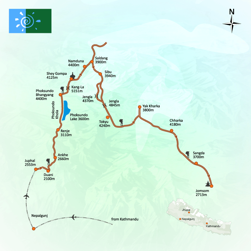
Altitude above sea level: (4,132 m) Tinje village

Hiking duration: 7-8 hrs. Approx.

Accommodation: Camping

Meal: Breakfast, Lunch, and Dinner

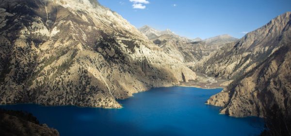
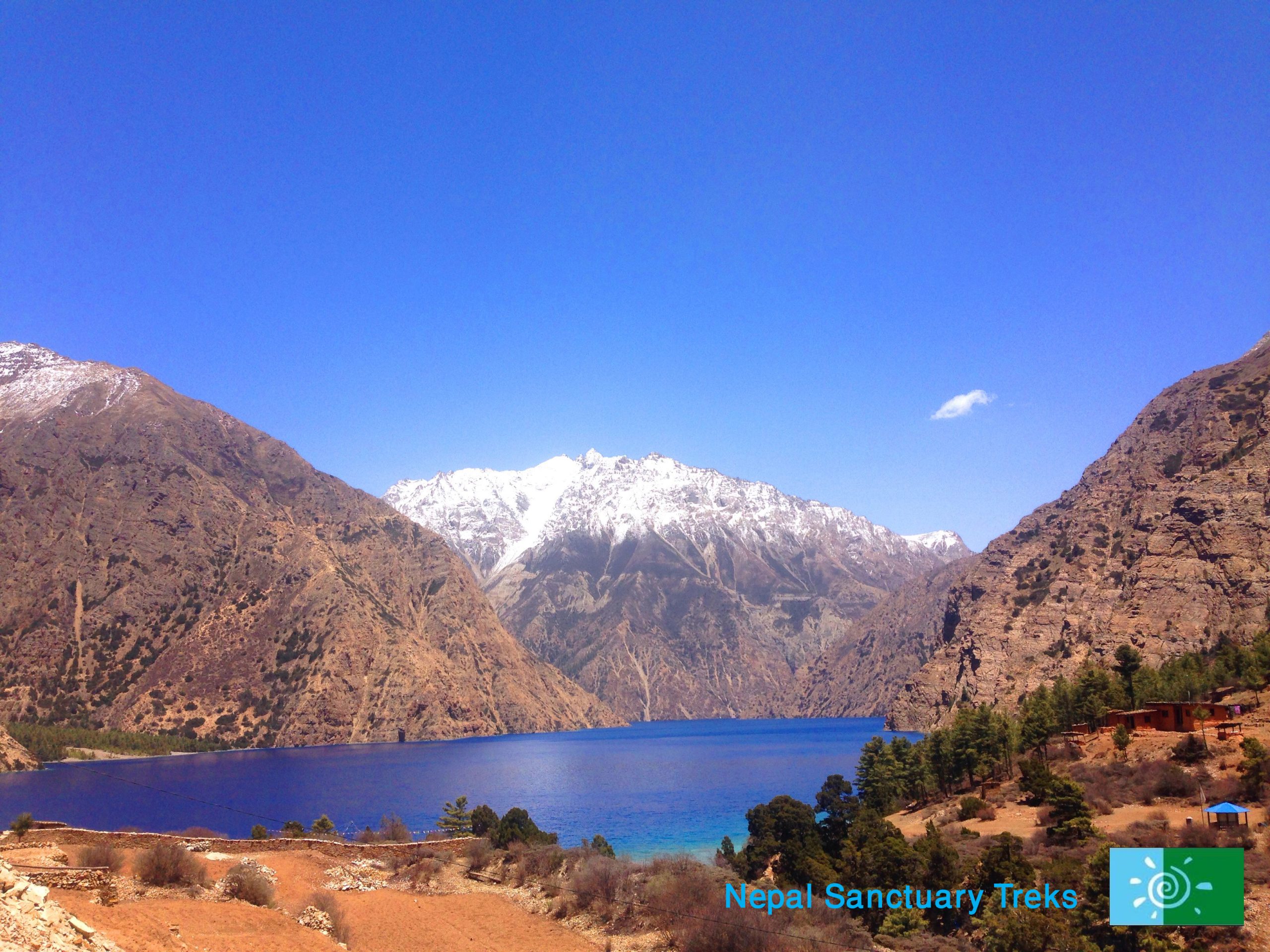
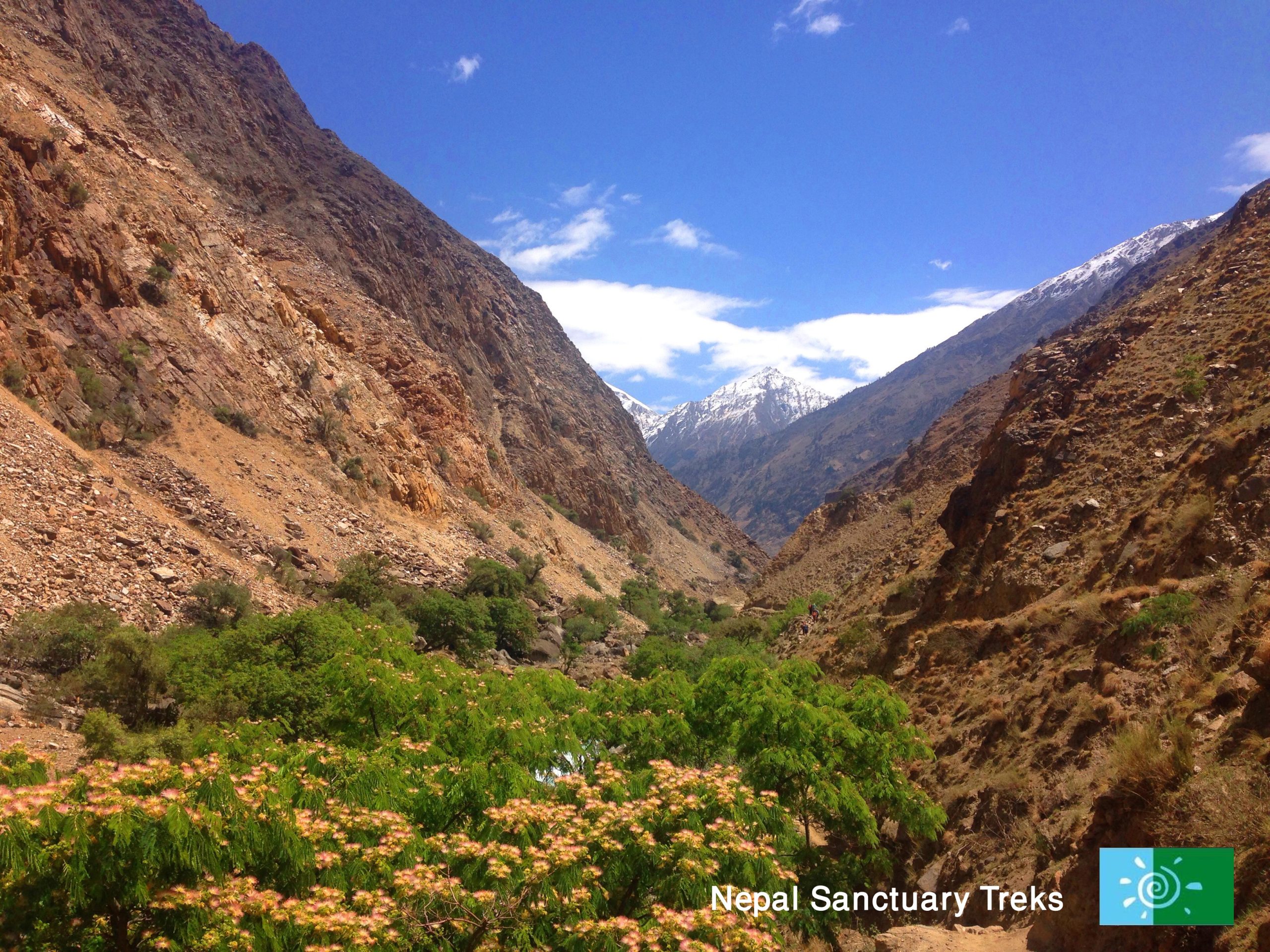
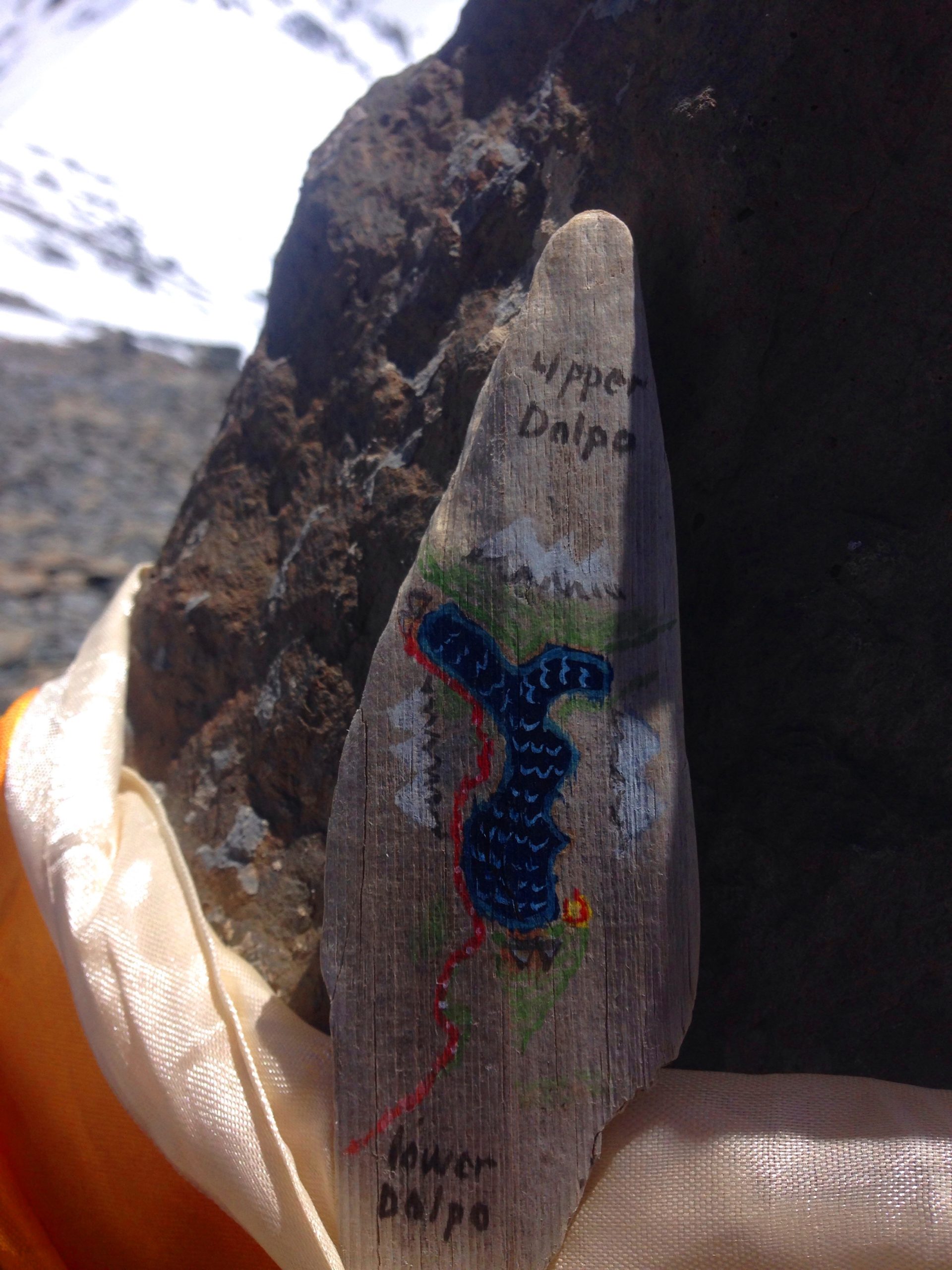
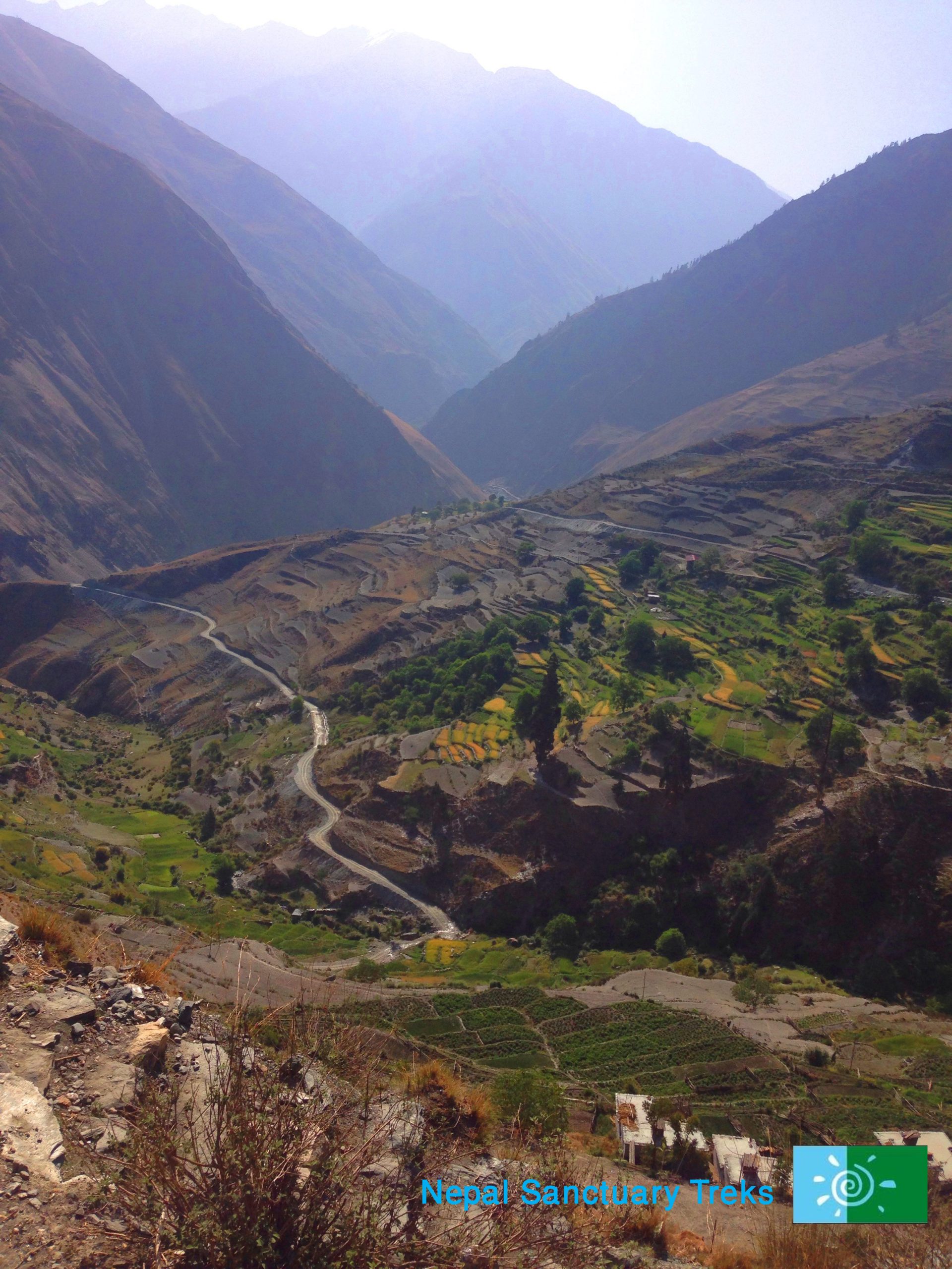
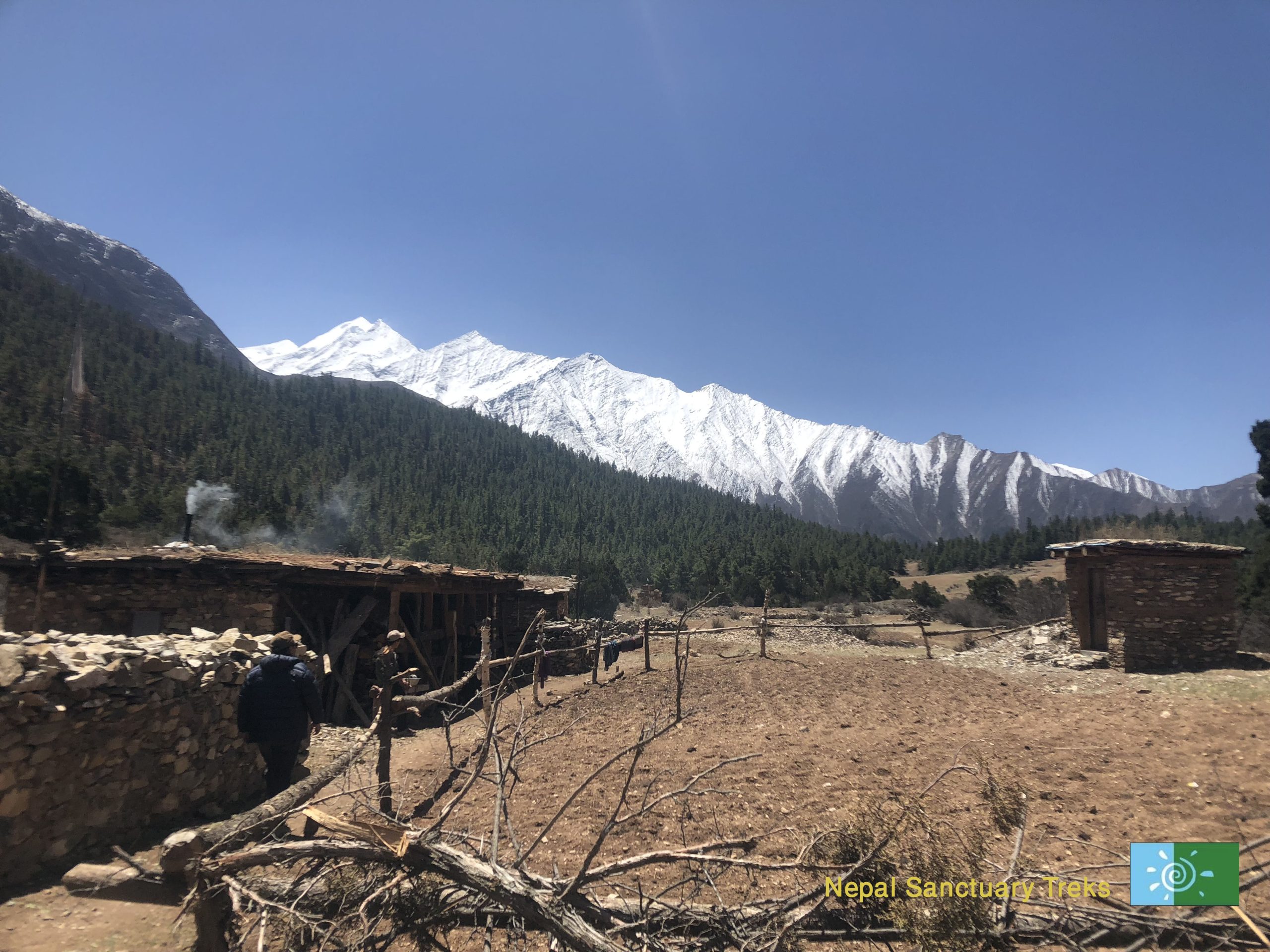
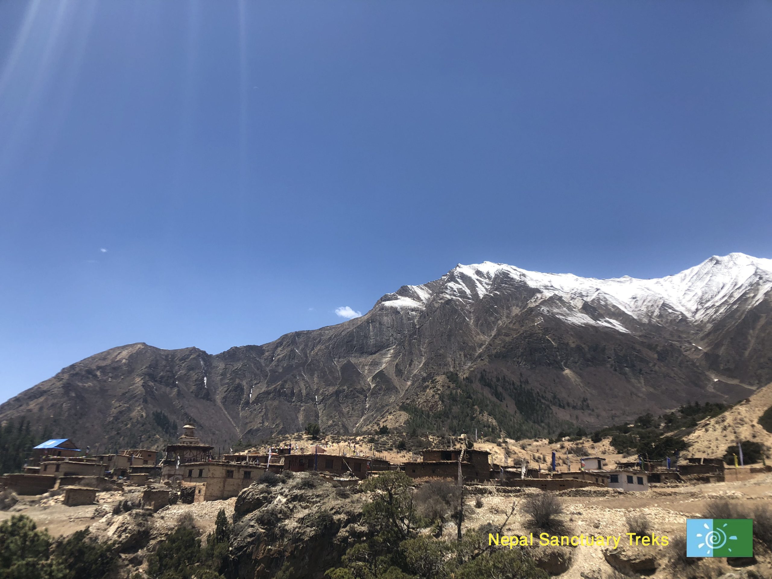
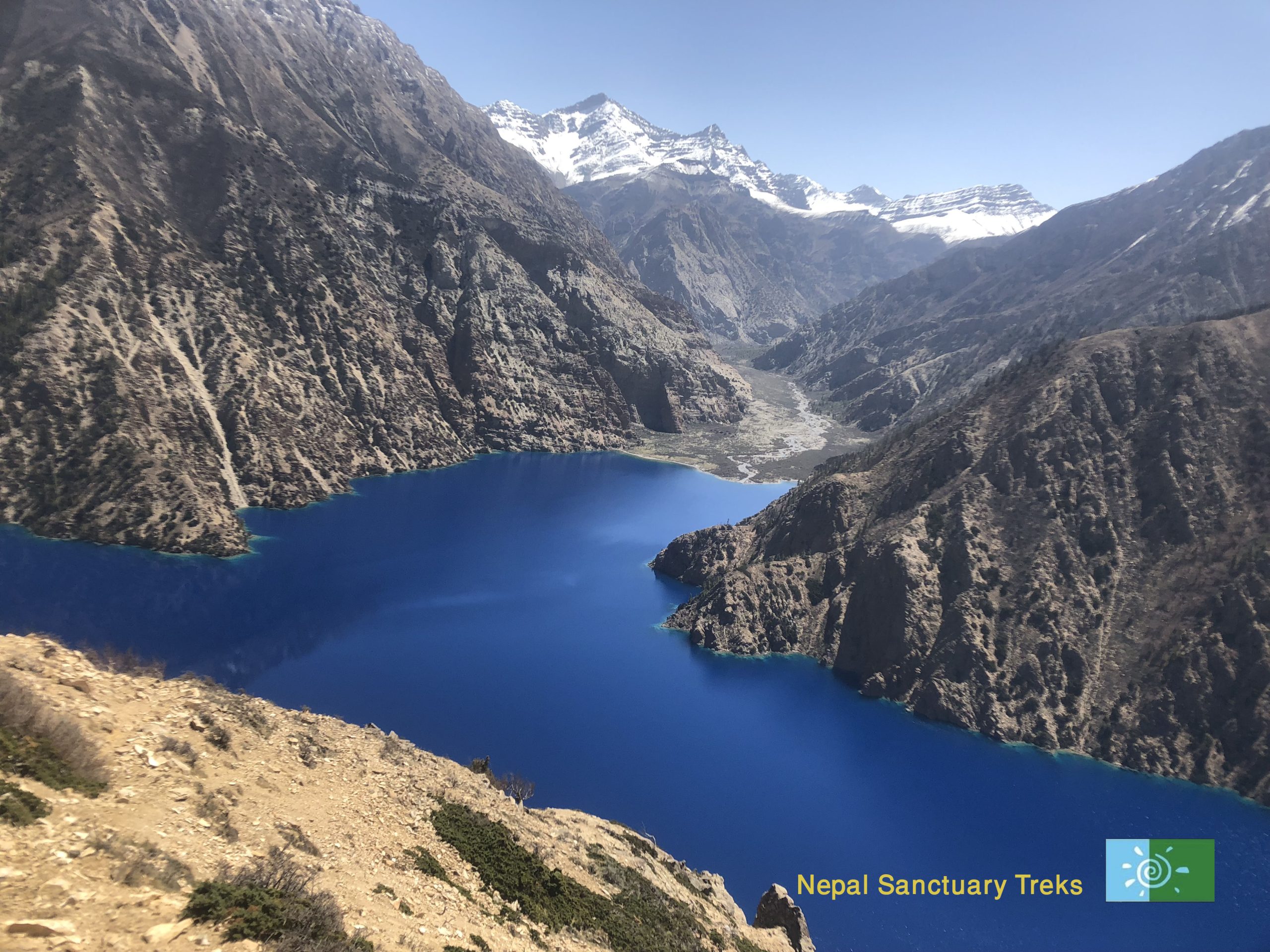
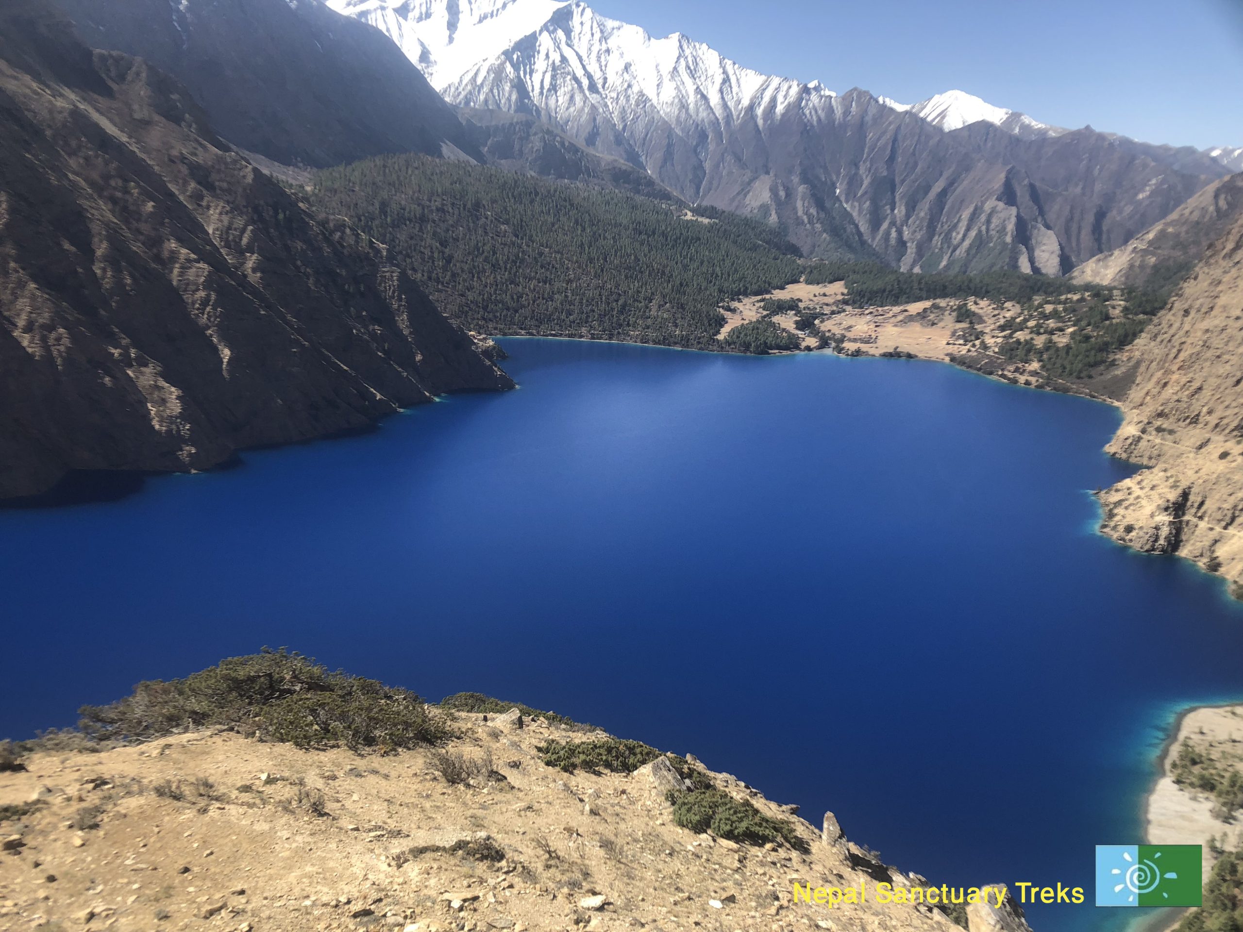
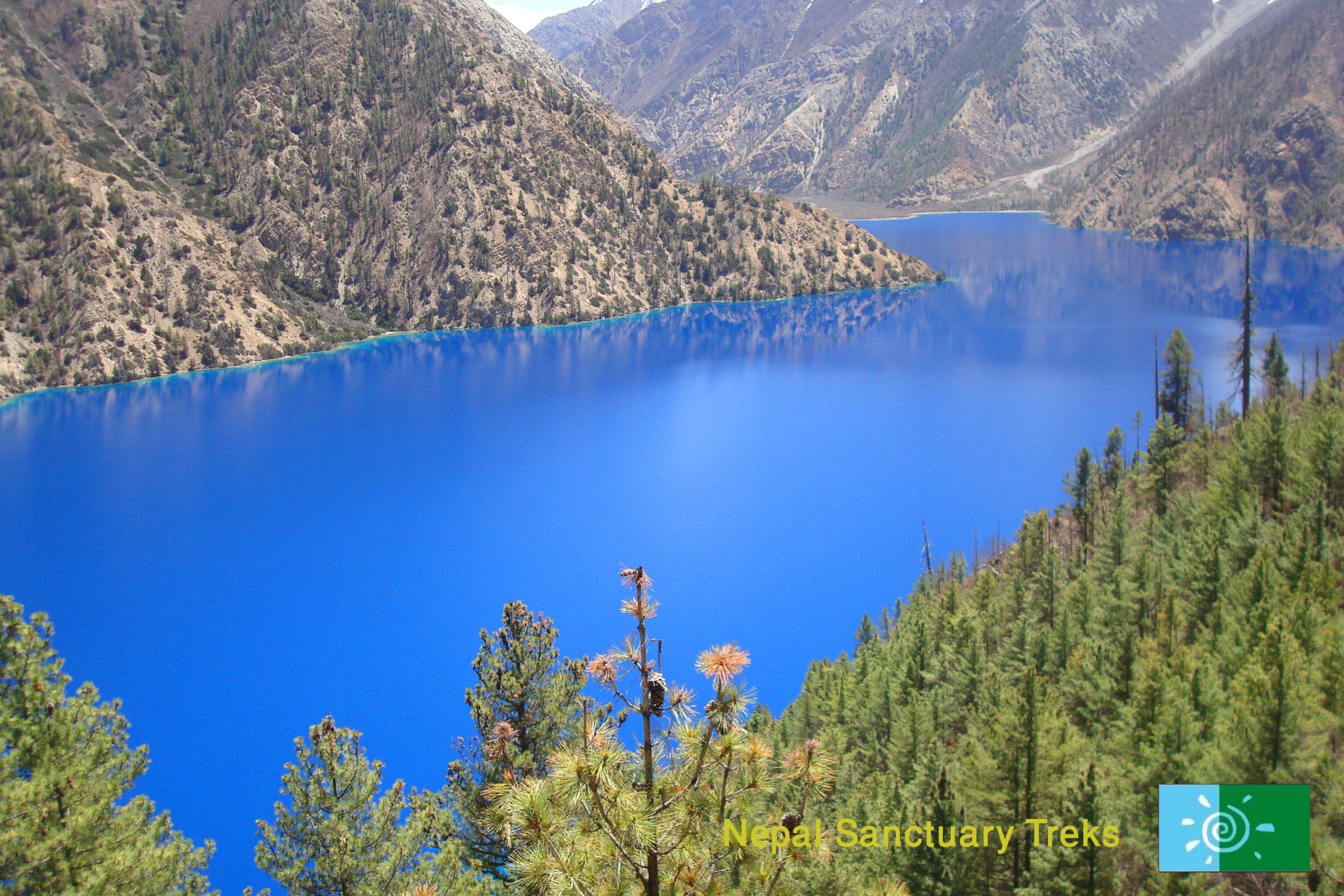
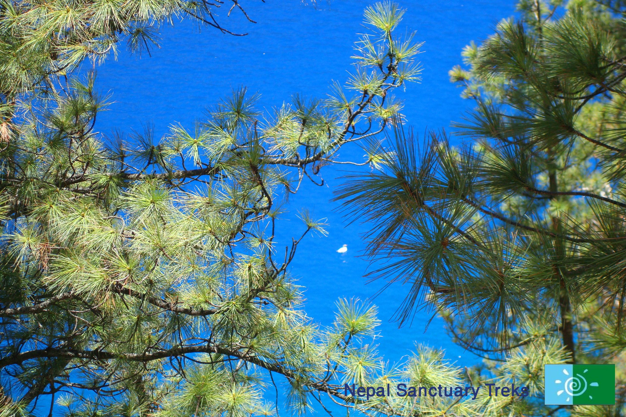
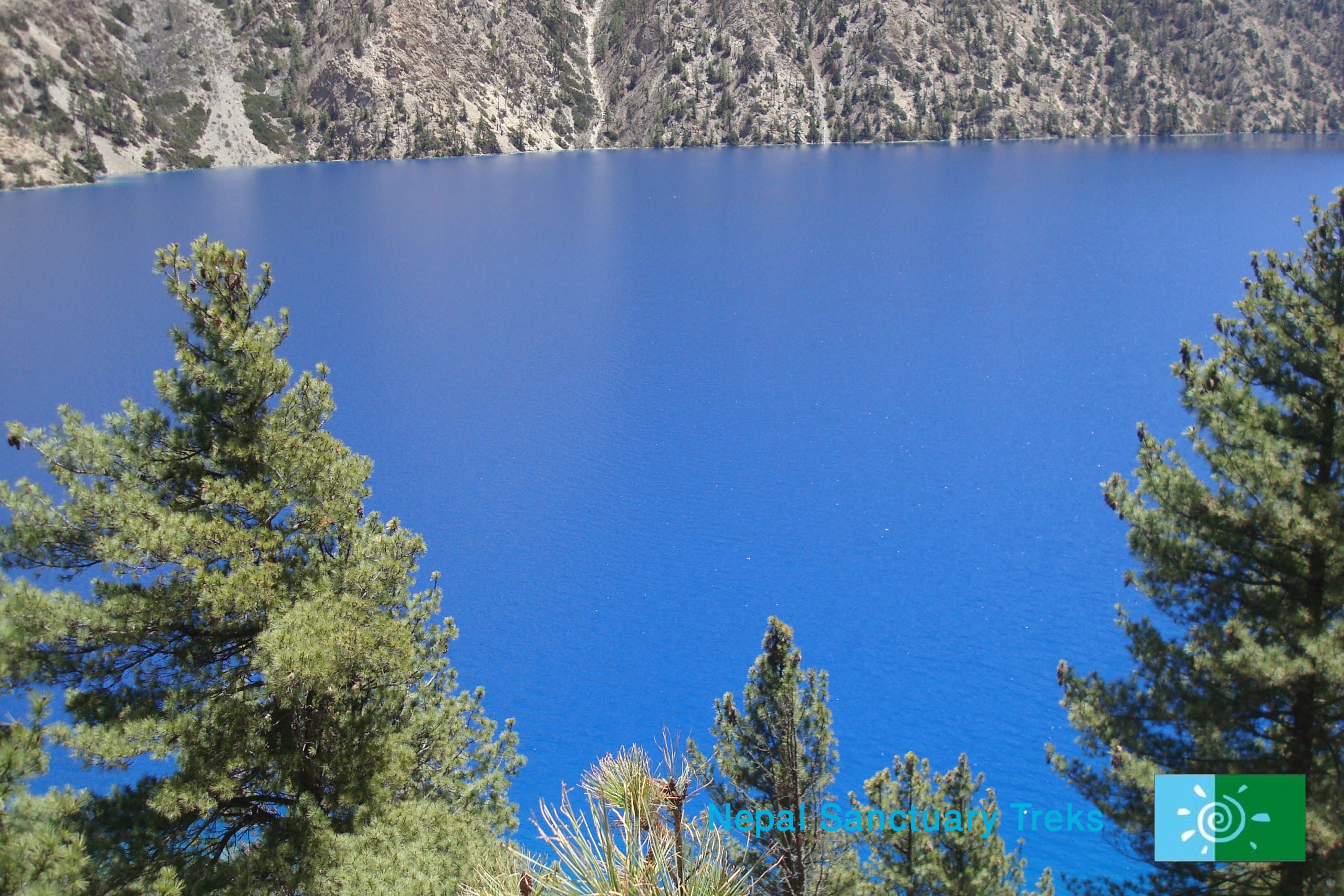
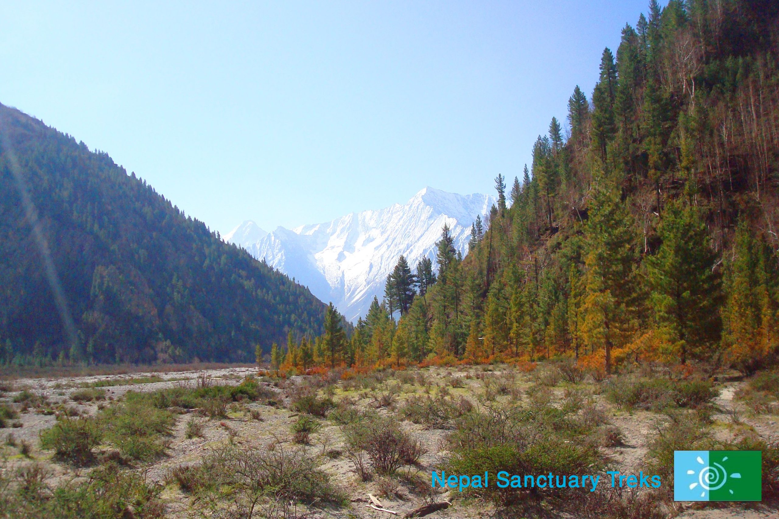
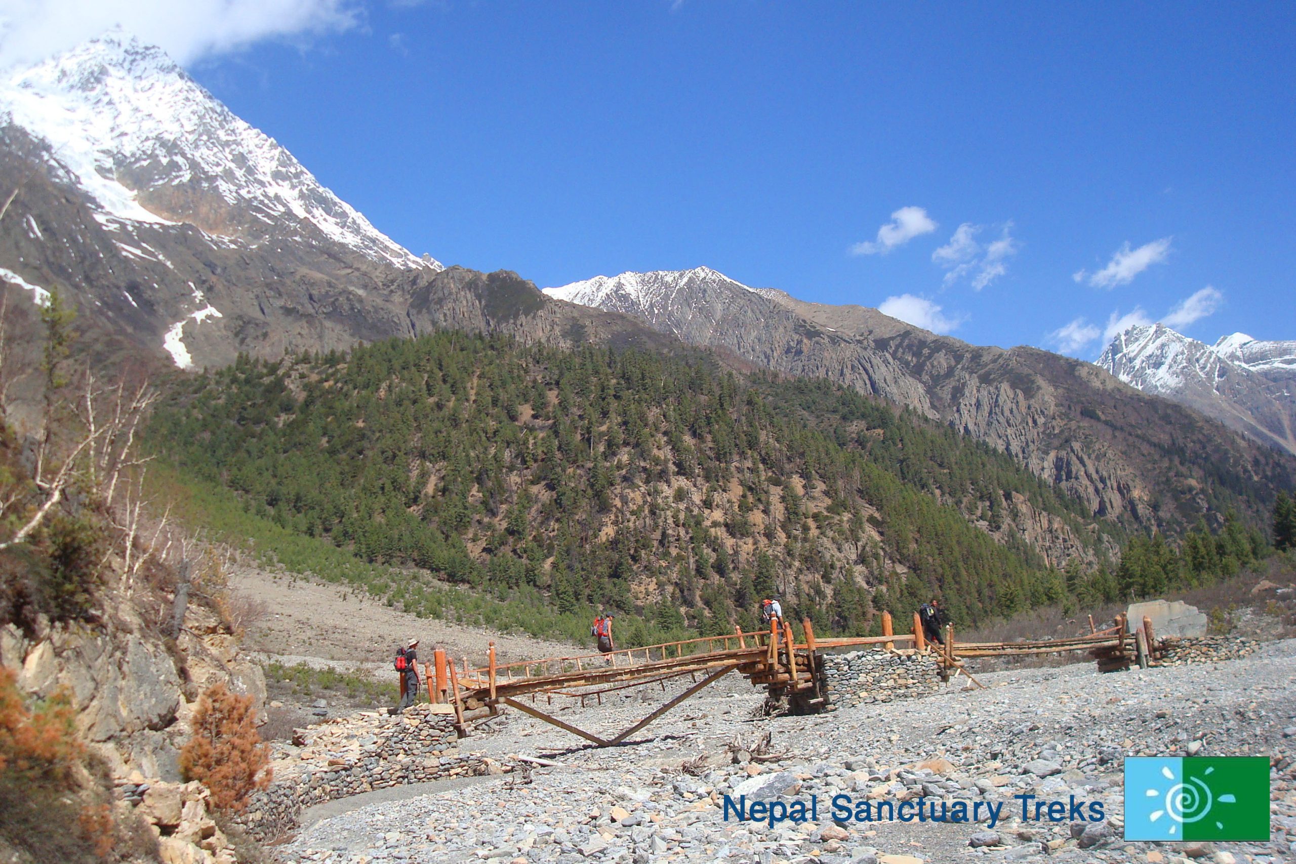
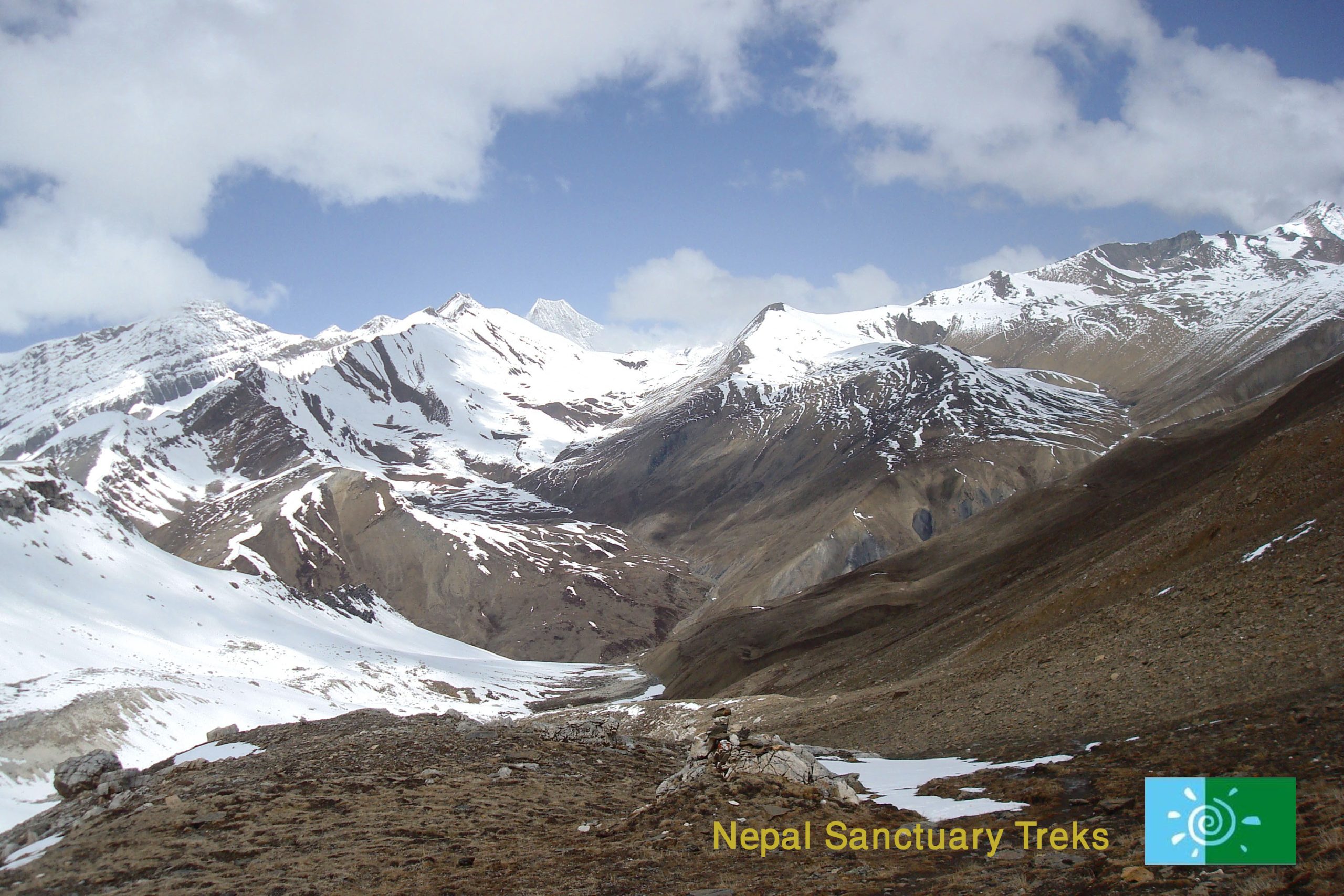
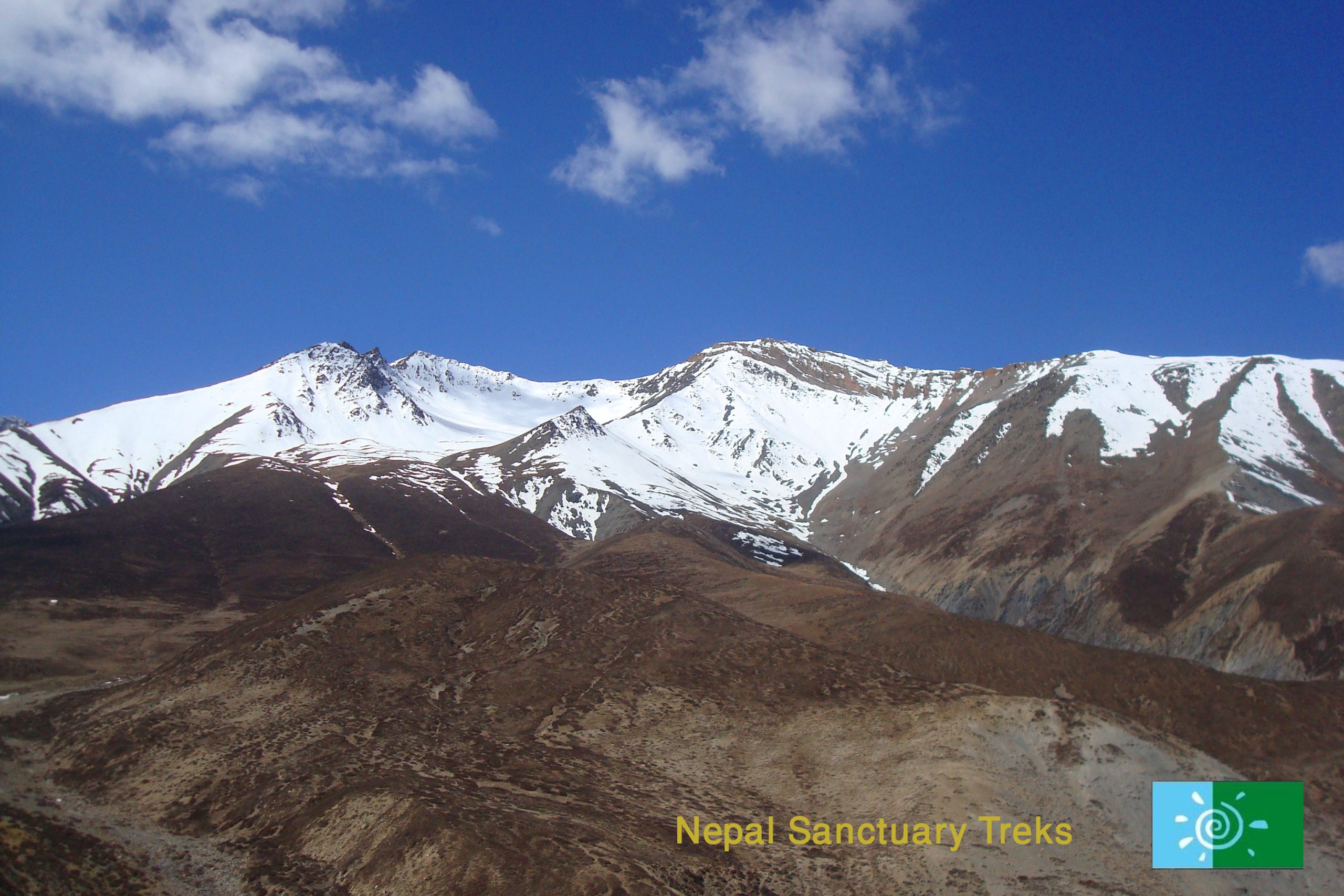
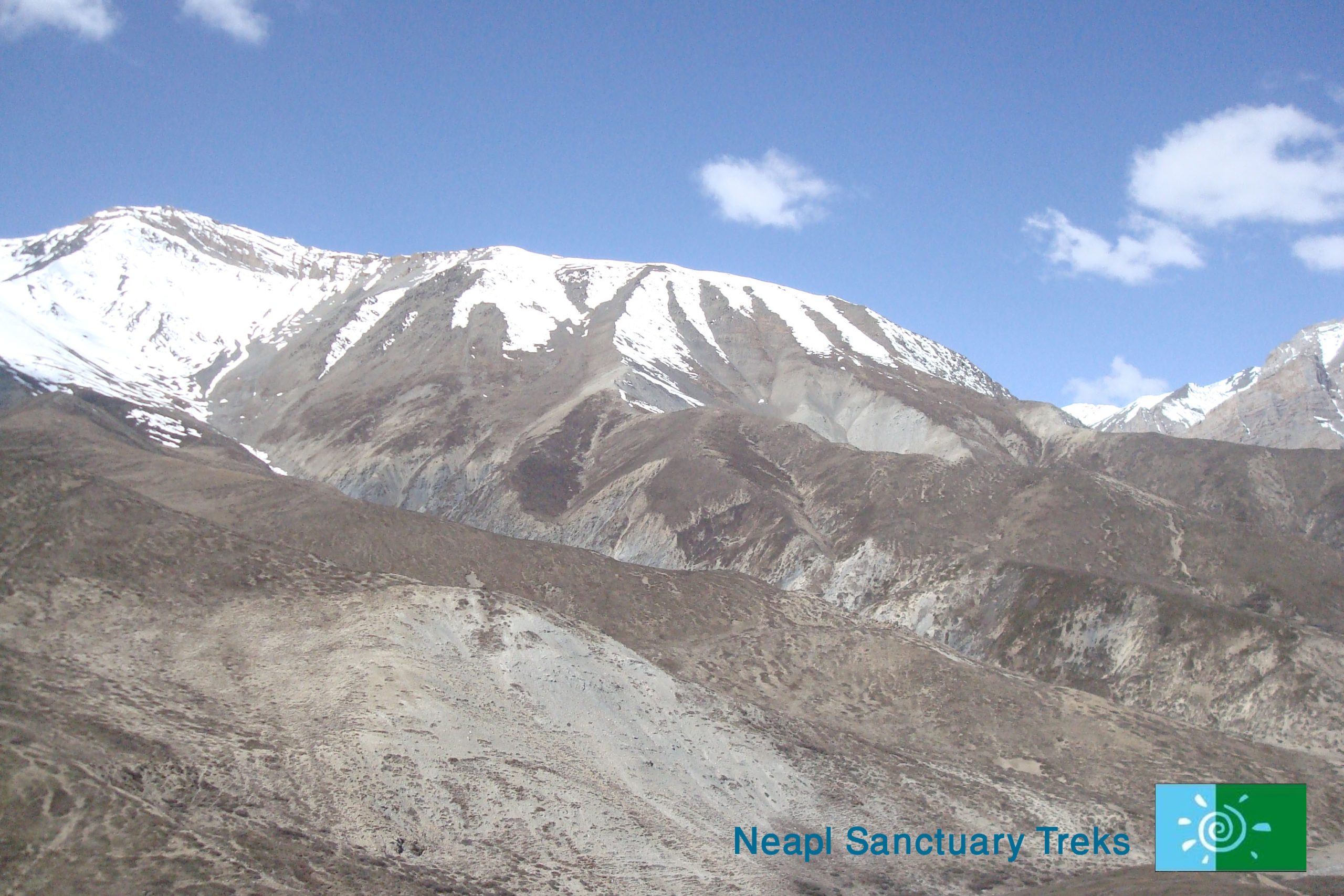
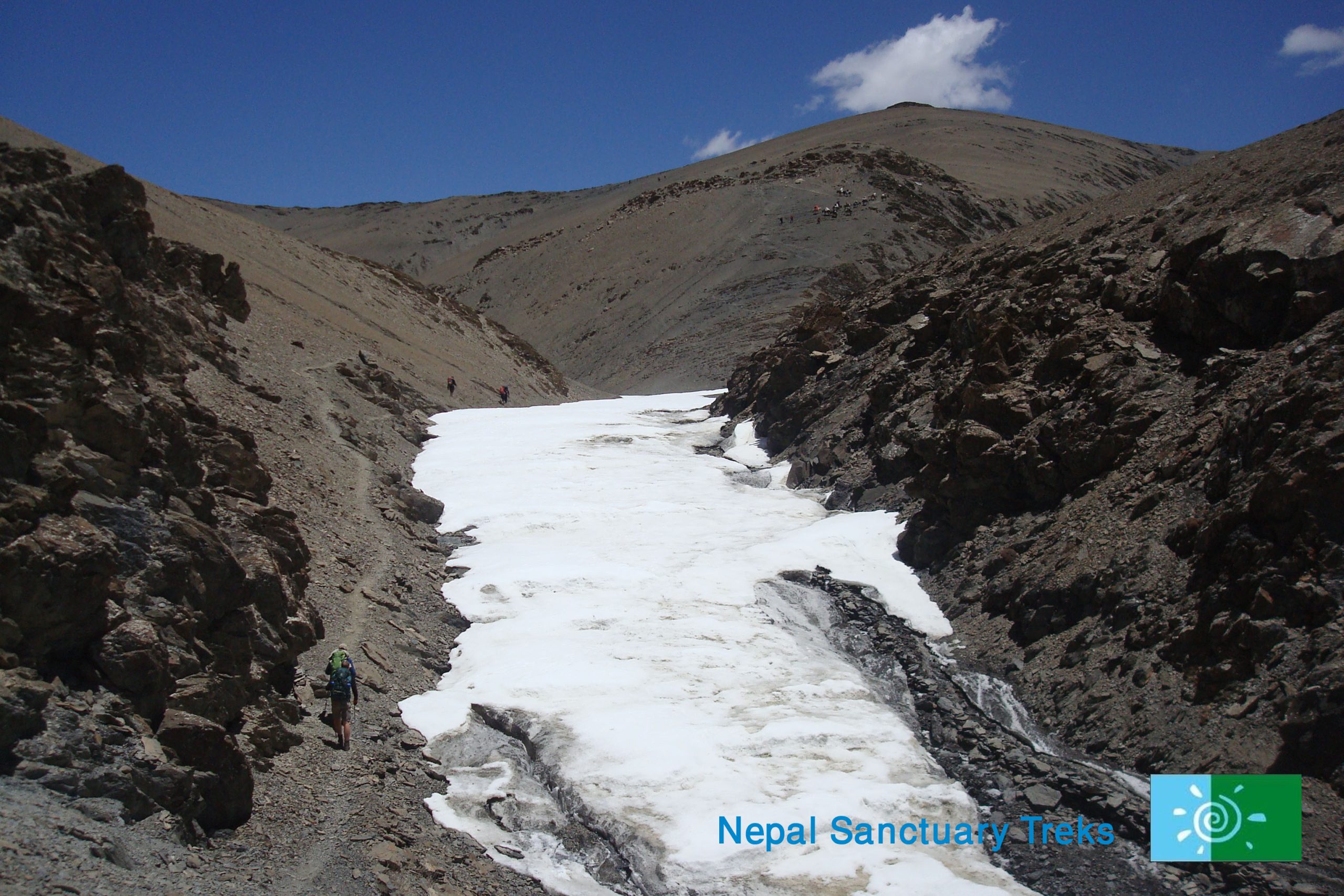
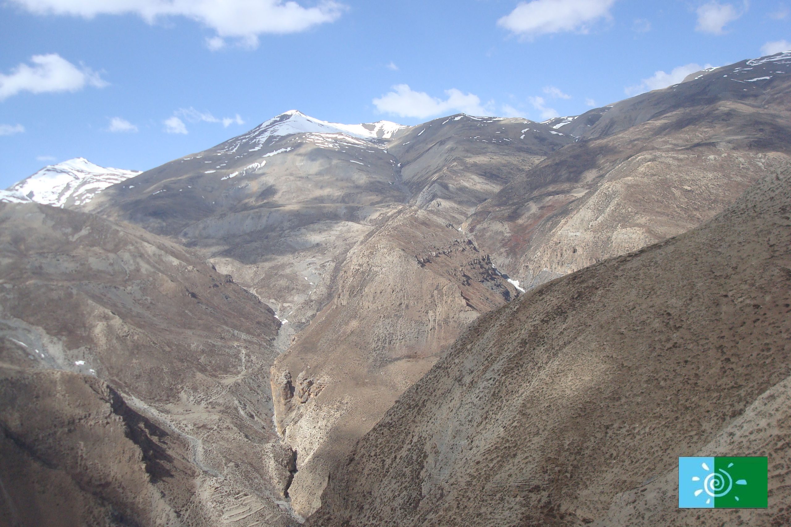
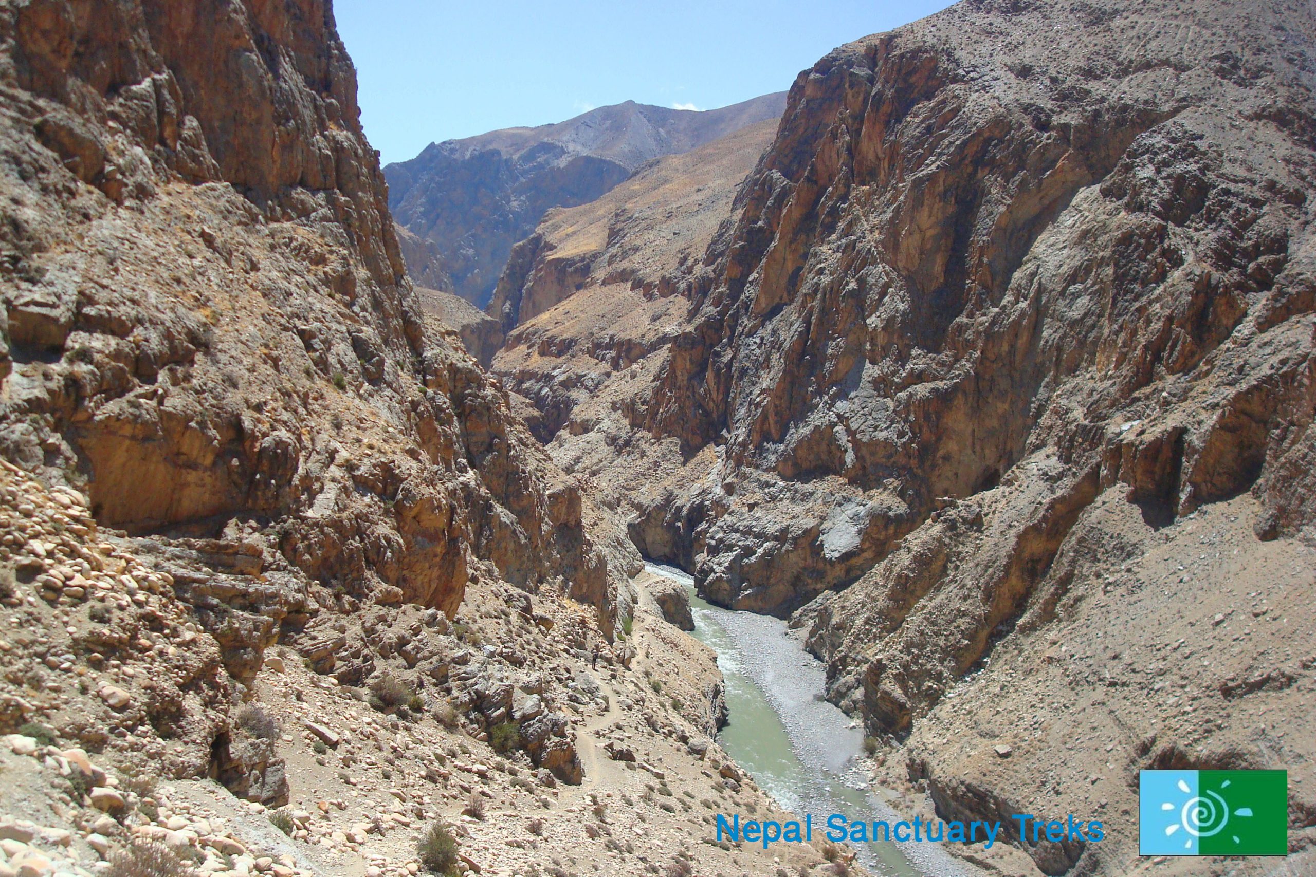
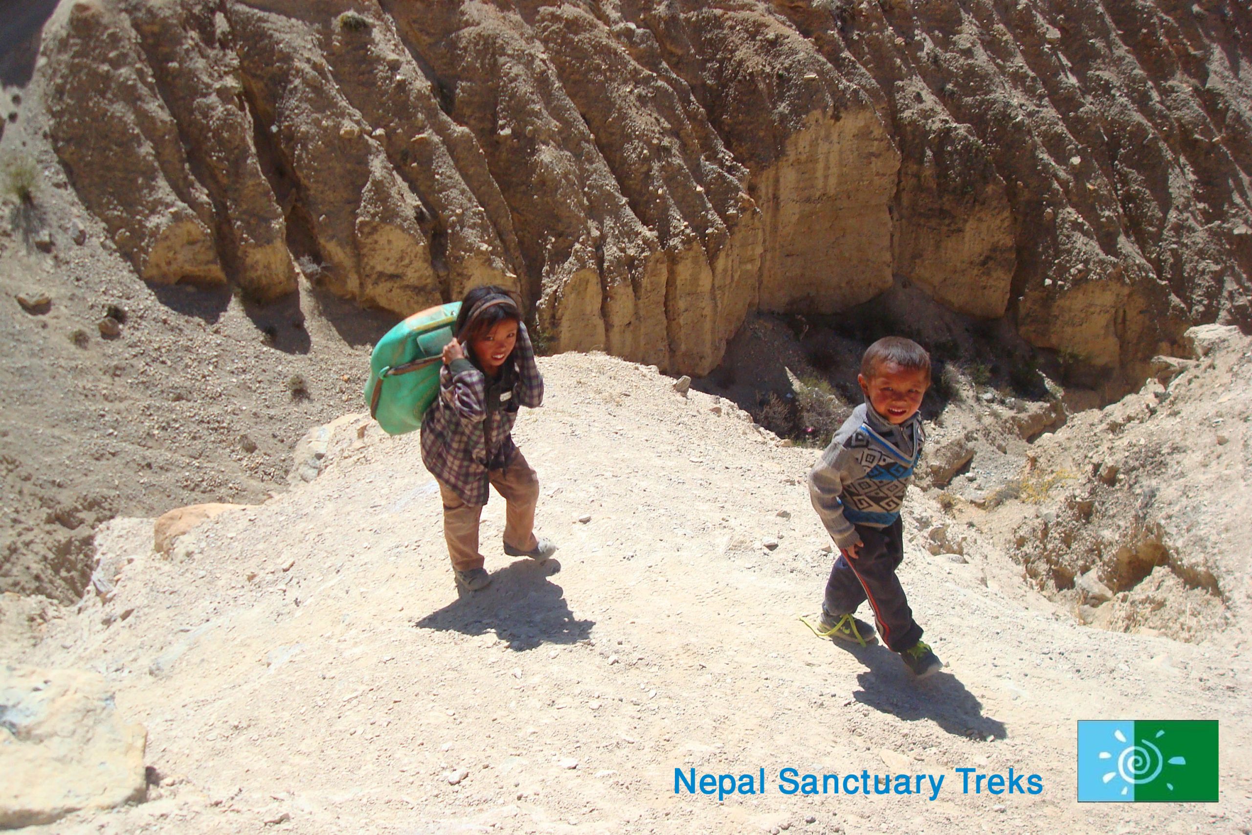
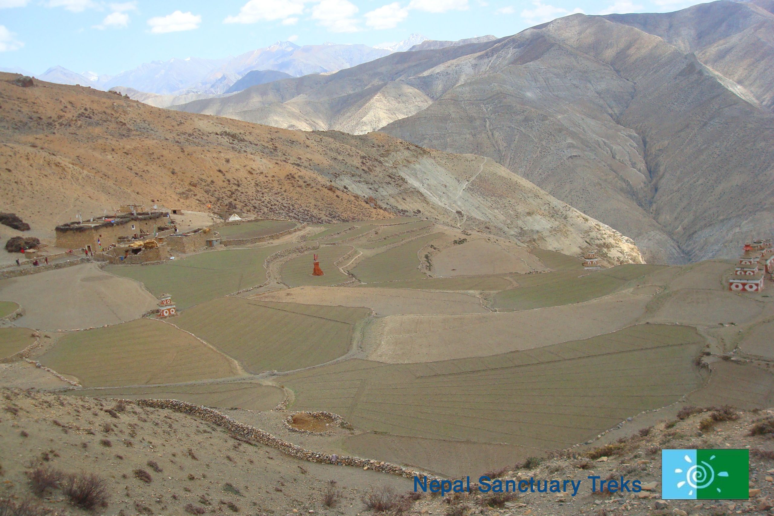
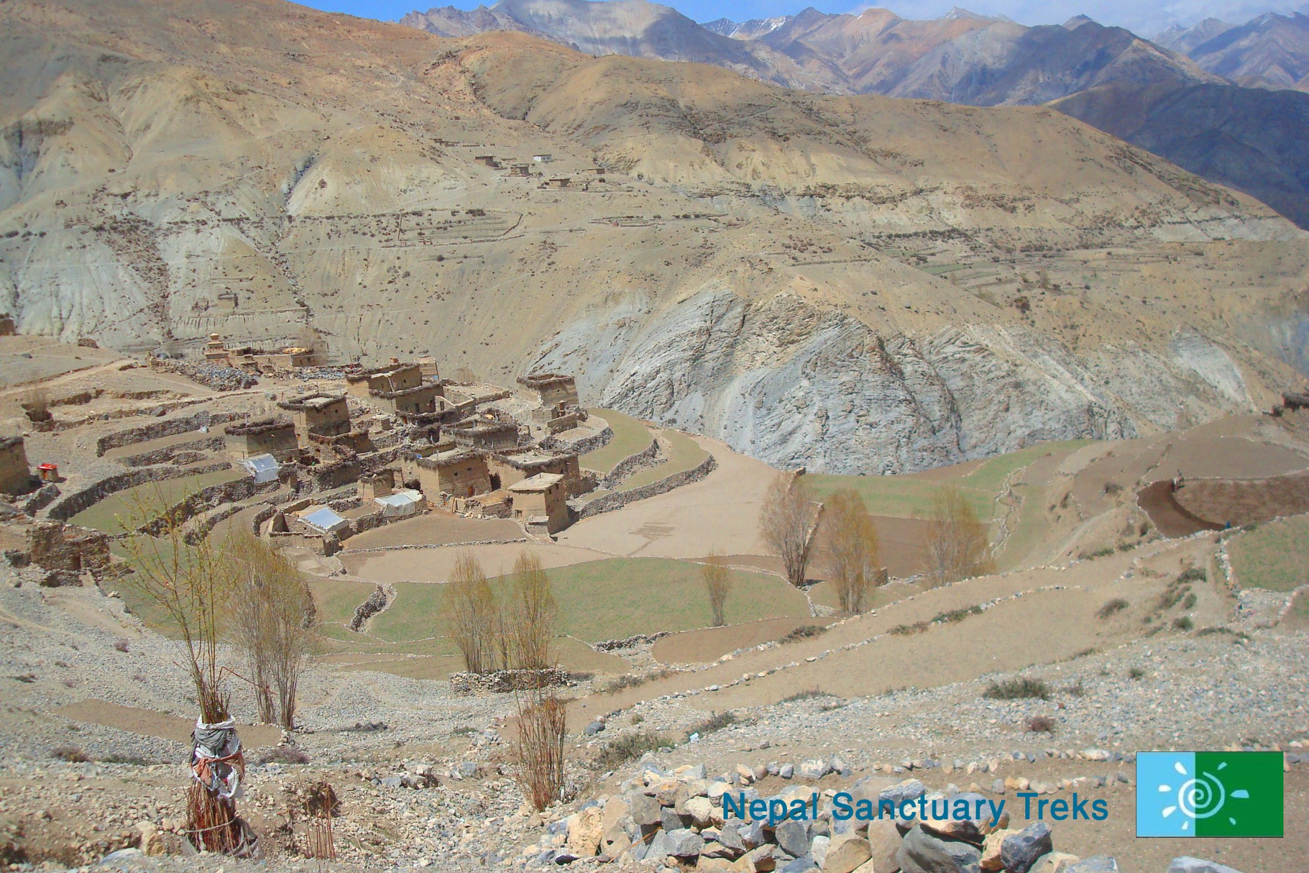
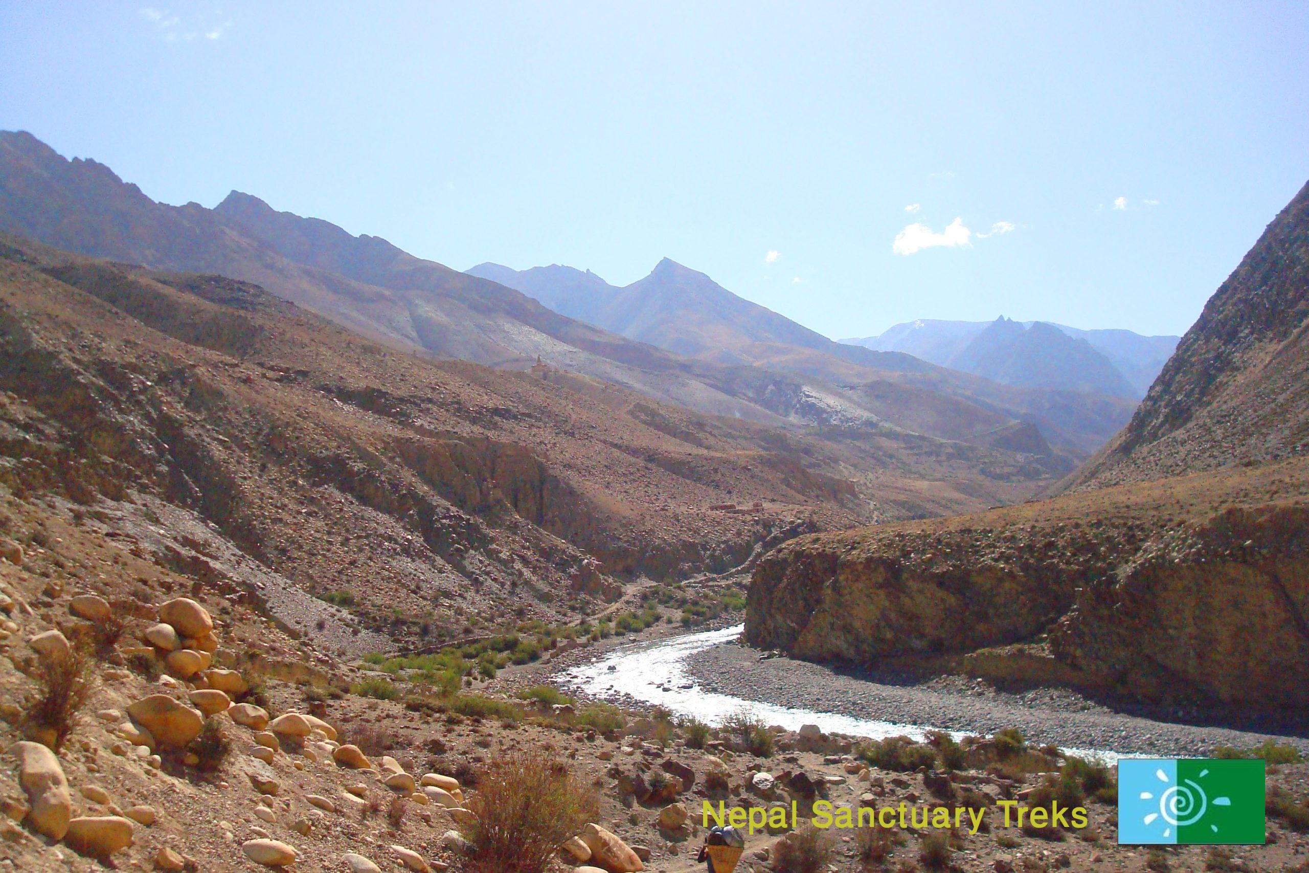
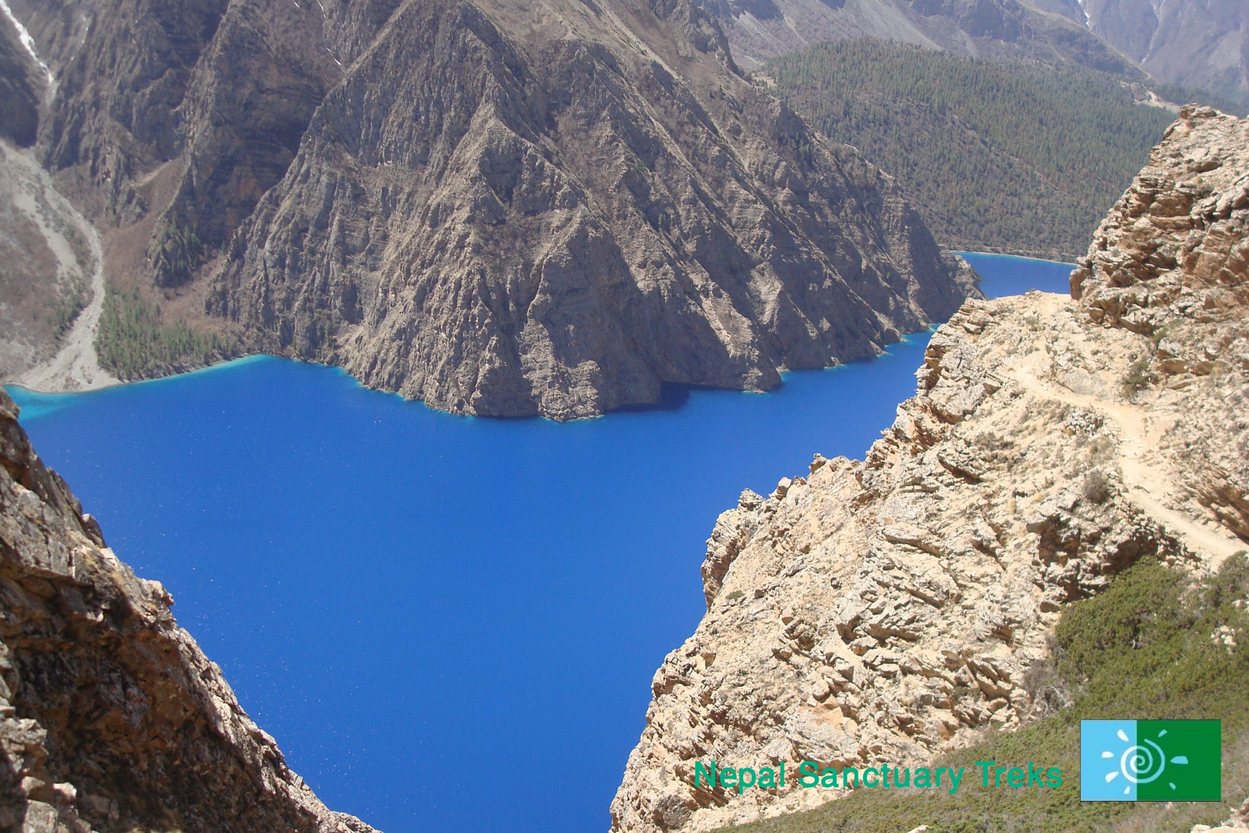
After a hearty breakfast at camp, you trek towards Tinje village.  You start trekking down the valley to Shimen village, well shaded with groves of willow. This village has large areas of terraced fields planted with buckwheat, barley, and potatoes. Look out for the new school and the Mani wall over 600 m long. The Panzang valley is one of the four main valleys that comprise Upper Dolpo, the others being Tarap, Nangkhong, and Tsharka.

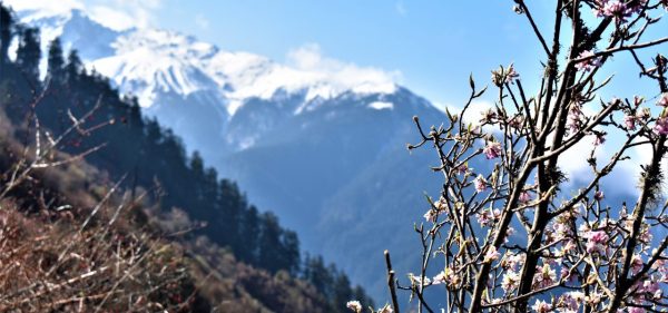
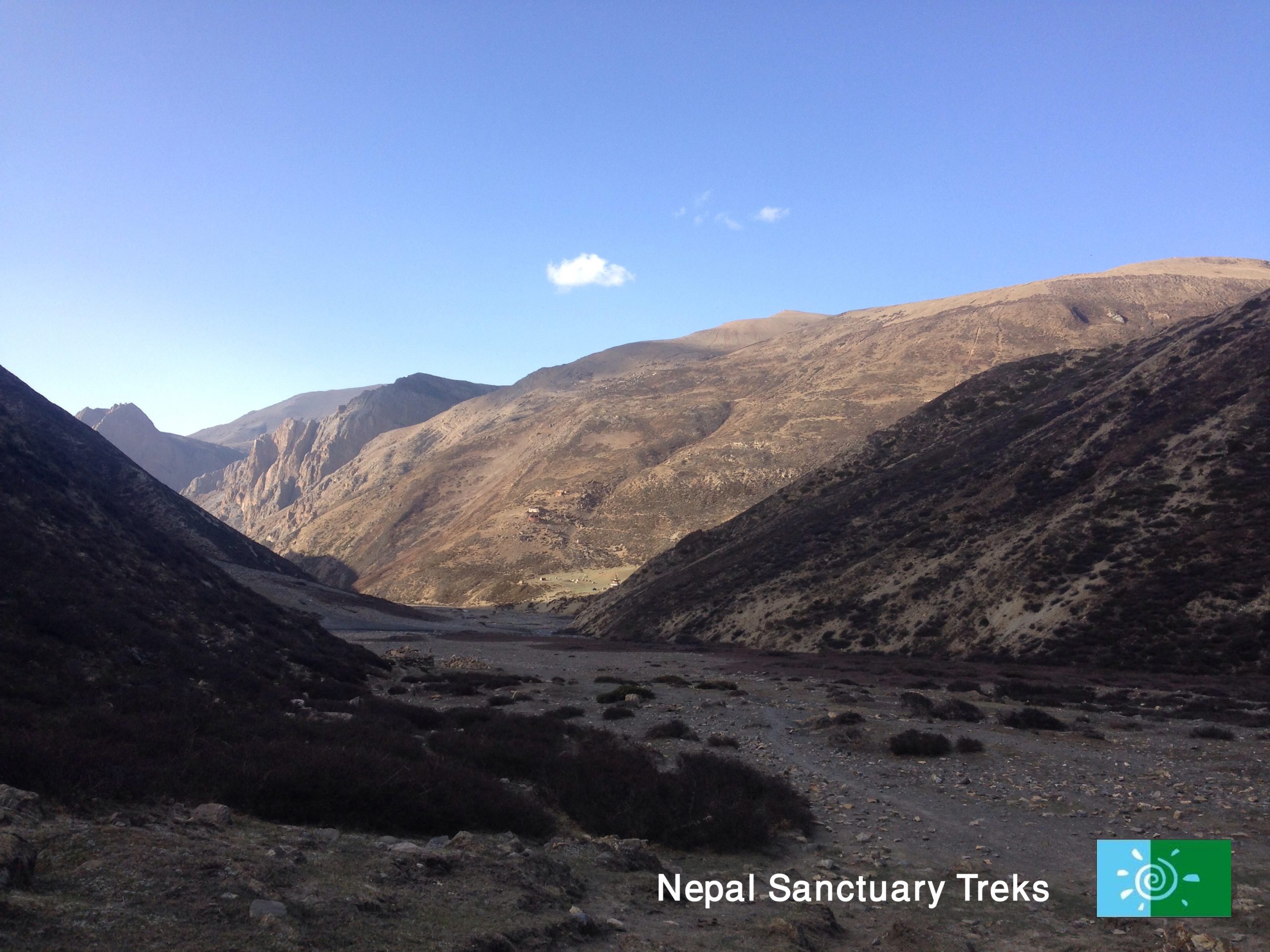
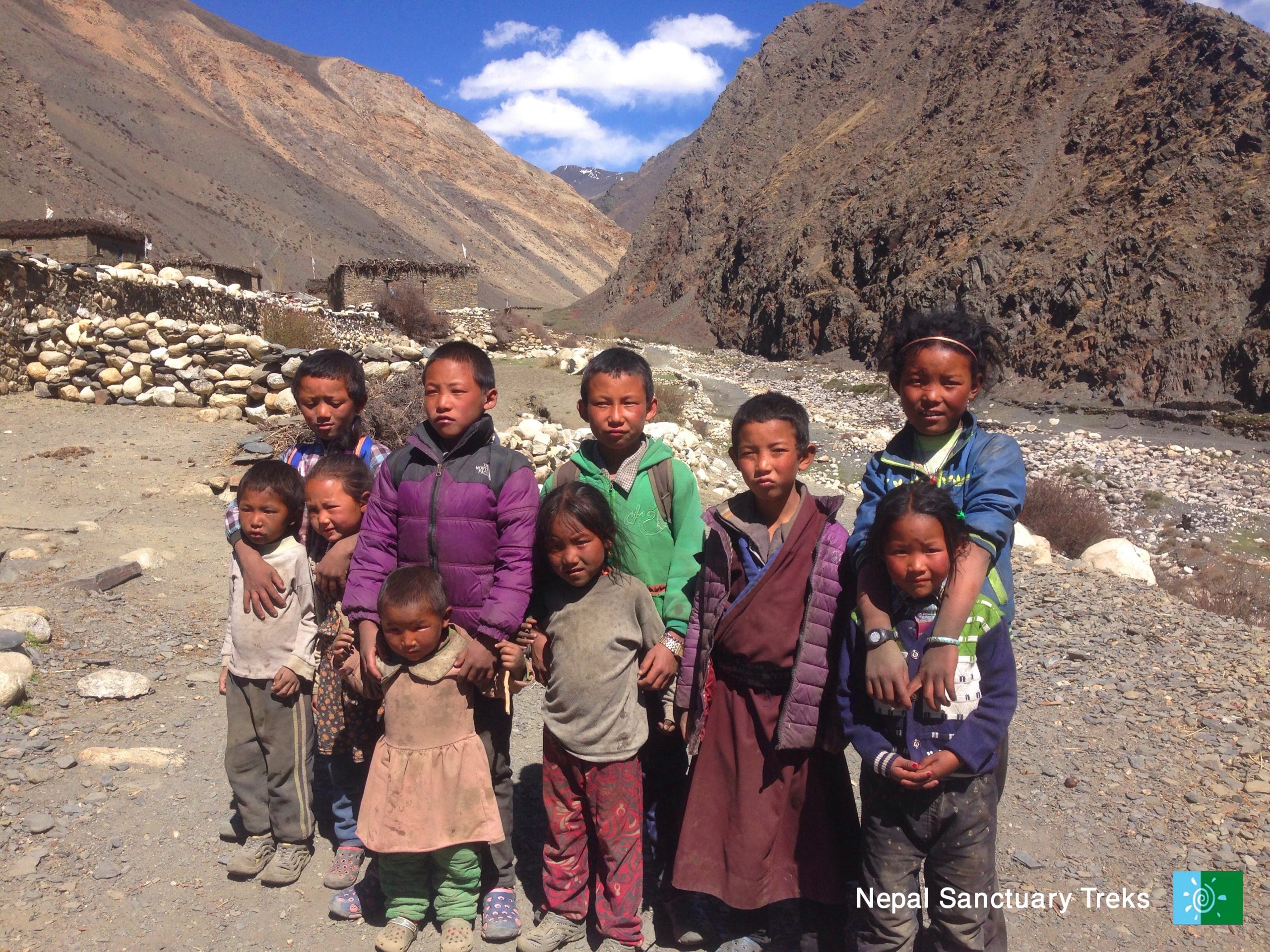
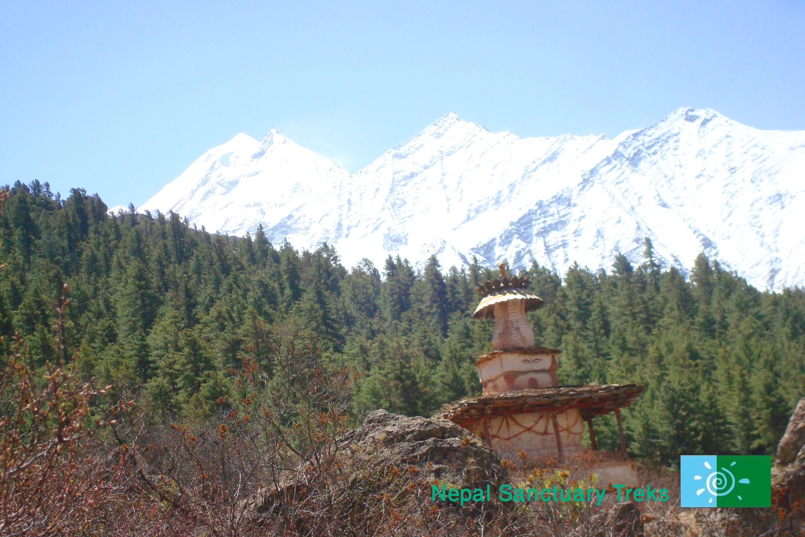
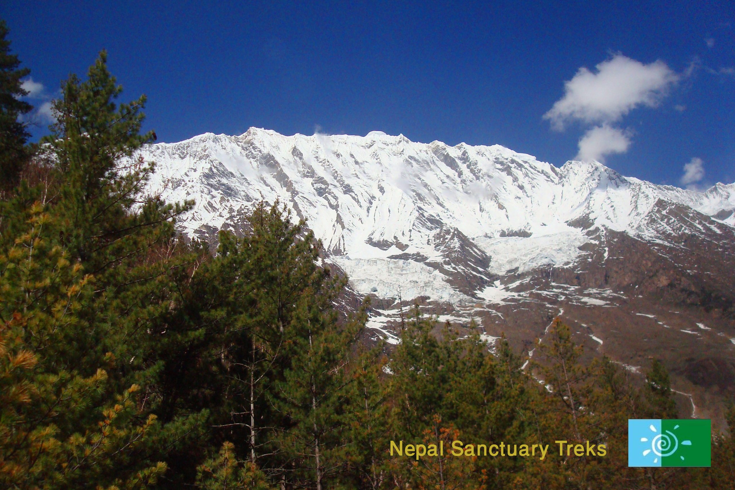
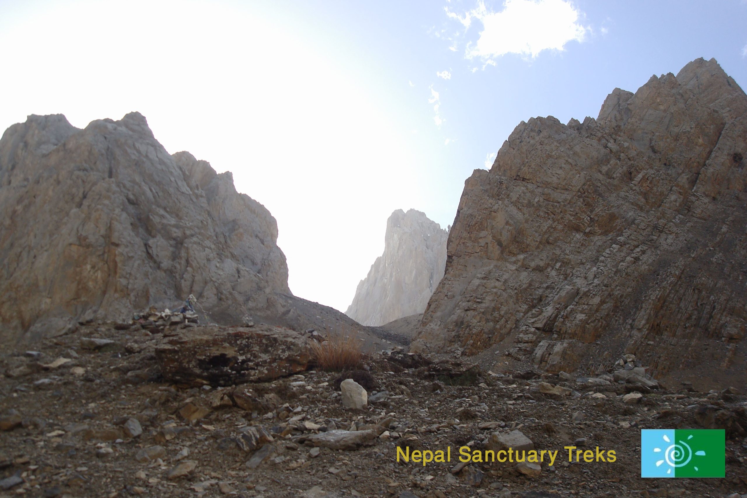
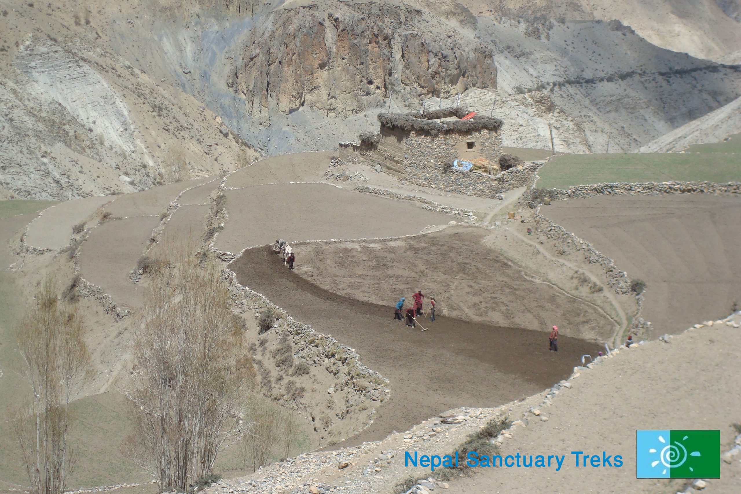
After an hour, you trek up a tributary river underneath overhanging conglomerate, then ascend to reach Mendo Camp on a grassy shelf. Shortly you will see Pu gompa on the other side of the river, follow Panzang Khola for a further 1 ½ hour to the lunch spot next to Namygal chorten. After lunch, the valley widens and after several hours you get to the village of Phalwa inhabited by Tibetans where the men have red sashes on their hair.

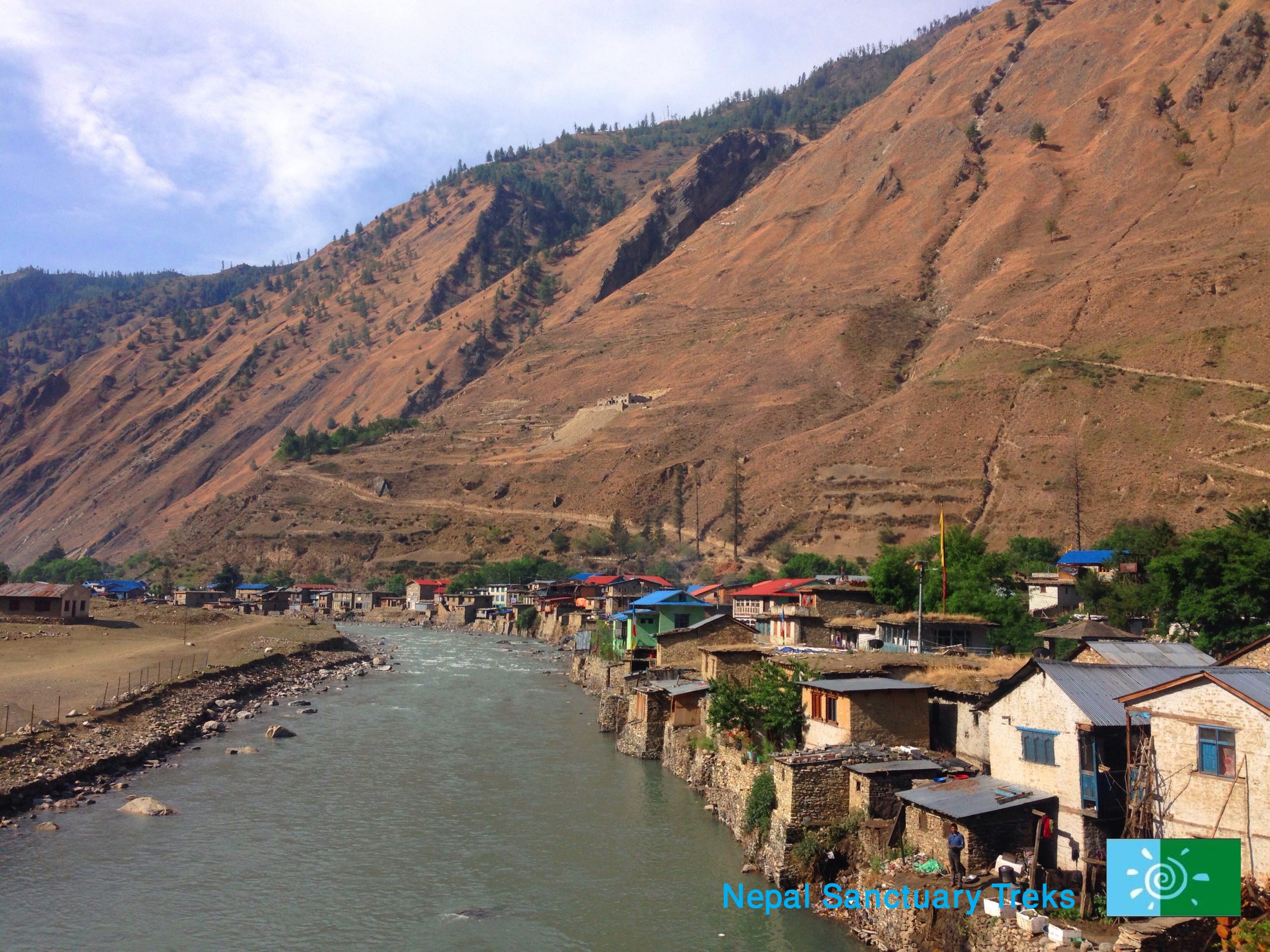
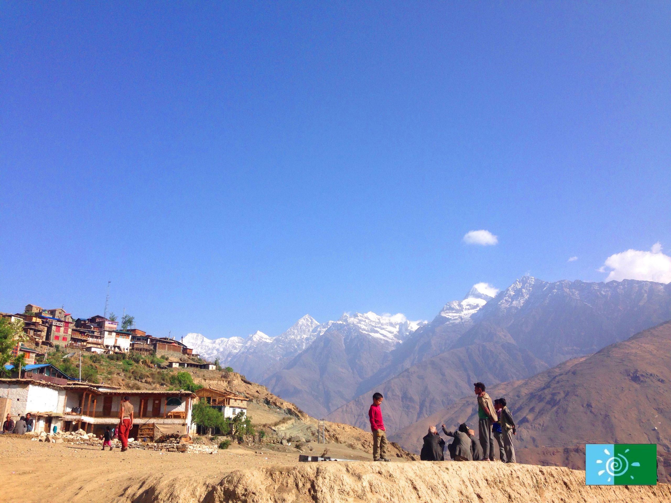
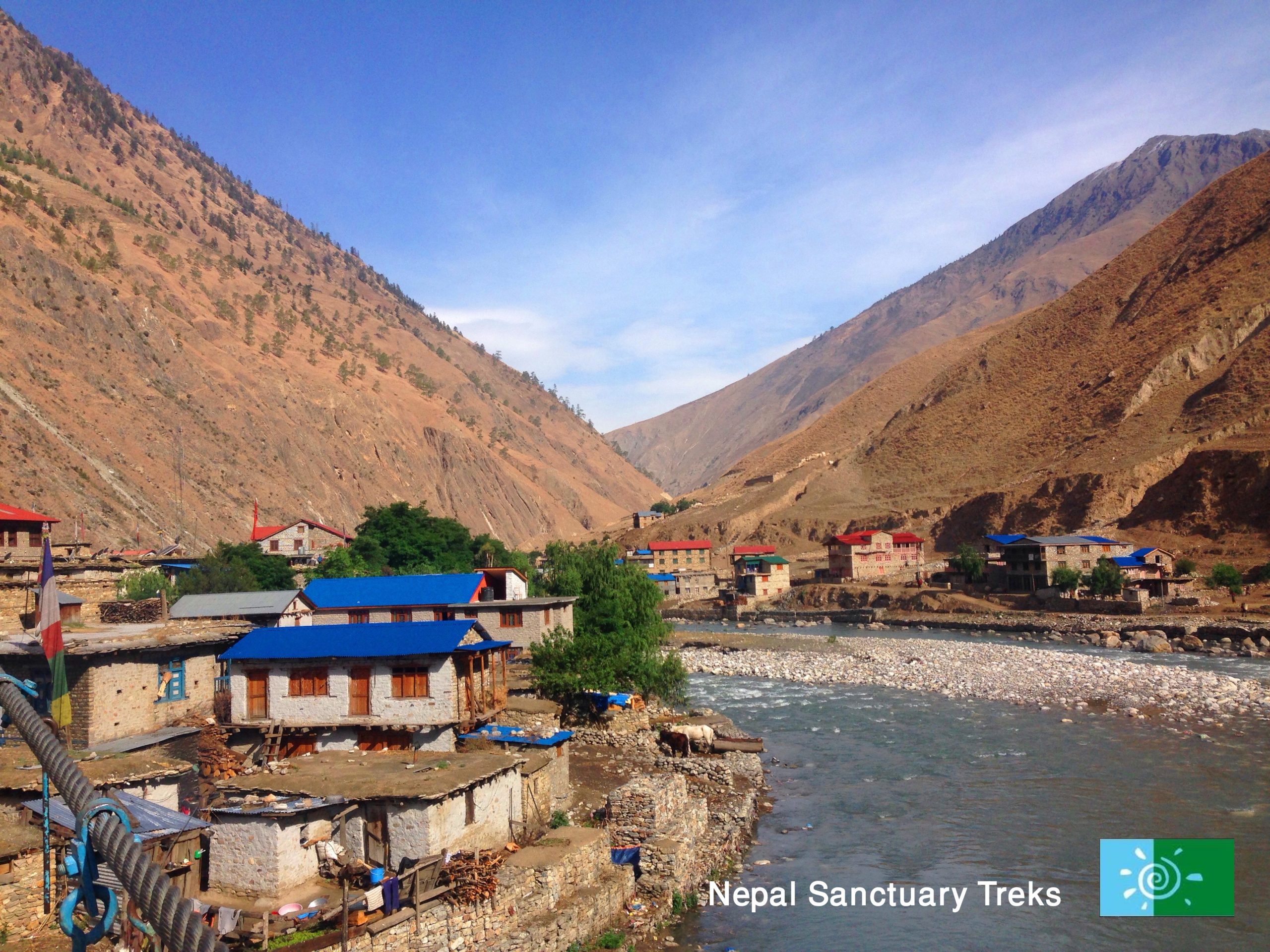
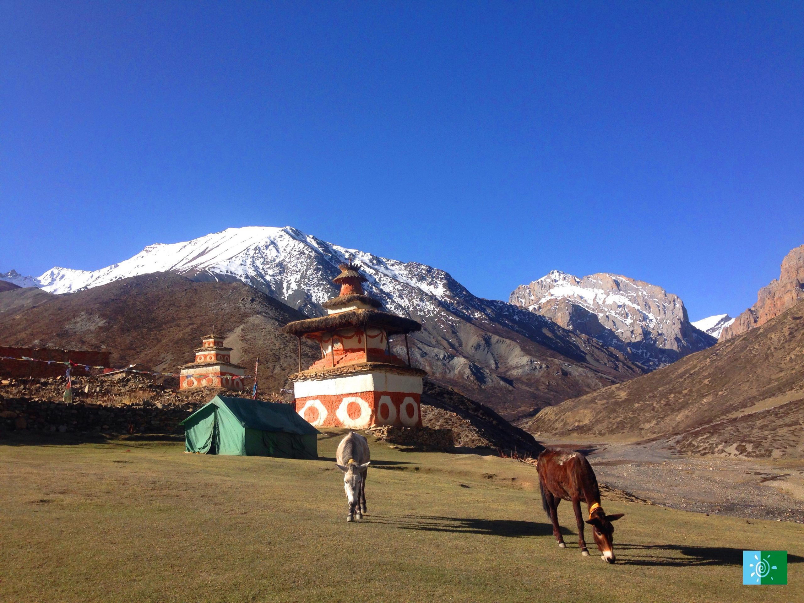
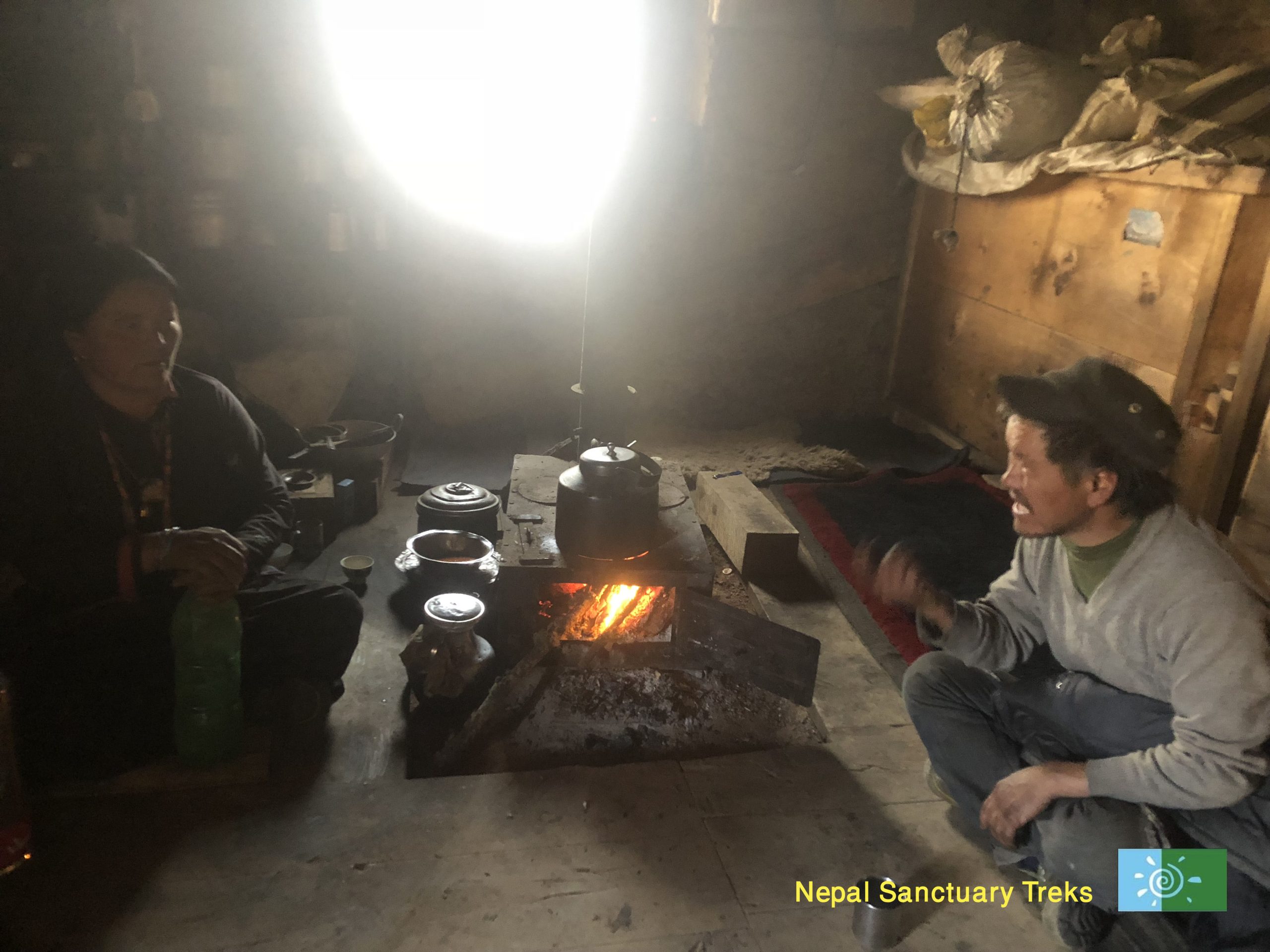
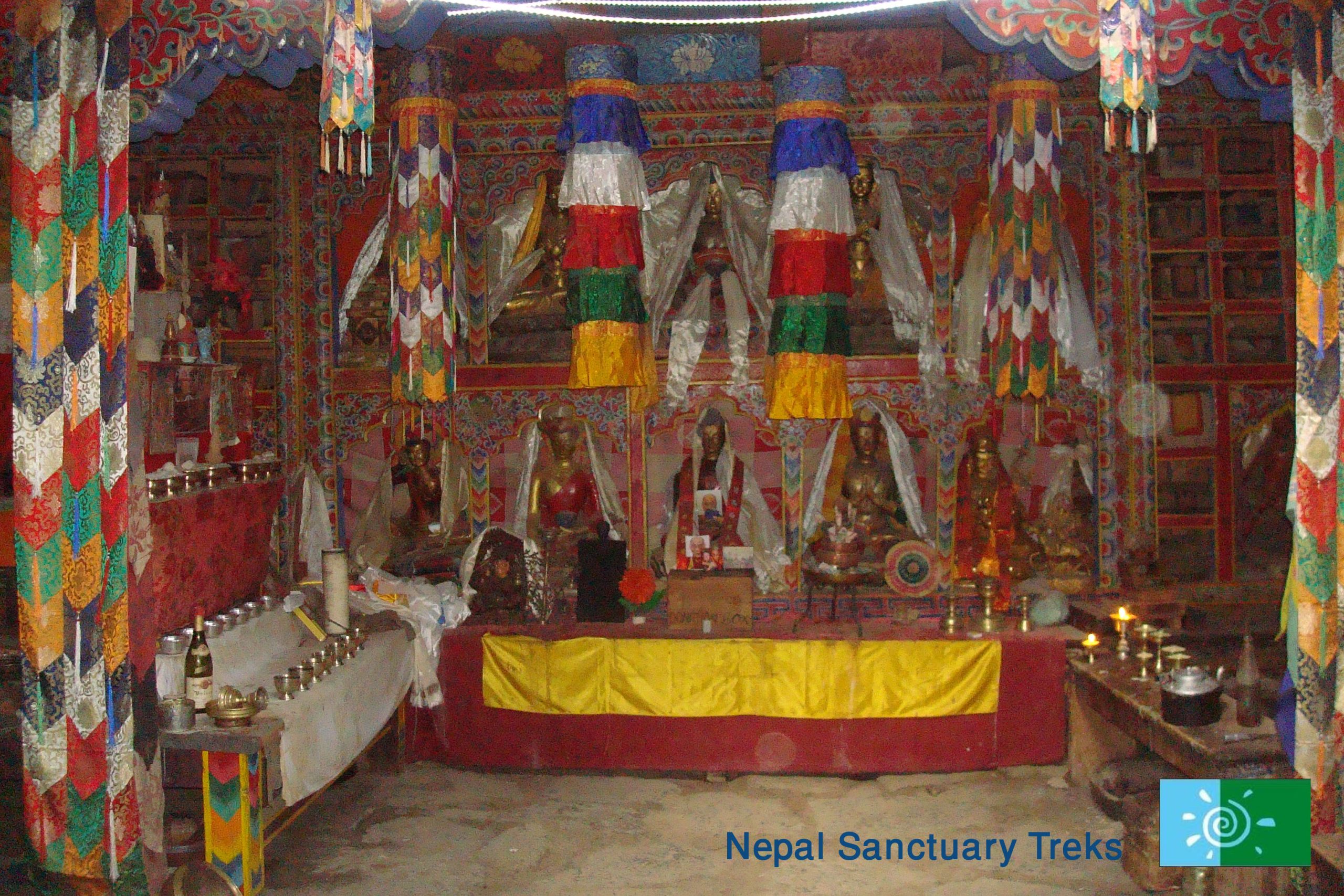
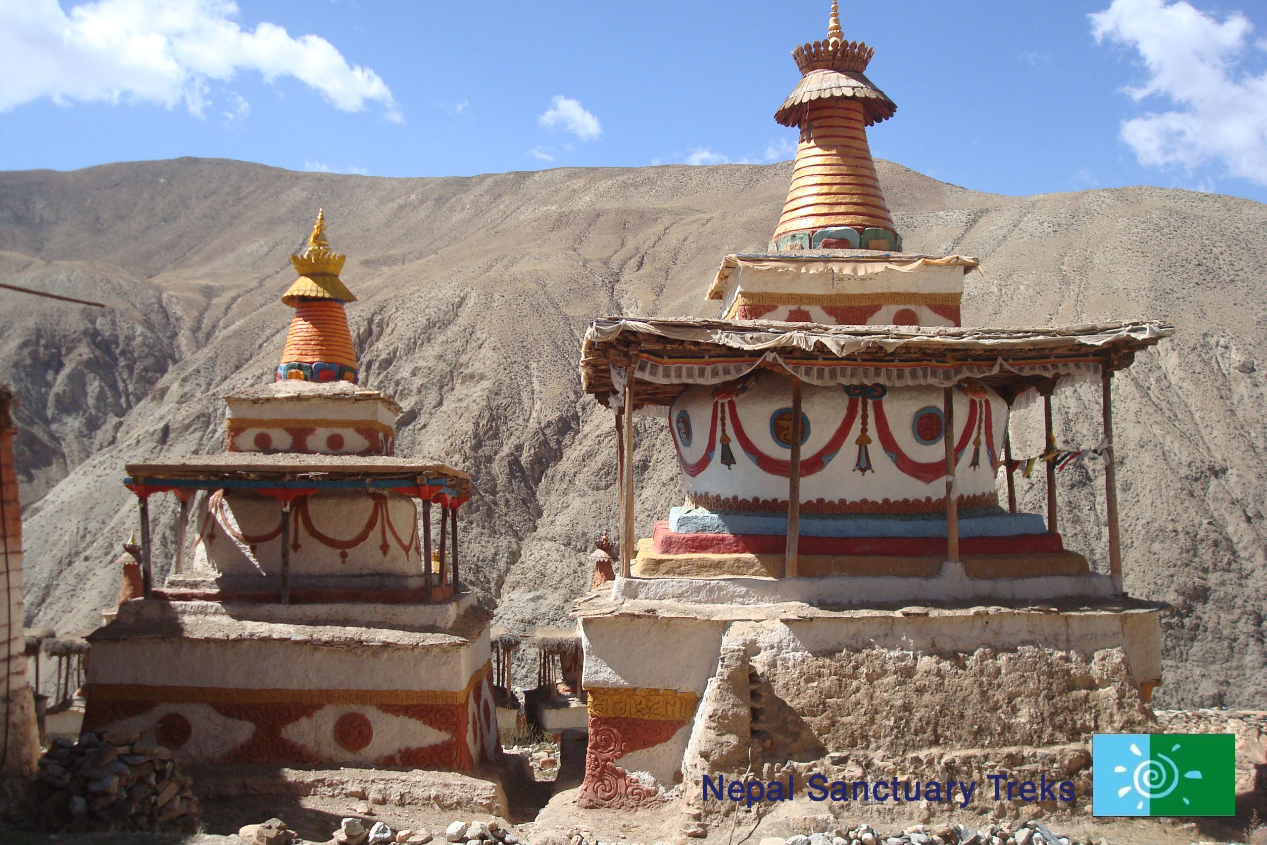
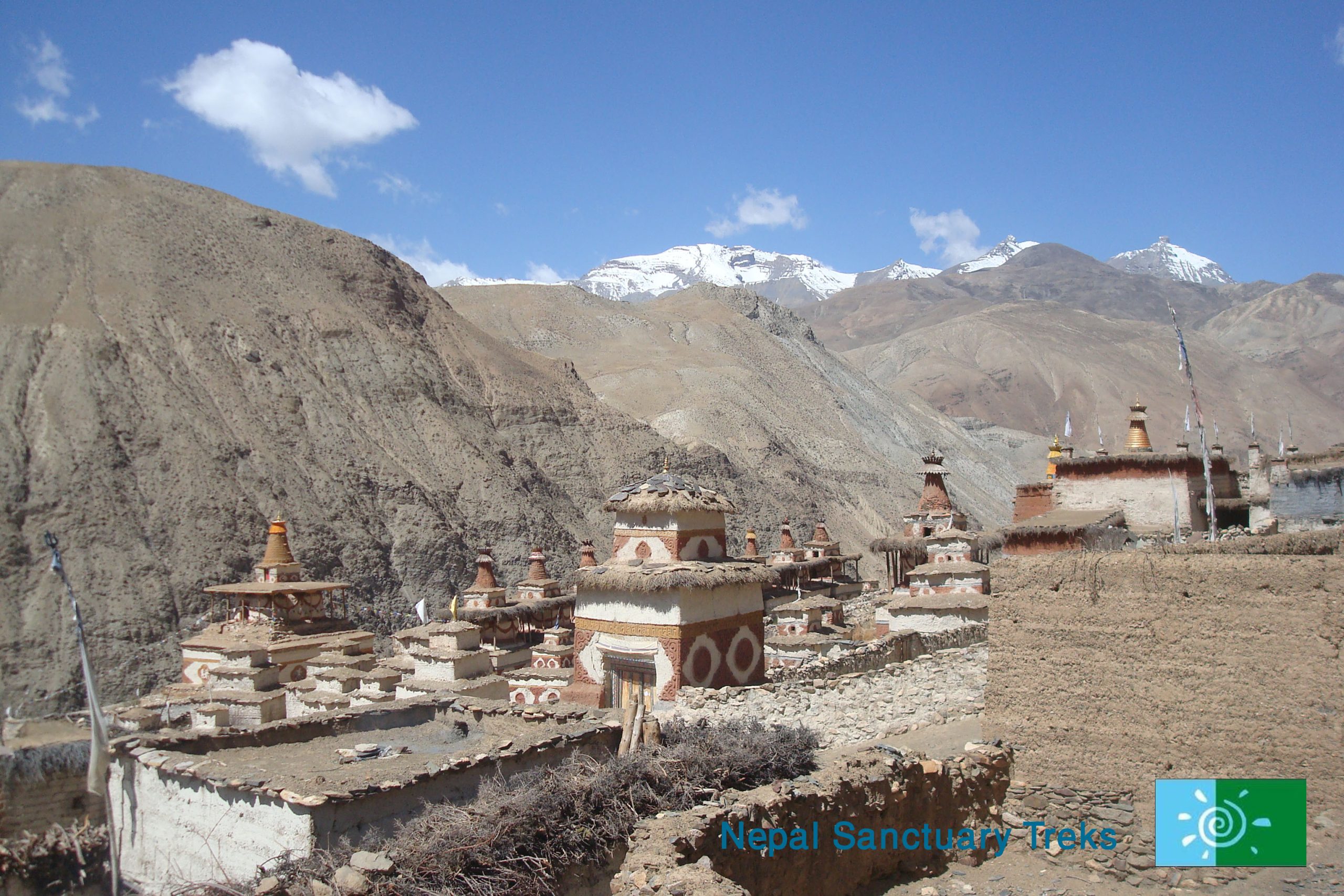
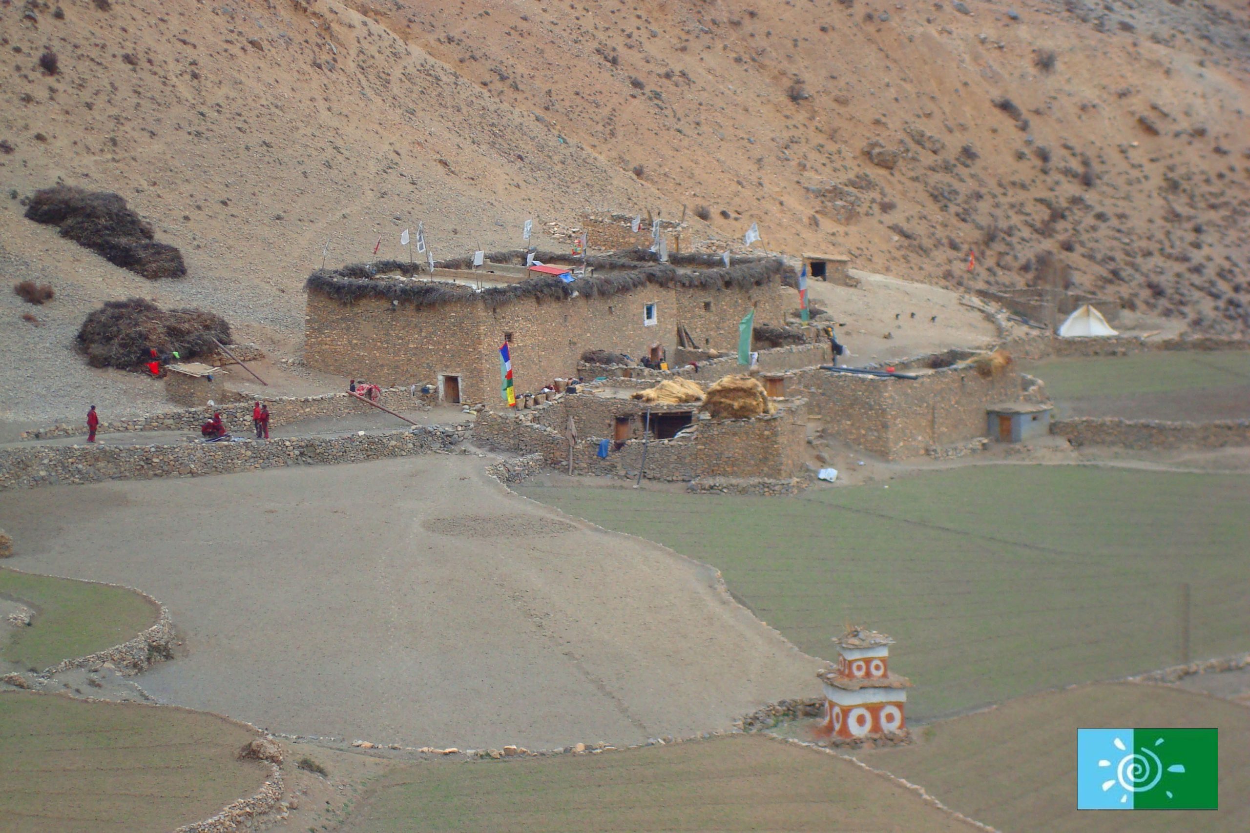
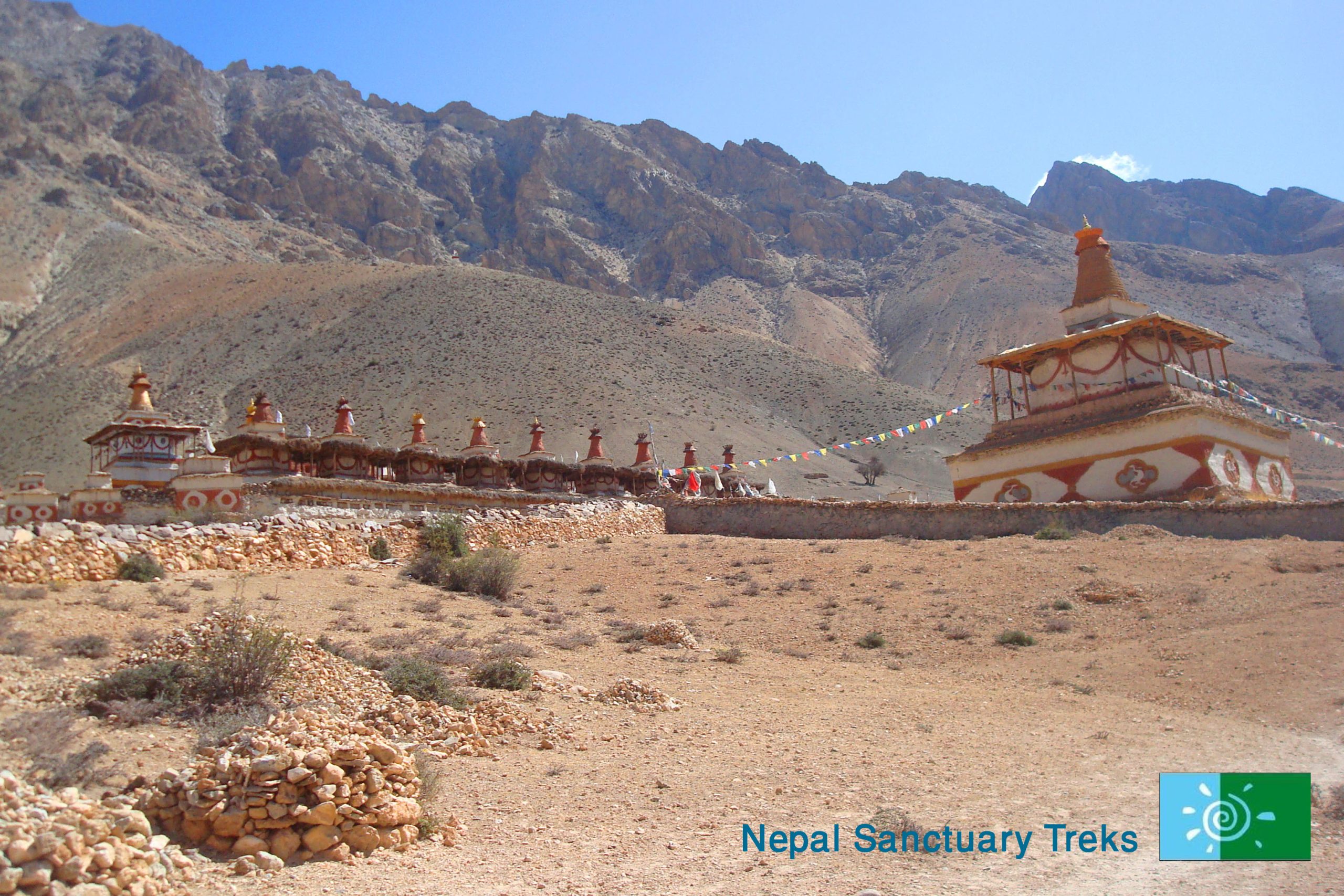
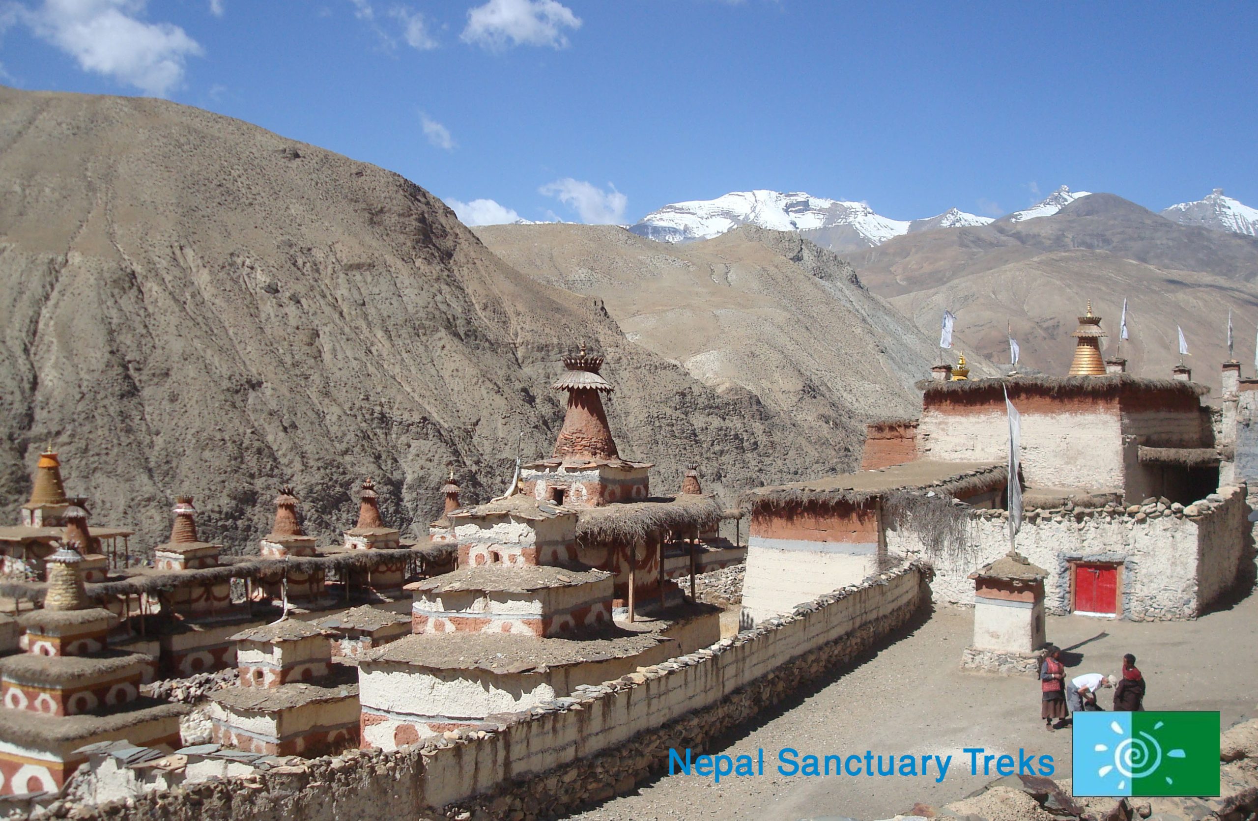
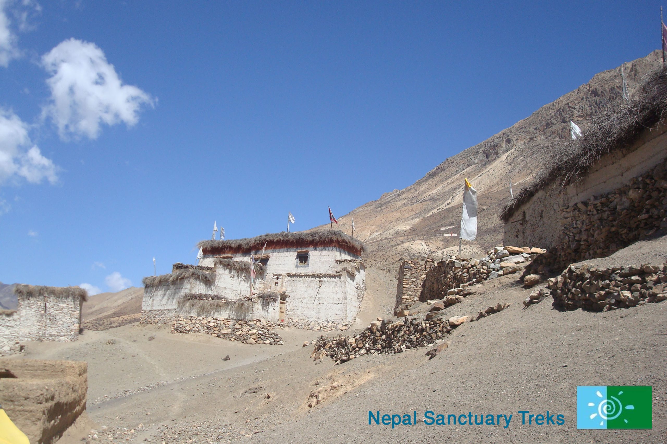
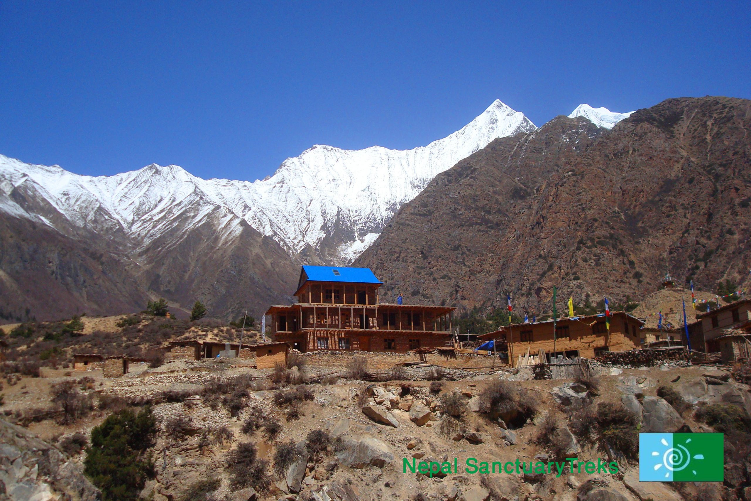
Soon after you arrive at Tinje, a major village in a wide valley with extensive fields two gompas, and an old fort.  The well-known Dolpo-pa artist Tenzing Norbu Lama was born in this village. At a young age, he trained in the art of traditional Tibetan thangka painting. Now Norbu’s artwork has been exhibited internationally and through Drokpa, a nonprofit organization, that has been involved in helping to train villagers from Tinje to paint and produce handcrafted leather goods. To get to camp you walk past the abandoned airstrip then go downhill to a grassy area by the river.

Day 18: Rest day at Tinje village

After breakfast, you can either take a rest or explore Tinje village. Tinje village lies at Upper Dolpo as Panzang Valley above the confluence of the Panzang River and Polte River. This village is a small terrain village and has historic fort remains in Upper Dolpo.

Day 19: Trek Tinje village-Rakpa

Altitude above sea level: (4,550 m) Rakpa

Hiking duration: 6-7 hrs. Approx.

Accommodation: Camping

Meal: Breakfast, Lunch, and Dinner

After breakfast, you follow Panzang Khola past the ruins of an old settlement on the other side of the river. After a couple of hours, you arrive at the river confluence, where you take the left tributary Kehen Khola for a further hour to reach the lunch spot in a grassy area next to the river.

Then continue walking up the left bank of Kehen Khola passing several doksas before arriving at Rakpa where we camp for the night.

In Rakpa, you will explore two monasteries of Tibetan style named Bon Po Monastery and Sharchhen Gompa. This is also the route of the Great Himalayan Trail (GHT) from Mustang to Dolpo Sect.

Day 20: Trek Rakpa-Yak Kharka

Altitude above sea level: (4,780 m) Yak Kharka

Hiking duration: 4-5 hrs. Approx.

Accommodation: Camping

Meal: Breakfast, Lunch, and Dinner

Today we set off from Rakpa and make our way to Yak Kharka.  Initially, you take a steady walk and then cross streams. Further, climb gradually before reaching Yak Kharka. Yak Kharka is a large, green area, named Yak Kharka because it is named Yak Kharka, because people came with their Yak for the business that they used to live in.

Day 21: Cross Charkha La – Charkha Village

Altitude above sea level:  (4,300 m) Chharka Village, Chharka La (5,015 m)

Hiking duration: 5-6 hrs. Approx.

Accommodation: Camping

Meal: Breakfast, Lunch, and Dinner

Leaving Yak Kharka, you will head to Chharka, crossing Chharkha La Pass. Upon reaching the top of the pass, you go downhill on the side of the gorge and descend to Chharka Village on Chharka Tulsi Khola’s bank. The scenic village of Chharka is home to Bon Monastery. The village looks like a fort. Here, you will see a cluster of tall houses. You will see no gaps between the houses, the outer wall of houses sticks to each other. This village is also popular for cattle. Here, you will see a number of yaks and sheep.

Day 22: Rest day at Charkha Village

After a leisurely breakfast, you can either take a rest or explore the Charkha village. You can visit this interesting village of closely-built, whitewashed dwellings, medieval in feel, with its Bon-po monastery, Sarchhen Gompa. Take a stroll through town and visit some of the old Tibetan-style houses, visit the shop to re-supply, or have a wash down by the (chilly) river.

Day 23: Trek Charkha village-Thulo Chaur

Altitude above sea level: 4,700 m

Hiking duration: 5-6 hrs. Approx.

Accommodation: Camping

Meal: Breakfast, Lunch, and Dinner

After a hearty breakfast, follow the path frequently used by the villager. Then you cross Chharka Tulsi Khola on a metal box girder bridge and then at the river confluence cross on a suspension bridge to follow the left bank of Thanjang Khola. The trail contours high above the river following a number of undulating ridges, after crossing a landslip zone you then descend to a Thulo Chaur (grassy area).

Day 24: Trek Thulo Chaur- Molum Sumna

Altitude above sea level: (4,860 m) Molum Sumna

Hiking duration: 6-7 hrs. Approx.

Accommodation: Camping

Meal: Breakfast, Lunch, and Dinner

After a hearty breakfast, you continue walking up the valley where the gorge narrows, and after a couple of hours you reach doksa at Norbulung. Molum Sumna is only an extra hundred meters above Norbulung, so you will have a good chance to acclimatize before attempting the double pass in front of us the next day. From Norbulung, you follow the flat trail all the way to Molum Sumna.

Day 25: Cross Sangda La – Ghalden Ghuldum

Altitude above sea level: High Sanga La (5,500 m), Lower Sangda La Pass (5,035 m), Ghalden Ghuldum (5,120 m)

Hiking duration: 7-8 hrs. Approx.

Accommodation: Camping

Meal: Breakfast, Lunch, and Dinner

After a hearty breakfast, you leave Molum Sumna behind and head towards Ghalden Ghuldum.

Today is a hard day as you will be crossing two passes. From here you make a long traverse across meadows to the foot of the Sangda La, then a long, steep final climb to the pass at 5,500 m. The Sangda La marks the border of Dolpo and the Annapurnas, so you have now entered the Annapurna region.

The views from this pass are remarkable, and definitely make the effort required to reach it worthwhile. Beyond the Mukut Himal to the south Tukche Peak, Dhaulagiri I, and Dhaulagiri II are clearly visible, while to the east the distinct notch of the Thorung La can be seen north of Dhamphus Peak. Beyond this col, the trail drops into a beautiful hidden valley before ascending to a second pass with views across the upper Chalung Khola towards the Khamjung Himal and Brikhuti in Mustang. From here you continue to descend steeply to Lower Sangda La and all the way to Ghalden Ghuldum.

Day 26 : Trek Galdang Guldung –Sangda village

Altitude above sea level: (3,800 m) Sangda Village

Hiking duration: 4-5 hrs. Approx.

Accommodation: Camping

Meal: Breakfast, Lunch, and Dinner

After breakfast, you start trekking to your next destination, hiking steep uphill. Then the trail goes downhill and then crosses the river. Further, the trail climb for half an hour when you will meet the path frequently used by local villagers.  Thereafter, continue with a level walk all the way to Sangda village. This village is a remote outpost of Gurung Tibetans originally from Mustang. This is blue sheep territory, so have your binoculars out!

Day 27: Drive Sangda Village- Jomsom

Altitude above sea level: (2,743 m) Jomsom

Driving duration: 3-4 hrs. Approx.

After a hearty breakfast, you take a long scenic drive to Jomsom. Enjoy a final free afternoon in Jomsom to recover from your adventures.

Day 28: Flight Jomsom –Pokhara- Kathmandu

Flight Duration: Jomsom-Pokhara (25 minutes), Pokhara-Kathmandu (25-30 minutes)

Accommodation: *** Hotel Manaslu or similar

Meals: Breakfast

After having an early breakfast, walk up to the airport nearby the hotel in Jomsom. Take a last glimpse of the breathtaking Himalayas. You will take a short flight to Pokhara and onto Kathmandu. After check-in at the hotel, spend your afternoon at leisure. You can spend the day resting or catch up on some last-minute shopping or shop for some locally made handicrafts and souvenirs.

Day 29: Final Departure

Meal: Breakfast

It is time to fly back home, keeping all the terrific experiences of Nepal in mind. The representative from Nepal Sanctuary Treks will transfer you to TIA airport, where you should check in 3 hours prior to your scheduled flight.

Ask Our Travel Expert

Affiliations & Recommendations

Upper Dolpa to Jomsom (GHT)