Trip Facts

icon-calendar
Trip Duration 54 Days
icon-meter
Trip Difficulty Strenuous
icon-mountain
Maximum Altitude 6143 m/20,154 ft.

Trip Overview

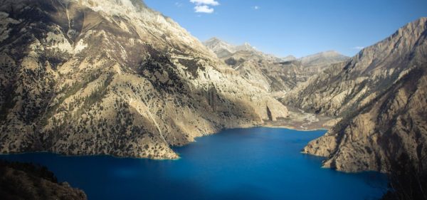
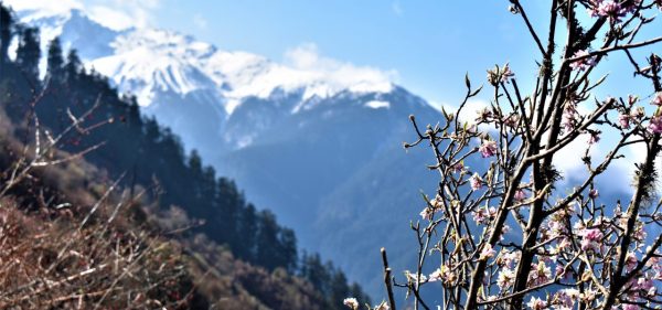
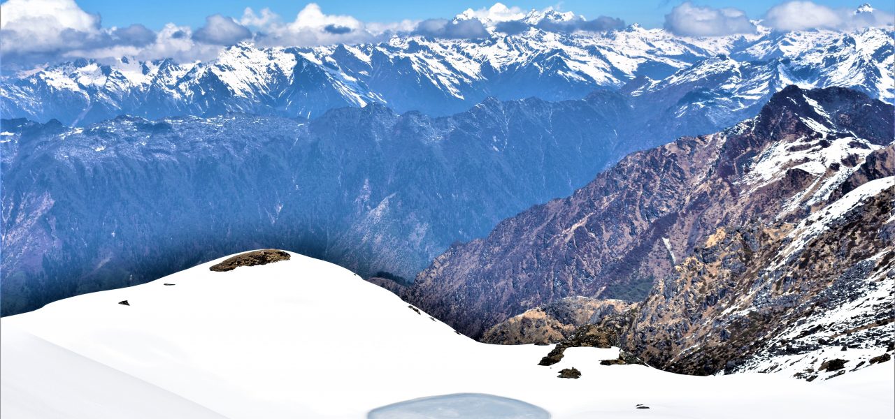
Embark on the Sherpani Col Pass Trek, a part of the Great Himalaya Trail (GHT), offering marvelous views of Barun Valley and the Khumbu area. This trek takes you across the mountain range between Makalu and Everest, providing spectacular views of majestic peaks like Makalu I, Makalu II, Jannu, Baruntse, Lhotse, Ama Dablam, Pumori, and Thamserku, including the three highest peaks: Everest, Makalu, and Kanchenjunga.

In addition to breathtaking scenery, the trek takes you through two protected areas, Sagarmatha National Park and Makalu Barun National Park, which are home to rare flora and fauna. This trail offers an off-the-beaten-path experience, combining rich culture, pristine nature, and ecological diversity.

Customize the itinerary of the Kanchenjunga to Everest Over Sherpani Col trek according to your preferences. For more information, get in touch with our Travel Expert.

Trip Itinerary

Day 01: Arrive at Kathmandu airport

Altitude above sea level: 1,302 m

Driving Time: Approx. 20-30 minutes, depending on traffic

Accommodation: Hotel Manaslu or similar

Upon arrival at Tribhuwan International airport, our representative will be awaiting you to cordially welcome you with great hospitality. The representative will be displaying the “Nepal Sanctuary Treks” placard outside the airport terminal.

You will be then escorted and transferred to the hotel in our private vehicle. Our staff will accompany you and help you with the check-in at your accommodation. Further, you will be given a brief description of the activities that will take place during the upcoming trip and a preliminary briefing on hygiene and safety by our representative.

Day 02: Cultural Introductory Tour and Trek Preparation

Altitude above sea level: 1,302 m

Tour Duration:  8 hrs. Approx.

Accommodation: Hotel Manaslu or similar

Meal: Breakfast

9:00 AM: After breakfast, you start a guided cultural tour around Kathmandu Valley. Experience the numerous colors, sounds, and tastes of authentic Kathmandu and its surroundings. Our experienced tour guides will tell you all you need to know and answer all your curiosities regarding those sites.

Local Market Tour

Take a short drive to Ason. Then, start wandering Ason and Indrachowk marketplaces to get a glimpse of traditional Nepalese life. Witness the bustle of the market, see how locals purchase the products and haggle for a bargain. Whilst walking around, enjoy the lively and vibrant atmosphere this local market has to offer. Observe firsthand the local produce people from Nepal actually purchase. You will also take in the sights and smells of the market. Your friendly tour guide will explain in full detail all the products and procedures you will see. There are lots of photo opportunities to capture with your camera.

Kathmandu Durbar Square

Next, head towards Kathmandu Durbar Square, also called Hanuman Dhoka Durbar. This ancient site used to be the residence of the Nepali royal family and administrators. It incorporates an architecturally extraordinary complex of ancient palaces, temples, courtyards, and shrines dating from the 15th to the 18th century.

The prominent sites of Kathmandu Durbar Square are Kumari Ghar or the house of the living goddess.  Kasthamandap is a huge rest house that is said to have been built with wood from a single tree and is the source from which Kathmandu valley got its name. Other sites around Kathmandu Square are the ferocious Kal Bhairab – the red monkey God- Hanuman, hundreds of erotic carvings, temples, and statues dedicated to different deities.

Swayambhunath

Swayambhunath (monkey temple), is the magnificent ancient religious architecture and center of faith of Hinduism and Buddhism. Its lofty white dome and dazzling golden spire are visible from far and wide. Swayambhunath is the ideal place to observe the religious harmony in Nepal. In the shadows of the imposing structure and besides the integrated architecture, can be found the daily surge of devotees faithfully offering their prayers to the gods. Upon arriving at the top, you can hear the Buddhist song “Om Mani Padme Hum” resounds everywhere. The candles and the aromatic fragrance of incense that burns constantly create a serene vibe and enormous prayer wheels which encircle the stupa.

PM: Boudhanath

Thereafter, take a short drive towards Boudhanath.  From the moment you step into the sanctuary, you’ll immediately feel the spiritual energy that comes from the place. Boudhanath is one of the biggest stupa in Nepal, built in the 5th century and listed on the world heritage list by UNESCO in 1979. The surrounding area is a central spiritual hub of Tibetan life and culture in Nepal. Observe a beautiful dome-shaped structure stupa surrounded by brilliant colorful prayer flags. It is believed that prayer flags convey mantras and prayers into the universe while fluttering in the wind. The Stupa is said to entomb the remains of Kassapa Buddha.

Witness monks draped in maroon robes rolling the prayer wheels, burning incense, and flickering butter candles. Moreover, it’s fascinating to see the people feeding grains and maize to hundreds of pigeons around stupa areas. The devotees turn the prayer wheels & chant, which is humbling to see such dedication to their beliefs.

Delight in the serenity as you hear the Buddhist mantra ‘Om Mani Padme Hum’ being chanted by devotees, alongside the echo of music streaming out from the nearby shops.

Pashupatinath

Moving on, visit Pashupatinath temple, a Hindu shrine dedicated to Lord Shiva located on the bank of Bagmati River. The word Pashupati means “the king of animals” and the temple is famous for its monkeys. You will be visiting the Pashupatinath area to indulge in a spiritual journey.

Pashupatinath is more than just a religious destination. It is a combination of religion, art, and culture. The temple, spread across 246 hectares of land, abounds in temples and monuments. Hundreds of rituals are performed here every day. Witness people performing the religious ritual and funeral pyres burning at open-air cremation. Also, see elaborately dressed holy men meditating outside the temple and pilgrims placing offerings at the shrines. After touring around prominent sites, you will be transferred safely back to your hotel.

Day 03: Fly to Bhadrapur (45 minutes approx.) and drive to Ilam (3 hours 16 minutes approx., 97.3 km)

With an early wake-up call, you will get ready and be transferred to the airport from where you will fly to Bhadrapur. Landing at Bhadrapur there will be a vehicle waiting for us which will drive us to Ilam. It is a famous destination for natural scenery and landscapes, tea production, and diverse agricultural economy. We will stay overnight at Ilam and prepare ourselves for tomorrow’s trek.

Day 04: Drive to Taplejung (5 hours), trek to Mitlung (921m) approx. 3 1/2 hours walk

We leave Ilam early in the morning and drive to Taplejung through cardamom and tea cultivated area. The scenic drive offers you the first glimpse of Mt. Kanchenjunga and Mt. Jannu. In addition, you get to see pasture land and small villages. Then we begin to trek along the paved road for one hour and take a gradual steep descent to the Tamur River that takes us to the village of Mitlung.

Day 05: Trek to Chirwa (1,246m) 5 – 6hrs trek

With an early start, we continue our trek following Tamor River along the paved road and after one and half hour the trails lead to Siwa Bazar. Siwa Bazaar is a small market and you can see Limbus settlement, high school, hospitals, and a police checkpoint. We continue to follow the Tamor River for one and a half hours and stop at Tawa village for lunch. After lunch, we walk on a zigzag path for about 1 hour that leads you to Thiwa Village. An additional hour walk will take you to our destination Chirwa.

Day 06: Trek to Sekathum (1,660m) 5-6hrs trek

After having breakfast we rejoin our trail; as we begin we follow trekking along the Tamur River. The trail passes through a varied landscape, we trek uphill and downhill passing dense forest. After a couple of hours, we arrive at Taplechowk where our trekking permit will be checked and its doorway to Kanchenjunga Conservation Area. We traverse the suspension bridge over the river and walk on the west bank along with the cardamom farm. We will stop for lunch at Phembu and continue to walk zigzag path crossing over the Suspension bridge of Tamur River. We will reach at Serkathum following Ghunsa Khola walking on a zigzag trail. After 20 minutes of walk, we will arrive at Sekathum.

Day 07: Trek to Amjilosa (2,510m) 5-6hrs trek

After breakfast, we continue our trek crossing a suspension bridge and enter dense forests of bamboo trees, Utis trees and varied types of trees. You are likely to see troops of Langur monkeys and musk deer. We then cross another suspension bridge over Ghunsa Khola and reach Jaubari. You can see a beautiful waterfall here. We continue to follow Ghunsa Khola that takes you to Lamatar where we stop for lunch. After lunch, we walk through the zigzag trail and enter into dense forests. After that, we cross one more suspension bridge and take gradual ascend for 2 hours and 20 minutes of walkthrough straight trails will take you to our camp. We stay overnight in Amjilosa.

Day 08: Trek to Gyabla (2,730 m) 5-6 hours trek

After having breakfast we continue our trekking. Leaving Amjilosa behind we trek from the river bank all the way through thick bamboo and rhododendron forest to traverse the ridge. Then we walk down on the way to Ghunsa Khola where you can see many houses made up of stones.

Further, we walk through several ascend and descend after a short climb before passing a large waterfall.  Eventually, we will arrive at Gyabla after a steep ascent. Gyabala is a beautiful village with a Tibetan settlement where we overnight.

Day 09: Trek to Ghunsa (3,595m) 5-6hrs trek

We will have an early breakfast and rejoin our trail; as we begin trekking we descend down the river as the valley widens. We will have lunch once we reach Phole, another Tibetan settlement where you can buy handicrafts handmade by the locals and visit the monastery. On the way between Phole and Ghunsa, we pass memorial of helicopter crash casualties in 2002. Leaving the village, we trek further through pine forest to Ghunsa.  Ghunsa is a charming Tibetan village; prayer flags flutter from the wooden houses and there are two monasteries, a welcome sight after the many days of wilderness.

Day 10: Acclimatization day at Ghunsa (3,595 m).

Today is an important day for acclimatization as we need to let our bodies adapt the altitude so that we can avoid altitude sickness. You can spend the time relaxing and exploring the village.  A day hike can be organized to a close-by monastery called Lapsang La Pass. From the pass, you can see the beautiful view of Ghunsa peak and several other unnamed peaks. We will return back and can get some rest, we will stay overnight in Ghunsa.

Day 11: Trek to Khambachen (4,100 m) 5-6 hrs trek

After having breakfast we leave Ghunsa and trek towards our next destination. We trek along the river bank heading towards the north; the trail offers us amazing views of the mountain. As we continue trekking we pass through meadows with wildflowers, rhododendron and pine forests. Trekking further we reach Rampuk Kharka where we cross a bridge and continue passing the waterfall and a landslide. As we cross the landslide area we will get to see a view of Mt. Jannu. Soon we will arrive at Khambachen which is the Tibetan settlement consist of dozen houses situated in a grassy plain area surrounded by magnificent mountain. In addition, you can see an incredible backdrop of the enormous north face of Jannu.

Day 12: Acclimatization and rest day at Khambachen.

It is time for a day to rest after a week of walking! You can explore the area around Khambachen and climb a ridge behind the village for better views of the mountains- or if you are feeling energetic you could visit Jannu’s Base Camp.

Day 13: Trek to Lhonak (4,785 m) 5-6 hrs trek

After having breakfast we begin to trek early as today is another challenging trek day. The trail ascends through open rocky fields to Ramtang (4,370m/14,337 ft.) and then traverses moraines North West of the Kanchenjunga Glacier to Lhonak. The campsite at Lhonak is near some huge stone huts and you can see magnificent views of Wedge Peak (6,750m/22,145 ft.), Mera (6,344m/20,813ft), Nepal Peak (6,910m/22,670 ft), and Twins (7,351m/24,117 ft.) among others.

Day 14: Day trek to Pangema (KBC); (5,143 m) 6-7 hrs trek and return back to Lhonak

After having an early breakfast we begin to trek; as we begin we trek along the Kanchenjunga Glacier. We must be attentive and careful while trekking as we will trek through the rocky trail as there are possibilities of landslides. Trekking further from here we reach Pangema/Kanchenjunga North Base Camp, it is a flat grassy base camp. If we trek a bit higher we will be offered with splendid views of Kanchenjunga, Chang Himal, Nepal Peak, and Tibetan Himalaya range. We will then descend back to Lhonak.

Day 15: Return to Ghunsa (3,595 m).

After breakfast, we walk back along the same trail through Kambachento Ghunsa village.

Day 16: Trek to Nango La Camp (4,776m) - 6 to 7 hours walking.

Descend the main trail from Ghunsa and turn off at the junction before Phole village. Follow the trail up the side valley following the Yangma Samba Khola through pine forest until reaching the camp located in a kharka (pasture).

Day 17: Cross Nango La pass (4,820m) and trek to Yangma Khola (3,430m)- 6 to 7 hours walking.

After an early morning start, it takes about two to three hours depending on conditions to reach the top of the Nanga La pass. From the top one can see Lopsang Peak and also Mirgin La trail over to Kanchenjunga Southside. On the descent, one enters into a valley where further down there is a stone shelter. From here to keep to the north bank of Thasa Khola and walk through a forest before entering Yangma Khola valley. The trail goes north up this valley before you cross the bridge to the camp.

Day 18: Trek to Olangchu Gola (3,191 m) - 5 to 6 hours walking.

From camp descend along the western bank of Yangma Khola until the confluence with Tamor Khola, then follow the northern bank of Tamor Khola upstream until Olangchun Gola. This is a prosperous village that trades with Tibet. Olangchung Gola is a beautiful Sherpa village with around 45 houses, a 465 years old monastery with a golden manuscript and KCAP office. There is also a sub-health post, a primary school and a border police station at Olangchung Gola.

Day 19: Trek to Upper Langmale (3,893m)- 6 to 7 hours walk

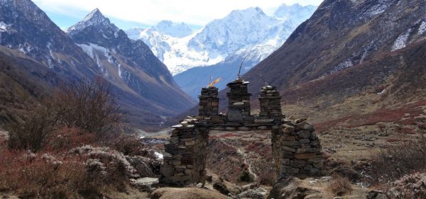
Trek to Upper Langmale – (3,893m) The trek in the next three days will pass through complete wilderness. However, piles of stones along the way act as signs posts, showing us our direction. The trek passes through pine and rhododendron forests. After a walk of two and a half hours, we reach a place called Jadak (3636m) for lunch. A walk of three hours on snowy track will take us to our camping site at Upper Langmle.

Day 20: Trek to pass camp (4,453m)- 5 to 6 hours walk

We trek through a pine forest along the Dingsamba Khola then higher up through rhododendron bushes in a broad valley. We continue in a north-westerly direction into a wide and flat floodplain and at the end of this valley we walk over a black rock band into a higher valley. We make camp here for the night before crossing Lumba Sumba pass.

Day 21: Cross Lumbha Sambha La to Thudam (3,556m), walk approx 6hrs.

Today we gain magnificent views of the Lumbha Sambha as we climb to the crest of a saddle, the trail here is faint and often undefined due to snow. We traverse below a peak and to another saddle and then make our crossing of the Lumbha Sambha (5159m). From here there are views of Jannu and Makalu to the east. From the pass, we descend to the northwest.

Day 22: Trek to kharka (2,820 m) - 7 hours walk approx

The eleventh-day trek runs along the banks of Chujung Khola. The trail offers a panoramic view of peaks in the Makalu range. On the way, you see lo of small bushes and bamboo groves-the best habitat for a red panda. If you are lucky, you can see this endangered species. It is better to carry packed lunch, as it is difficult to find drinking water along the trail. After a walk of about six hours from Thudam, we reach Kharka for overnight.

Day 23: Trek to Chyamtang (2,187 m) - 6 hours approx.

Today’s walk passes through dense rhododendron forest. As there is no villages on the way and also there are numerous side trails. After a walk of about three hours from Kharka, we reach a place called Chaurikharka for lunch. From Chaurikhara, we can clearly see Chyamtang. Arun River, Ridha Village and the road that leads to Kimathanka. After lunch, the trek is all downhill for about three hours until we reach Arun River. After crossing the suspension bridge over the Arun, the trek is uphill for about an hour until Chyamthang – our destination for the day. Chyamthang is a small houses. Sherpas are the dominant population in the villages.

Day 24: Trek to Hongon (2,323 m)- 6 to 7 hours walk

From Chyamtang, we trek slightly uphill to Guthi Gompa and then drop down to Lingam. Treading through the forested trails we emerge at Chepuwa and beyond Chepuwa once again we enter the beautiful woods of rhododendrons and emerge out to Gimbar. We have our lunch here. Beyond Gimbar, we cross the bridge over a small stream and tread through the forested region to Hongon.

Day 25: Trek to Forest Camp (2,900 m)- 7 hours walking.

The trail ascends steeply to a ridgeline and further onto a minor pass at 2,710m. After the pass take the right fork at a junction where you traverse the hillside then climb to another small ridge before reaching Tojo Khola. You stay on the east bank of this river and follow a trail through rhododendron forest covered in moss.

Day 26: Trek to Mulun Pokhari (3,954m) - approx. 5 hours walk

From Forest Camp you continue walking through rhododendron then higher up the trail becomes rocky and there are good views of Arun river to the south. Before reaching the plateau there is some scrambling and at the end of this section are several chortens. Shortly after the chortens is the beautiful lake of Molun Pokhari and the camp is an hour further in a valley to the west.

Day 27: Trek to Dhunge kharka (2,980 m) - approx. 7 hours walk

From camp, there is a small trail ascending up a ridge to the south, before heading south-east, then east to a minor pass at 4,200m. Descend on a trail along a ridge to the left and then at a small lake descend next to a stream to the valley bottom. Cross Dhunge Khola to a large kharka on the other side and continue down the valley to a drier campsite.

Day 28: Trek to Adventure pass camp (3,900 m) - approx. 7 hours walk

A small trail through dense forest continues to follow the west bank of Dhunge Khola. After 1 ½ hour rounding a ridge that draws you away from the main river valley, the trail forks beneath cliffs in the middle of a small clearing. Cross Kolakharka Khola on a log bridge then follows an overgrown trail to Saldim Khola.

Day 29: Trek to Kalo Pokhari (4,100m) - approx. 6 hours walk

Ascend from camp before exiting on the left on a small trail that ascends just to the left of a cascade. Continue climbing between two streams before the gradient begins to ease. Pass a small lake and ascend to a ridge, follow this before descending to an east-facing kharka. Then climb a craggy trail around a ridge to a minor pass before dipping through a shallow valley and climbing another ridge to arrive at a black water lake (called Kalo Pokhari).

Day 30: Trek to Kharka (4,097 m) - approx 7 hours walk

From camp climb the next ridge to a pass before a steep, rocky descent. From the valley bottom, the trail climbs another ridge to a minor pass where you can see a large valley and campsite below. It will take another 1 ½ hours to descend through dense rhododendron shrubs and a walk a little way up the valley to a kharka.

Day 31: Trek to Neha Kharka (3,960m) - approx. 7 hours walk

From below Kharka, you can see the blue-roofed Mumbuk teahouses on the far side of the valley and then you enter a forest of fir, pine, and rhododendron. Before you reach Barun Khola the trail descends to the northwest.

Day 32: Trek to Yangle Kharka (3,557 m) - approx. 5 to 6 hours

On either side of the river, there are huge rock walls towering overhead and views of Peak 6 and 7 down the valley. Further along, the valley widens and near Yangle Kharka there is a large flat grassy area with a basic teahouse where we camp for the night.

Day 33: Trek to Langmale Kharka (4,400m) - approx. 5 hours walk

Today we pass a number of yak pastures (kharkas) and herder huts with a number of different names and varying altitudes depending on which map or guidebook you read. As we are now approaching high altitude we limit our rate of ascent to ensure your body has the necessary time to acclimatize. We camp at the grazing area called Langmale Kharka where there is a new lodge and terraces cleared for camping.

Day 34: Acclimatization day at Langmale Kharka (4,450 m).

Today we have a shorter day to help our acclimatization before walking up to Makalu Base Camp tomorrow. There are superb views of the Himalayan mountains throughout the day so take your time and enjoy the walk you will see Peak 3, 4, and 5 as well as Chamlang. Overnight camping.

Day 35: Trek to Makalu Base Camp (4,900m) - 4 to 5 hours walking.

On approaching Sherson the southeast ridge of Mount Makalu comes into view and as one approaches Base Camp the stunning view of its south face is revealed. We set up camp at Makalu Base Camp where we intend to stay for two nights. Overnight camping.

Day 36: Day walk near Makalu Base Camp (4,900m).

We will arrange an optional walk on the slopes on the east side of Makalu Base Camp, this is well worth doing not only to help your acclimatization but also for the good views of Everest, Lhotse and of course Makalu. The walk will take about 5 hours return and reaches an altitude of 5,300m. Overnight camping.

Day 37: Trek to Sherpani Low Camp (5,200 m) - 4 to 5 hours walking.

From Makalu Base Camp the trail follows the ablation valley on the west side of Barun Glacier and then continues on lateral moraine however avoids descending onto the glacier-like the trail to Makalu Advanced Base Camp. Further along, the trail is rocky and traverse scree slopes marked by cairns. During the walk, there are spectacular views of Makalu’s West Ridge and foreshortened North West ridge as well as Everest and Lhotse at the head of the valley. Overnight camping.

Day 38: Rest day at Sherpani Low camp.

Day 39: Trek to Sherpani High Camp (5,700m) - 6 to 7 hours walking.

From Sherpani Low Camp we continue traversing on a rocky trail to the next side valley and then follow this to Sherpani High Camp located on rocky areas before the glacier. This is a tough day walking on loose moraine following another indistinct trail. Overnight camping.

Day 40: Cross Sherpani Pass (6,135m) & West Col (6,143m), trek to Baruntse Base Camp (5,700m).

After an early start around 1am, we walk up the glacier to Sherpani Pass with dawn arriving as the group starts the climb on fixed ropes. On the way up we follow a snowy gulley then a short traverse on a rock step before reaching the top of the pass. There is a rappel/ abseil for 40m on the other side of the pass down to the West Barun glacier, from here there is an hour walk to reach the top of the West Col where there is a 200m rappel/ abseil down to Hunku Glacier followed by an hour or so walk to Upper Baruntse Base Camp. This is a very demanding day using fixed rope for ascent and descent as well as sections of rope travel on the glacier in a very remote glacial area, the exact daily schedule will be decided by your Sirdar and Sherpas depending on conditions and weather as well as how the group and crew are faring with the expedition. Overnight camping.

Day 41: Rest day at Baruntse Base Camp (5,700m).

After the long day yesterday crossing Sherpani Pass and West Col the group and crew will need a rest day before continuing towards the Amphu Laptsa pass. Overnight camping.

Day 42: Trek to High Camp before Amphu Laptsa (5,500 m) - 6 hours walking.

The trail descends on the moraine to the lower Baruntse Base Camp then continues over moraine ridges with loose rock to the highest of the Panch Pokhari lakes in the Hongu valley. We put in a High Camp near to the start of the trail up to the Amphu Laptsa pass. Overnight camping

Day 43: Cross Amphu Laptsa at 5,850 m trek to Chukung (4,730 m) - 9 to 10 hours.

After a morning start around 4am, we follow the rocky trail from camp towards Amphu Laptsa pass, after an hour or so we climb a 10m ice step to access the glacier and then follow this to the top of the pass. The view from Amphu Laptsa is superbly dominated by Baruntse and the West Col is clearly visible. There are several rappels/ abseils from the pass until we get onto the rocky trail that leads towards our camp to Chukung. Overnight camping.

Day 44: Trek to Dingboche (4,360m) - 3 hours walk

Today there is a short walk to Dingboche, This village is in a sheltered location above the Imja Khola and is warmer and less windy than the neighboring village of Pheriche.

Day 45: Trek to Dzongla (4,843m) - approx. 5 hours walk

From Dingboche the trail contours above Pheriche and on towards the moraine of the Khumbu glacier and then across to Dughla. We head west towards the Cho La Pass, contouring around a headland towards the picturesque Dzong La which cuts across a jagged spur that descends from the summit of Lobuche Peak. The path takes an obvious, gently ascending line, but is very narrow and in snowy conditions can be slippery. High on the flanks of Lobuche, we will lunch beside a glacial lake before a long descent to a magnificent camp at the foot of Cholatse, near the base of the Cho La pass.

Day 46: Cross Cho La (5,40m) to Gokyo (4,75m) 8 to 9 hours walk

The views today are magnificent as we leave the Everest watershed and enter that of Cho Oyu, the sixth highest mountain in the world. The crossing is hard work, involving a steep scramble up rock boulders and then a walk across the gently ascending, snow-covered glacier that caps the pass. However, the views of the route ahead, and of the glacier itself, are breathtaking. We descend steep boulder-strewn slopes to the Gokyo valley below. This is a valley of turquoise lakes and great glaciers. For the first (and steepest) part of the descent there are discernible paths that zigzag down the mountainside – slippery in the snow!

The ground then levels out and the path all but disappears as we hop across a field of boulders. Finally, we climb a gentle slope to the top, from where it’s all downhill, following a narrow river valley all the way to its base at Tangnag, a small Sherpa settlement nestled beneath great rock walls, just a stone’s throw from the Ngozumba Glacier. We cross the glacier and ascend the lateral moraine valley past beautiful lakes with Siberian ducks swimming across the mirror-calm surface, to the village of Gokyo.

Day 47: Ascend Gokyo Ri (5,357m)

An early start is best for the opportunities that the early morning views offer. The steady and unrelenting ascent of Gokyo Ri will take around two hours. You will be elated when you reach the summit with its spectacular view. Probably the most comprehensive view of 8,000 metre peaks in Nepal.

Surrounding us are Cho Oyu (8153 m), Gyangchung Kang (7922 m), Lhotse (8501 m), Makalu (8475 m), Cholatse (6440 m), Taweche (6542 m), Kantega (6685 m), Thamserku (6808 m), Lobuche (6145 m) and Mt Everest (8848 m) Hundreds of other unnamed peaks fill the scene, whilst below us the Ngozumba Glacier, the largest in Nepal, stretches through the valley. We trek around Gokyo Lake and back to Gokyo for overnight.

Day 48: Cross Renjo La (5,400 m) to Lungden (4380 m) - approx 7 hours walk

A challenging crossing of the Renjo La Pass will be exciting descend into the remote northern valley where access is restricted, and the landscape is progressively that of the Tibetan Valleys beyond the border. There is a chance we will meet Tibetan Traders descending from the Nangpa La pass that leads through the Himalayas from Tibet with their caravans of woolly yaks laden with goods.

Day 49: Trek to Thame (3,820 m) - approx. 4 hours walk

The trail crosses suspension bridges over Bhote Koshi River and descends down to Tarnga. The path then heads towards Thambuteng Village following lush green valley of Langmuche Khola. Nearby Thambuteng village lies Kyarokerok Gompa which is 350 years old gompa and holds cultural and historical supremacy. Inspecting the statues, murals, architecture of the gompa, we follow the zigzag trail to Thame.

Day 50: Trek to Namche Bazaar (3,445 m) 3 hours walk

We turn south and down the valley towards Lukla for our return to Kathmandu. We return to civilization and no doubt there will be an earnest celebration of a challenging but satisfying expedition, the likes of which has been enjoyed by very few people.

Day 51: To Lukla (2800m). Walk approx. 7 hrs.

With an early breakfast we start our trek by descending downhill to Lukla. We will trek along the Dudhkoshi River, pine forests, hamlets and crop fields with the views of mountain-like Kusum Kanguru, Khumbila, Taboche, and Thamserku, etc. When we reach Lukla, we check-in at lodge and get some rest and stay overnight.

Day 52: Fly to Kathmandu (1,302m) approx. 35mins flight

We will have an early breakfast and fly back to Kathmandu from Lukla airport. You will then be accompanied to your hotel and have time to take rest and relax after a long amazing trek. Stay overnight in the hotel.

Day 53: Day at leisure in Kathmandu

It’s also a spare day in case of bad weather in Lukla if we could not fly on scheduled date and time or we can organize you a guided day tour in or around Kathmandu. You can spend your leisure time by shopping souvenirs for your beloved ones or simply relax after exhausting but momentous adventure.

Day 54: Transfer to Kathmandu airport for the flight back home.

It is time to fly back to home keeping all the terrifying experiences of Nepal in mind.

The representative from Nepal Sanctuary Treks will transfer you to TIA airport where you should check-in 3 hours prior to your scheduled flight.

Price Included

What's Included

  • Airport transfers,
  • Private transfer from Bhadrapur to Taplejung
  • Internal flight Kathmandu/Bhadrapur & Lukla/Kathmandu,
  • TIMS, conservation fee, national park fee,
  • High altitude mountaineering guide & trekking guides, cook, porters & other supporting staffs,
  • Tented accommodation during trek on full board
  • Staff insurance on the trek,
  • Duffel bag
  • Four nights in Kathmandu Guest House in Kathmandu with breakfast
  • Safety equipment including high altitude chamber and satellite phone

What's not Included

  • Additional tours and meals that are not mentioned,
  • Beverages,
  • Personal bills,
  • Visa fee: US$ 30 for 15 days and US$ 50 for 30 days and US$125 for 90 days multiple entries
  • Insurance (for cancellation, accident, health, emergency evacuation and loss, theft of or damage to baggage and personal effects), Liability insurance
  • Excess baggage beyond 20 kilogram
  • Crampons, Carabineers, Ice axe, Harness large, Ascender or Jamar, Slings and prussic cord
  • Personal Equipment ( Please refer to the packing checklist) section
  • Tips

Faqs

What should I need to bring for this trek?

Clothing
1    Waterproof Jacket and Pants both ventilated (pit zips, side zips, etc.)
1    Down jacket
1    Windproof Soft Shell jacket and pants for windy/cold days.
1    Fleece top and pants
2    Thermal tops
1-2    Thermal long johns depending on how much you feel the cold
4    Pairs of Coolmax Liner socks
2    Pairs of undies for cool/cold weather
2    Pairs of undies for warm/hot weather
2    Pair walking trousers
2    Loose fit trekking shirts with pockets
2    Lightweight synthetic T-shirts
1    Broad-brimmed sun hat
1    Warm hat and gloves
1    Polarizing sunnies with 100% UV protection
1    Buff or trekking Scarf

Footwear

1    Pair waterproof walking boots that can take crampons
1    Pair sandals to let feet breathe in the evenings and for washing

2    Pair of Warm Weather walking socks (e.g. Bridge dale Light Hiker)
2    Pair of Cool Weather walking socks (e.g. Bridge dale Trekker)
1    Pair of Cold weather walking socks that can also be used as bed socks

General Gear
1    Sleeping Bag rated to -15 Celsius / 3 Fahrenheit
1    Sleeping sheet and pillow (you will be given a pillow if you prefer)
1    Inflating sleeping mat (you will be given a mat if you prefer)
1    45-ish liter pack for trekking
1    Pair of Trekking poles
1    Head torch and spare batteries
1    sunblock
1    lip balm with sunblock
1    Mozzie/fly repellant
1    toiletry bag with essentials (no hairdryers!!)
1    pack towel
1    Neck pillow for plane/bus trips if required
1    Camera with back-up batteries if needed
1    2 to 3 liters of water bottles or bladder system depends on how much you normally drink

Waterproof compression bags for storage in the tote bag
1    Reading material/diary spare pens
1    General repair kit
1    Tent for appropriate conditions
1    Tote Bag for the spare gear you do not carry
1    Pillow or stuff sack for clothing
1    Medical kit

Water purification tablet

Note: we provide a comprehensive group first aid kit however please  bring personal medications and other items you might use regularly such  as:

Any personal medications
Blister treatment- Compeed patches are the best
Plasters
Multivitamins plus iron supplement
Analgesic- paracetamol, ibuprofen, and aspirin
Throat lozenges
Diamox (optional)- helps with acclimatization, can buy in Kathmandu

Optional
1    Chair kit for a sleeping mat
1    Shorts for bathing/swimming in rivers
1    Closed-cell foam mat
1    Sarong for bathing, around camp on hot days.

1    Anti-bacterial hand gel

Miscellneous
Sunglasses

Toothpaste, Toothbrush

Mini Towel

Toilet paper

Soap

Hard Wear
1 crampon for each group member
1    harness for each group member
1    ice axe for each group member (or trekking pole if non-technical)
2    large slings >2m
2    medium slings 1.5 – 2m
1    medium to a large ice screw
60m static rope 8 – 9mm
2    screw gate karabiners for each group member
2    single prussic for each group member
1    snow stake/medium to a large dead man
4    spare screw gate karabiners

1    Safety Helmet

Ask Our Travel Expert

Affiliations & Recommendations

Kanchenjunga to Everest Over Sherpeni Col (GHT)