Manaslu | A wonderland | 10 facts that will amaze you.

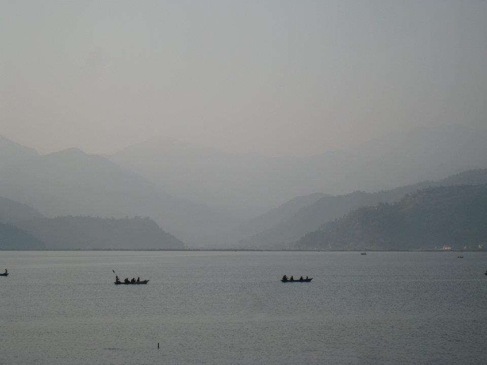
Manaslu trek offers an off-beaten trail experience in the Himalayan Region. Manaslu is famous for small teahouses along the Manaslu trek.
The Manaslu trek exists 40 miles away from Kathmandu to the east of the Annapurna region. The name ‘Manaslu’ means ‘the mountains of spirit.’
The word ‘Manaslu’ came from the Sanskrit word ‘Manasa’ which means intellectual or soul.
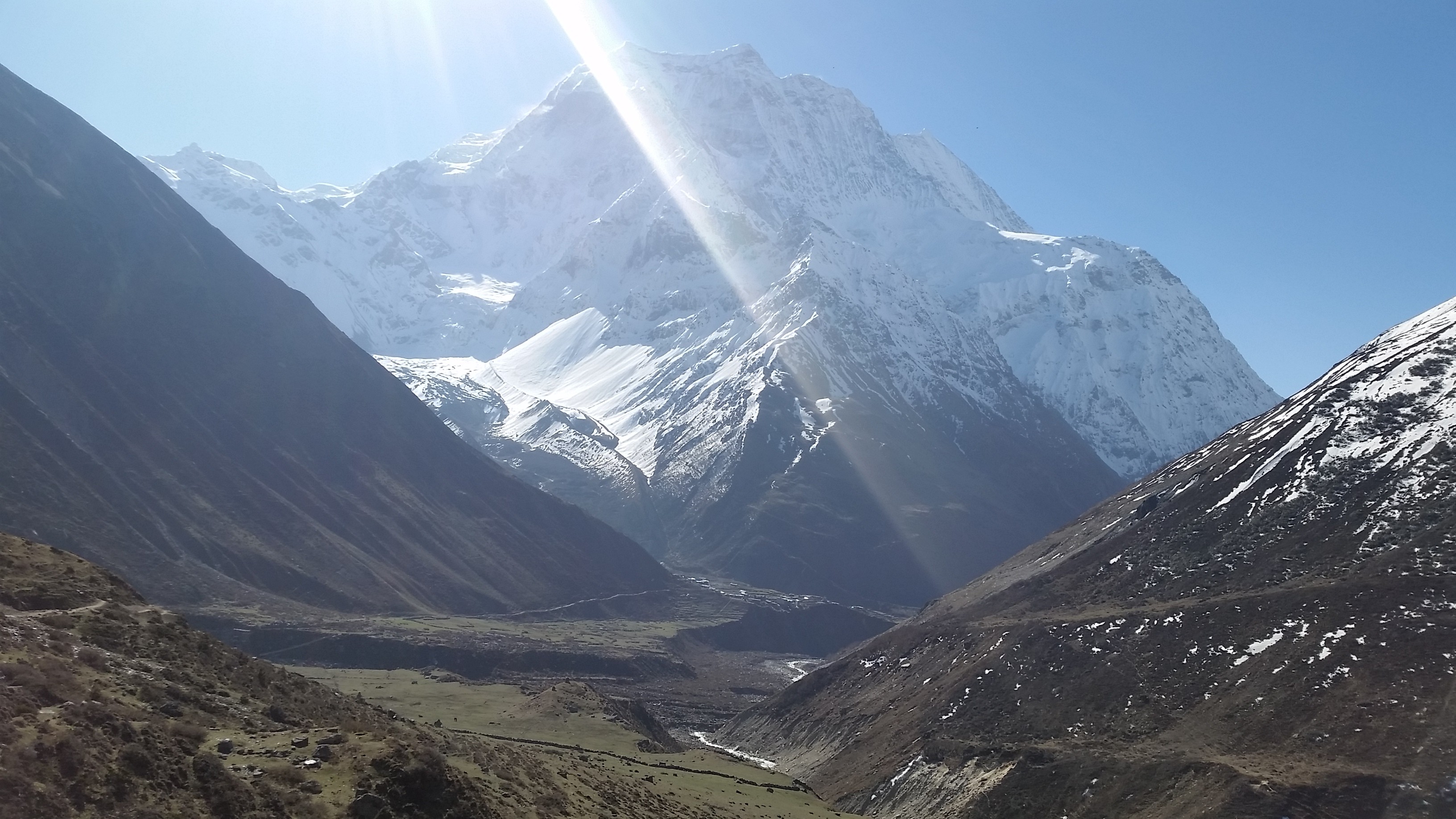
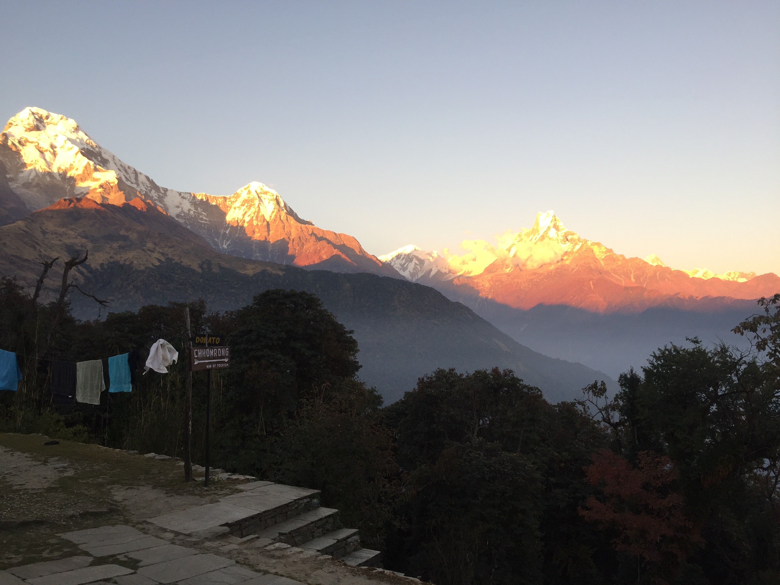
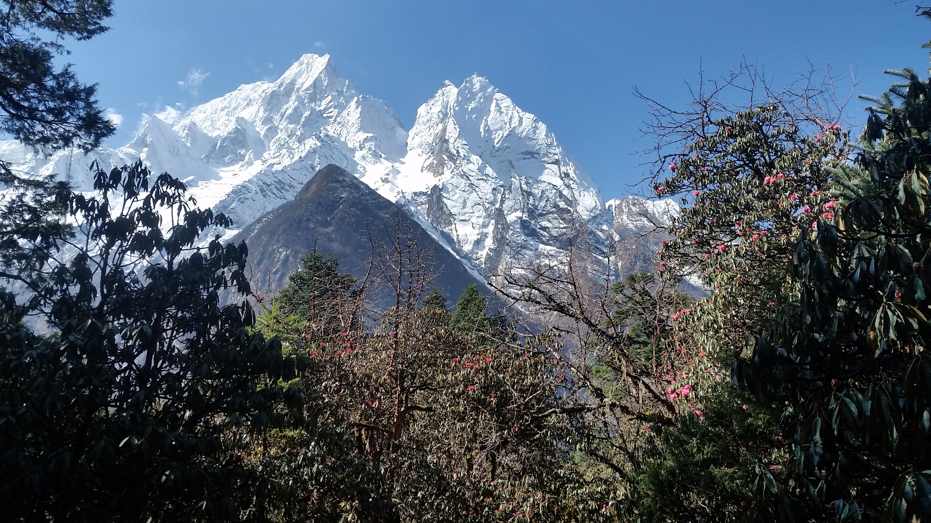
Manaslu trek offers the spectacular beauty of a perfect blend of nature, the lifestyle of local people, and stunning views of breathtaking mountain ranges in Manaslu region.
Every year, many foreigners accomplish Manaslu Circuit trek. Manaslu trek leads you to Nubri and Tsum valley, which is the hidden treasure of Manaslu.
Blue sheep in Manasulu dharmasala

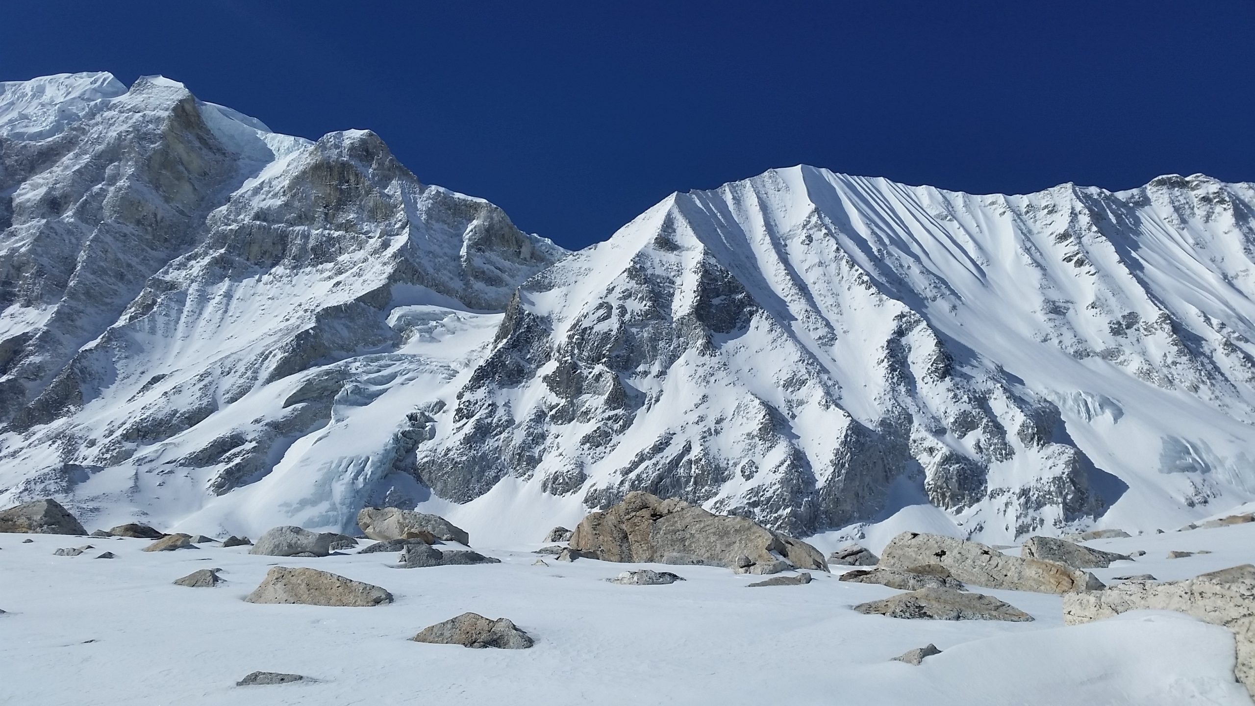
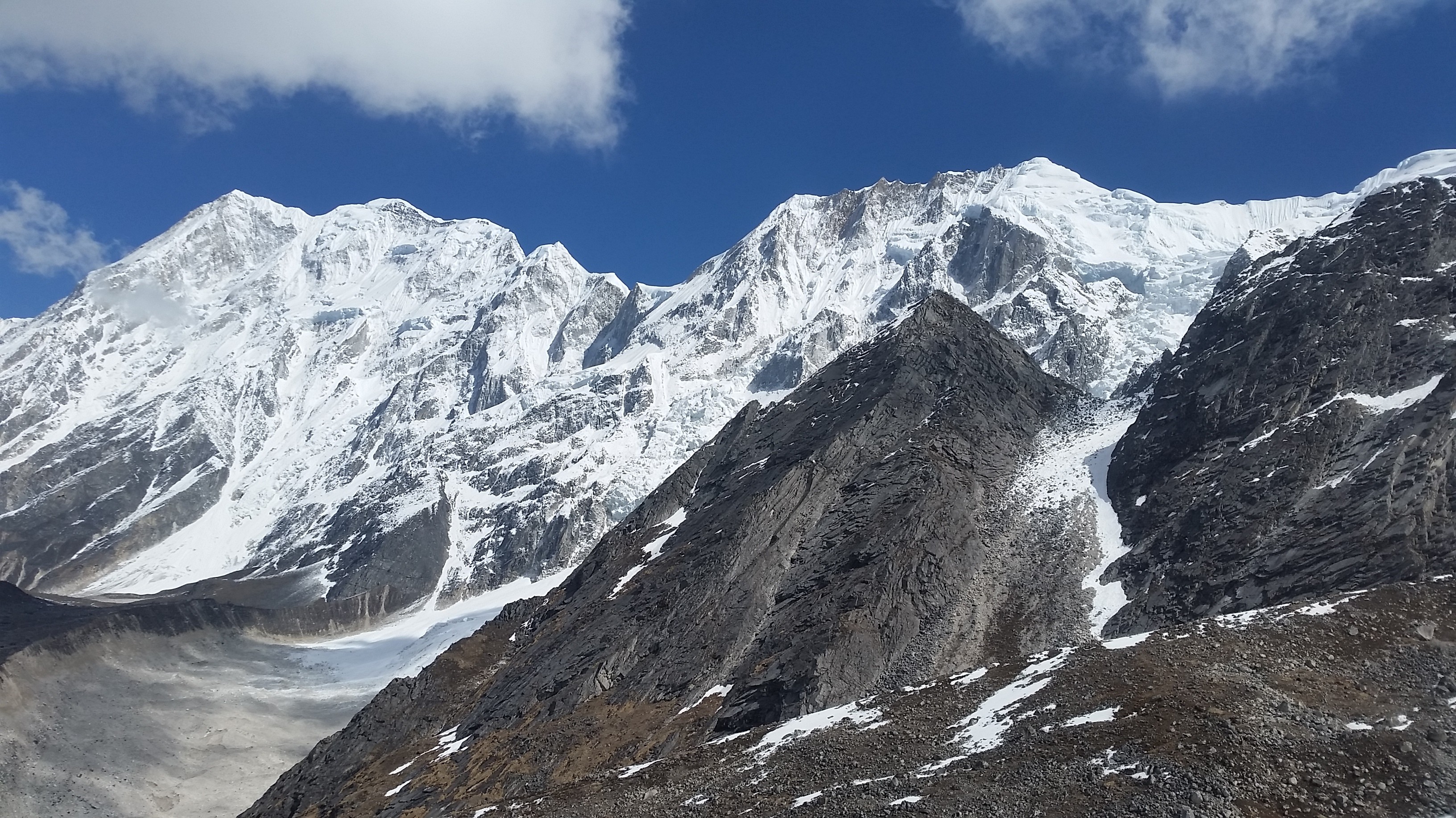
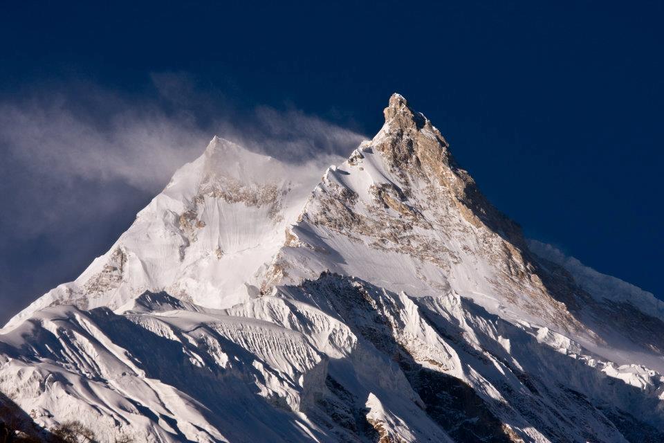
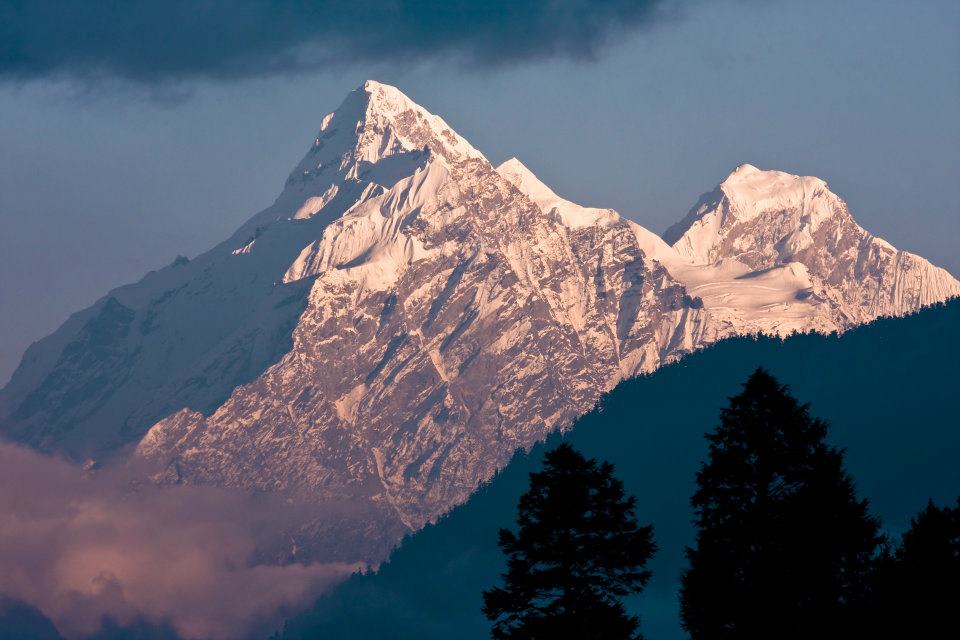
Eighth-Highest Mountain in the World

Manaslu is the eighth-highest mountain on the earth at 8,163 meters (26,781 ft) and opened in 1992 A.D. It is located in Mansiri Himal, part of the Nepalese Himalaya region, in the west-central of Nepal.
Now, Manaslu Trek is controlled by the tourism board and under the restricted trekking trail of Nepal. Before planning to Manaslu trek, trekkers need to take permission from the Manaslu region.
It has the eye-catching views of the long ridge mountain range near Manaslu including Nagdi Himal, Himalchuli, and Boudha Himal.
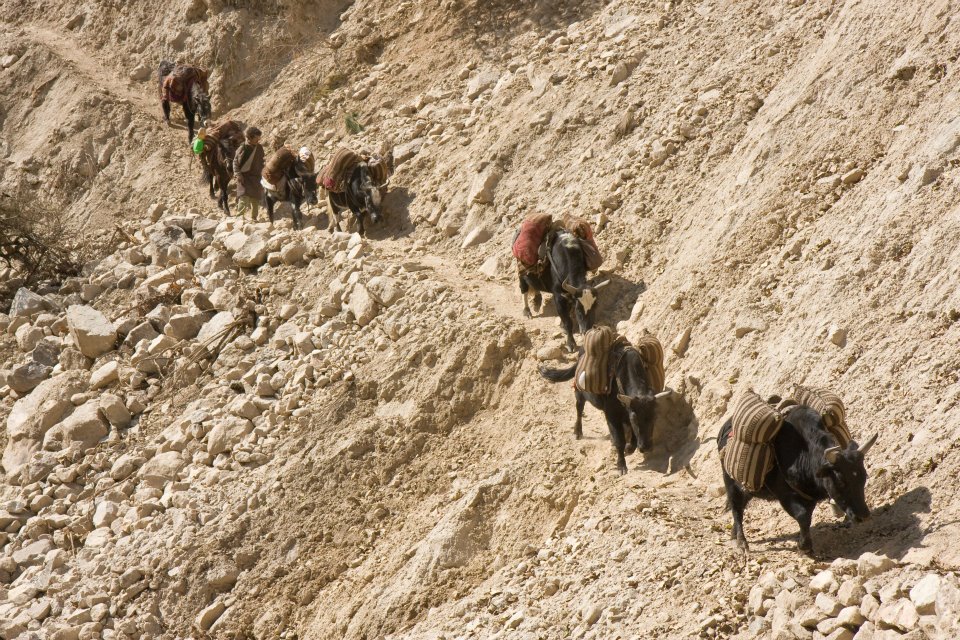
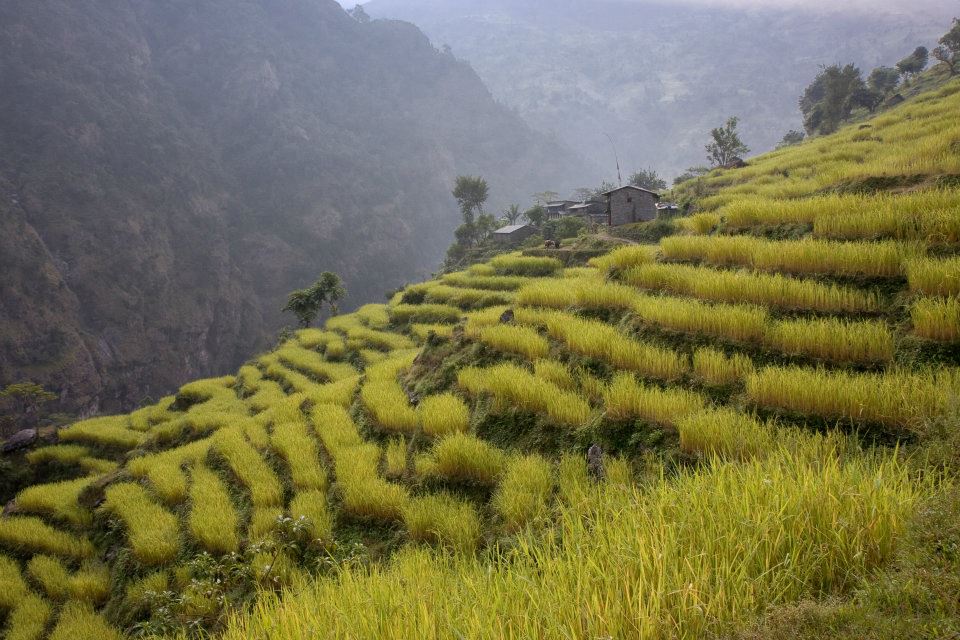
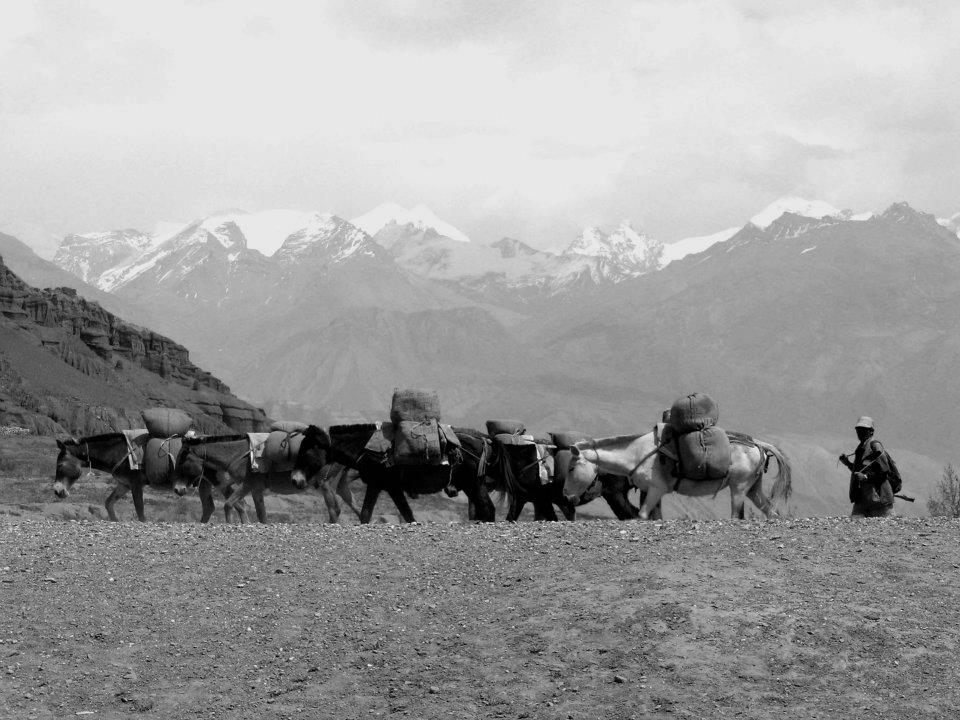
Manaslu is the highest peak in the Gurkha district. Manaslu offers much trekking in the Annapurna region. The trekking follows the trail, an ancient salt-trading route along with Buri Gandaki river.
The trail starts from Arughat, the small town bazaar, and ends in Besisahar.

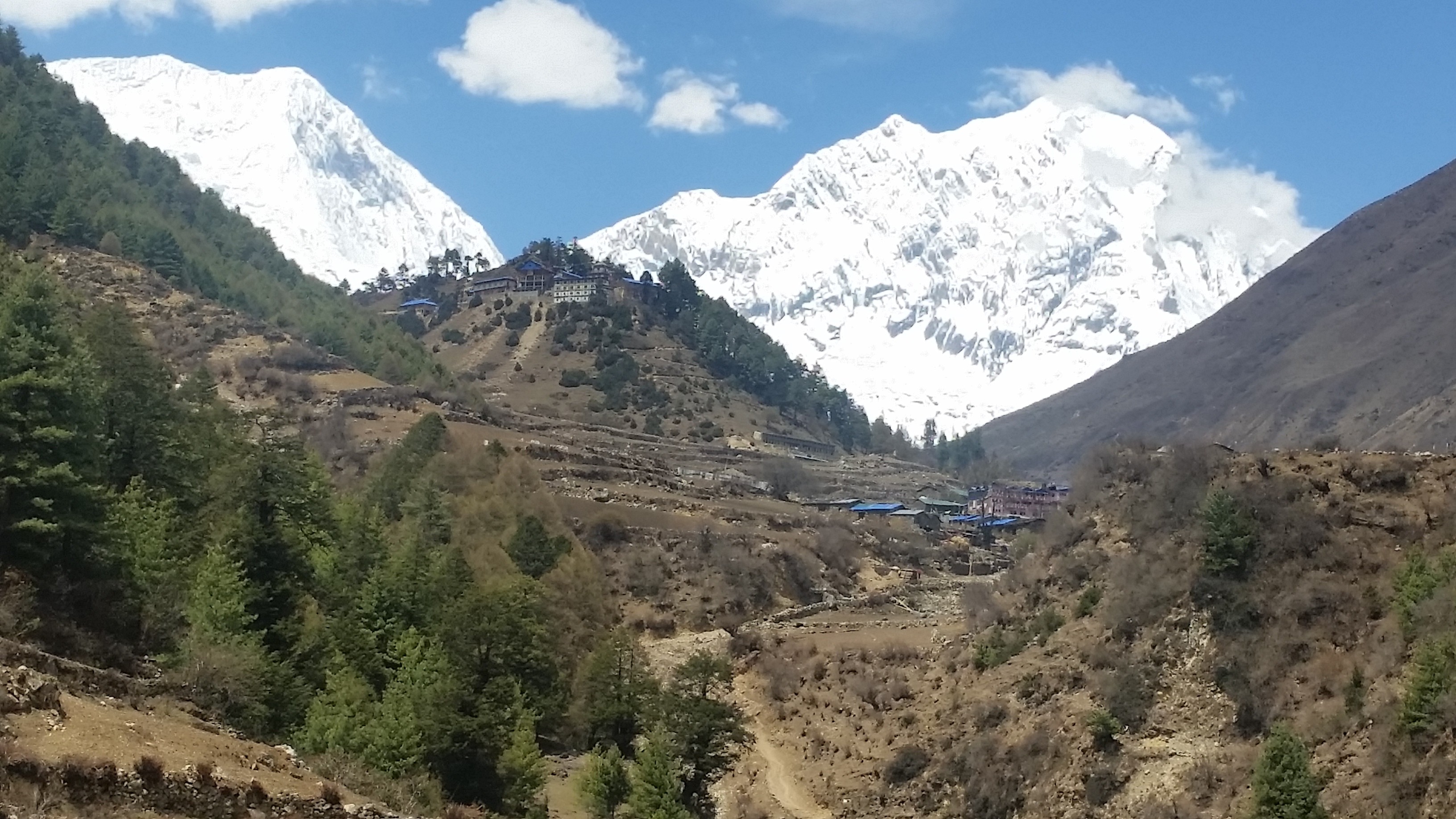
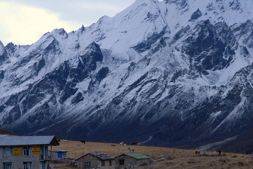
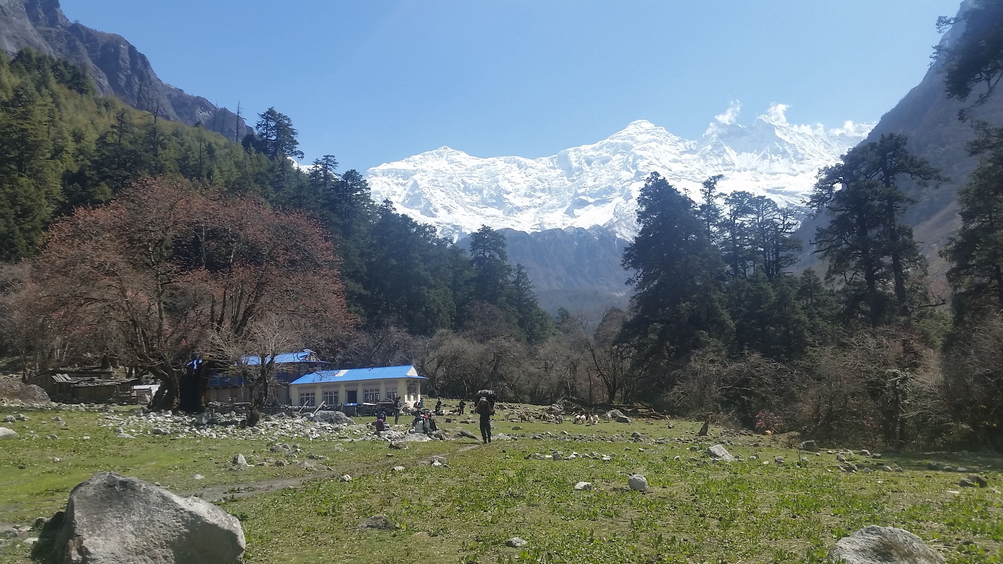
Manaslu is Famous for small tea houses

Manaslu is also known for tea houses. The tea houses are built and managed by the local people. Local people make money by selling food and providing a night’s stay for trekkers with charges or fees.
The small tea houses make this trekking more famous.
Trekkers can take a rest and have a cup of tea there. Also, tourists love to stay there and get opportunities to know closely about their lifestyle. Dal Bhat is the most famous food all around Nepal as well as in the Himalayan region.

First climbed Mount Manaslu

Toshio Imanishi and Gyalzen Norbu were the first to climb Mount Manaslu on 9 May 1956.
Before them in 1950, H.W. Tilman was the first European who made his attempt after he unsuccessfully trekked to Annapurna IV.  
In 1952, a Japanese reconnaissance party reached around 5275 meters after the monsoon season on the east side of the mountains.
In 1953, the Japanese team of 15 climbers led by Y. Mita via the northeast face K. Kato, J. Yamada and  S Ishizaka made a summit around 7750 meters before turning back.
After them; many Japanese teams climbed the summit of Manaslu but got failed. Mount Manaslu is called Japanese Mountain and is also known as Killer Mountain because of its frequent icefall, and high altitude trekker gets sick or killed.
Yak Calf Samagaun

 Historical places

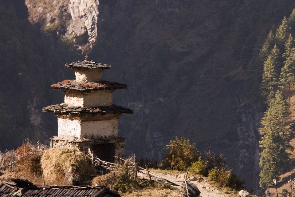
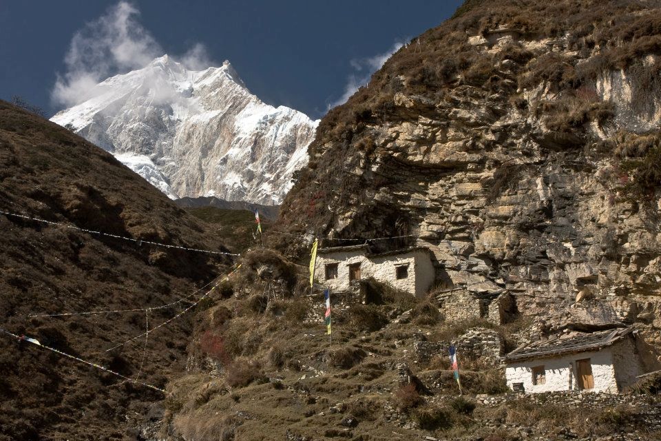
Mount Manaslu, which is located in the Gurkha district, has lots of historical places including the Manakamana Temple and Gurkha Durbar.
It is a beautiful and adventurous trek with stunning views of Manaslu and passing through many Hindu and Tibetan villages.
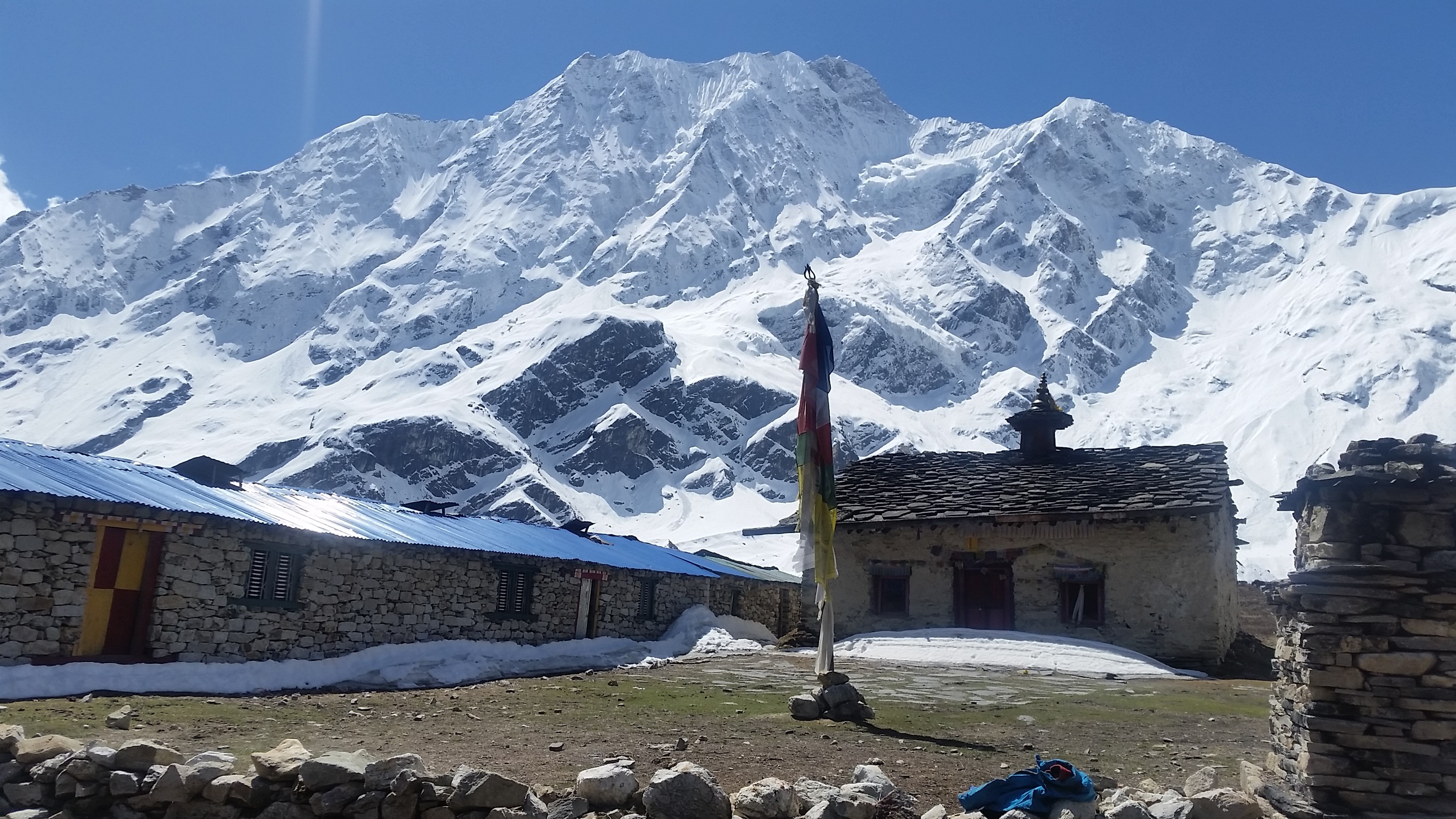
The trek also passes through the beautiful green forest, ancient architecture, and Buddhist Monastery where many children studied to be a monk.

Ethnicity and religion

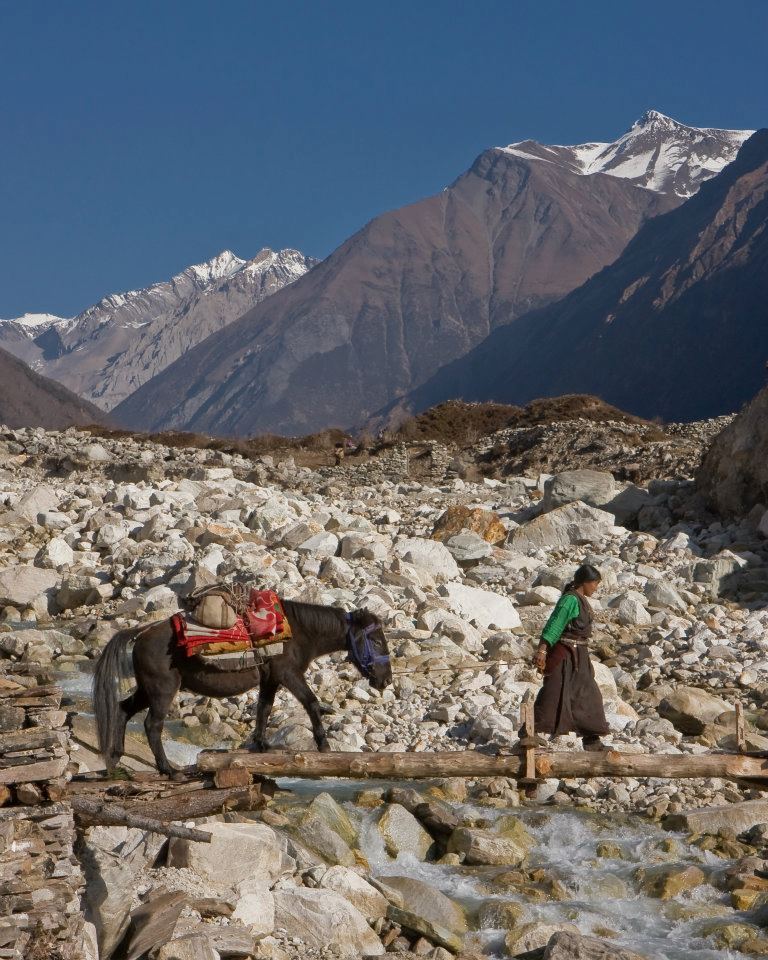
Manaslu shares much of the culture and history with its neighboring territory, Tibet. Manaslu has two ethnicities mainly inhabitant this region: Tsum and Nubri.
Gurung is the main ethnic group that has joined the Brigade of Gurkhas in huge numbers. Close to Tibet, The Bhutias and akin to the Sherpa groups follow the Tibetan ethnicity.
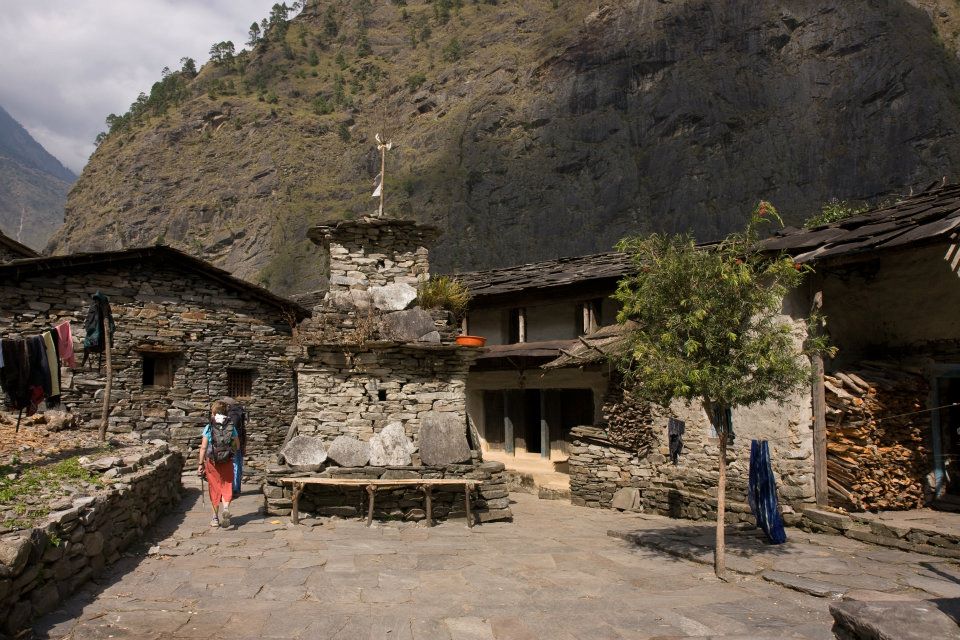
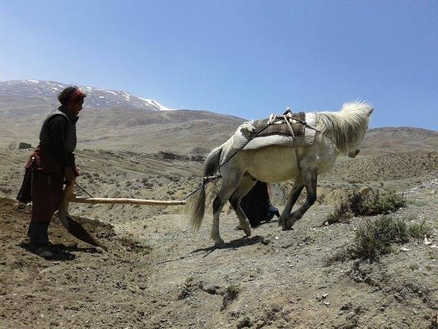
Rich in tradition and culture. The local people live a traditional lifestyle and with unique houses, that have walls built with stones and roofs with stone slabs. Due to the earthquake, many houses have been destroyed and are still under construction.
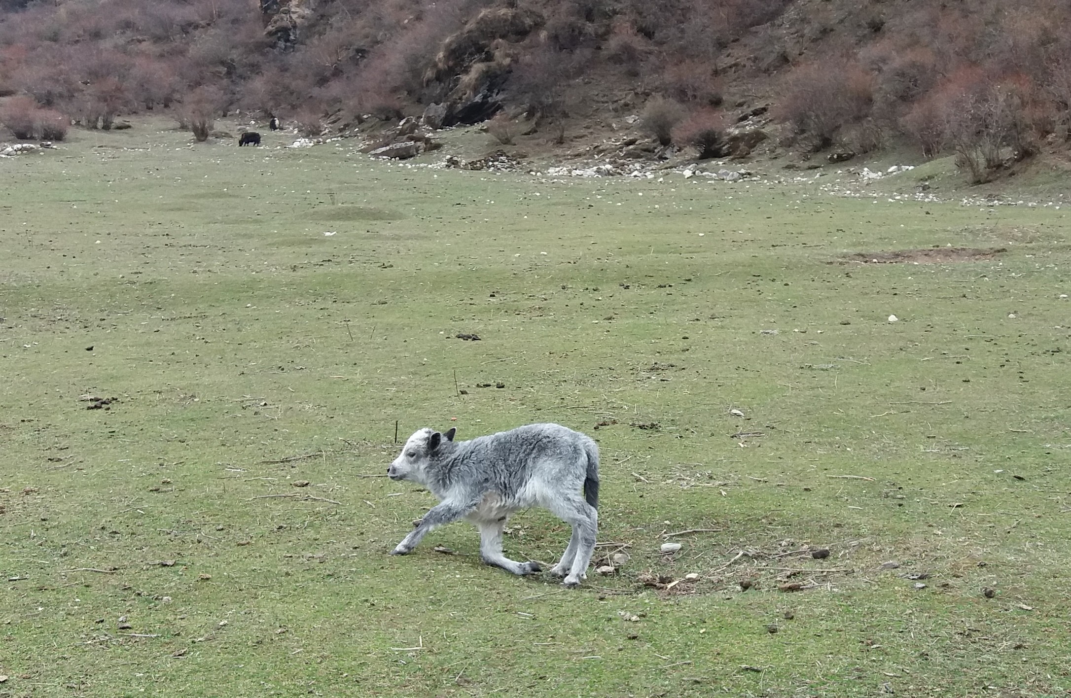
Their main occupation is agriculture and animal husbandry such as barley, maize as crops, and oats and nuts as fruits. Local people also make income from the lodge and small tea houses. Local people are mostly from Tibet and speak their own languages.
Manaslu Rhododendron

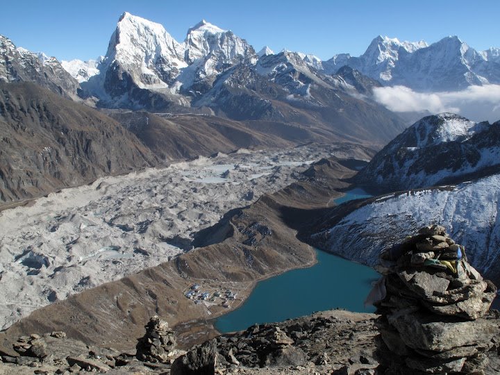
Geographically amazing

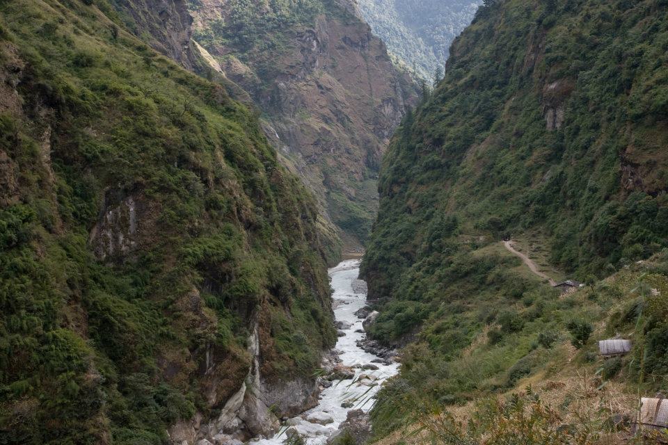
Manaslu trekking is geographically spectacular and fabulous. Manaslu region which is also termed the Manaslu Conservation Area comprises subtropical Himalaya foothills to arid trans-Himalaya high pastures border in Tibet. Starting from Arughat and extending into Larkya La Pass.
The area covers six climate zones; the tropical and subtropical zone varies in elevation with different altitudes. Elevation varies starting from 1000-2000 meters, the temperature zone(2000-3000 meters), the sub-alpine zone (3000-4000 meters), the alpine zone(4000-5000 meters) meadows, and the arctic zone of ranges lying above 4,500 meters.
The temperature of Manaslu also varies widely according to the climatic zones. The snow always covers above 5000 meters of elevation, and as the level increase, the air pressure becomes low.
The trekking route is through mountains prone to the consequences of monsoon rainfall, landslides, and landfalls.

Rich in Bio-diversity

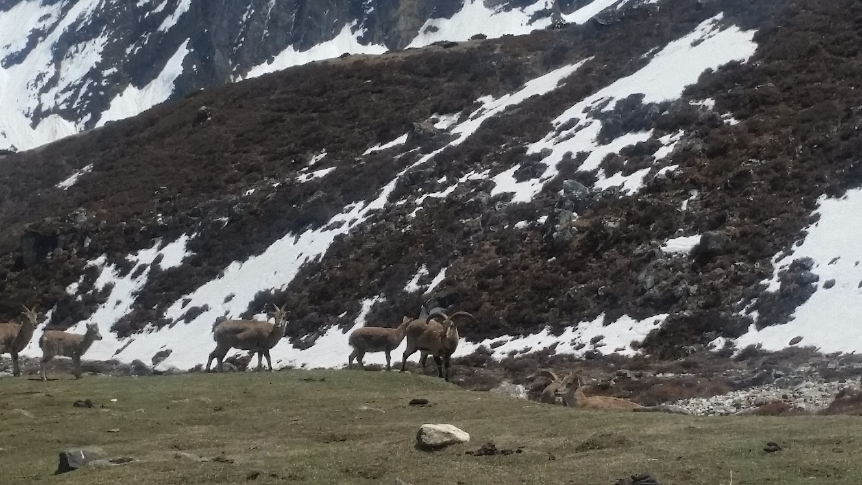
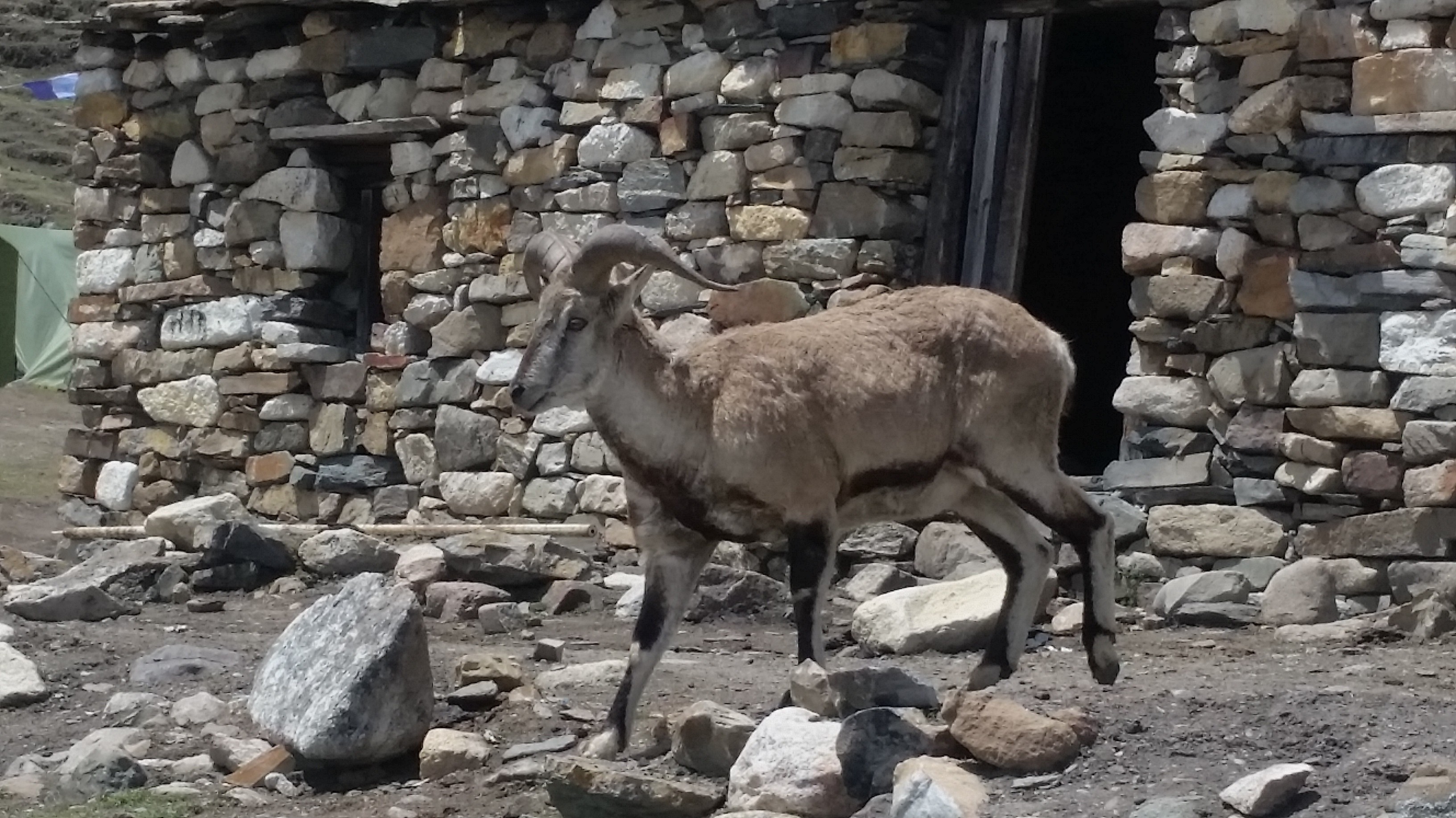
Manaslu region is highly habitat with various flora and fauna, including endangered animals such as snow leopard and Red Pandas.
Other animals such as gray wolf, Himalayan musk deer, blue sheep, Asian Black Bear, Langur monkey, and over 110 species of birds, 33 mammals, and some reptiles are also found.
These species make the region more beautiful and melt human hearts too.
Conservation of wildlife in the area has been done by monks of the monasteries in that area by banning hunting.
The elevation categorizes the hills. For example, Low Hill, Medium mountain, and High Mountain with exclusive forests and a variety of species.
There is not much vegetation of variety. The valley basin has a rich ecotone diversity including nineteen types of forest and mostly rhododendron and Himalayan blue pine which is flanked by Ganesh Himal and Sringi ranges.
Himalayas manaslu trek

Tsum Valley and Nubri Valley

Manaslu region has mainly two inhabitants valley: Tsum Valley and Nubri Valley.

Tsum Valley is one of the remote areas of Nepal. Tsum has a long history of Buddhism. Tsum is also known as ‘Tsum Tso Chuksum’ which means thirteen provinces ruled as a single territory. Still, the ancient Tsum Kingdom remains, and the village has a unique traditional culture.
Tsum Valley Trek in the Manaslu region has beautiful views of four 7,000 meters peaks of the Ganesh massif, and also visitors can experience the distinct Tibetan culture of Tsumba people.
Nubri Valley is the next remote place in the region. Nubri valley has virgin beauty and is still untouched by modernization.
The local people follow their traditions, culture, and art. The local people wear traditional clothes and speak their language. The ancient trail along with mixed cultures, especially the Tibetan, and great hospitality.
Small tea houses and lodges are available in this area. The ancient old Buddhist monastery is established which gives a glimpse of Buddhist culture.
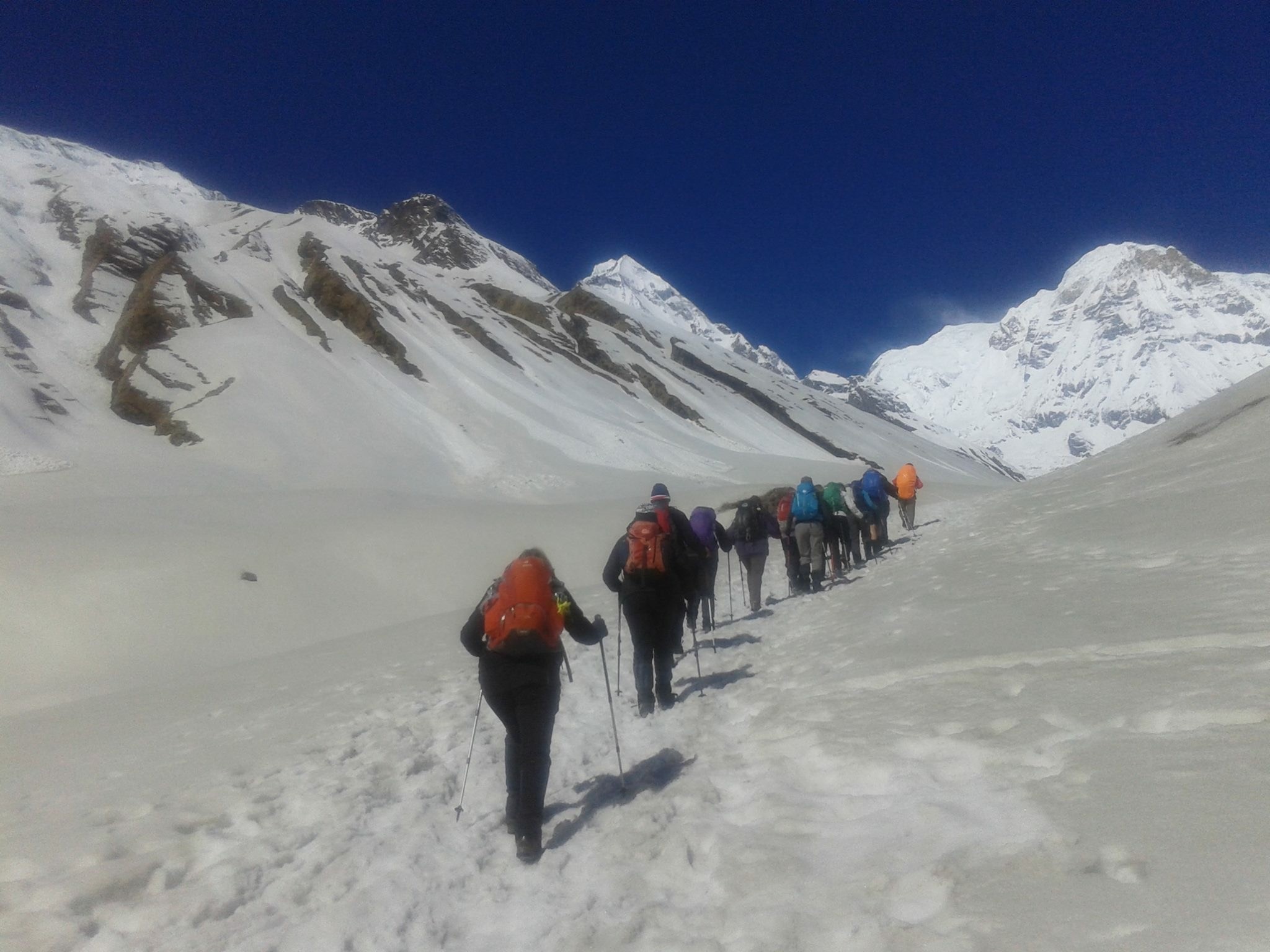
Larkya La Pass

Larkya La pass, also known as Larke Pass is at the maximum altitude of 5,106 meters where trekkers get jaw-dropping views of Mount Manaslu, Ganesh Himal, and other mountain ranges.
Although Larke Pass is at a lower elevation than other Passes like Thorong La Pass, Chola Pass, it is more difficult because of its long walk and the higher elevation.
Besides, descending from Bimtang is more technical and climbing.
Manaslu trek 2

A difficult but adventurous trek

Manaslu is the most difficult trek in comparison to Annapurna Circuit Trek. Manaslu region has few trekkers that make the visit more exclusive and unspoiled and presents the virgin beauty of Manaslu.
But the difficult trail to Manaslu is paid off as trekkers see the spectacular view of snow-capped Himalayas ranges, the traditional villages, local people with unique customs and cultures, and yaks in the upper hills.

Manaslu Circuit Trek: Itinerary

The Manaslu Circuit Trek is one of the unexplored trails that encompass a peaceful, natural and beautiful experience that is ideal for those seeking a getaway from bustling life.

Manaslu Circuit is getting popular as a new trekking destination. Mt. Manaslu is the eighth highest mountain in the world; it is in the very center of the Nepalese Himalaya and to trek around the base of this giant mountain along with its isolated trail is probably one of the best treks.

Manaslu Trek-1

The trail traverses through pristine areas where you will witness the beauty of nature and picturesque village of Tamang and Sherpa settlements with their unique culture.

The Manaslu region is well-known for its high altitude glacier lakes, a diverse range of flora and fauna and charming cultural region.

This trek suits best for those who are looking for challenging trekking in a remote area of the Nepal Himalaya. 

The highest point of this trek is Larkya La pass (5,135m/16,847ft), and trekking around Manaslu offers a unique opportunity to experience an untouched region of Nepal.

Manaslu trek 2

Trek can be 14 days that begins at Arughat and ends at Besishar.  The best season to visit the region is from March to May in spring and September to December during the winter.


Trip Highlights:

The maximum altitude is 5160m/16929 feet.

 The fascinating backdrop of Manaslu & surrounding Himalayan range.

Cross many suspension bridges over the different rivers, including the Budhi Gandaki River and several Mani walls on the way.

Manaslu Trek 3

Observe the traditional village lifestyle and culture.

 Tibetan culture and high pass crossing Larke La (5210m).

Experience walking through pine, rhododendron and bamboo forest and enjoy the nice view of the waterfall


Itinerary:

Day 1:  Kathmandu-Arughat (550 m/ 1804 ft) 7 hrs drive and further 1 ½ more to Soti Khola (597 m/1958 ft)

Our destination start for today is Arughat, which is about a 7-8 hour drive from Kathmandu. During the drive, we enjoy scenery landscape along with the Mountain View.

We will be driving on a paved highway from Kathmandu to Dhading Bensi, and then drive from Dhanding Bensi to Arughat on a bumpy road passing through bamboo forests and Gurung villages.

Upon reaching Arughat, we drive further towards Sotikhola. Overnight at Sotikhola

Day 2   Trek to Macha Khola  [900m/2952 ft]: 6 – 7 hours

In the early morning, we continue our trek by traversing the bridge, and we trek through the Sal forests and ascend onto a ridge above huge torrents on the Budhi Gandaki and continue to Korsani.

Manaslu Trek 4

The trail now gets a bit more difficult as we ascend over a huge rock and pass a brook on a single log bridge then weaves its way up and down again to the banks of the Buri Gandaki.

It continues up a steep rocky track to the Gurung village of Labishe. From Dobhan, we climb following a rocky ridge to old school from where the valley widens.

Then the trail descends to a tropical waterfall with a wooden bridge. The trail climbs over another ridge and dropping to the sandy river bed.

We walk along with rounded stones before ascending over a side ridge. We move down again to the river and traverse one more suspension bridge to reach Machha Khola village.

We stay overnight at ManchaKhola

Day 3   Walk to Jagat [1410m/ 4625 ft]: 6 – 7 hrs

From Korlabesi there is a sharp climb to a ridge and after a few additional ups and downs from here will take us to Tatopani hot spring.  

From hot spring, we climb over another ridge and cross a suspension bridge over the Buri Gandaki. At this point, we climb the wide stone stairway to Dobhan.

Manaslu Trek 5

The trail gets quite rough and starts by ascending to two teashops at Duman, then we cross the landslide area, and after some ups and downs through the narrow valley, it reaches a large field.

There is some jumble over gravel slope until we decline to the wide river valley. After crossing a suspension bridge, the trail ascends a set of stone stairs, drops to the river and ascends once again to Thado Bharyang.

Crossing the west bank of the Budhi Gandaki, we climb over a ridge, trek along the river and then climb towards the village of Jagat.   We stay overnight in Jagat.

Day 4:  Trek to Deng (1,860m/6,102ft) 6-7hrs

There are good views of Shringi Himal as you walk along the side of a cliff. Today we will set off our journey to Salleri by climbing over a rocky ridge to Salleri and move down to Sirdibas.

The trail descends to Setibas where the Mani walls (prayers engraved into wayside rocks) show that we are entering a region with increasing Tibetan influence.

Manaslu Trek 6

The valley widens a little and continues past the stone houses of Ghattu Khola, We continue to Ghatta Khola and then walk upstream through a long suspension bridge to reach a Gurung village in Phillim.

And then turns north just above the lowest houses in the village and stays fairly level until Serson. Further Serson the trails enter a steep gorge and descend through grassy slopes, to cross the wooden bridge at the river’s narrowest point; below you will see the convergence of the Shar Khola and Buri Gandaki rivers.

The village of Nyak is located close to here. As the trail widens, we pass through bamboo forests to reach the Deng Khola. After crossing the river, we reach the Deng village where we overnight here.

Day 5: Trek to Namrung (2,540m/8,333ft) 7-8hrs trek

We take a short walk from Deng and the trail traverse back over the Budhi Gandaki and climb Rana at 1910m. After a short climb from the bridge before heading west on level ground and we pass the large waterfall.

 Once we cross the wooden bridge, the trail curve up and out of the canyon and ascends over the river before dropping into the Shringi Khola Valley.

After crossing the suspension bridge over the Shringi Khola, there is a sharp climb, and the trail passes along the Buri Gandaki.

Manaslu Trek 7

The trail passes through forests and painted Mani stones and a corner from where we reach Ghap. You pass more Mani walls on the southern part of the river.

The trail climbs along the river, passes a waterfall and continues all the way through dense rhododendron forests with a wooden bridge in the middle which crosses the Buri Gandaki.

The trail continues along the north side to a big cave and then crosses the river at a narrow gorge where you can see grey Langur monkeys.

The forest becomes less dense, and the trail is leveled once we cross the river at a gorge. After an enjoyable walk, we then continue a final steep climb that will take you to our destination to Namrung through a stone archway where we stay overnight.

Namrung is the greatest viewpoint for Siring and Ganesh Himal as well as Mt. Himal Chuli.

Day 6: Trek to Samagaon [3530m/11,578 ft]: 6-7 hours

Manaslu Trek 8

The trail traverses the ridge onto the Buri Gandaki Valley side and followed by descending to a rock scattered moraine.

We further pass through extensive meadow and fields near Sama gompa after crossing some rocky trails. You will get the opportunity to explore a small part of Tibet with numerous Gompas and an authentic Tibetan village.

The village is settled perfectly against a wooded moraine at the end of the valley. We will rest overnight here in the village.

Day 7:  Acclimatizing day at Samagaun

We will take a break to rest and acclimatize to the increasing altitudes. We stay in Samagaon and explore the surrounding areas and traditional Tibetan community from where we will be able to see beautiful views of Manaslu.

  For the people who don’t want to hike can rest and explore the village. We will come back to the village and spend overnight at Samagaun.

Day 8: Trek to Samdo [3860m/12,660 ft]: 4 – 5 hours

On the eighth day, we follow to the Budhi Gandaki River, which turns north and crosses the suspension bridge over a side stream. The trail to the left takes us to the Manaslu Base camp.

Manaslu Trek 9

We then trek all the way through Larkya La trail we come across through numerous Mani walls. The valley broadens along an easy trail on a ridge above the river passing the juniper and birch forests to the stone huts at Kermo Kharka.

We then descend a ridge to cross a wooden bridge and ascend between diverging in the river to a headland. From this viewpoint, one can see the white stone Kani marking the way into Samdo.

Day 9: Rest and acclimatization day at Samdo (3,860m/12,660 ft)

This is another day to take a break for proper acclimatization. You can either take a rest or walk towards Gya La (‘large pass’) to the north of Samdo, which is the frequently used trading route to Tibet.

However, it takes an entire day to walk to Gyala and hence could be a bit exhausting. We overnight at Samdo.

Day10: Trek to Larkya Rest House (4,470m/14,665ft)

Today we begin the climb to the pass along the traditional trade way to Tibet. The broad trail descends you to fields to a huge old Mani wall and stone huts, dropping to the river and traverse it on a wooden bridge at 3850m.

This place shows up on maps as the legendary Larka Bazaar, which used to be a prosperous market.

Manaslu Trek 10

A Mani wall marks the beginning of the climb to the pass where the trail starts climbing through tundra and juniper; you can see the huge Larkya Glacier coming from Manaslu.

Continue on the ridge to the right to find a trail that traverses over the top of two gorges. As you climb up the side of a gorge to a viewpoint at the edge of a huge gorge at 4000m, the trail grows steeper.

Climb in and out of the gorge and contour to the only shelter on the way to the pass which is a rest house at 4460m. 

Day 11: Cross the Larkya La (5,135m/16847ft), trek to Bimtang (3,590m/11778 ft)

On this day we make a long gentle ascend across the moraine, and climb down to a lake and then trails become rough as it traverses to the south of steep, and lush slopes.

The trailhead towards the moraine to a ridge marked by two cairns, from here the prayer flags marking the pass can be seen. We then descend to the four frozen lakes then take a final steep climb to the pass.

Manaslu Ttrek 11

When you go down from the pass, the trail continues the top of the moraine to the west and passes through many sharp ascents and descents. As we cross the moraine then descends more lightly on wobbly gravel to another grassy moraine at 4,450m.

The trail now becomes easier to continue and reaches a small pasture at 4,080m. As the trails head down to a large meadow, the valley becomes broader where we pass Mani wall and a small rest house that marks Bimthang at 3,590m.

We stay overnight at Bimthang, a huge valley surrounded by high peak


Day 12: Trek to Tilje [2300m/7544ft]: 5 – 6 hours

From a ridge at Bimthang, we can view vistas of magnificent Mt. Manaslu, Lamjung Himal, Himlung Himal, and Cheo Himal.

The trails descend further and pass high pasture (Sangure Kharka) followed by a bridge over Dudh Khola.

Manaslu Trek 12

We then cross a wooden bridge and descends into pine and rhododendron forest to Hompuk at 3,430m and follow a trail through a narrow valley until we reach the highest cultivated land of the valley at Karche, 2785 meters.

 From there we pass a landslide before a steep climb over a ridge decorated with prayer flags. It makes a drop to the river bank at Gho. The trail follows through fields and takes to you at Tilje, a large Gurung village.  

We overnight in Tilje village.

Day 13: Trek to Chamje (1,430m/4691 feet)

Today we leave the village behind through a stone arch, traverse the Dudh Khola and follow along its embankment downward through the forest.

As we walk along, we see the Marsynagdi valley with its terraced fields and villages, and finally, the houses of Dharapani become visible in the distance.

Manaslu Trek 13

We cross Thonje by passing through a wooden bridge and a chorten-shaped arch, and we make our way to Dharapani by crossing a long suspension bridge over the Marsyangdi.

This is a trail where we enter the Annapurna Circuit route in reverse as you lead through the steepest part of the Marsyangdi gorge.

Day 14: Transfer to Besisahar and private transfer back to Kathmandu

 From Dharapani we take the vehicle to Beishar which takes 4-5 hours. 

Manaslu Trek 14

We pass all the way through the banks of Marsyangdi and Trishuli River, enjoying the scenery and refreshing views of the hilly areas and mountains on the way back to Kathmandu.


10 Best treks in Nepal: Read to know what you need Exactly

Nepal is the most beautiful country nestled by several Himalayas ranges. Nepal is a popular country for trekking all over the world. It is home to world’s highest peak and also largest lake, glaciers, lush hills and dwindling white river.

It is a  perfect choice who love to trek and explore. More than 200,000 tourists visit Nepal every year. Nepal has always been on the top list for mountain trekking. It is also popular for the ancient heritage, old culture, traditional lifestyle and natural beauty.

During the traveling, you can experience the views of the breath-taking mountains, beautiful green forests, wildlife and thrilling rough and tough terrains and heights of the hills. Also, you will get chance to know the different culture and life at different places.

Nepal is small in geographically, but it has huge, diverse land terrains. It’s a one time opportunity to explore yourself trekking in Nepal.

If you had lots of experience in trekking and want to trek in next level, then you can trek to Himalaya region such as Everest Base Camp, Annapurna Circuit Trek, Upper Mustang and others mountain region. Or if you are looking for both combination of cultural and adventure trek; you can treks like Poonhills, Gandruk, lower Mustang, Shivapuri and several others.

Before going to the trekking, there is something you need to consider. You need to be physically fit and have enough knowledge about the trekking. The difficulty of trek depends upon a traveler’s physical condition. Short treks are considered to be easier while longer treks require some mental and physical fitness. The trekking usually requires 5-6 hours of walking per day and some days traveler even needs to walk up to 8-10 hours at high altitude. So sometimes training is necessary for few of the difficult trekking.

The things before the trek you need to consider and they are:

  1. Firstly, state your physical ability and mental wellbeing.
  2. The total duration of the trekking.
  3. Level of trekking difficulty that you are seeking.
  4. The trekking route; Tourists route or Non-tourist route.
  5. The complete budget of the trek.
  6. Season for trekking.
  7. Size of the group to trek.
  8. Trekking permits and necessary documents.

Here we have compiled 10 best treks in Nepal with their pros and cons. We have also tried to write some of the details of these treks. If you need additional information on these treks you can directly contact us from our Contact Us page or you can chat with us with icon below.  Hopefully, that will assist you to select the favorite trekking destination.

Everest Base Camp


View images here.

The world highest summit lies in Nepal at height of 8,848 meters tall. Everest Base camp is one of the best trekking destinations in Nepal. More than 25,000 trekkers trek to Everest Base Camp yearly. Due to its popularity, the base camp is a bit crowded during the peaks climbing season. No doubt Everest base camp is onf the best treks in Nepal.

While trekking, you get an opportunity to look closely at the lifestyle of the Sherpa people living in that region. During the trek, you will see many Buddhist Monastery, prayer flags, suspension bridge, traditional houses and magnificent jaw-dropping view of mountain ranges.

Everest Base Camp Highlights:

  • Close view of Mount Everest(8,848m)
  • Amazing view of Mt. Kanchenjunga, Mt.Lhotse, and Mt. Makalu.
  • Visit old Buddist monastery of the region.
  • A close look at Sherpa Village and their traditional lifestyle.

To get in the Everest Base Camp fly to Lukla from the Kathmandu airport and trek from Lukla to Namche Bazaar to Everest Base Camp. Namche Bazaar is the gateway to Everest Base Camp.

Trekking Details:

  • Maximum Height of Kalapathar at 5,600 m.
  • Best time to trek: Autumn(October to November) and Spring(May to June)
  • Trekking days: 14 days to 16 days
  • Trekking Difficulty: Medium
  • Trek permits.
  • High-Price

Annapurna Circuit Trek

Trekking in Annapurna Base Camp

This image was clicked by our One of our Trekking Guide Gopal Lama. You can view more images of ABC here

Annapurna is the second best trekking route of Nepal. Annapurna is the tenth highest mountain on the earth at the altitude of 8,091 meters. Annapurna Trek cross two different valleys and encircle the massif Annapurna.

Trekking to the Annapurna, you will see the beautiful Annapurna mountain ranges like Dhaulagiri, Machhapuchre, Manaslu, Gangapurna, Tilicho Peak, Pisang Peak, Paganda Peak and spectacular sunrise view. Also discovery the Hindu holy sites and Buddist along the way;  Gurung villages with lush green forest, the lifestyle of the local people and their unique cultural heritage. Annapurna Trek crossing through the point at Thorong La pass (5,416 m).

There are four regions that passed through on the trek; Lamjung, Manang, Mustang, and Myagdi. Annapurna treks begins from the Besisahar or Bhulbhule in Marsyangdi river valley and concludes in the Kali Gandaki rivers. The trails pass through the various villages, Subtropical forest, several waterfalls and gigantic cliff along with paddy fields. That is why Annapurna Base Camp is considered is one the best treks in Nepal.

Annapurna Circuit Trek highlights:

  • Breath-taking mountain views of Annapurna I, Annapurna II, Annapurna III, Annapurna IV, Himchuli, Machhapuchre, Dhaulagiri and others mountain peaks.
  • Walk through the subtropical forest including oak, bamboo and rhododendron trees, Buddhist villages and Hindu holy sites.
  • Crossing the widest pass in the world, Thorong La Pass (5,416m).

Trekking Details:

  • Highest elevation- 5,416 meters
  • Duration – 15 to 17 days
  • Very Commercial and busy route.
  • Best seasons- Autumn (October to November) and Spring( March to May)
  • High price
  • Trekking Difficulty- Moderate
  • There are many teahouses through the trek.

Poon Hill Trek

Poon Hill sunset view

This image of Poon Hill Sunset Gopal Lama. You can additional information here.

Poon Hill Trek is popular for short and easy trekking that you will explore major attraction during the trekking in just 5-7 days in Annapurna region. It is very exciting tours and takes you through the stunning panoramic views of mountains such as Annapurna, Dhaulagiri as well as others Himalayan ranges. The short trail continue through the forest of rhododendron and bamboo and takes through Gurung and Magar villages. You can not miss Poon Hill when talking about best treks in Nepal.

25 minutes of flight from Kathmandu to Pokhara. The trek begins from Nayapul heading towards Tikhedhunga. Then Tikhedung to Ghorepani to Poonhill and head back to Tadapani to Gandruk to Pokhara.

Poon Hill Trek Highlights:

  • Best Sunrise and Himalayas view.
  • One of the biggest settlements of Gurung and Magar
  • Stunning view of Dhaulagiri, Annapurna ranges, Manaslu and other mountains.
  • Easy and short trekking in Annapurna region.

Trekking Details

  • Maximum height altitude of 3210 meters.
  • Trekking Duration- 5 to 7 days
  • Trekking Difficulty- easy
  • Best Season- September to November and March to May.
  • Price depends upon travel agency.

Langtang Valley Trek

Himalayas while in the Langtang trekking

View more images of Langtang and Gosaikunda Trek

Langtang valley trek is situated at a distance just 19 miles to the north of Nepal. It is popular as the valley of glacier treks. Langtang is a beautiful and one of the mesmerizing place to see snow-capped mountains. Langtang valley offers pine woodland forests, lush green slopes, stunning views of the Himalayas and rugged rock.

Langtang trek takes around 8-9 hours of drive from Kathmandu. The trekking starts point is Syavrubesi where you follow the Langtang river to Kyanjin Gompa and stay overnight then continue to Langtang Valley. Trek back to Kyanjin Gompa to Syabrubesi to Kathmandu. During the trek, you can visit ancient Buddhist monastery, the local villages where you can have a small talk to Tamang people who are very frank to tourist.

Langtang Trek Highlights

  • Langtang Valley Trek is also known as The Glacier of Trek.
  • Climbing the Tersko Ri Peak.(5,000 m)
  • Nice view of the Sunrise and Himalayas.
  • Ancient Buddhist Monastery and typical life of Tamang people.

Trekking Details:

  • Duration- 7 to13 days
  • Best Season- Autumn (October to November) and Spring (March to May)
  • Trekking Difficulty- Moderate
  • Price- reasonable
  • Accommodations- Hotel and lodge are available.

Manaslu Trek

Picture taken in Manaslu region

You can view more images like this in this link.

Manaslu is the eighth highest mountain in the world at 8,163 meters (26,781 ft) above the sea level, located in the Mansiri Himal in the west-central part of  Nepal. The name ‘Manaslu’ means ‘mountain of the spirit.’ Manaslu comes from Sanskrit word Manasa; it means intellect or soul. The Manaslu region was opened for trekking only in 1992 AD.

The Manaslu Circuit trek offers the stunning view of snowcapped mountain range and the ancient trail along with mix culture, heritage and hospitality of authentic Hindu and Tibetan-style Buddhist village. The trail follows the spectacular Burhi Gandaki River towards its sources.The highest point in this trek is the ‘Larkya La Pass’ at an elevation of 5,106 meters (16,752 ft).

The Manaslu Himalayan region is a adventures trek in Nepal. The beauty of Manaslu is unpredictable. The trekking to Manaslu area is considered one of the finest destination of Nepal. The area is highlighted by two culture; Gorkha which is the ancestral seat of the reigning Shah dynasty and the temple of Manakamana.

The Manaslu Trek starts from Kathmandu to Arughat about 5-6 hours drive. The trekking route for going and coming back isn’t the same route. You will go one route then return by another route.

Manaslu Highlight:

  • Manaslu is the most difficult trekking in Nepal.
  • The scenic view of the back Mount Manaslu, Ganesh Himal, Mt. Himchuli and other mountain ranges and the subtropical forest at the lower part through the Himalayas foothills to the high, cold and challenging crossing of the Larkya La at the elevation of 5,106 meters (16,752 ft).
  • Many tea houses are there for the trekkers, so they don’t worry about food.
  • Explore the traditional culture, rich heritage and the lifestyle of the locals.
  • Pristine Budhi Gandaki River Valley.
  • Scenic view while driving from Kathmandu to Arughat and Beshishar to Kathmandu.                                                

Trekking Details:

  • Highest altitude at 8,163 meters
  • Duration- 16 to 18 days
  • Best time- Autumn (September to November) and Spring (March to May)
  • Trekking Difficulty- Very Difficult
  • Trekking Permits

Upper Mustang Trek

Horses in Mustang Trek


You can view more images like this here.

Mustang is rich in the natural beauty, cultural heritage, and a historical place which situated in Dhaulagiri zone in Nepal. This beautiful land divided into two parts; the Upper Mustang and the Lower Mustang. The Lower Mustang is full of natural scenery, and Upper Mustang is popular for the adventurous trekking. Snowfall mostly in the winter season, visitors enjoy playing with snow during this season. The beautiful places lie in the Mustang district such as Jomsom, Kagbeni, Lo Manthang and many others. Muktinath Temple is a holy place for both Hindus and Buddhists. Within, Hinduism it is called Mukti Kshetra which means the ‘place of liberation or moksha’ and had 108 water taps.

Upper Mustang trekking was officially opened in 1992 with a limited number of trekker are allowed to visit there to protect the Tibetan Culture. Upper Mustang is then in the best trekking route even in the monsoon times. The best things to visit in monsoon is that local peoples are busy with everyday works and get the fabulous view of cliff mountains, beautiful hills, and snow-capped mountains. To reach Upper Mustang take a flight to Jomsom and treks to Kagbeni.

Upper Mustang Highlight:

  • Majestic views of mountain ranges like Nilgiri, Dhaulagiri, Tukche, Annapurna.
  • Get to see the old Buddhist monasteries, houses made by the stones, traditional culture of Tibetan and yaks.
  • Travel through landscapes of arid regions, barren edges, deep gorges, and mountain valleys and eroded rock faces.
  • Crossing through the two high peak Thorong La and Mesokanto La.

Trekking details:

  • Duration- 15 to 17 days
  • Best time- Autumn (September to November) and Spring (March to May)
  • Trekking difficulty- Moderate
  • Need trekking permits
  • High-price (Including accommodation, meals and other equipment)

Mardi Himal

Mardi Himal Trek

View more images of Mardi Himal on our Facebook Page

The Mardi Himal is newly opened route in the Annapurna region and also known as hidden treasure trek too. The Mardi Himal Trekking is a short, easy; well manage camping and tea house trek that discovery the beautiful view of Annapurna area.

Mardi Himal is least visited of the trekking peak, and this trek is the best destination to avoid the crowd. Though the availability of foods and accommodation on the route is at a bare minimum. Mardi Hima Treking is still an enjoyable trekking route which requires minimum efforts Mardi Himal Trek is about a week-long trip in the Himalayas with stunning views of snowy peaks through small Nepali Villages. It is an interesting trek compared to other popular treks in Annapurna region.

Mardi Himal is located to the east of the Annapurna Base Camp. Mardi Himal offers the spectacular view of Annapurna, Dhaulagiri, Machhapuchre (Fishtail) and Manaslu Himalayas ranges. Also, the natural beauty allows seeing the Nepal national bird-Pheasant, national flowers- Rhododendron, Musk deer, Snow Leopard, Himalayan Thar and many more wild animals and several plants which are used to make medicine.

Mardi Himal has different trekking route from beginning to the end of the trek. The trek starts from Phedi and ends in Lwang.

Mardi Himal Highlights:

  • Mardi Himal Base Camp is at 4500 meters marks the highest point of the Mardi Himal Trek.
  • The highest sleeping point on Mardi Himal Trek is at High Camp.
  • Mardi Himal Trek is popular the Annapurna Range where you can see amazing views of Machhapuchre (also known as Fishtail, 6,993 m), Annapurna South (7,010m), and Mount Hiunchuli (3,441 m).
  • Mardi Himal trek route has been popular over past five years, and Teahouse (guest house) has established there for visitors.

Trekking Details:

  • Highest altitude: 4500 meters
  • Duration – 8 to 10 days
  • Best time- Autumn (September to November) and Spring (March to May)
  • Trekking Difficulty- not too difficult
  • Trekking permits
  • Accommodation – Teahouse, lodge, homestay
  • Price depends according to travel agencies.

Upper Dolpa Trekking

Upper dolpa trekking`

Know more about Itinerary of Dolpa Trek.

The beautiful Dolpa is situated between Dhaulagiri region and the plateau Tibet. Dolpa is the most remote trekking route of Nepal which is opened in the 80s. Dolpa is most beautiful and still fresh trekking which never affected by the outer world. The trekkers visit Dolpa to mesmerizing views of the Himalayas such as Dhaulagiri, Annapurna Kanjirowa mountains. Treks pass through several Himalayas, Gompa Monastery, Jhunphal and also enjoy the beauty of the deepest glacier lake, Phoksundo lake in Nepal.

 It is not only the adventure treks but also a cultural treks. It is the mixture of Tibetan and Nepalese Culture.

 The Caravan was filmed in Dolpa region which was nominated in Oscar movie. Upper Dolpa was also mention in the books ‘The Snow Leopard’ by Peter Matthiessen, ‘Himalayan Pilgrimage’ by David Snellgrove and ‘Stones of Silence’ by George Schaller.

Upper Dolpa trekkings begins from Jhunphal (2,285 m/ 7495 ft). The trail passes through numerous terrains of mountain ranges, over the Numa La Pass (5,190 m/ 17,028 ft), until to reach Phoksundo lake at Ringmo village inside the Phoksundo National Park and finally terk to Jumla and end the trek.

Dolpa Trekking Highlights:

  • Hike in an isolated and less tourists region of Nepal.
  • Visit Phoksundo lake, the deepest lake in Nepal.
  • Stunning views of Kanjirowa mountain.
  • Unique and traditional culture of Himalayas people.
  • Visit ancient old Gompa Monastery.
  • The abundance of Wildlife including Musk Deer, Himalayan Blue Sheep and rare Snow Leopard which makes the environment more beautiful.

Trekking Details:

  • Duration- 25 to 27 days
  • Trekking Difficulty – Difficult
  • Best time- Autumn (September to November) and Spring (March to May)
  • High-price
  • Trekking Permits
  • Accommodation- Camping
  • Trekking Area- Very remote

Kanchenjunga Trek

Kanchenjunga is the worls’s third tallest peak at 8,586meters of the remote region which lies in the border of Nepal and India. The trail difficult due to it situated far north-eastern corner of  Nepal. Mt. Kanchenjunga to be one of most beautiful mountain massifs in the world. The name Kanchenjunga means ‘Five Treasures of The Great Snow’ which is In references of five summits which make up Kanchenjunga.

The 25 to 27 days of trails begins after fly to Suketar from Kathmandu. The journey has a unique insight of the rural Region of Nepalese lifestyle. Through the trekking, you discover Pipal Tress, villages, Limbu People famous for inventing Tongba, Oak and rhododendron forests, High terrains. Crossing the Mirgin-La Pass gives you views of Makalu, Chamlang, and Everest. After passing the Glacier, you will view of Kanchenjunga Peak from Kanchenjunga Base Camp.

Kanchenjunga Highlights:

  • Kanchenjunga Base Camp
  • Splendid view of Mt. Everest, Makalu, and Kanchenjunga
  • Crossing the Mirgin La Pass and Lapsang La Pass
  • Villages of Sherpa and Limbu

Trekking Details:

  • Duration-25 to 27 days
  • Trekking Difficulty- easy/ moderate
  • Best time- Autumn and Spring
  • Trekking Permits
  • Accommodation- Camping

Gokyo Valley Trek

Gokyo Trekking

Gokyo trek is situated in the west of Everest Base Camp. From Gokyo Ri, you can have a magnificent view of Mt. Everest, Lhotse, Makalu and Chu Oyo mountains. Gokyo is one of the popular trekking destination of Nepal, and many tourist come here to enjoy the natural beauty.

Gokyo Valley trekking starts from the Lukla where trekking is the only one means of transportation. Then trek to Namche Bazaar which is a small town with various shops, hotel, lodge, restaurant and the settlements of Sherpa people. After you reach the Gokyo Ri, you will view the heart-melting mountains views.

While you trek to the Gokyo Valley, you can see the old historical Buddhist monastery, the traditional life of the local peoples and never forget to taste the Sherpa’s Cuisine.

Gokyo Valley Highlights:

  • Most amazing view of the Mt. Everest, Makalu, and Chu Oyo Mountains.
  • Close look to Sherpa Lifestyle.
  • Five emerald lakes of Gokyo Ri
  • Scenic view of Gokyo Ri lakes
  • Buey and commercial route

Trekking Details:

  • Maximum Altitude- 5,360 m
  • Duration- 14 to 15 days
  • Best time- Autumn and Spring
  • Trekking Difficulty- very difficult
  • Accommodation- Hotel, lodge, and teahouse
  • Price-High
  • Trekking Permits

Top treks of Nepal does not end here. We will keep on adding more trekking routes and their description. Anyway if you have any queries regarding these treks or anything about Nepal drop us an email at info@nepalsanctuarytreks.com or you can directly chat with us with the button below. And don’t forget to like our facebook page.


Trekking to Manaslu: Itinerary, Highlights, Trek Permit

Manaslu is getting more popular as a new trekking destination, but in comparison to Annapurna region, the number of the trekkers are less.

Manaslu is the eighth highest mountain in the world at 8,163 meters (26,781 ft) above the sea level, located in the Mansiri Himal in the west-central part of  Nepal.

Manaslu Trekking-1

The name ‘Manaslu’ means ‘mountain of the spirit.’ Manaslu comes from Sanskrit word Manasa; it means intellect or soul. The Manaslu region was opened for trekking only in 1992 AD.

The Manaslu Circuit trek offers a stunning view of snowcapped mountain range and the ancient trail along with mix culture, heritage and hospitality of authentic Hindu and Tibetan-style Buddhist village.

The trail follows the spectacular Burhi Gandaki River towards its sources.The highest point in this trek is the ‘Larkya La Pass’ at an elevation of 5,106 meters (16,752 ft).

The Manaslu Himalayan region is an adventurous trekking region in Nepal. The beauty of Manaslu is unpredictable. The trekking to Manaslu area is considered one of the finest destination of Nepal.

The area is highlighted by two culture; Gorkha which is the ancestral seat of the reigning Shah dynasty and the temple of Manakamana.

Detailed Itinerary for Manaslu Trek

Best time to visit

Spring and Autumn are the best seasons for Manaslu Circuit Trek. Spring is the season of rhododendron which makes the forest more beautiful.

Manaslu Trekking-2

During spring season March, April, and May are the best months for trekking because in these months the weather is clear and calm as well as you can view the high mountains covering with full of snow. 

Another is an autumn season to trek to Manaslu. After the rainy season, September, October, and November are the perfect month to get there. You can see the phenomenal view of natural beauty and also trekkers can experience the local culture of that place.

Manaslu Trekking

The trek can be made shorter or longer depending on the length of your walking days from the starting point. There are basic tea houses along the trek so you can choose to stay in the teahouse or stay in the camp.

The trekking starts point is Seti Khola and ends in Chyamche.

The trek starts from the Kathmandu to Arughat, a pleasant bazaar; it takes about 5-6 hours drive to reach there. Begins the trek through Gurung and Magar villages, passing the Sal forest then climb up and down to expose the track to Lapubesi 6-7 hours.

Manaslu Trekking

Again trail continues from Lapubesi to Khorlabesi around 6-7 hours of walk. The walk continues for 6-7 hours to Jagat to Deng about 5-6 hours of trekking through the bamboo forest. And the place is cover by the Gurung community which follows Buddhism.

The trail heading from Deng to Namrung climbs up to Ghap where you will see many lodges to stay. Then walk through the rhododendron with many types birds and cross the wooden bridge and climbing up on the well-made stairs and arrive in the Namrung village.

Next, you will pass through the mani walls, forest, and fields before climbing the Li and then onto Sho. Here locals people wear the traditional dress and children wear small chubas like gowns and fine art paintings.

The views of Manaslu, Manaslu North, the hill on the west are beautiful.

Sheep in Manaslu

Trek from Namrung to Samagaon takes  6-7 hours where you can see the yaks, pastures, and houses made of the stone. While you are hiking up to Manaslu one day is acclimatization day for rest.

Then it is a short walk of about 4-5 hours from Samagaon to Samdo. The village has more animal and fodder shelters than human accommodation. Trek from Samdo to Dharmasala takes around 4-5 hours.

Dharamsala is a stone hut with three rooms and an intact roof. Due to the lack of doors, it can fill with snow during winter season. The view is marvelous, and a bunch of large blue sheep covers the green hills.

Again you will climb steadily towards the Bimtang leaving behind Dharamsala, which is a long walk about 8-10 hours.  The climb is not difficult, but it is long and rocky. After the non-stop trail from Dharamsala, you will reach Larkya-La and see several mountain peaks.

Larkya La is at the maximum altitude where you might be prone to altitude sickness. Then you need a continuous walk to Bimtang for 3-4 hours to get there The stunning view of icefalls, mountain ranges, and glacier makes this place breath-taking.

Then trek from Bimtang to Dharapani passes through the rhododendron forest which is the best forest of Nepal. In the spring season, the mauves, red, pink, and white colored rhododendrons can be seen along with the amazing view of black Mt. Manaslu.

Manaslu trekking

Then you will pass the Gurung village, cross the Dhud Khola and descend towards the Marsyandi Valley through the scrubby forest, and get to Dharapani after 8-9 hours of walk.


The trail continues from Dharapani to Tal village to Chyamje dropping down to Syange taking 6-7 hours. Then drive from Syange to Kathmandu via Besisahar by land cruiser, jeep or bus which take 7-9 hours.

Physical condition and fitness

The difficulty of the trekking depends upon the physical condition of traveler. Shorter treks are easier while longer treks require some mental and physical fitness.

The trekking to Manaslu usually requires 5-6 hours of walk per day and even up to 8-10 hours on some days in case of high altitude. For trekking, trekkers should be well prepared to walk for several hours. Thus, good health and high level of fitness are most important.

Manaslu Trek Difficulty

Manaslu is a restricted region in Nepal. Trek to Manaslu is permitted with only professional guides and through the registered company.

Manaslu is challenging trekking, though the highest trek route is the Larkya La at the elevation of 5,106 meters (16,752 ft) where the oxygen level will decrease by about 11.0%.

Manaslu Trekking

Winter season and rainy season are dangerous to trek to Manaslu. The temperature is freezing could drop below 15 degrees Fahrenheit and suffers from the high altitude cough and mountain sickness.

There are many steel cable suspension bridges and some time you have to go through a non-existent bridge as well.

Manaslu Trek Permit

The trek requires a Restricted Area Permit of $50 per week and trekkers travel in a group of at least two people with a registered guide. You need both as the check for Manaslu Conservation Area Project (MCAP) and Annapurna Conservation Area Project (ACAP).

Things you have to take with you

Traveling is adventurous, but before going anywhere, you should always carry the requirements during the travel. Manaslu is located in the Himalaya where it is very cold.

As per the duration of the travel, make the list of things that you need. Carry a map and a guidebook which helps to know about that place.

Manaslu Trek 10

Also, Sleeping bag, down jacket, sunglasses, head-torch, buff, trekking poles, medical kit, hiking boots, hats, warm clothes, water bottle and hand sanitizer.

The lodges are available in different places so you don’t worry about food, and also you can carry packed lunch.

Manaslu Highlight includes:

  1. Manaslu is a restricted area for trekking trail without professional guides.
  2. The breathtaking view of the back Mount Manaslu, Ganesh Himal, Mt. Himchuli and other mountain ranges.
  3. Larkya La Pass, the highest point of the Manaslu Circuit Trek.
  4. Many tea houses can be found for the trekkers, so they don’t need to worry about food.
  5. Opportunity to explore the traditional culture, rich heritage and the lifestyle of the locals.
  6. Pristine Budhi Gandaki River Valley.
  7. Scenic view while driving from Kathmandu to Arughat and Beshishar to Kathmandu.


Detailed Itinerary for Manaslu Circuit Trek

Affiliations & Recommendations