Manaslu Trek: An ultimate guide to most popular tea-house trek

Manaslu Trek is least visited trekking region compared to other trekking regions and is in a very remote area, but Manaslu offers an ultimate adventure trek.

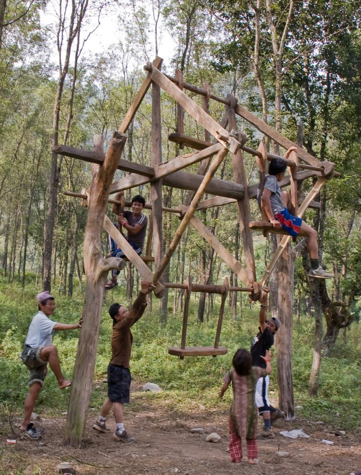
It is famous for small teahouses where trekkers can take rest and have a cup of tea with an amazing scenic view of snow-capped Himalayan ranges.

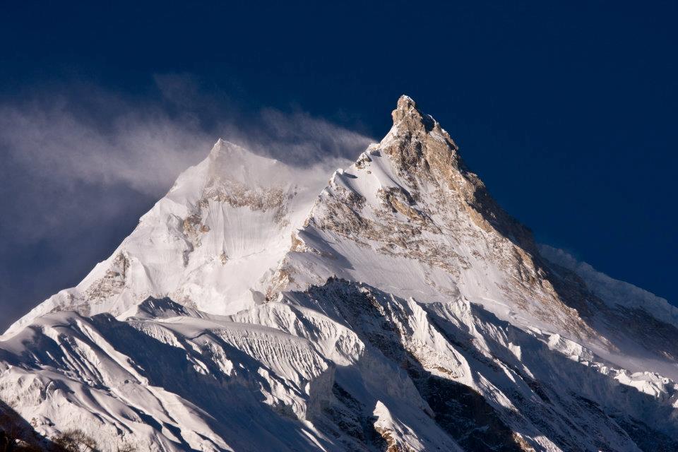
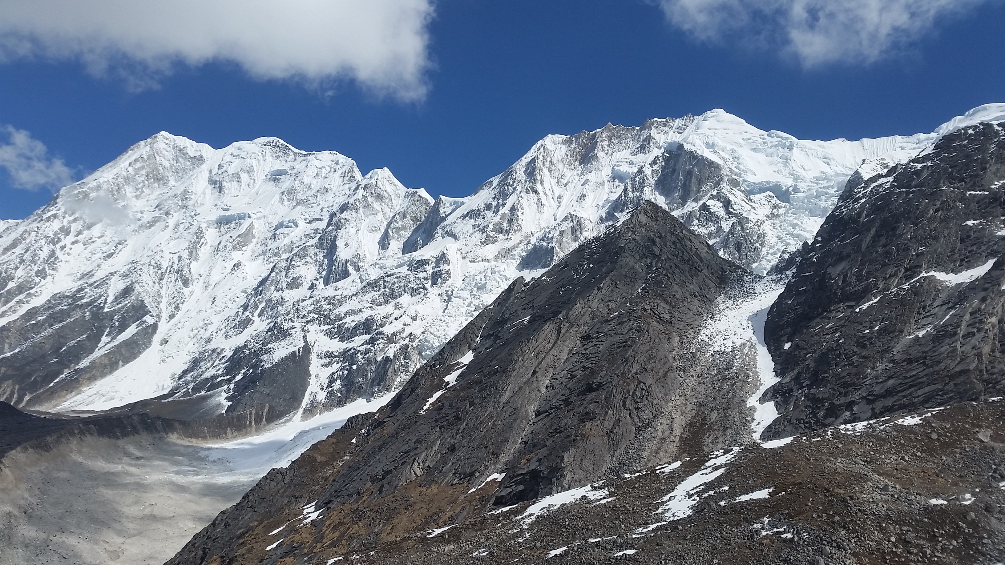
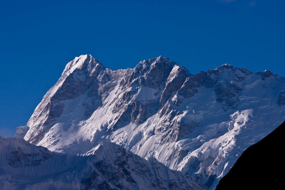
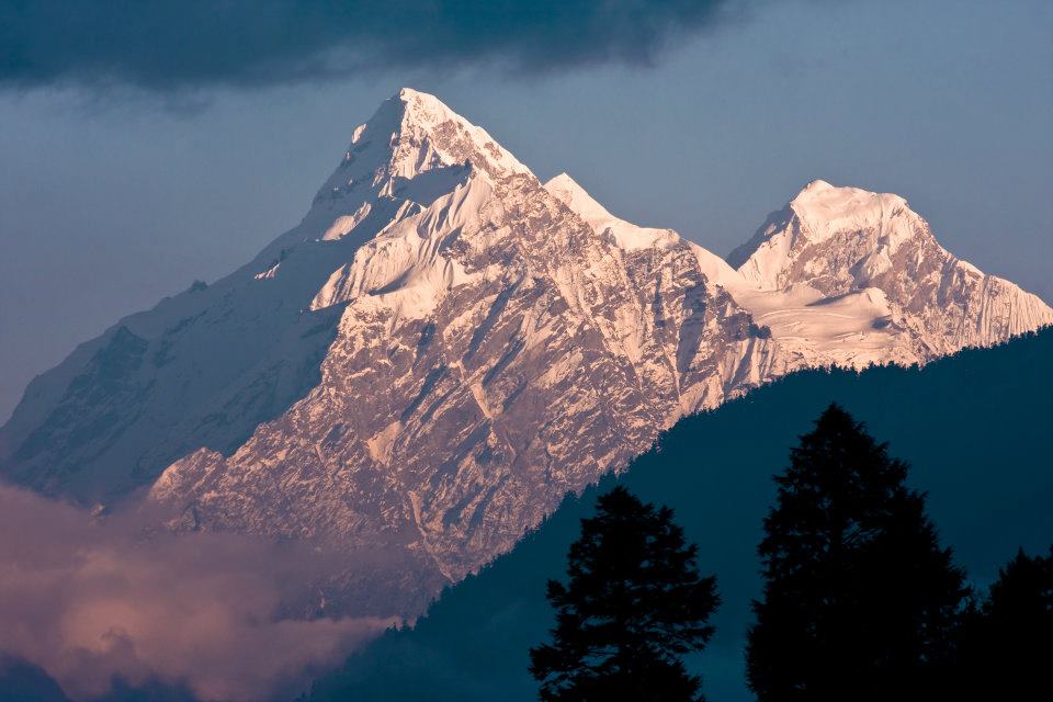
Manaslu: Eighth highest mountain in the world

Manaslu is the eighth highest mountain on the earth at 8,163 meters (26,781 ft) above from the sea level. Manaslu is located in the Mansiri Himal in the west-central part of Nepal.

The mountain name is first known as Kutan I. ‘tang’ being the Tibetan words used for the flat place, thereby describes the mountain’s general summit. Later the name of the mountain was changed to Manaslu.

Himalayas manaslu trek
Manaslu trek: Himalayas

‘Manaslu’ means ‘mountain of the spirit.’ Manaslu word comes from Sanskrit word Manasa; it means intellect or soul.

Manaslu is one of the adventurous trekking among other trekking in the Himalaya region. It is the highest peak of Gorkha district and is located about 40 miles east of Annapurna.

The Manaslu region was opened for trekking only in 1992.

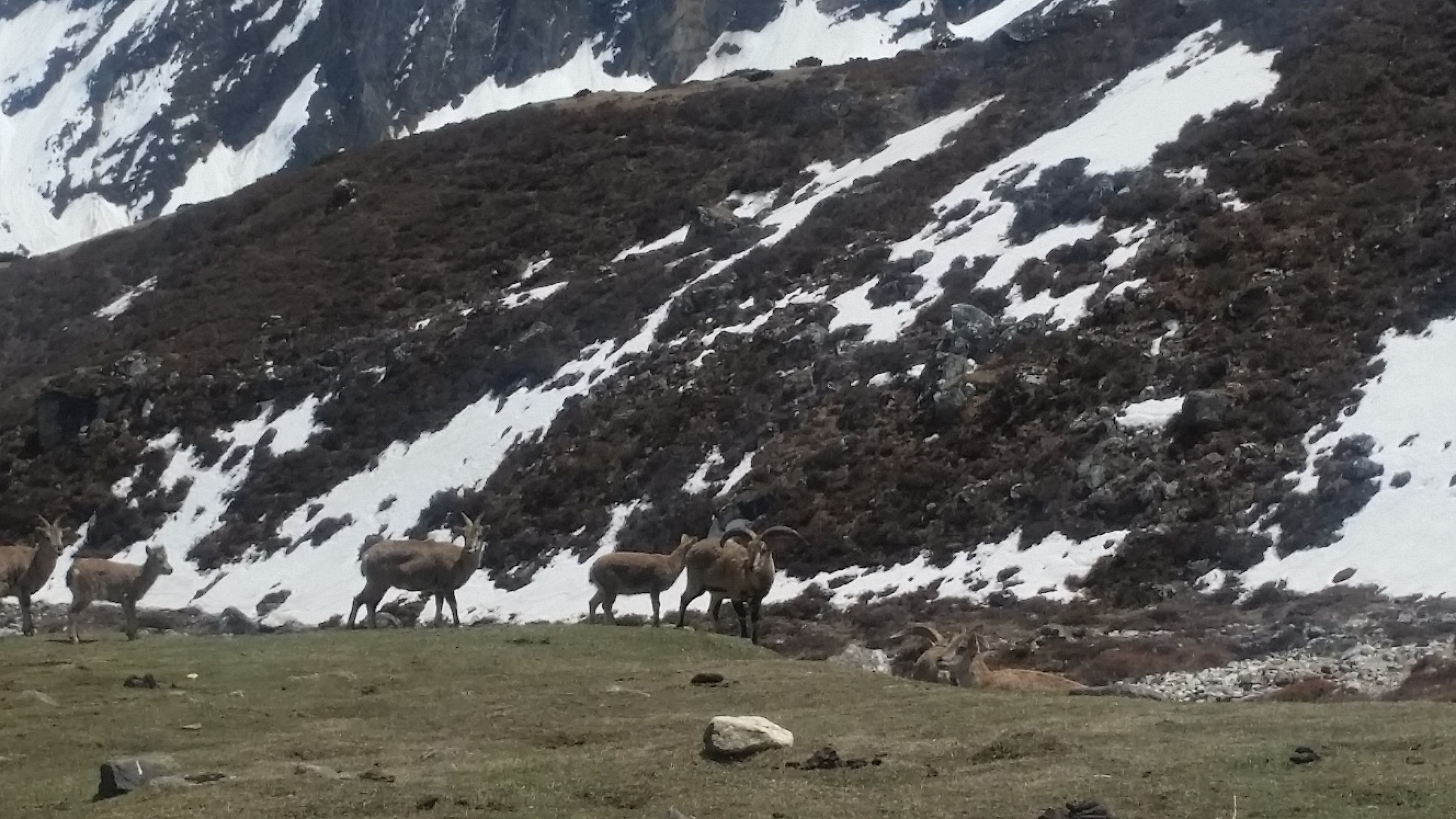
The mountain’s long ridge and valley glaciers offer feasible approaches from all directions, and it culminates in a peak that towers steeply above its surrounding landscape and is a dominant feature when seen from far.
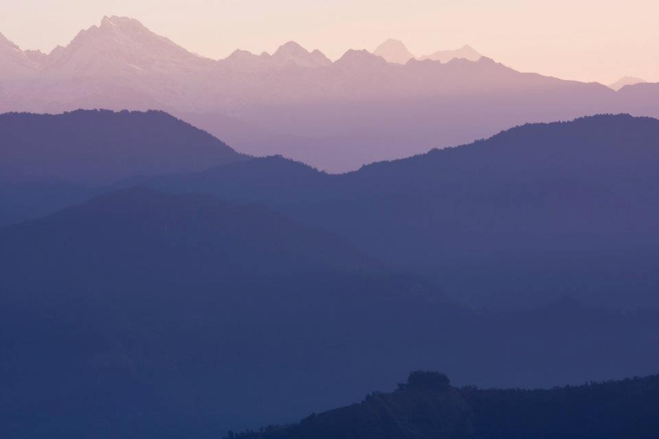
Beauty of Manaslu

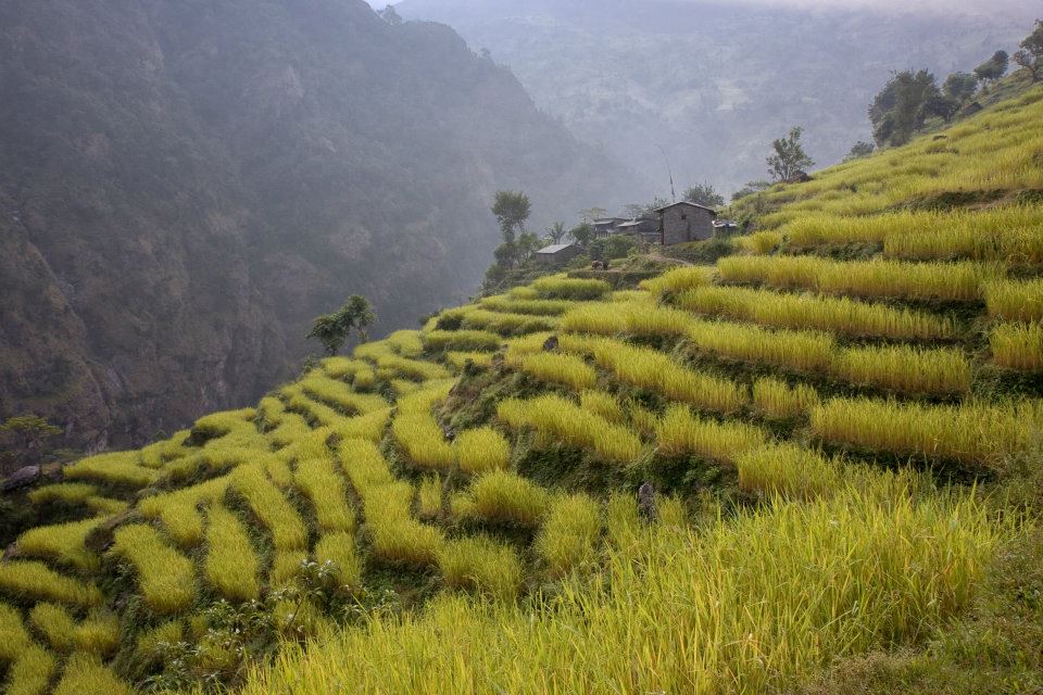
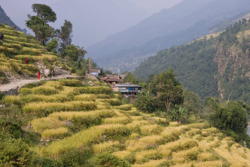
Manaslu trek offers a jaw-dropping view of snow-capped mountain range and the ancient trail along with mix culture, heritage and hospitality of authentic Hindu and Tibetan-style Buddhist village.

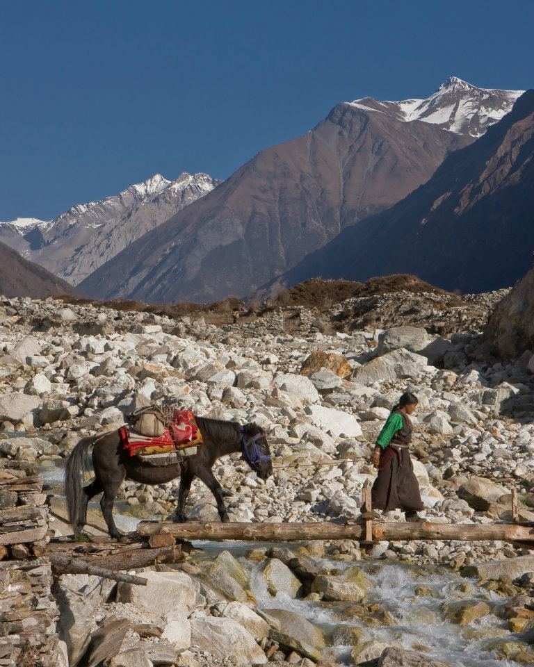
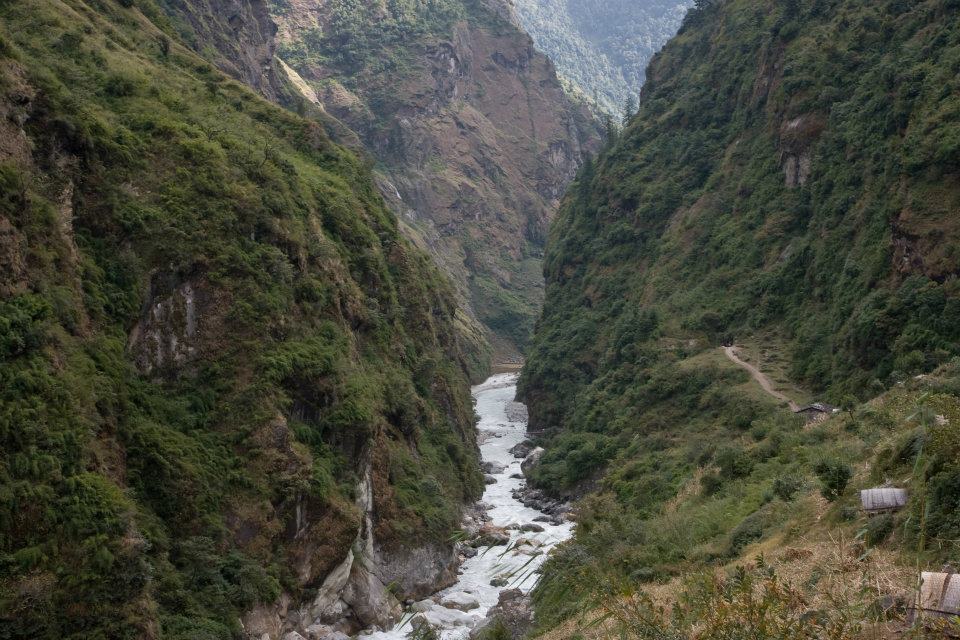
The beauty of Manaslu is unbeatable. The trekking trail follows an ancient salt-trading route along the spectacular Burhi Gandaki River. The highest point in this trek is the ‘Larkya La Pass’ at an elevation of 5,106 meters (16,752 ft).

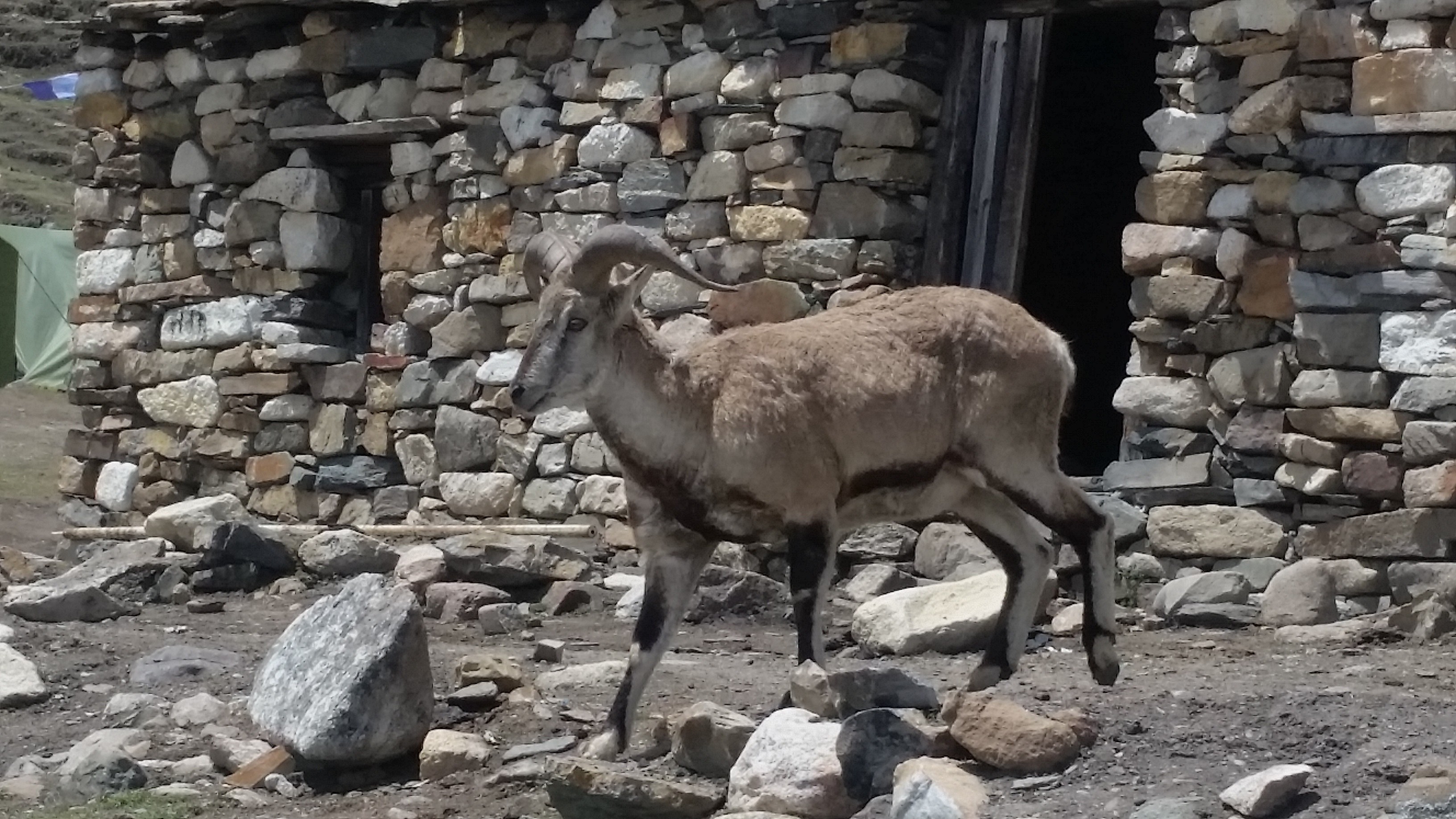
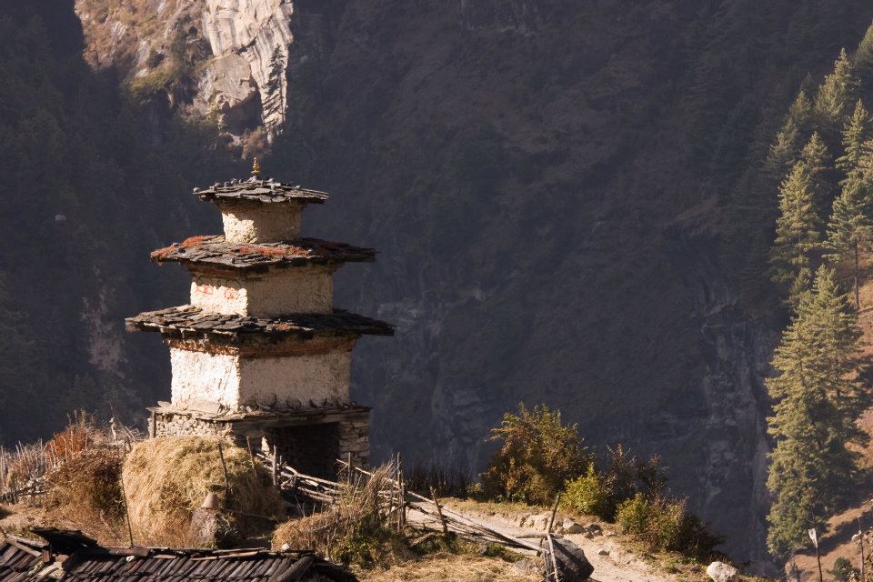
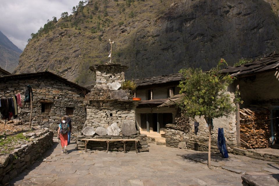
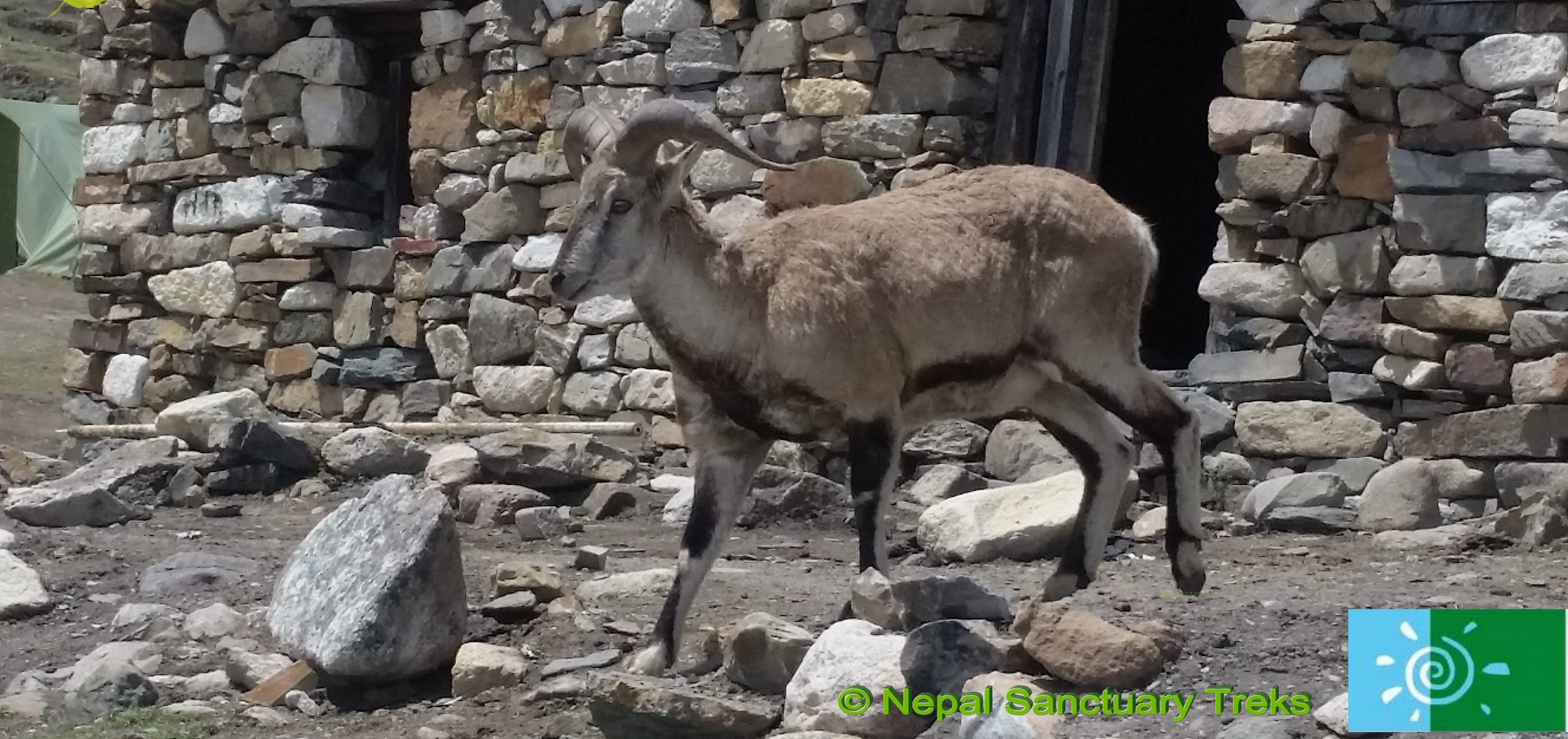
Manaslu Trek is famous for the beauty of the high Himalayas as well as local ethnic culture, traditional lifestyle, old monasteries and local people with unique houses.

Manaslu Trekking
Manaslu Trekking:

Manaslu is mainly inhabitant with two regions: Nubri and Tsum. Most people visited the Nubri valley after tourism board announced it as a touristic place in 1950.

And Tsum still out of touch with modernity. You will see traditional lifestyle, art, and culture. The local people are mostly of Tibet and speak their language. Different people with different cast live in a different place.

In the central part of the region, the large number of Gurung people are the main ethnic who have joined Brigade of Gurkha and closer to Tibet, the Bhutias, akin to Sherpa people who follow Buddhist.

Earlier climbers to Manaslu region

In 1956, 9 May, Toshio Imanishi and Gyalzen Norbu first climbed the Mount Manaslu. The Japanese team was lead by Maki Yuko, also known as Aritsune Maki. Next successful climb on 19 May 1971 by Kazuharu Kohara and Motoki, group of 11 Japanese teams.

 While climbing Mt. Manaslu only a few make it happen, but most people fail to climb the highest peak. Many foreigners were failed to reach at 8000 meters. On November 9, 1986, Jerzy Kukuczka, Artur Hajzer climbed the eighth highest peak.

Manaslu Trek: River

Carlos Carsolio, the youngest and being the fourth person of eight-wonderland in history reach the summit of Manaslu. During the climb, most people died due to the high altitude.

Manaslu trek forms section of the Great Himalaya Trek. Tourists are the important part of GHT which connects to the rural life, provides the essential commodities and school for children.

The trekking trail to Mount Manaslu has only one route which starts from the Gorkha district of Arughat Bazaar and ends in Syange.

The Manaslu trek is a challenging and strenuous trek. The trail can be shorter or longer depending upon your walking hour per day. Along the trek; there are many tea houses and the breath-taking scenery that will make your heart melt in each step. 

Manaslu Trekking: Himalaya with cloud

Manaslu Trekking: An amazing tea-house experience

 Manaslu is now popular for the tea houses trek. There are many teahouses available on the trail where you could stay overnight or take rest and have some tea during the trek.

Now, these tea houses developed into mountain lodges offering foods and accommodation in nominal price.

Local people manage most of the teahouses, and tourists love to stay in the tea-houses because they get chance to know the local people’s daily lifestyle, tradition, culture which are rarely seen in the rural area.

Trekking Permit

A trekking permit is required to trek any part of Nepal. But before you go there, you need trekking permits, cost, and other information.

There are two types of cost of permits according to the season. You should pay US$ 70 per week and after seven days US$ 10 per day per person. This applies only from September to November month.

Manaslu trek: Blue Mountains

Similarly, from December to August, the cost is US$ 50 per week and after seven days US$ 7 per day. If you want to trek more than one places, then you need more than one permits. Each permit requires details for the route and region.

The trekkers should pay entry fees including 13%  Vat to trek Conservation Areas and Trekkers Information Management System (TIMS). Entry fees to trek Conservation Areas are following:

  1. For SAARC countries: Nepali Rupees 200
  2. For other countries: Nepali Rupees 2,000

Nepal Tourism Board which is located in the Kathmandu issues entry permits. 

Choosing a trekking agency

There are many trekking agencies in Nepal. If you are looking for the best trekking agency, then Nepal Sanctuary Treks is the best agency in Kathmandu Valley.

Nepal Sanctuary Treks carefully plan and pay attention to detail and design trek itinerary just the way you want and deliver all information required for client’s safety, comfort, and pleasure.With the support and guidance of our trek specialist, you can co-create a trekking itinerary to suit your style, taste and physical fitness. 

https://www.nepalsanctuarytreks.com/about-us/why-nepal-sanctuary/

Manaslu Trek: Blue Sky and Himalaya


Manaslu Circuit Trekking

Manaslu Trek has one route to reach the peak and another route to return. The Manaslu Trekking is restricted area trek, so consequently, before organizing Manaslu trek, we must take permission for Manaslu region.

It is considered to be one of the challenging and finest trekking adventures of Nepal. The trek could make shorter or longer on the length of your walking days from the starting point to ending point.

Arughat

The trek for Arughat starts from Kathmandu and takes about 6-7 hours by jeep. You can also travel by local bus. However, it takes a long time.

Manaslu Trek: manaslu Region withh cloud and snow

Arughat is the small local bazaar, lies in the bank of the river and has some lodges to spend the night there. The necessary things that you need for the trip are; instant foods and others items can be bought there.

Soti Khola

Manaslu Trek begins from the Soti Khola. From Arughat to Soti Khola you can go by bus or private vehicle, but the road is not properly managed. Most people go there by local bus.

The road ends in Soti Khola, and then the walk continues to Manaslu from there. You need more effort to climb up the hills starting at a minimum elevation of 730 m. You can get a pretty nice view of beautiful green hills from the Soti Khola.

Lapubesi

From Soti Khola to Lapubesi after about 6-7hours of the walk, through the Sal forest and some villages, green field you will reach villages of Lapubesi which is an inhabitant of Gurung people.

Manaslu Trek: Mountains and Himalayas

The Gurung people live in the central part of Nepal, of areas such as Gorkha, Baglung and the high slopes of Annapurna. They are Tibetan-Gurung people, farmers who grow rice, millet, maize which are daily works.

They follow both Hindu and Buddhist religions, although they have their religion, with certain rituals and ceremonies. The Gurungs still combine with the belief of the two dominant religions of Nepal.

Khorlabesi

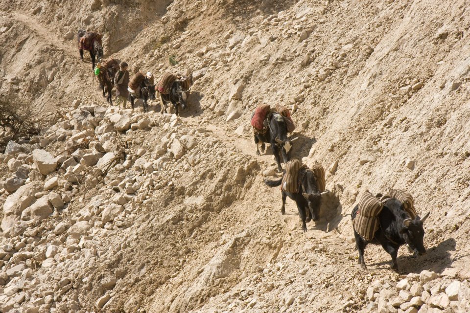
The trail continues to Khorlabesi for around 7-8 hours of walk from Lapubesi. Crossing the path of the jungle, sometimes up and sometimes steep downside of hills and reach Khorlabesi villages.

You can see pretty scenes of hills and villages then towards to Jagat.

Jagat

Around 6-7 hours of walk from Khorlabesi, you will reach your next point Jagat. To reach Jagat, you have to go through lots of ups and downs, hills and rock but it makes your mood much better than before.

Manaslu Trek: Trees Silhouette

Deng

Jagat to Deng takes about 5-6 hours of trekking which passes through the pine forest, Philim villages, and Ekle Bhatti. Ekle Bhatti is a small teahouse where you can take rest and have a cup of tea.

After some hours later you will reach to Deng, a silent valley with small hotels settlement.

Namrung

Trek to Namrung, after leaving Deng you walk continuously to Ghap to Namrung villages. Namrung is a small village inhabited by Bhote, Lama peoples.

Their main occupation is agriculture and animal husbandry. They raise maize, barely, potato as crop and oats, nut, as fruits. They have their own culture and religion.

The local people want to preserve their historical culture and religion, so they have open Historical Cultural Lakpa Dhundup Museum at Namrung prok VDC.

Manaslu Trek: White small houses in the mountain

You will walk through villages, beautiful waters, rhododendron forest with white Langur monkey and also you can see beautiful views of Himalayas peak including Ganesh Himal and Himchuli.
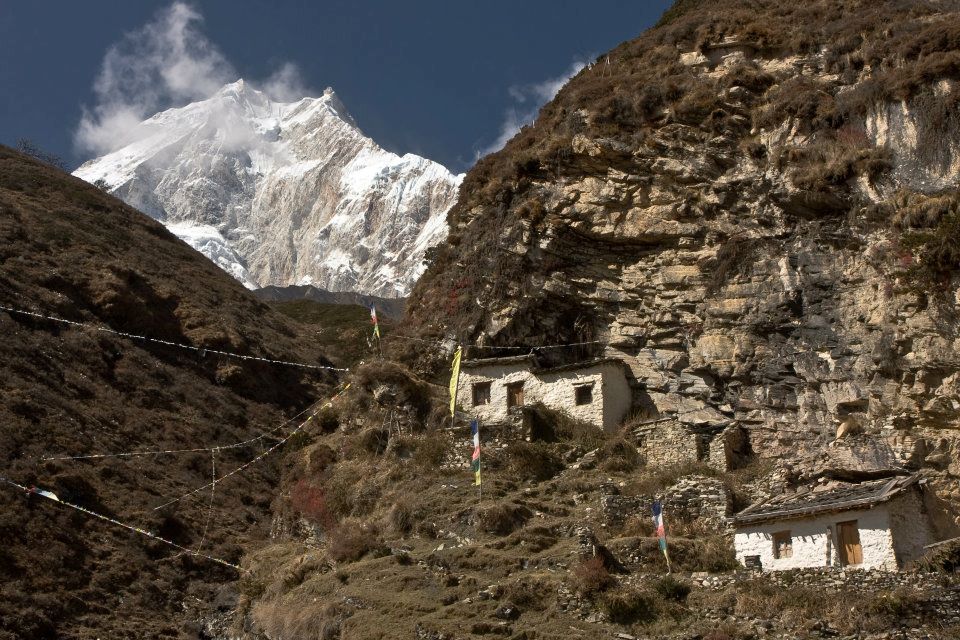
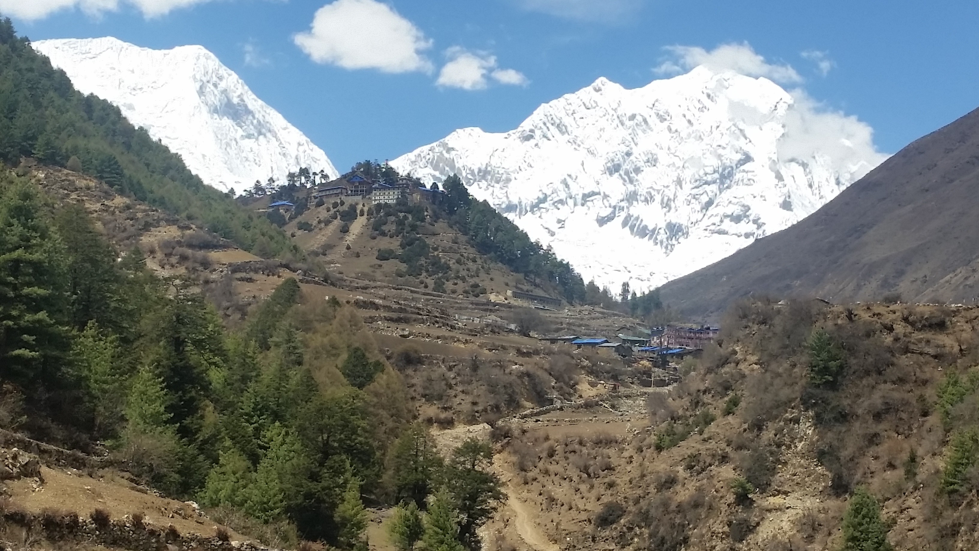
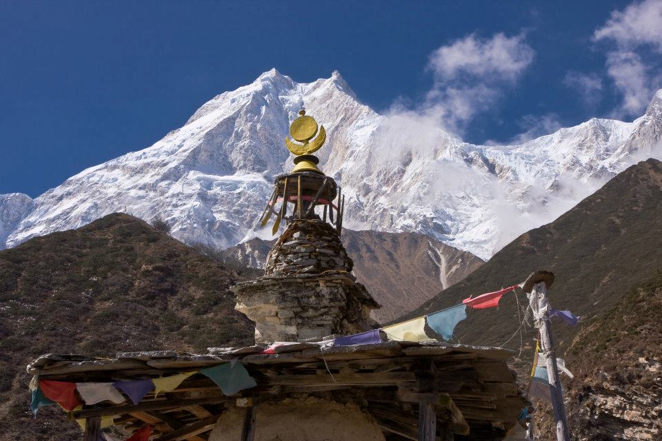
Samagaon

The next trek to Samagaon takes 6-7 hours to arrive there. While walking towards Samagaon following Lihi, Sho, Lo, Shyale villages, hilly terrains and bushy forests.

Samagaon is a beautiful village surrounded by prayers flag, and they follow Buddhist Religion. Also, it offers amazing views of Himalayas peaks including Manaslu, Himchuli and peak 29.

During the walk to Samagaon, you can also visit Birendra Tal, Phungen Gompa.
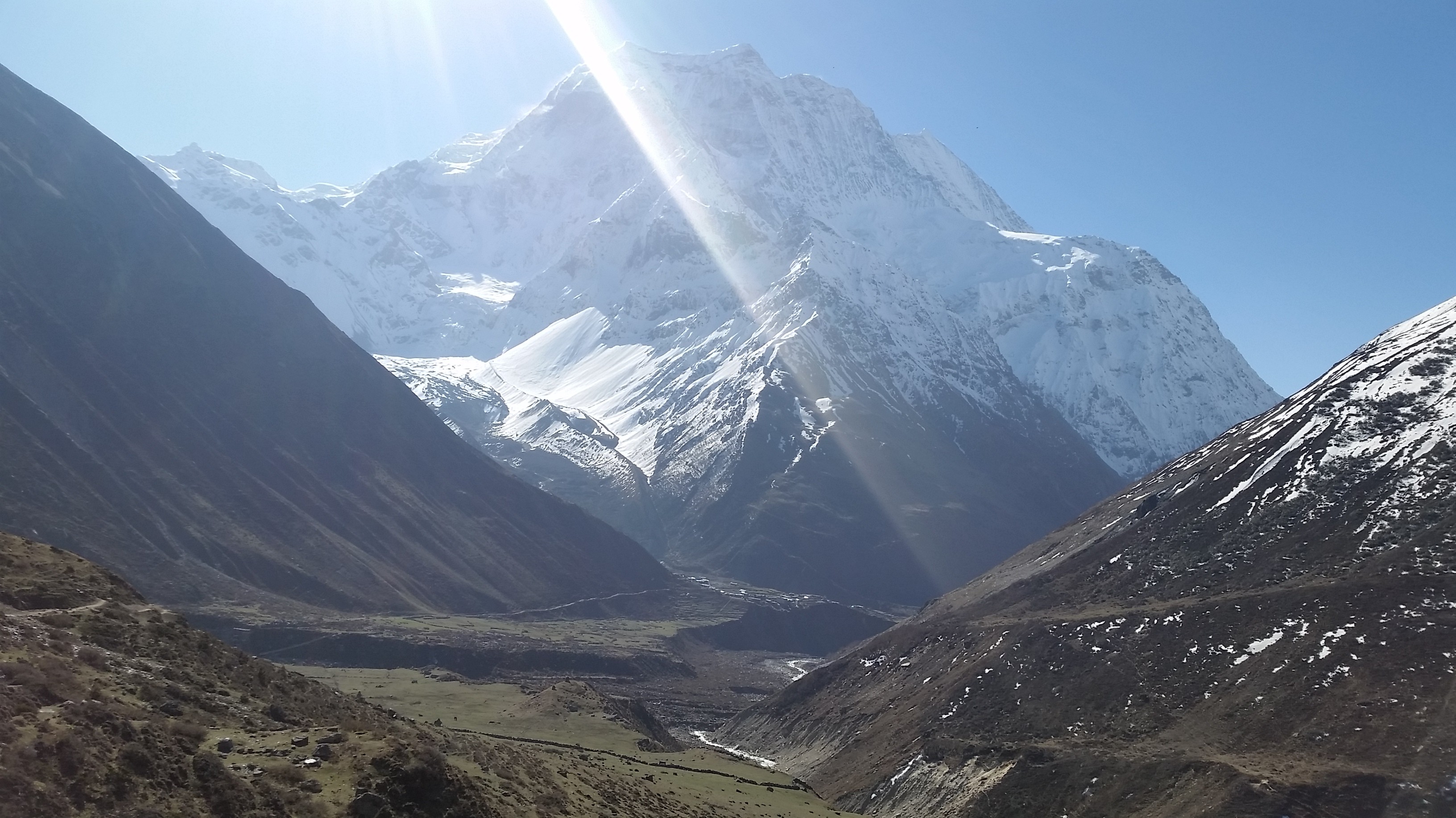
Samdo

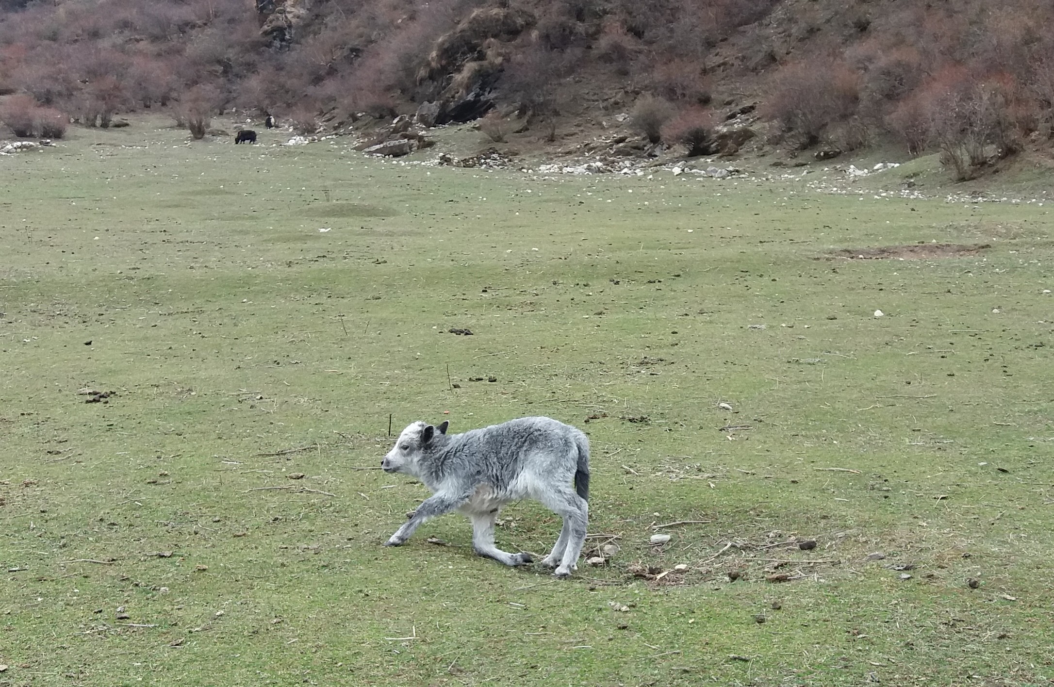
It is a short walk of around 3-4 hours to Samdo after leaving Samagoan. Samdo, the most beautiful place of Manaslu. The places are especially known for yak herding.

This village has more animals and fodder shelter than human settlement. This place offers excellent views of Simrang Himal, Hiunchuli himal, Ngadi Himal, Larkhye Peak, Cheo and Kang Guru Himal.

Dharamsala

Next trek to Dharamsala, a hut made by the stone of three rooms and a roof but doesn’t have doors and windows. Everyone can go into Dharamsala, but there’s nothing inside.

Manaslu Trek: Crops
Manaslu Trek: Crops

To reach Dharamsala from Samdo; it takes around 4-5 hours of walk passing through Larke Bazaar “a seasonal Tibetan Market.” Dharamsala is also known as Larkya Phedi which is a final part of Manaslu Circuit before Larke Pass.
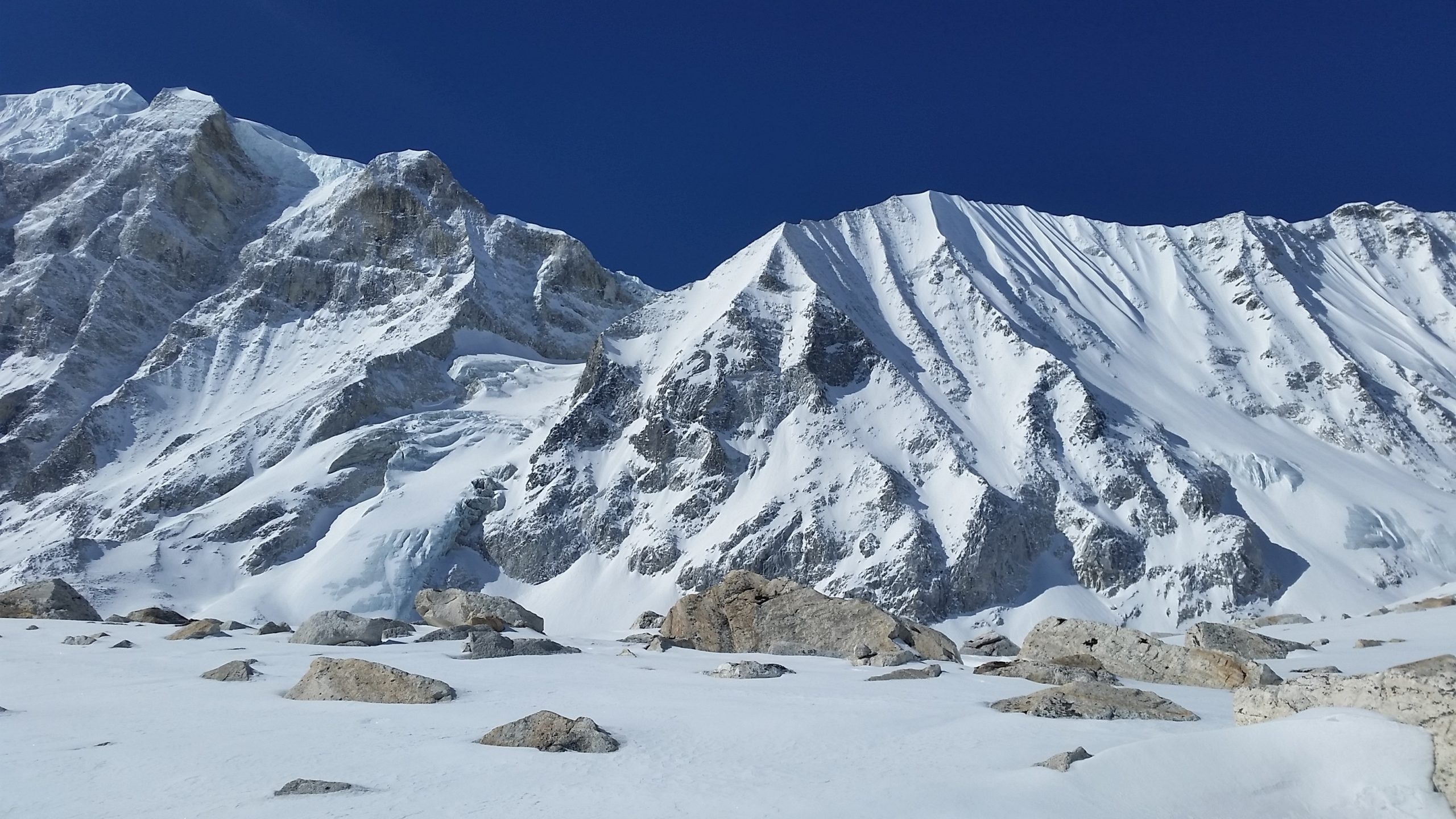
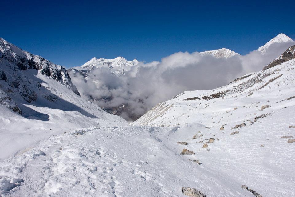
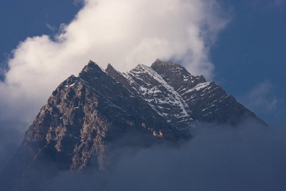
Larkya Pass

Larkya Pass is the maximum altitude of 5,106 meters.

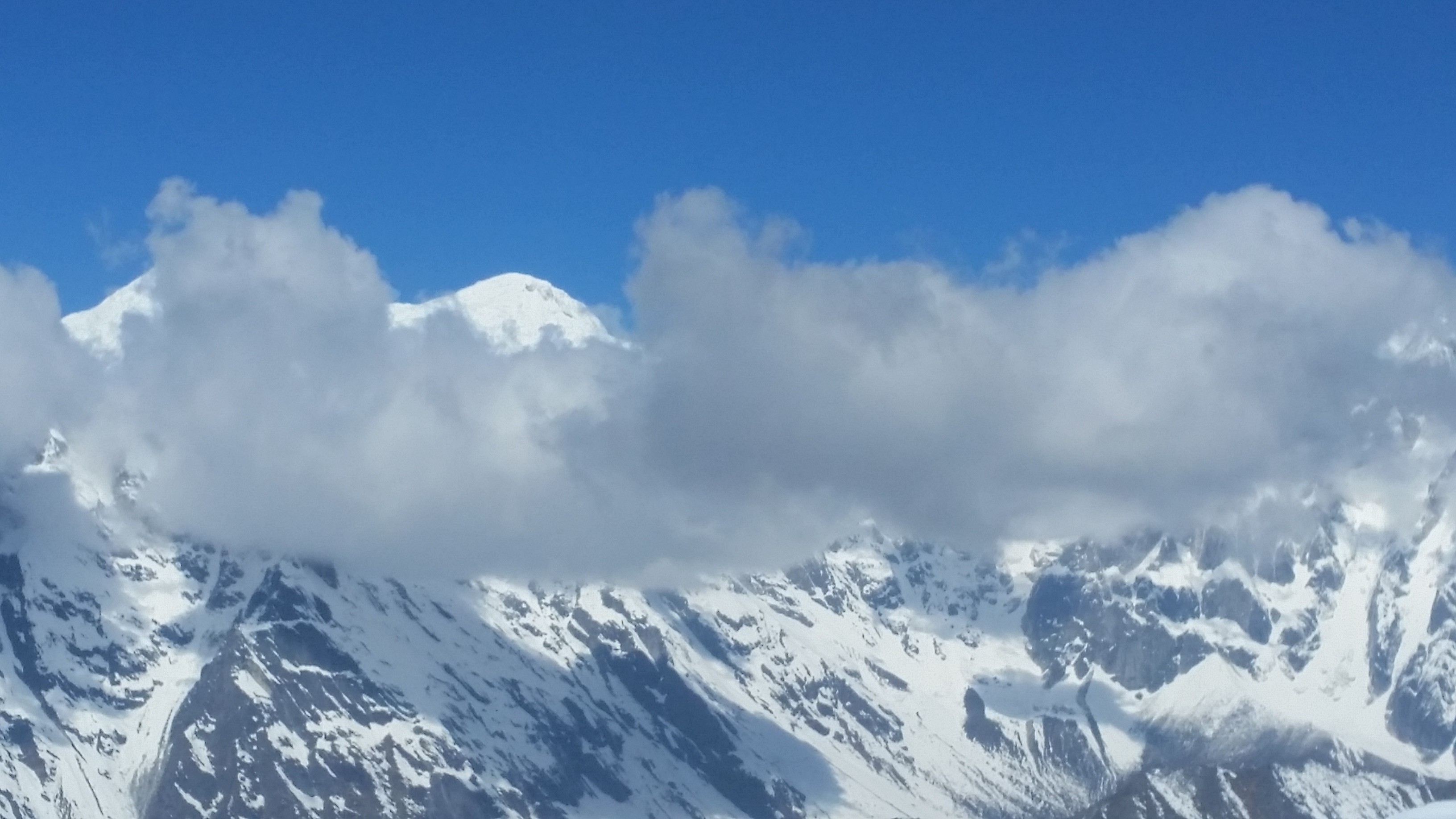
From Dharamsala, you will climb steadily up to reach the top of Pass. Finally, you will see breath-taking panoramic views of snow-capped Himalayas peak of Mount Manaslu, Annapurna II, Himlun Himal and other mountains.

You can snap the pictures of the beautiful Himalayas and videos too before descending to Bhitmag. Many trekkers become sick due to its maximum altitude.

Bimtang-Tilje-Dharapani

Leaving the beautiful Mount Manaslu behind and start descending to Bimtang takes 3-4 hours and trek to Tilje around 6-7 hours of walk. Passing the rhododendron forest take you to Karachi; one of the highest cultivated village of Nepal.

Then continue to walk to Gho villages where few lodges are available. After few hours of walk, you will reach Tilje village which has better lodges then Gho villages.

After a short walk from Tilje, crossing Marsyangdi Khola through on a long suspension bridge finally, you will reach Dharapani. Dharapani is a small village where small hotel and lodge are available.

Chamche-Besisahar

Chamche is the final trail of Manaslu Trek from Dharapani following Tal villages. Chamche is the most popular place for Annapurna Circuit Trek route with several lodges and accommodation facilities.

Then walk down to Besisahar, which is the headquarters of Lamjung district. Here different cast and religion of people live in one community and have a different culture.

From here, you can get vehicles such as a jeep or local bus and drive to Kathmandu about 7-9 hours.

Manaslu Trek Map

Manaslu Trek: Map 


Manaslu Trek Itinerary

Manaslu trek is one of the challenging and demanding trek. Before Manaslu trek, you need to manage itinerary on your daily basis traveling routine.

The well- planned and managed itinerary ensure the best itinerary that makes you trek enjoyable.


You can follow the link below for best itinerary:

https://www.nepalsanctuarytreks.com/package/manaslu-circuit-trek/

Ten facts  About Trekking in Manaslu Region

1. Mount Manaslu is an eighth highest peak in the world which opened in 1992. It is still under restricted trekking area of Nepal. It offers stunning views of Manaslu Peak including Ngadi Chuli, Himalchuli, and Boudha Himal.

2. Manaslu is an inhabitant of different ethnics groups such as Gurung, Lama, Bhotias, and Tibetan. They have different cultures. There many ancient monasteries, ethnic heritage and culture and unique houses made of stone.

3. Manaslu Trek is famous for small teahouses. The teahouses are built and managed by the local peoples. Tourist loves to stay there and get opportunities to know closely about local lifestyle.

4. Manaslu Trekking has countable visitor than Annapurna Base Camp Trek, Everest Base Camp Trek, and other trekking which makes entire Manaslu region unspoiled and more exclusive.

Manaslu Trek: Mountain surrounded by cloud

5. Manaslu is mainly inhabitant with two regions: Nubri and Tsum. Most people visited the Nubri valley after tourism board announced it as a touristic place in 1950. And Tsum is still out of touch with You will see traditional lifestyle, art, and culture.

6. Crossing the higher pass of Larkya Park at elevation 5,106 meters. Descending to Bimtang is more difficult than climbing. Descending towards Bimtang must use some technical trick. From Bimtang, the back view of Mt. Manaslu is amazing.

7. Toshio Imanishi and Gyalzen Norbu were the first to climb Mount Manaslu on 9 May 1956.

After them, many Japanese teams have climbed the summit of Manaslu but got failed. Mount Manaslu called Japanese Mountain and also known as Killer Mountain because of its frequent icefall, and high altitude trekker gets sick or kill.

8. Mount Manaslu which is in Gorkha district has lots of offers historically as well geographically such as Manakamana Temple, Lower Manaslu Trek, Tsum Valley Trek, Nubri Valley Trek. Manaslu Trekking route starts from Arughat and ends in Besisahar.

9. The spectacular scenario of rhododendron forest, perfect views of mountain ranges, a combination of rich culture, natural beauty and biological diversity.

10. The Tsum Valley Trek in the region has beautiful views of surrounding mountains peak, but extra trekking permit is compulsory need to travel there.


Precautions to take in Manaslu Region

Before you travel there, you need to know all things about Manaslu region such as about high altitude, weather, hygiene and daily health care. Firstly, you can easily become dehydrated at high altitude.

The lower air pressure will force you to breath more quickly and deeply. So, you will have a drink a lot of water than you normally would have. The most common symptoms include thirst, dry lips, nose or mouth, headache and feeling fatigued.

Manaslu Trek: Village

You should drink at least 3 liters everyday trekking. Also, it is important to maintain your daily hygiene in a remote area which might affect your health and brings hand sanitary with you.

Due to cold weather, you might get sick, so warm clothes such as down jacket, electrical socks, hat, etc. are most necessary things that must have with you.

Tsum and Ganesh Himal Trek and Nubri Valley

Tsum valley and Nubri valley is one of the famous and hidden treasures of Manaslu region. Tusm words come from the Tibetan word ‘Tsombo’ which means vivid. Tsum valley is mostly the origin of Tibetan and people in that valley speak unique dialect.

Tsum valley offers the beautiful forests covered with rhododendron tree and a stunning view of Ganesh Himal.

Tsum valley always combines with Manaslu Circuit. The trail starts from the Arughat and continues the low, high passing through the forest and small villages.

Manaslu Trek passes through the Tsum Valley. The place is famous for the ancient Buddhist monastery.  Geographically the valley called ‘Tsum Tso Chuksum’ which means thirteen provinces ruled as a single territory.

Manaslu Trek: Blue Sheep in Manaslu Dharmashala

Nubri Valley also connects with Manaslu trek. Nubri valley still follows the traditional culture, art and it is untouched by the modernization.

Weather and Difficulty in Manaslu Region

Manaslu trekking is one of tough trekking compared to other mountain treks. The best time to visit Manaslu is Autumn and Spring season. Autumn months starts from October to November and March to May.

The weather on this season is pretty much fine than other seasons. In Monsoon and Winter seasons it hard to trek in Manaslu due to the rainfall and high coldness. 

So How to start your Trip?

Firstly, the question might strike in your mind about How to start your Trip? It’s not that difficult; you can contact Nepal Sanctuary Treks.

Nepal Sanctuary Treks is the best trekking agency of Nepal. We would be glad to consult you via phone, Whatsapp or email if you feel further discussion. Our trekking professional will assist you to provide proper guidelines, process and more information on Manaslu trek.

Nepal Sanctuary Trek contact details:

Nepal Sanctuary Treks

G.P.O Box 5493

House No. 1246, Lamtangeen Marg, Chundevi-4, Kathmandu

Tel: +977-1-4426721, 4431610, 4434542

Email: info@nepalsanctuarytreks.com, gtulsi@wlink.com.np

Manaslu | A wonderland | 10 facts that will amaze you.

Manaslu trek offers an off-beaten trail experience in the Himalayan Region. Manaslu is famous for small teahouses along the Manaslu trek.
The Manaslu trek exists 40 miles away from Kathmandu to the east of the Annapurna region. The name ‘Manaslu’ means ‘the mountains of spirit.’
The word ‘Manaslu’ came from the Sanskrit word ‘Manasa’ which means intellectual or soul.
Manaslu trek offers the spectacular beauty of a perfect blend of nature, the lifestyle of local people, and stunning views of breathtaking mountain ranges in Manaslu region.
Every year, many foreigners accomplish Manaslu Circuit trek. Manaslu trek leads you to Nubri and Tsum valley, which is the hidden treasure of Manaslu.
Blue sheep in Manasulu dharmasala

Eighth-Highest Mountain in the World

Manaslu is the eighth-highest mountain on the earth at 8,163 meters (26,781 ft) and opened in 1992 A.D. It is located in Mansiri Himal, part of the Nepalese Himalaya region, in the west-central of Nepal.
Now, Manaslu Trek is controlled by the tourism board and under the restricted trekking trail of Nepal. Before planning to Manaslu trek, trekkers need to take permission from the Manaslu region.
It has the eye-catching views of the long ridge mountain range near Manaslu including Nagdi Himal, Himalchuli, and Boudha Himal.
Manaslu is the highest peak in the Gurkha district. Manaslu offers much trekking in the Annapurna region. The trekking follows the trail, an ancient salt-trading route along with Buri Gandaki river.
The trail starts from Arughat, the small town bazaar, and ends in Besisahar.

Manaslu is Famous for small tea houses

Manaslu is also known for tea houses. The tea houses are built and managed by the local people. Local people make money by selling food and providing a night’s stay for trekkers with charges or fees.
The small tea houses make this trekking more famous.
Trekkers can take a rest and have a cup of tea there. Also, tourists love to stay there and get opportunities to know closely about their lifestyle. Dal Bhat is the most famous food all around Nepal as well as in the Himalayan region.

First climbed Mount Manaslu

Toshio Imanishi and Gyalzen Norbu were the first to climb Mount Manaslu on 9 May 1956.
Before them in 1950, H.W. Tilman was the first European who made his attempt after he unsuccessfully trekked to Annapurna IV.  
In 1952, a Japanese reconnaissance party reached around 5275 meters after the monsoon season on the east side of the mountains.
In 1953, the Japanese team of 15 climbers led by Y. Mita via the northeast face K. Kato, J. Yamada and  S Ishizaka made a summit around 7750 meters before turning back.
After them; many Japanese teams climbed the summit of Manaslu but got failed. Mount Manaslu is called Japanese Mountain and is also known as Killer Mountain because of its frequent icefall, and high altitude trekker gets sick or killed.
Yak Calf Samagaun

 Historical places

Mount Manaslu, which is located in the Gurkha district, has lots of historical places including the Manakamana Temple and Gurkha Durbar.
It is a beautiful and adventurous trek with stunning views of Manaslu and passing through many Hindu and Tibetan villages.
The trek also passes through the beautiful green forest, ancient architecture, and Buddhist Monastery where many children studied to be a monk.

Ethnicity and religion

Manaslu shares much of the culture and history with its neighboring territory, Tibet. Manaslu has two ethnicities mainly inhabitant this region: Tsum and Nubri.
Gurung is the main ethnic group that has joined the Brigade of Gurkhas in huge numbers. Close to Tibet, The Bhutias and akin to the Sherpa groups follow the Tibetan ethnicity.
Rich in tradition and culture. The local people live a traditional lifestyle and with unique houses, that have walls built with stones and roofs with stone slabs. Due to the earthquake, many houses have been destroyed and are still under construction.
Their main occupation is agriculture and animal husbandry such as barley, maize as crops, and oats and nuts as fruits. Local people also make income from the lodge and small tea houses. Local people are mostly from Tibet and speak their own languages.
Manaslu Rhododendron

Geographically amazing

Manaslu trekking is geographically spectacular and fabulous. Manaslu region which is also termed the Manaslu Conservation Area comprises subtropical Himalaya foothills to arid trans-Himalaya high pastures border in Tibet. Starting from Arughat and extending into Larkya La Pass.
The area covers six climate zones; the tropical and subtropical zone varies in elevation with different altitudes. Elevation varies starting from 1000-2000 meters, the temperature zone(2000-3000 meters), the sub-alpine zone (3000-4000 meters), the alpine zone(4000-5000 meters) meadows, and the arctic zone of ranges lying above 4,500 meters.
The temperature of Manaslu also varies widely according to the climatic zones. The snow always covers above 5000 meters of elevation, and as the level increase, the air pressure becomes low.
The trekking route is through mountains prone to the consequences of monsoon rainfall, landslides, and landfalls.

Rich in Bio-diversity

Manaslu region is highly habitat with various flora and fauna, including endangered animals such as snow leopard and Red Pandas.
Other animals such as gray wolf, Himalayan musk deer, blue sheep, Asian Black Bear, Langur monkey, and over 110 species of birds, 33 mammals, and some reptiles are also found.
These species make the region more beautiful and melt human hearts too.
Conservation of wildlife in the area has been done by monks of the monasteries in that area by banning hunting.
The elevation categorizes the hills. For example, Low Hill, Medium mountain, and High Mountain with exclusive forests and a variety of species.
There is not much vegetation of variety. The valley basin has a rich ecotone diversity including nineteen types of forest and mostly rhododendron and Himalayan blue pine which is flanked by Ganesh Himal and Sringi ranges.
Himalayas manaslu trek

Tsum Valley and Nubri Valley

Manaslu region has mainly two inhabitants valley: Tsum Valley and Nubri Valley.

Tsum Valley is one of the remote areas of Nepal. Tsum has a long history of Buddhism. Tsum is also known as ‘Tsum Tso Chuksum’ which means thirteen provinces ruled as a single territory. Still, the ancient Tsum Kingdom remains, and the village has a unique traditional culture.
Tsum Valley Trek in the Manaslu region has beautiful views of four 7,000 meters peaks of the Ganesh massif, and also visitors can experience the distinct Tibetan culture of Tsumba people.
Nubri Valley is the next remote place in the region. Nubri valley has virgin beauty and is still untouched by modernization.
The local people follow their traditions, culture, and art. The local people wear traditional clothes and speak their language. The ancient trail along with mixed cultures, especially the Tibetan, and great hospitality.
Small tea houses and lodges are available in this area. The ancient old Buddhist monastery is established which gives a glimpse of Buddhist culture.

Larkya La Pass

Larkya La pass, also known as Larke Pass is at the maximum altitude of 5,106 meters where trekkers get jaw-dropping views of Mount Manaslu, Ganesh Himal, and other mountain ranges.
Although Larke Pass is at a lower elevation than other Passes like Thorong La Pass, Chola Pass, it is more difficult because of its long walk and the higher elevation.
Besides, descending from Bimtang is more technical and climbing.
Manaslu trek 2

A difficult but adventurous trek

Manaslu is the most difficult trek in comparison to Annapurna Circuit Trek. Manaslu region has few trekkers that make the visit more exclusive and unspoiled and presents the virgin beauty of Manaslu.
But the difficult trail to Manaslu is paid off as trekkers see the spectacular view of snow-capped Himalayas ranges, the traditional villages, local people with unique customs and cultures, and yaks in the upper hills.

Manaslu Circuit Trek: Itinerary

The Manaslu Circuit Trek is one of the unexplored trails that encompass a peaceful, natural and beautiful experience that is ideal for those seeking a getaway from bustling life.

Manaslu Circuit is getting popular as a new trekking destination. Mt. Manaslu is the eighth highest mountain in the world; it is in the very center of the Nepalese Himalaya and to trek around the base of this giant mountain along with its isolated trail is probably one of the best treks.

Manaslu Trek-1

The trail traverses through pristine areas where you will witness the beauty of nature and picturesque village of Tamang and Sherpa settlements with their unique culture.

The Manaslu region is well-known for its high altitude glacier lakes, a diverse range of flora and fauna and charming cultural region.

This trek suits best for those who are looking for challenging trekking in a remote area of the Nepal Himalaya. 

The highest point of this trek is Larkya La pass (5,135m/16,847ft), and trekking around Manaslu offers a unique opportunity to experience an untouched region of Nepal.

Manaslu trek 2

Trek can be 14 days that begins at Arughat and ends at Besishar.  The best season to visit the region is from March to May in spring and September to December during the winter.


Trip Highlights:

The maximum altitude is 5160m/16929 feet.

 The fascinating backdrop of Manaslu & surrounding Himalayan range.

Cross many suspension bridges over the different rivers, including the Budhi Gandaki River and several Mani walls on the way.

Manaslu Trek 3

Observe the traditional village lifestyle and culture.

 Tibetan culture and high pass crossing Larke La (5210m).

Experience walking through pine, rhododendron and bamboo forest and enjoy the nice view of the waterfall


Itinerary:

Day 1:  Kathmandu-Arughat (550 m/ 1804 ft) 7 hrs drive and further 1 ½ more to Soti Khola (597 m/1958 ft)

Our destination start for today is Arughat, which is about a 7-8 hour drive from Kathmandu. During the drive, we enjoy scenery landscape along with the Mountain View.

We will be driving on a paved highway from Kathmandu to Dhading Bensi, and then drive from Dhanding Bensi to Arughat on a bumpy road passing through bamboo forests and Gurung villages.

Upon reaching Arughat, we drive further towards Sotikhola. Overnight at Sotikhola

Day 2   Trek to Macha Khola  [900m/2952 ft]: 6 – 7 hours

In the early morning, we continue our trek by traversing the bridge, and we trek through the Sal forests and ascend onto a ridge above huge torrents on the Budhi Gandaki and continue to Korsani.

Manaslu Trek 4

The trail now gets a bit more difficult as we ascend over a huge rock and pass a brook on a single log bridge then weaves its way up and down again to the banks of the Buri Gandaki.

It continues up a steep rocky track to the Gurung village of Labishe. From Dobhan, we climb following a rocky ridge to old school from where the valley widens.

Then the trail descends to a tropical waterfall with a wooden bridge. The trail climbs over another ridge and dropping to the sandy river bed.

We walk along with rounded stones before ascending over a side ridge. We move down again to the river and traverse one more suspension bridge to reach Machha Khola village.

We stay overnight at ManchaKhola

Day 3   Walk to Jagat [1410m/ 4625 ft]: 6 – 7 hrs

From Korlabesi there is a sharp climb to a ridge and after a few additional ups and downs from here will take us to Tatopani hot spring.  

From hot spring, we climb over another ridge and cross a suspension bridge over the Buri Gandaki. At this point, we climb the wide stone stairway to Dobhan.

Manaslu Trek 5

The trail gets quite rough and starts by ascending to two teashops at Duman, then we cross the landslide area, and after some ups and downs through the narrow valley, it reaches a large field.

There is some jumble over gravel slope until we decline to the wide river valley. After crossing a suspension bridge, the trail ascends a set of stone stairs, drops to the river and ascends once again to Thado Bharyang.

Crossing the west bank of the Budhi Gandaki, we climb over a ridge, trek along the river and then climb towards the village of Jagat.   We stay overnight in Jagat.

Day 4:  Trek to Deng (1,860m/6,102ft) 6-7hrs

There are good views of Shringi Himal as you walk along the side of a cliff. Today we will set off our journey to Salleri by climbing over a rocky ridge to Salleri and move down to Sirdibas.

The trail descends to Setibas where the Mani walls (prayers engraved into wayside rocks) show that we are entering a region with increasing Tibetan influence.

Manaslu Trek 6

The valley widens a little and continues past the stone houses of Ghattu Khola, We continue to Ghatta Khola and then walk upstream through a long suspension bridge to reach a Gurung village in Phillim.

And then turns north just above the lowest houses in the village and stays fairly level until Serson. Further Serson the trails enter a steep gorge and descend through grassy slopes, to cross the wooden bridge at the river’s narrowest point; below you will see the convergence of the Shar Khola and Buri Gandaki rivers.

The village of Nyak is located close to here. As the trail widens, we pass through bamboo forests to reach the Deng Khola. After crossing the river, we reach the Deng village where we overnight here.

Day 5: Trek to Namrung (2,540m/8,333ft) 7-8hrs trek

We take a short walk from Deng and the trail traverse back over the Budhi Gandaki and climb Rana at 1910m. After a short climb from the bridge before heading west on level ground and we pass the large waterfall.

 Once we cross the wooden bridge, the trail curve up and out of the canyon and ascends over the river before dropping into the Shringi Khola Valley.

After crossing the suspension bridge over the Shringi Khola, there is a sharp climb, and the trail passes along the Buri Gandaki.

Manaslu Trek 7

The trail passes through forests and painted Mani stones and a corner from where we reach Ghap. You pass more Mani walls on the southern part of the river.

The trail climbs along the river, passes a waterfall and continues all the way through dense rhododendron forests with a wooden bridge in the middle which crosses the Buri Gandaki.

The trail continues along the north side to a big cave and then crosses the river at a narrow gorge where you can see grey Langur monkeys.

The forest becomes less dense, and the trail is leveled once we cross the river at a gorge. After an enjoyable walk, we then continue a final steep climb that will take you to our destination to Namrung through a stone archway where we stay overnight.

Namrung is the greatest viewpoint for Siring and Ganesh Himal as well as Mt. Himal Chuli.

Day 6: Trek to Samagaon [3530m/11,578 ft]: 6-7 hours

Manaslu Trek 8

The trail traverses the ridge onto the Buri Gandaki Valley side and followed by descending to a rock scattered moraine.

We further pass through extensive meadow and fields near Sama gompa after crossing some rocky trails. You will get the opportunity to explore a small part of Tibet with numerous Gompas and an authentic Tibetan village.

The village is settled perfectly against a wooded moraine at the end of the valley. We will rest overnight here in the village.

Day 7:  Acclimatizing day at Samagaun

We will take a break to rest and acclimatize to the increasing altitudes. We stay in Samagaon and explore the surrounding areas and traditional Tibetan community from where we will be able to see beautiful views of Manaslu.

  For the people who don’t want to hike can rest and explore the village. We will come back to the village and spend overnight at Samagaun.

Day 8: Trek to Samdo [3860m/12,660 ft]: 4 – 5 hours

On the eighth day, we follow to the Budhi Gandaki River, which turns north and crosses the suspension bridge over a side stream. The trail to the left takes us to the Manaslu Base camp.

Manaslu Trek 9

We then trek all the way through Larkya La trail we come across through numerous Mani walls. The valley broadens along an easy trail on a ridge above the river passing the juniper and birch forests to the stone huts at Kermo Kharka.

We then descend a ridge to cross a wooden bridge and ascend between diverging in the river to a headland. From this viewpoint, one can see the white stone Kani marking the way into Samdo.

Day 9: Rest and acclimatization day at Samdo (3,860m/12,660 ft)

This is another day to take a break for proper acclimatization. You can either take a rest or walk towards Gya La (‘large pass’) to the north of Samdo, which is the frequently used trading route to Tibet.

However, it takes an entire day to walk to Gyala and hence could be a bit exhausting. We overnight at Samdo.

Day10: Trek to Larkya Rest House (4,470m/14,665ft)

Today we begin the climb to the pass along the traditional trade way to Tibet. The broad trail descends you to fields to a huge old Mani wall and stone huts, dropping to the river and traverse it on a wooden bridge at 3850m.

This place shows up on maps as the legendary Larka Bazaar, which used to be a prosperous market.

Manaslu Trek 10

A Mani wall marks the beginning of the climb to the pass where the trail starts climbing through tundra and juniper; you can see the huge Larkya Glacier coming from Manaslu.

Continue on the ridge to the right to find a trail that traverses over the top of two gorges. As you climb up the side of a gorge to a viewpoint at the edge of a huge gorge at 4000m, the trail grows steeper.

Climb in and out of the gorge and contour to the only shelter on the way to the pass which is a rest house at 4460m. 

Day 11: Cross the Larkya La (5,135m/16847ft), trek to Bimtang (3,590m/11778 ft)

On this day we make a long gentle ascend across the moraine, and climb down to a lake and then trails become rough as it traverses to the south of steep, and lush slopes.

The trailhead towards the moraine to a ridge marked by two cairns, from here the prayer flags marking the pass can be seen. We then descend to the four frozen lakes then take a final steep climb to the pass.

Manaslu Ttrek 11

When you go down from the pass, the trail continues the top of the moraine to the west and passes through many sharp ascents and descents. As we cross the moraine then descends more lightly on wobbly gravel to another grassy moraine at 4,450m.

The trail now becomes easier to continue and reaches a small pasture at 4,080m. As the trails head down to a large meadow, the valley becomes broader where we pass Mani wall and a small rest house that marks Bimthang at 3,590m.

We stay overnight at Bimthang, a huge valley surrounded by high peak


Day 12: Trek to Tilje [2300m/7544ft]: 5 – 6 hours

From a ridge at Bimthang, we can view vistas of magnificent Mt. Manaslu, Lamjung Himal, Himlung Himal, and Cheo Himal.

The trails descend further and pass high pasture (Sangure Kharka) followed by a bridge over Dudh Khola.

Manaslu Trek 12

We then cross a wooden bridge and descends into pine and rhododendron forest to Hompuk at 3,430m and follow a trail through a narrow valley until we reach the highest cultivated land of the valley at Karche, 2785 meters.

 From there we pass a landslide before a steep climb over a ridge decorated with prayer flags. It makes a drop to the river bank at Gho. The trail follows through fields and takes to you at Tilje, a large Gurung village.  

We overnight in Tilje village.

Day 13: Trek to Chamje (1,430m/4691 feet)

Today we leave the village behind through a stone arch, traverse the Dudh Khola and follow along its embankment downward through the forest.

As we walk along, we see the Marsynagdi valley with its terraced fields and villages, and finally, the houses of Dharapani become visible in the distance.

Manaslu Trek 13

We cross Thonje by passing through a wooden bridge and a chorten-shaped arch, and we make our way to Dharapani by crossing a long suspension bridge over the Marsyangdi.

This is a trail where we enter the Annapurna Circuit route in reverse as you lead through the steepest part of the Marsyangdi gorge.

Day 14: Transfer to Besisahar and private transfer back to Kathmandu

 From Dharapani we take the vehicle to Beishar which takes 4-5 hours. 

Manaslu Trek 14

We pass all the way through the banks of Marsyangdi and Trishuli River, enjoying the scenery and refreshing views of the hilly areas and mountains on the way back to Kathmandu.


Affiliations & Recommendations