The Manaslu Circuit Trek is one of the unexplored trails that encompass a peaceful, natural and beautiful experience that is ideal for those seeking a getaway from bustling life.
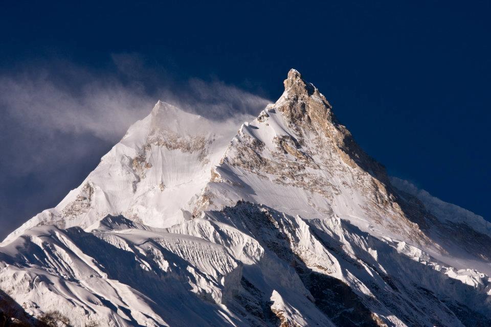
Manaslu Circuit is getting popular as a new trekking destination. Mt. Manaslu is the eighth highest mountain in the world; it is in the very center of the Nepalese Himalaya and to trek around the base of this giant mountain along with its isolated trail is probably one of the best treks.
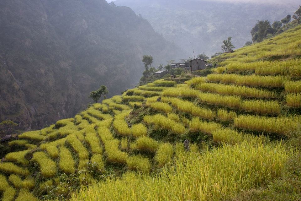
The trail traverses through pristine areas where you will witness the beauty of nature and picturesque village of Tamang and Sherpa settlements with their unique culture.
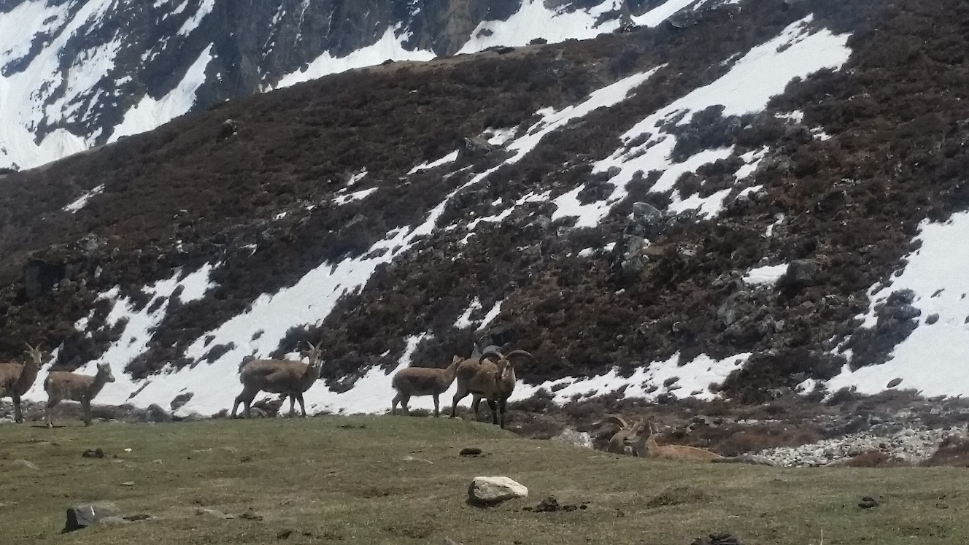
The Manaslu region is well-known for its high altitude glacier lakes, a diverse range of flora and fauna and charming cultural region.
This trek suits best for those who are looking for challenging trekking in a remote area of the Nepal Himalaya.
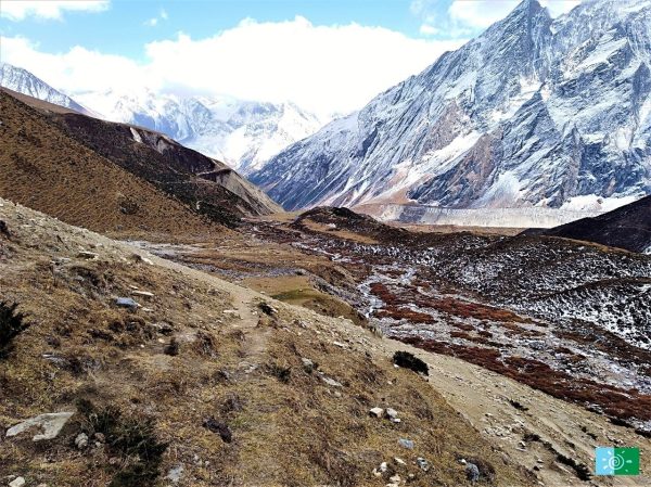
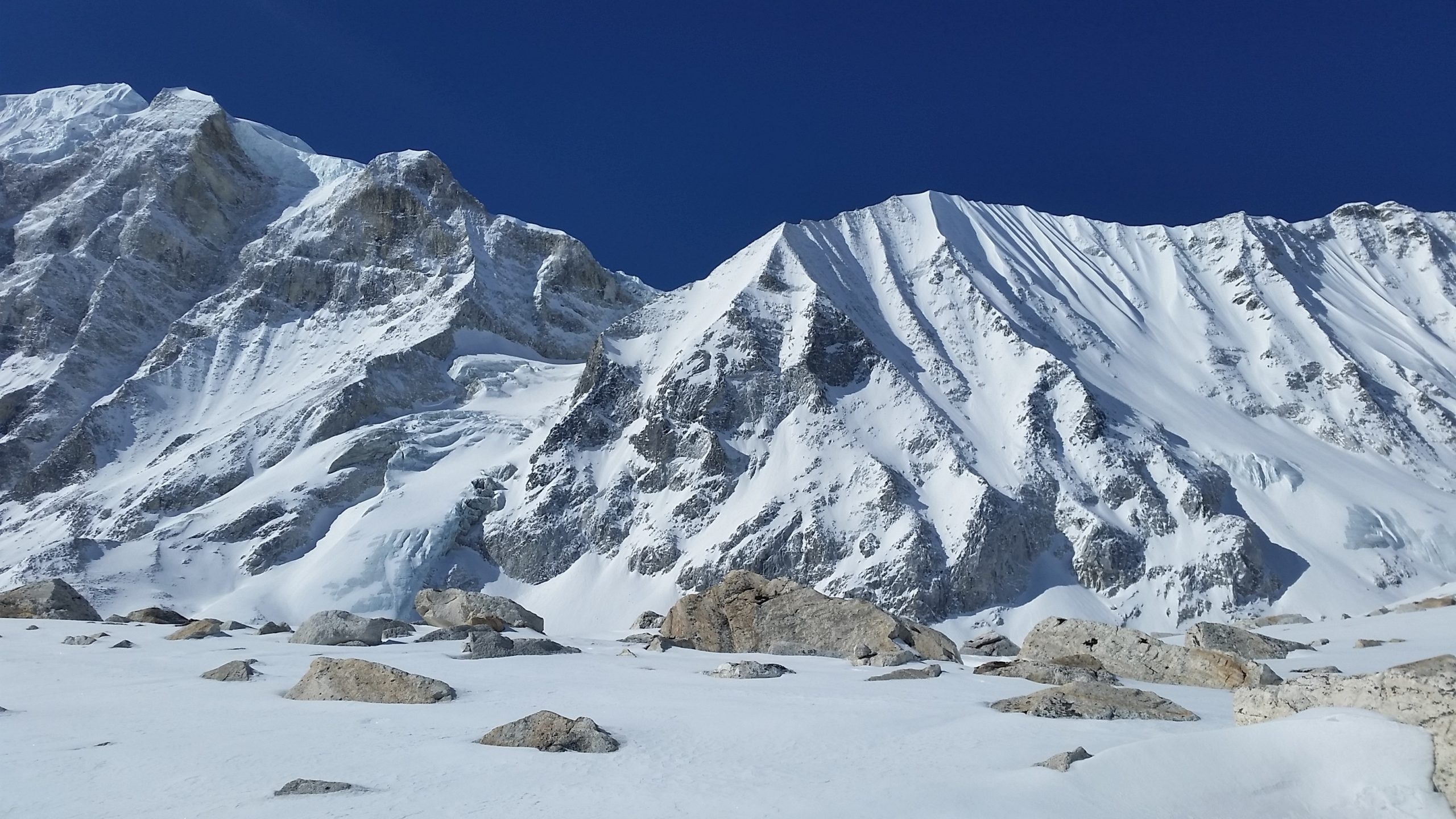
The highest point of this trek is Larkya La pass (5,135m/16,847ft), and trekking around Manaslu offers a unique opportunity to experience an untouched region of Nepal.
Trek can be 14 days that begins at Arughat and ends at Besishar. The best season to visit the region is from March to May in spring and September to December during the winter.
Trip Highlights:
The maximum altitude is 5160m/16929 feet.
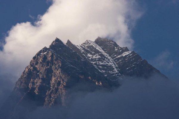
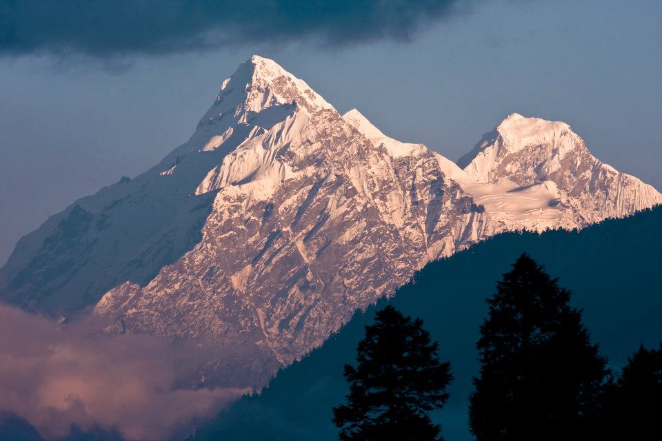
The fascinating backdrop of Manaslu & surrounding Himalayan range.
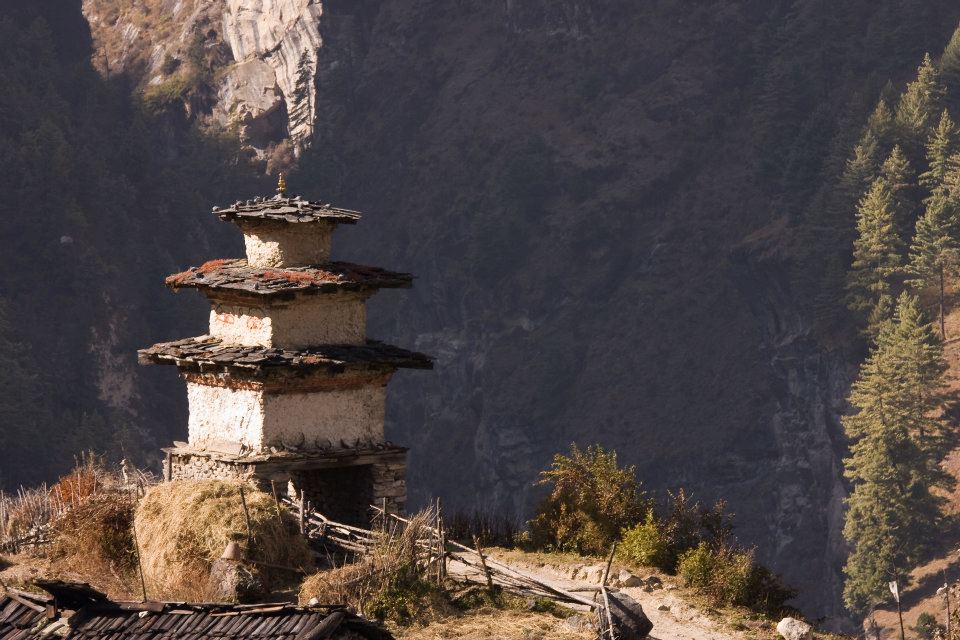
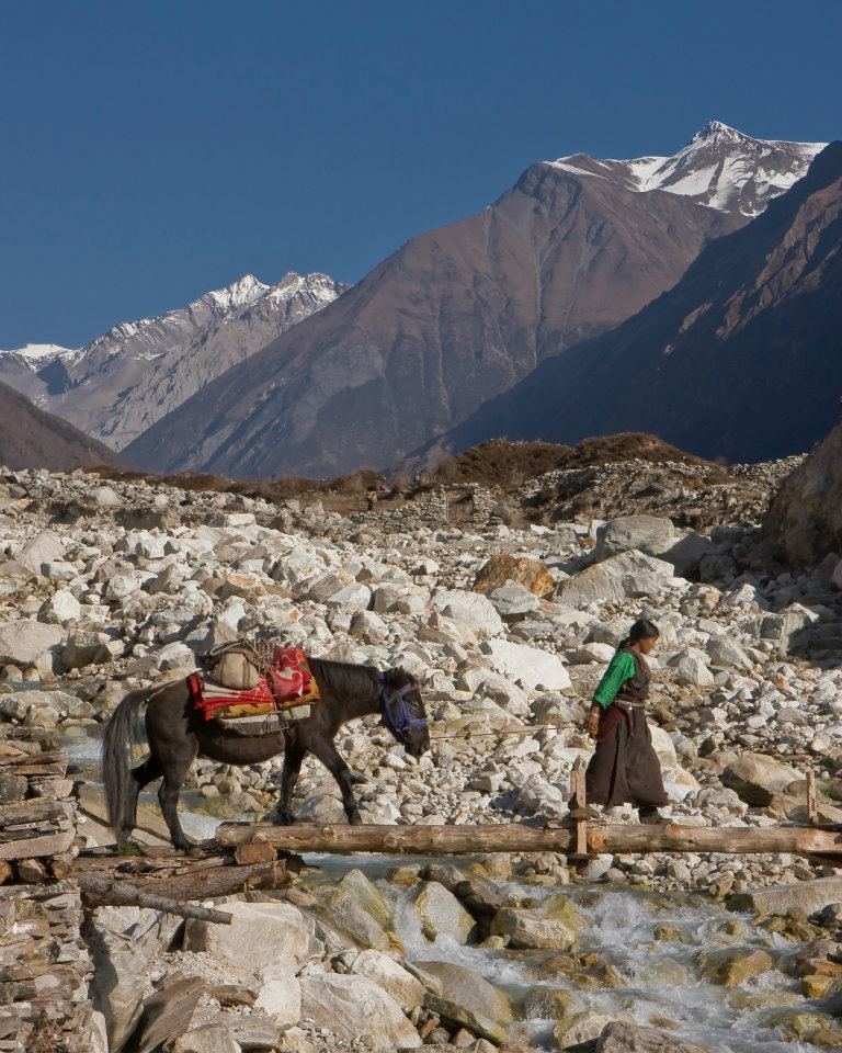
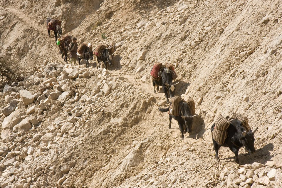
Cross many suspension bridges over the different rivers, including the Budhi Gandaki River and several Mani walls on the way.
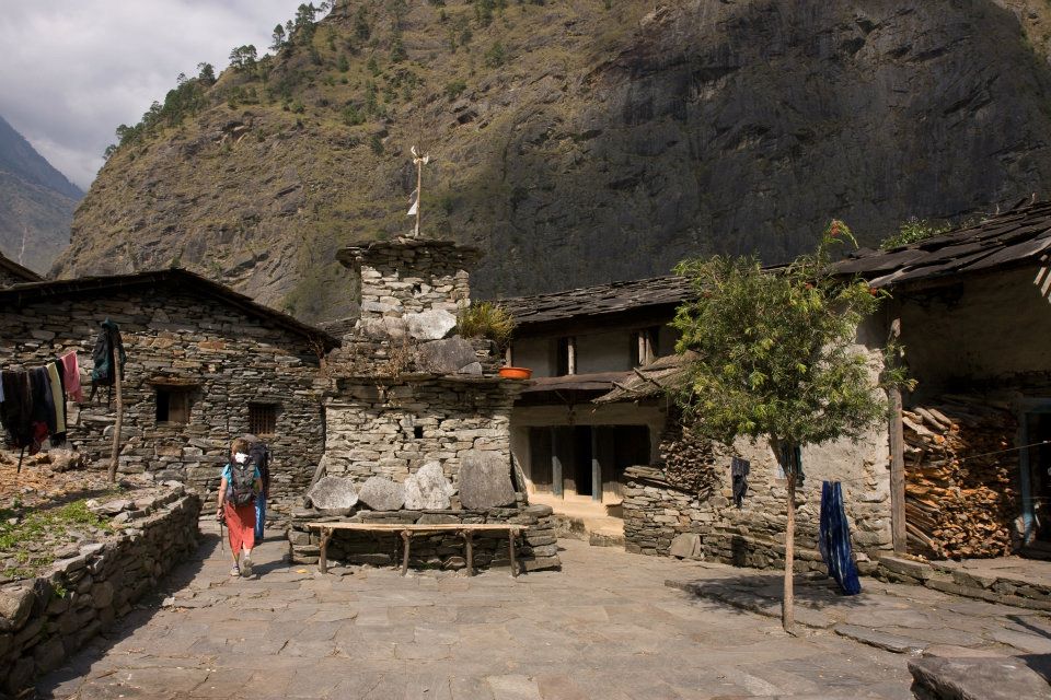
Observe the traditional village lifestyle and culture.
Tibetan culture and high pass crossing Larke La (5210m).
Experience walking through pine, rhododendron and bamboo forest and enjoy the nice view of the waterfall
Itinerary:
Day 1: Kathmandu-Arughat (550 m/ 1804 ft) 7 hrs drive and further 1 ½ more to Soti Khola (597 m/1958 ft)
Our destination start for today is Arughat, which is about a 7-8 hour drive from Kathmandu. During the drive, we enjoy scenery landscape along with the Mountain View.
We will be driving on a paved highway from Kathmandu to Dhading Bensi, and then drive from Dhanding Bensi to Arughat on a bumpy road passing through bamboo forests and Gurung villages.
Upon reaching Arughat, we drive further towards Sotikhola. Overnight at Sotikhola
Day 2 Trek to Macha Khola [900m/2952 ft]: 6 – 7 hours
In the early morning, we continue our trek by traversing the bridge, and we trek through the Sal forests and ascend onto a ridge above huge torrents on the Budhi Gandaki and continue to Korsani.
The trail now gets a bit more difficult as we ascend over a huge rock and pass a brook on a single log bridge then weaves its way up and down again to the banks of the Buri Gandaki.
It continues up a steep rocky track to the Gurung village of Labishe. From Dobhan, we climb following a rocky ridge to old school from where the valley widens.
Then the trail descends to a tropical waterfall with a wooden bridge. The trail climbs over another ridge and dropping to the sandy river bed.
We walk along with rounded stones before ascending over a side ridge. We move down again to the river and traverse one more suspension bridge to reach Machha Khola village.
We stay overnight at ManchaKhola
Day 3 Walk to Jagat [1410m/ 4625 ft]: 6 – 7 hrs
From Korlabesi there is a sharp climb to a ridge and after a few additional ups and downs from here will take us to Tatopani hot spring.
From hot spring, we climb over another ridge and cross a suspension bridge over the Buri Gandaki. At this point, we climb the wide stone stairway to Dobhan.
The trail gets quite rough and starts by ascending to two teashops at Duman, then we cross the landslide area, and after some ups and downs through the narrow valley, it reaches a large field.
There is some jumble over gravel slope until we decline to the wide river valley. After crossing a suspension bridge, the trail ascends a set of stone stairs, drops to the river and ascends once again to Thado Bharyang.
Crossing the west bank of the Budhi Gandaki, we climb over a ridge, trek along the river and then climb towards the village of Jagat. We stay overnight in Jagat.
Day 4: Trek to Deng (1,860m/6,102ft) 6-7hrs
There are good views of Shringi Himal as you walk along the side of a cliff. Today we will set off our journey to Salleri by climbing over a rocky ridge to Salleri and move down to Sirdibas.
The trail descends to Setibas where the Mani walls (prayers engraved into wayside rocks) show that we are entering a region with increasing Tibetan influence.
The valley widens a little and continues past the stone houses of Ghattu Khola, We continue to Ghatta Khola and then walk upstream through a long suspension bridge to reach a Gurung village in Phillim.
And then turns north just above the lowest houses in the village and stays fairly level until Serson. Further Serson the trails enter a steep gorge and descend through grassy slopes, to cross the wooden bridge at the river’s narrowest point; below you will see the convergence of the Shar Khola and Buri Gandaki rivers.
The village of Nyak is located close to here. As the trail widens, we pass through bamboo forests to reach the Deng Khola. After crossing the river, we reach the Deng village where we overnight here.
Day 5: Trek to Namrung (2,540m/8,333ft) 7-8hrs trek
We take a short walk from Deng and the trail traverse back over the Budhi Gandaki and climb Rana at 1910m. After a short climb from the bridge before heading west on level ground and we pass the large waterfall.
Once we cross the wooden bridge, the trail curve up and out of the canyon and ascends over the river before dropping into the Shringi Khola Valley.
After crossing the suspension bridge over the Shringi Khola, there is a sharp climb, and the trail passes along the Buri Gandaki.
The trail passes through forests and painted Mani stones and a corner from where we reach Ghap. You pass more Mani walls on the southern part of the river.
The trail climbs along the river, passes a waterfall and continues all the way through dense rhododendron forests with a wooden bridge in the middle which crosses the Buri Gandaki.
The trail continues along the north side to a big cave and then crosses the river at a narrow gorge where you can see grey Langur monkeys.
The forest becomes less dense, and the trail is leveled once we cross the river at a gorge. After an enjoyable walk, we then continue a final steep climb that will take you to our destination to Namrung through a stone archway where we stay overnight.
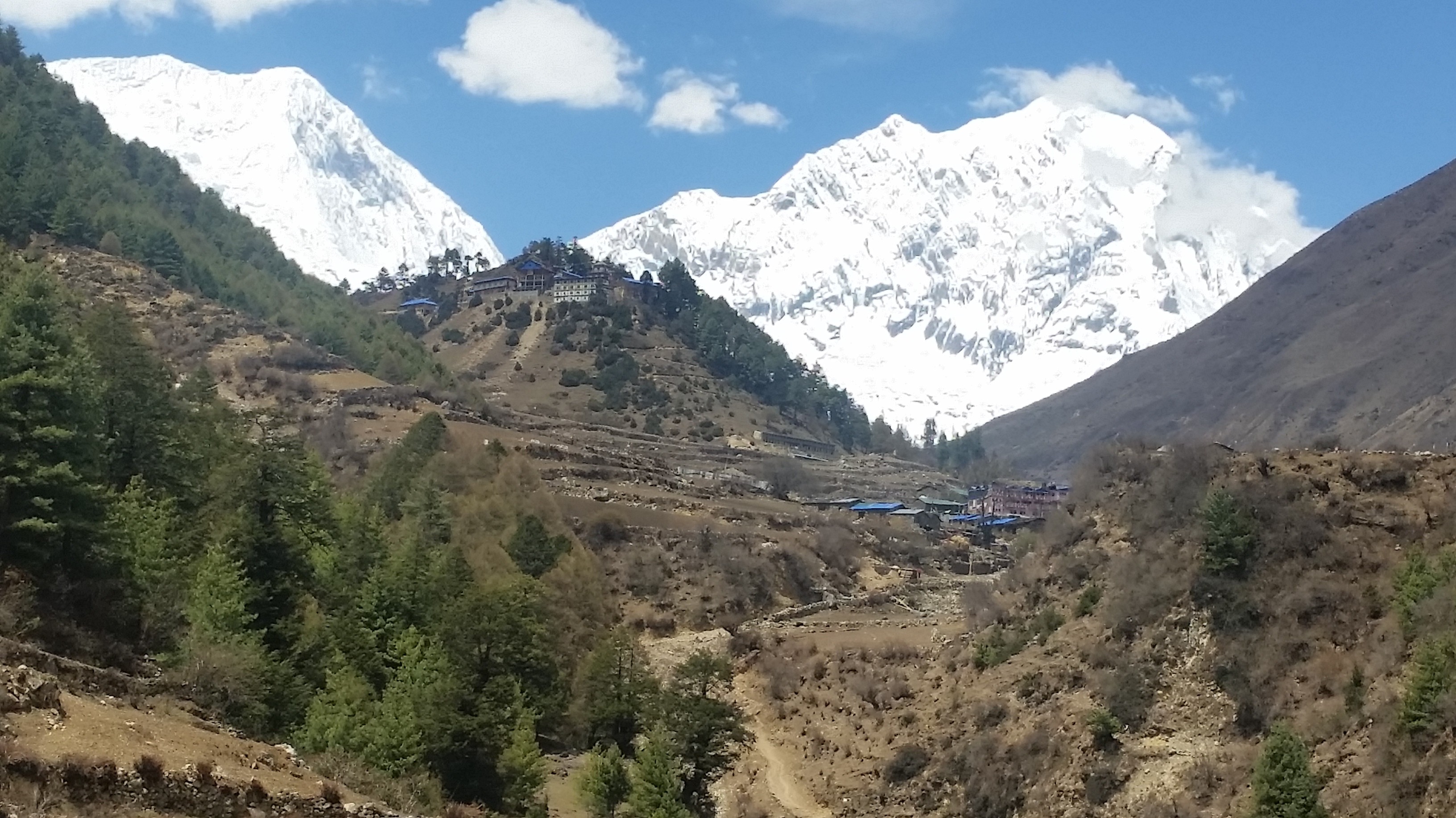
Namrung is the greatest viewpoint for Siring and Ganesh Himal as well as Mt. Himal Chuli.
Day 6: Trek to Samagaon [3530m/11,578 ft]: 6-7 hours
The trail traverses the ridge onto the Buri Gandaki Valley side and followed by descending to a rock scattered moraine.
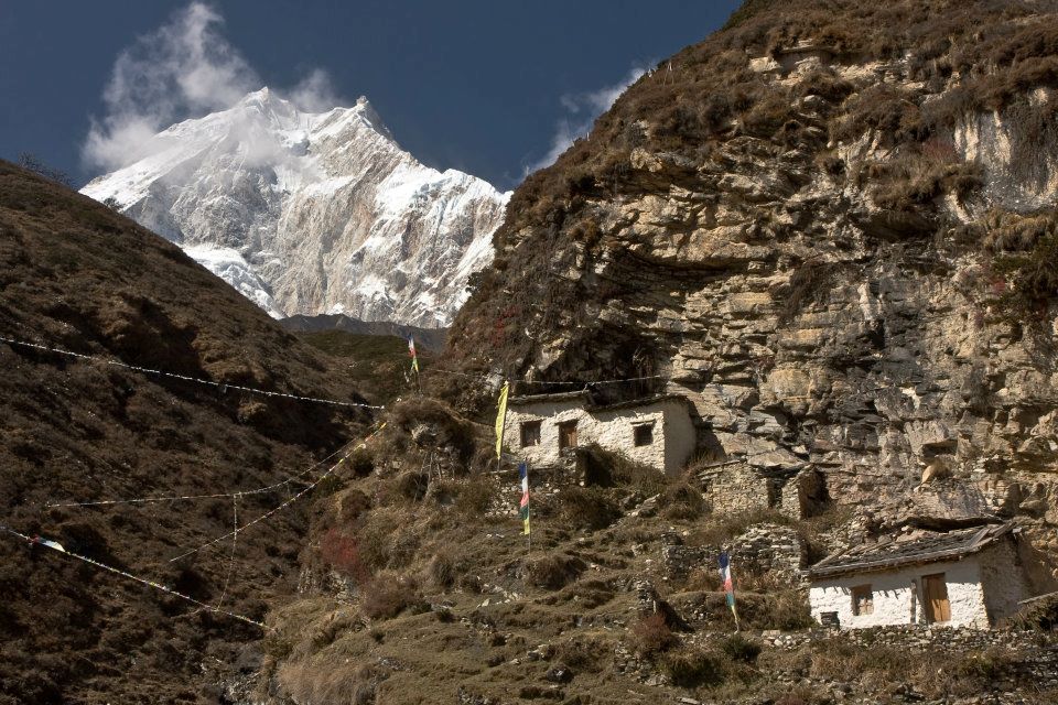
We further pass through extensive meadow and fields near Sama gompa after crossing some rocky trails. You will get the opportunity to explore a small part of Tibet with numerous Gompas and an authentic Tibetan village.
The village is settled perfectly against a wooded moraine at the end of the valley. We will rest overnight here in the village.
Day 7: Acclimatizing day at Samagaun
We will take a break to rest and acclimatize to the increasing altitudes. We stay in Samagaon and explore the surrounding areas and traditional Tibetan community from where we will be able to see beautiful views of Manaslu.
For the people who don’t want to hike can rest and explore the village. We will come back to the village and spend overnight at Samagaun.
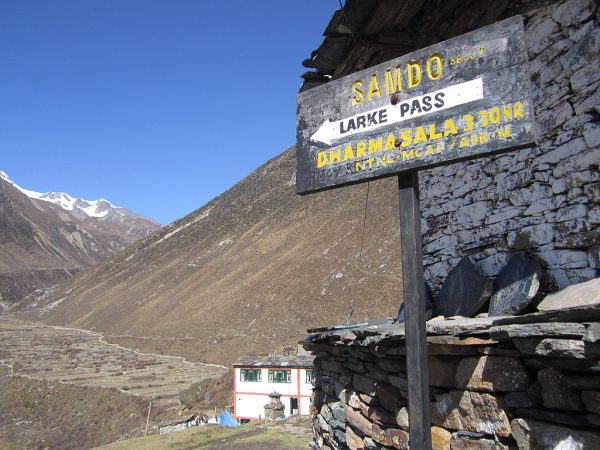
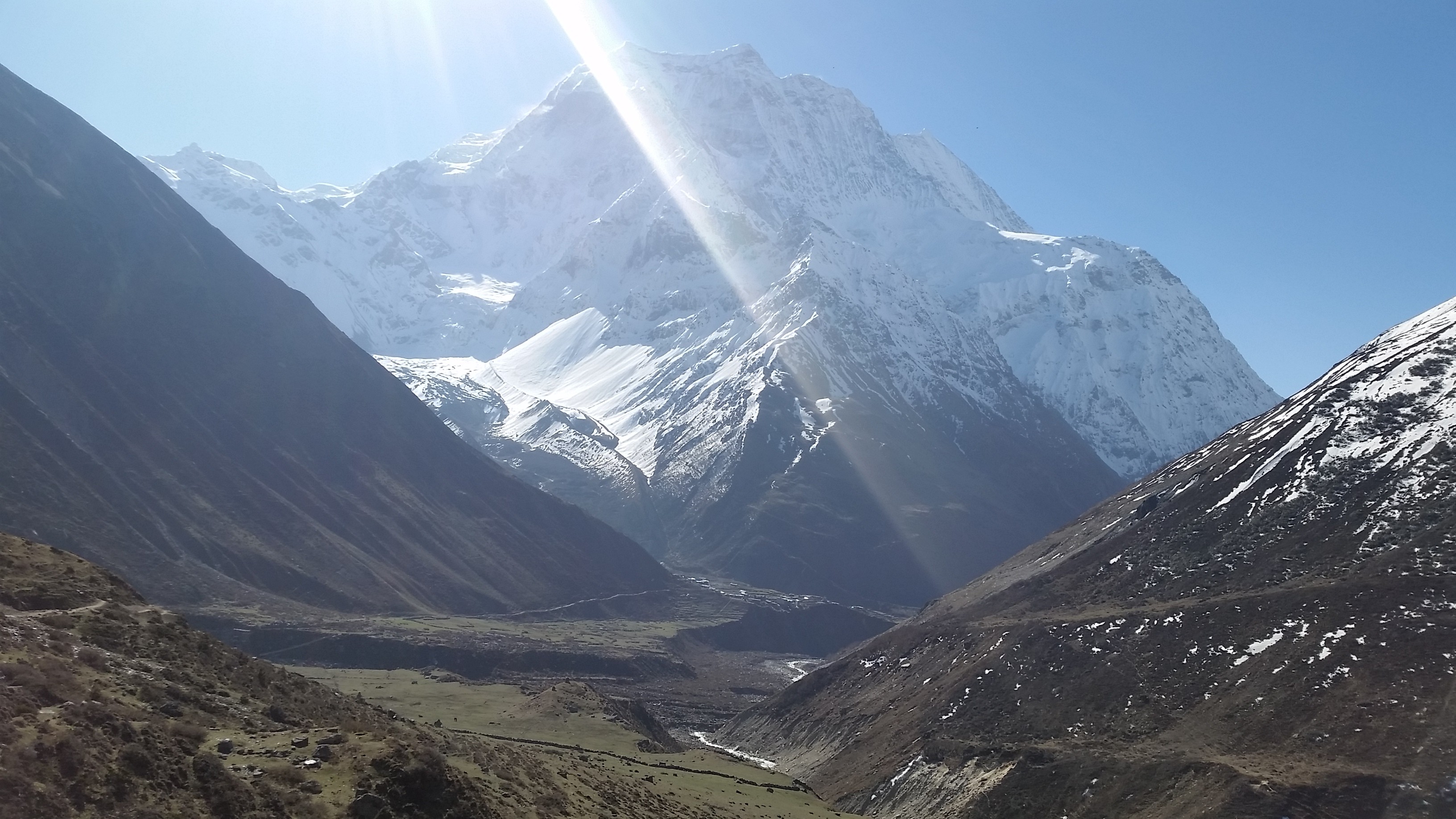
Day 8: Trek to Samdo [3860m/12,660 ft]: 4 – 5 hours
On the eighth day, we follow to the Budhi Gandaki River, which turns north and crosses the suspension bridge over a side stream. The trail to the left takes us to the Manaslu Base camp.
We then trek all the way through Larkya La trail we come across through numerous Mani walls. The valley broadens along an easy trail on a ridge above the river passing the juniper and birch forests to the stone huts at Kermo Kharka.
We then descend a ridge to cross a wooden bridge and ascend between diverging in the river to a headland. From this viewpoint, one can see the white stone Kani marking the way into Samdo.
Day 9: Rest and acclimatization day at Samdo (3,860m/12,660 ft)
This is another day to take a break for proper acclimatization. You can either take a rest or walk towards Gya La (‘large pass’) to the north of Samdo, which is the frequently used trading route to Tibet.
However, it takes an entire day to walk to Gyala and hence could be a bit exhausting. We overnight at Samdo.
Day10: Trek to Larkya Rest House (4,470m/14,665ft)
Today we begin the climb to the pass along the traditional trade way to Tibet. The broad trail descends you to fields to a huge old Mani wall and stone huts, dropping to the river and traverse it on a wooden bridge at 3850m.
This place shows up on maps as the legendary Larka Bazaar, which used to be a prosperous market.
A Mani wall marks the beginning of the climb to the pass where the trail starts climbing through tundra and juniper; you can see the huge Larkya Glacier coming from Manaslu.
Continue on the ridge to the right to find a trail that traverses over the top of two gorges. As you climb up the side of a gorge to a viewpoint at the edge of a huge gorge at 4000m, the trail grows steeper.
Climb in and out of the gorge and contour to the only shelter on the way to the pass which is a rest house at 4460m.
Day 11: Cross the Larkya La (5,135m/16847ft), trek to Bimtang (3,590m/11778 ft)
On this day we make a long gentle ascend across the moraine, and climb down to a lake and then trails become rough as it traverses to the south of steep, and lush slopes.
The trailhead towards the moraine to a ridge marked by two cairns, from here the prayer flags marking the pass can be seen. We then descend to the four frozen lakes then take a final steep climb to the pass.
When you go down from the pass, the trail continues the top of the moraine to the west and passes through many sharp ascents and descents. As we cross the moraine then descends more lightly on wobbly gravel to another grassy moraine at 4,450m.
The trail now becomes easier to continue and reaches a small pasture at 4,080m. As the trails head down to a large meadow, the valley becomes broader where we pass Mani wall and a small rest house that marks Bimthang at 3,590m.
We stay overnight at Bimthang, a huge valley surrounded by high peak
Day 12: Trek to Tilje [2300m/7544ft]: 5 – 6 hours
From a ridge at Bimthang, we can view vistas of magnificent Mt. Manaslu, Lamjung Himal, Himlung Himal, and Cheo Himal.
The trails descend further and pass high pasture (Sangure Kharka) followed by a bridge over Dudh Khola.

We then cross a wooden bridge and descends into pine and rhododendron forest to Hompuk at 3,430m and follow a trail through a narrow valley until we reach the highest cultivated land of the valley at Karche, 2785 meters.
From there we pass a landslide before a steep climb over a ridge decorated with prayer flags. It makes a drop to the river bank at Gho. The trail follows through fields and takes to you at Tilje, a large Gurung village.
We overnight in Tilje village.
Day 13: Trek to Chamje (1,430m/4691 feet)
Today we leave the village behind through a stone arch, traverse the Dudh Khola and follow along its embankment downward through the forest.
As we walk along, we see the Marsynagdi valley with its terraced fields and villages, and finally, the houses of Dharapani become visible in the distance.
We cross Thonje by passing through a wooden bridge and a chorten-shaped arch, and we make our way to Dharapani by crossing a long suspension bridge over the Marsyangdi.
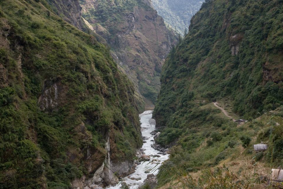
This is a trail where we enter the Annapurna Circuit route in reverse as you lead through the steepest part of the Marsyangdi gorge.
Day 14: Transfer to Besisahar and private transfer back to Kathmandu
From Dharapani we take the vehicle to Beishar which takes 4-5 hours.
We pass all the way through the banks of Marsyangdi and Trishuli River, enjoying the scenery and refreshing views of the hilly areas and mountains on the way back to Kathmandu.