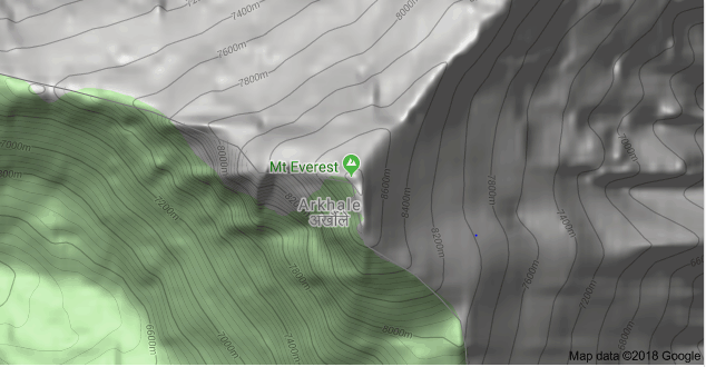
Where is Everest?
It is the question of many travelers, trekking lovers in particular. To know the exact location of Mount Everest, one needs to know its home country first. The Mount Everest is located on the Mahalangur range of the great Himalayas of Nepal. Let’s find out the answer to ‘where is Everest’ on the following map.
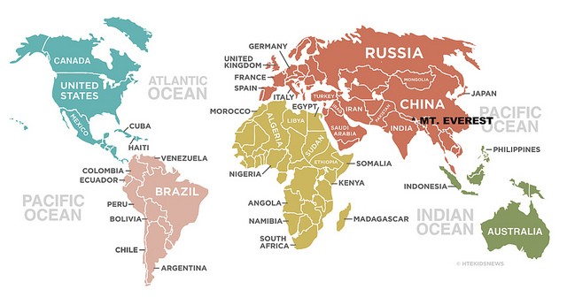
It stands exactly at the border of Nepal and Tibet in South Asia. As per the measurements of China’s National Surveying and mapping Administration in 2005, the exact location of Mount Everest is (27°59’ North latitude, 86°55’ East longitudes).
The Mahalangur range consists of four of the six highest peaks in the world. The topographical structure and geographical composition make Everest one of the best destination in the world for adventure sports.
People who visit Nepal first time can exact recognize which one is the mount Everest unless others explain to them.
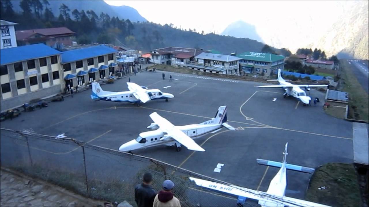
Now you must be wondering how to get to Everest?
As Everest is on the border, it has two sides. On the Nepali side (southeast ridge), it is located in the Sagarmatha national park in Solukhumbu district.
In Nepal, There is the Everest base camp’s south side which is one of the most popular trekking routes in the Himalayas.
Trekkers usually fly from Kathmandu to Lukla as there are no roads from Kathmandu to Lukla. However, there is the alternative of trekking to Lukla.
Similarly, the other side of Everest (the north ridge) is in Tibet, in Tingri County in the Xigaze area, a place that is considered to be an autonomous region and part of the people’s republic in China.
And the base camp located on the Tibet side is known as North Base Camp which requires the permit from the Chinese government.
The other names of Mount Everest are ‘Sagarmatha’ as called by Nepalese people and ‘Chomolungma’ as called by Tibetan people.
The name Mount Everest was derived from the surveyor general of India ‘Sir George Everest’ who was the first to locate the exact location of Everest. It is also known as the third pole.
So how tall is the Mount Everest?
Although the height of Everest is said to be 8848 meters (29029 ft.) according to the measurement by Nepal, there is still debate on what is the exact height of Mount Everest.
According to the measurement of the Chinese government, the height is 8844 meters (29016 ft.).
The weather in Mount Everest
One thing the trekkers should know about the weather in Everest is that it changes fast and may be risky. The weather might change unexpectedly, although you had the fine result from the forecast.
It is very difficult to predict the weather, so you need to be prepared for any disaster.
The oxygen at the base camp is only 53% of the oxygen available at sea level.
Most of the trekkers are said to be ignoring the signs of Acute Mountain Sickness and get perished on the route. Ignoring the signs of AMS such as a headache, dizziness, disorientation is very risky. So be careful in such situations.
How some deaths occur in Everest?
Since 1969, Every year at least a person dies in the attempting to climb Everest. Those deaths are caused by several reasons such as frostbite, snow blindness, suffocation, starvation, and hypothermia.
The region above 7500 meters is called Death Zone as it is the main region where deaths occur due to snow disease. It is also dangerous because the doctors that monitor climbers are only available below 5400 meters.
If this fact has amazed you, you might want to read 23 amazing facts about Mount Everest.