Trip Facts

icon-calendar
Trip Duration 118 Days
icon-meter
Trip Difficulty Challenging
icon-mountain
Maximum Altitude 6,143 m/20,154 ft.

Trip Overview

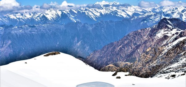
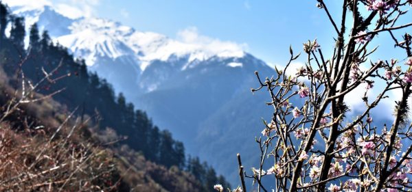
The Great Himalaya Trail (GHT) in Nepal is an incredible long-distance trek that takes you from the eastern border with India to the western border with Tibet. It explores remote mountainous areas, showcasing the majestic Himalayas and vibrant local cultures.

The full GHT traverse in Nepal spans about 1700 kilometers and takes 120 days, with 10 distinct sections offering unique trekking experiences. From Kanchenjunga and Makalu Barun to Everest, Rolwaling and Langtang, and Manaslu and Annapurna, each section is rich in natural beauty and cultural heritage.

The best time to embark on the GHT trek in Nepal is during the spring (March to May) and autumn (September to November) seasons when the weather is stable and the mountain views are breathtaking.

Trekking the GHT in Nepal is both challenging and rewarding, providing a special opportunity to immerse yourself in diverse nature and culture. However, proper preparation and equipment are essential before starting this adventure.

Trip Itinerary

Day 1: Arrive at Kathmandu airport (1,302 m/4,270 ft)

Upon arrival at Tribhuwan International airport, our representative will be awaiting you to welcome with Nepal Sanctuary Treks placard. You will be then escorted and transfer to Hotel. Further details and short preliminary briefing will be provided after transferring to the hotel. Stay overnight in Hotel.

Day 2: Optional Morning tour to ancient marketplace and visit world’s UNESCO Heritage sites

After early breakfast, we will start our fresh morning by wandering Ason and Indrachowk marketplaces to get a glimpse of traditional Nepalese life. You’ll witness the bustle of the market, see how locals purchase the products and haggle for a bargain. Whilst walking around enjoy the lively and vibrant atmosphere this local market has to offer.

We walk through a narrow alley and see people rushing. Observe the first hand the local produce people from Nepal actually purchase. You will also take in the sights and smells of the market. Your friendly tour guide will explain in full detail all the products and procedures you will see. There is plenty of opportunities to buy something for your selves and lots of photo opportunities to capture in your camera.

Next, we head towards Kathmandu Durbar Square, also called Hanuman Dhoka Durbar, and used to be the residence of the Nepali royal family and administrators. This  ancient sites situated in the traditional heart of Kathmandu that incorporates an architecturally extraordinary complex of ancient palaces, temples, courtyards, and shrines dating from the 15th to the 18th century.

The most revered places of Kathmandu Durbar Square is the three-storied temple named Kumari Bahal. The structured like a typical Newari Vihara. In this house lives Kumari, a girl who is respected as the living goddess. During the festival of Indra Jatra, the Kumari is paraded around the square in a custom-built gilded chariot and worshipped by the people.

The tallest temple of Kathmandu valley ‘Taleju Bhawani’ built in 1549 AD. This temple is deliberated to be the most outstanding work of art in the Durbar square and considered to be the royal goddess.

Jagannath temple built in 16th century is well-known for erotic carvings, and the Hanuman Dhoka (the royal palace) is situated in Kathmandu Durbar Square.

Kalbhairav is considered to be the destructor form of Lord Shiva. Built in the 17th century, this, 10 ft. high stone statue of terrifyingly portrayed Kal Bhairav is sited near Jagannath temple.

Temple of Shiva Parvati, rectangular in shape enshrines Nava Durga, a group of goddesses on the ground floor. It has a wooden image of Shiva and Parvati at the window of the upper floor looking out at passerby in Durbar Square.

Swayambhunath:

You are then taken to Swayambhunath (monkey temple) which is the magnificent ancient religious architecture and center faith of Hinduism and Buddhism. Its lofty white dome and dazzling golden spire are visible from far and wide. Upon arriving at the top, you can hear the Buddhist songs “Om Mani Padme Hum” resound everywhere. The candles and the aromatic fragrance of incense that burns constantly create a serene vibe and we can turn the enormous prayer wheels which encircle the stupa.

Boudhanath:

Buddhist shrine of Boudhanath, one of the largest stupa in Nepal as well as the sacred Buddhist sites in Kathmandu. You will observe the monk chant in the prayer hall while people lighting butter lamps and reciting mantras. You can see the vibrant prayer flags tied to the stupa that conveys mantras and prayers into the universe while fluttering in the wind. Traditionally, prayer flags come in sets of five, one in each of five colors. The five colors signify the elements and the Five Pure Lights.

Pashupatinath:

Further, we visit Pashupatinath temple, a Hindu shrine dedicated to Lord Shiva located on the bank of Bagmati River. You can see elaborately dressed holy men meditating outside the temple and pilgrims placing offerings at the shrines. You can also observe people performing the religious ritual and funeral pyres burn at open-air cremation.  After visiting fascinating cultural heritage sites, you will transfer back to the Hotel. The evening can either be spent strolling the marketplaces in Kathmandu or resting at the hotel.

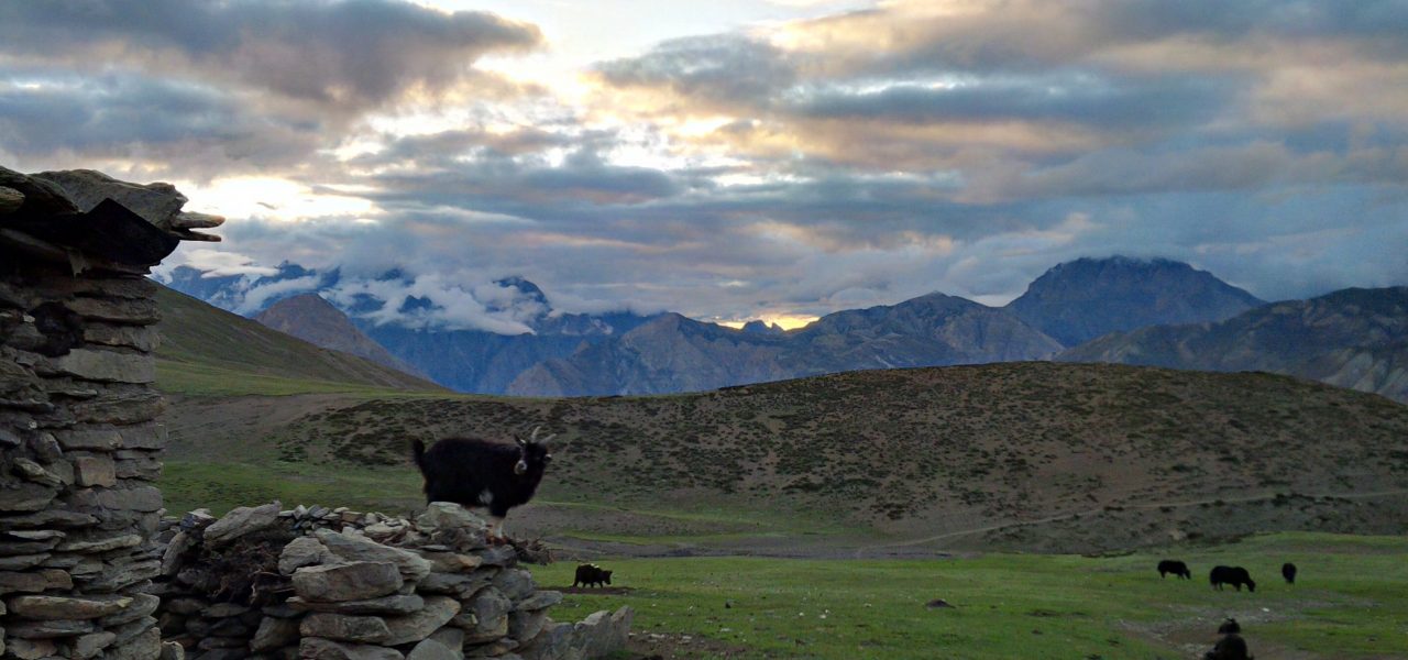
Day 3: Flight Kathmandu – Nepalgunj approx. 50 minutes

You will be transferred to the airport and will take our flight to Nepalgunj. If it’s a clear day then you will be able to see amazing views of the Himalayan range. After landing in Nepalgunj you will be escorted to your hotel. You will have the afternoon to yourself to explore Nepalgunj or to relax at the hotel.

Day 4: Flight Nepalgunj - Juphal (2475 m), trek to Shyanta (2520 m) 5 to 6 hours

It takes around 35 minutes to arrive at Juphal by the flight from Nepalgunj. While on the air, you could see the vistas of Dhaulagiri, Churen Himal, Sisne Himal, and Kanjiroba Himal following all the way up to the Juphal. Upon arriving there, we will trek towards the Shyanta.

Day 5: Trek to Amchi Hospital (3,110m)- 6 hours walking.

After breakfast, we leave Shyanta behind and trek towards Amchi Hospital. This is a very fascinating place and worth a visit. Indeed it is more a clinic, which is well visited by local people. An Amchi is a doctor who is educated in traditional Tibetan medicine, and always is a lama (monk) as well. In the Amchi Hospital, you can observe a collection of herbs and minerals used for treatment you can see the beautiful Tibetan village with flat-roofed houses and fields of buckwheat.

Day 6: Trek to Phoksundo Lake (3,600m) - 4 hours walking.

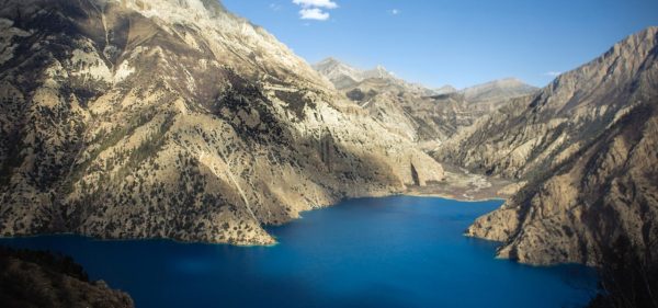
After having our breakfast we begin to trek by passing arid settlement called Palam and climb uphill for an hour to a ridge at about 3,800 meters (12,467 ft.). Once you reach a view tower you will get to see the spectacular highest waterfall in Nepal and Ringmo Village with Phoksondo Lake. On the way, you likely to encounter with blue sheep. We walk down through a birch forest passing Chorten and Mani walls at the doorway to Ringmo village. After a short walk, we reach Phoksondo Lake.


Day 7: Rest & acclimatization day.

Today is important for acclimatization as we will be trekking to higher altitude; altitude sickness can be a problem so to avoid altitude sickness we stay back and let our body adopt the altitude. As we stay back a day hike to Bon monastery which is believed that this religion origin prior to Buddhism, explore Ringmo village can be organized for acclimatization.

Day 8: Trek to Phoksondo Lake North Camp (3,630m) - 4 hours walking.

After breakfast, we start our trek for today. We will have to recheck the Inner Dolpa restricted area permit before we enter to the north of Phoksondo Lake. The trail offers magnificent views of the lake and amazing Himalaya. We follow the western part of Phoksondo Lake along a narrow cliff trail.

We climb to a ridge with magnificent vistas over the enchanting lake to Ringmo village and the snowcapped mountain of Kanjiroba (6,612m), Norbung Kang (6,085) and Jhyarko Dingla (5,892m). Further, we take a steady decline through birch trees that lead to our Phoksondo Lake North Camp.

Day 9: Trek to Lar Tsa Camp (4,200m)- 7 hours walking.

After breakfast, we leave Phoksondo North Camp and head towards a wide valley with a couple of river stream.  On the left side of valley, you can see superb views of Kanjero Himal. After four hours trek, we will stop for lunch at Dobhan (river confluence) camp. After lunch, we ascend uphill for approximately three hours towards Lar Tsa Camp.  Lar-Tsa camp is popularly known for producing Yarchagompa “Caterpillar fungus” which is used by the practitioner of Tibetan and Chinese medicine for cancer and fatigue treatment.  You can also see the beautiful view of Kanjiroba Himal (6,612m) from Lar Tsa camp

Day 10: Trek to Snowfields Camp (4,650m) - 3 to 4 hours walking.

We have an early breakfast and begin to trek by walking up to the valley and traverse river on a bridge. Then start walking uphill to the small pass. Then you step towards the narrow gorge. Once you cross narrow gorge you will see Snowfield high camp. After one and half hour trek, you will reach snowfield camp. Snowfields Camp is at the base of Kang La that traverses into Dolpo

Day 11: Cross Kang La at 5,380m, trek to Shey Gompa (4,400m) - 6 to 7 hours walking.

The trail is steep and challenging all the way up to Kang La pass. From the top of the pass, we will be offered with a view of the large valley divided by river. Now we descend steeply to the base of the valley then trek along the bank of the river until we arrive at Shey Gompa, Shey means crystal so the famous Buddhist monastery is located beneath Crystal Peak.  Our campsite will set up in a meadow area with several herders

Day 12: Exploration day at Shey Gompa.

Today is also a rest day; we stay back in Shey Gompa. After a decent breakfast, we can either rest in the tent or explore the area, an optional day hike will be organized to Tsakang gompa, hours of walk from Shey. We will return back to the camp and stay overnight here

Day 13: Cross Saldang La (5,060m), trek to Namgung (4,430m)- 5 to 6 hours walking.

After an early breakfast, we rejoin our trail, leaving Shey gompa behind. We trek a pleasant trail through juniper trees descending into a grey, stony canyon. From here the trail becomes zigzag and we further trek to the top of Namgung La Pass, from the pass you can enjoy views from the north into Tibet and east towards Mustang. From the top, we then descend northwards to a small village of Namduna Gaon where we will camp the night.

Day 14: Trek to Karang (4,050m)- 6 hours walking.

After breakfast, we trek through the Namgung Khola Valley to Karang. Stay overnight at a camp in Karang.

Day 15: Trek to Mischagaon village (4,200 m) - 6 hours walking.

After having breakfast, we carry on our trek by descending to Torak Sumdo (3,670 m) with a confluence of the Polang Khola and Namgung Khola. Further, we traverse to the north bank and ascent to Yanger Gompa (3,750 m). Then trek along the river valley to the campsite near the stream. Stay overnight at a camp in Mischagaon

Day 16: Cross Muri La (5,030m) to Chanpola Goth near Shimen village (4,250m)- 6 hours walk

After having an early breakfast we start to take steep ascent for hours to Muri La Pass. From the pass, you can see the beautiful landscape of the Upper Dolpa area and Tibet. After savoring the view we start to heading down for three hours that lead us to Chapula Goth.

Day 17: Trek to Tinje village (4,180m) - 7 hours walking.

After breakfast, we start to walk downhill for one hour to Shimen village with huge areas of terraced fields of buckwheat, barley, and potatoes.  You will see the longest mani wall (600m) of Dolpo. We start walking along the Tinje Khola. We will stop for lunch here. After lunch, we walk along the river and you will see the rocks inscribed in a mantra. Once you get to Phal Gaun, there is a road on the left side of the valley that leads to Tibet. We will continue to trek taking the right-side trail towards the beautiful Tinje village of Tibetan settlement. You can still see airstrip which was used during the conflict between Tibet and China in the past. Tinje is the main village in a broad valley with widespread fields with two gompas and an old fort. We stay overnight in camp at Tinje.

Day 18: Trek to Rapka (4,550m) - 6 to 7 hours walking.

After breakfast, we follow Panzang Khola past ruins of an old settlement on the other side of the river, after two hours we arrive at river confluence where we take the left tributary Kehen Khola for a further hour to reach our lunch spot in grassy area next to the river. After lunch, we continue walking up the left bank of Kehen Khola passing several doksas before arriving at Rakpa where we camp for the night.

Day 19: Cross Chharka La (5,015 m), trek to Chharka (4,300 m) - 7 hours walking.

After breakfast, we walk the leveled path for one hour and cross the riverAgain start walking onto riverside of a different valley that will lead towards Chharka La. if the weather is apparent, you can see the superb view of Dhaulagiri 2.  The gradual climbs to the pass take 5 hours walking and further three and a half hours walk leads you to Chharka village. Chharka is the last village of Upper Dolpa. Several years before Chharka was considered as SAKA. In Tibetan word, SAKA means “Good place” and also the hamlet was popular for fine salt since there was salt mine. Salt found in Chharka was the finest one, therefore, the ‘Chharka’ means good salt. Hence, Chharka is titled from Good salt & a good place.

Day 20: Exploration day at Chharka village.

After breakfast, you can take rest or explore around Chharka village. We will explore the two gompas, Buddhist and Bönpo, signifying the two religions of Dolpo. Situated in Chharka village, Sachen Gompa is Ningmapa sect gompa which was made by Saga Jampa, Dorje Choekyong Sangpo in 1400A.D. Later in 1993 Menla Phunjok of Chharka village had re-built the gompa in the involvement of village dwellers.

The ancestors and heredity of Chharka people are Siro, Habha, Yangton, Tolung, Purang, Nopri, Toyo which were originated from Dulung Village, Mustang, Lasing, Tibet, Poldya of Tinje Village. You can observe diverse people while exploring the village.

Day 21: Trek to Norbulung (4,750 m) and to Molum Sumna (4,860 m) - 6 to 7 hours walking.

On this day, we will be trekking through the most magnificent trails from Chharka to Norbulung. We trek to the trodden way from the caravans of Yaks and people along the way. Norbuling has been named by one of the well-known expeditors George Schaller as a new world of “remote peaks crowned by remoter snows”. Further, we’ll descend from the plateau down to the main river traversing it on a bridge. Stay overnight camping at Molum Sumna.

Day 22: Cross higher Sangda La (5,515m), trek to Sangda Phedi (5,100m) - 6 to 7 hours walk.

Today we will commence our trek early in the morning.  We pass through the meadow of Molum Sumdo and then carry on to a ridge with a cairn at just over 5,100m. Then, it is an additional couple of hours to get Sangda La walking through a lush plateau with grazing yaks. Further, we start ascending the trail to the Sangda La pass marking the boundary among Dolpo and Annapurna. The trail drop on loose rock debris to Sangda Phedi.

Day 23: Cross lower Sangda La (5,035m), trek to Sangda (3,800 m) - 6 to 7 hours walking.

After breakfast, we start our today’s trek following Bheri Khola then contour up and ascent the lower Sangda La at 5,035m. Once you reach the pass you will be rewarded with magnificent towering peaks views over to Kali Gandaki valley and Thorong La and more a range of 6,000m mountains comprising Tongu Himal and Mukot Himal. There is a sharp descend from the pass on a wobbly trail that traverses a ridge with a cairn at 4,800m then descent to a huge rock at 4,500m. We further trek down to a verdant plateau with pine trees then take right and cross the new suspension bridge at 3,900m.

We take steep ascent and the trail crosses high above Kyalunpa Khola, after an hour we traverse a crest with prayer flags. We trek down through a steep gorge to traverse the tributary river for ½ hour to the second river again crossing on rocks. In a while, you will see the entrance Chorten to Sangda village followed by a huge wall around their fields Stay overnight at Sangda village.

Day 24: Trek to Dhagarjun (3,280m) - 7 to 8 hours walking.

After breakfast, we ascend to a hill behind the Sangda. Today we cross numerous ridges and reach the last crest (4280 m). Further, we take to descend to the Annapurna round trail in the Kali Gandaki valley. Then trek through a side of a cliff and trek down to Dhagarjun. Dhagarjun is a huge village with Bhotia people. Stay overnight at a camp in Dhagarjun.

Day 25: Trek to Muktinath (3,760 m) - 6 to 7 hours 

After breakfast, you can take rest or explore around Chharka village. We will explore the two gompas, Buddhist and Bönpo, signifying the two religions of Dolpo. Situated in Chharka village, Sachen Gompa is Ningmapa sect gompa which was made by Saga Jampa, Dorje Choekyong Sangpo in 1400A.D. Later in 1993 Menla Phunjok of Chharka village had re-built the gompa in the involvement of village dwellers.

The ancestors and heredity of Chharka people are Siro, Habha, Yangton, Tolung, Purang, Nopri, Toyo which were originated from Dulung Village, Mustang, Lasing, Tibet, Poldya of Tinje Village. You can observe diverse people while exploring the village.

Day 26: Rest day

Today is also a rest day; we stay back in Muktinath. After a decent breakfast, we can either rest or explore the area. We can visit the temple and 108 waterspouts at Muktinath are sacred to Hindus and form part of the cultural history of Nepal. Hindus consider Muktinath temple to be a source of the celestial energy.

Day 27: Trek over Thorung la (5,415m) to Lethdar- 7 to 8 hours walk

After breakfast, we trek to Lethdar by crossing Thorong La Pass. The pass is situated on a trail that links the village of Manang in the Manang District to the east, with the temple of Muktinath and the adjacent village of Ranipauwa, in the Mustang District to the west. Stay overnight at Lethdar.

Day 28: Short trek to Manang (3,540m) - 3 hours walk

After breakfast, we leave Lethdar behind and trek towards Manang. Manang comprises Gangapurna Lake, the turquoise glacial lake from the Gangapurna glacier. We can also hike above the lake where there is a Chongkor viewpoint that offers spectacular mountain views and the majestic Gangapurna Lake itself. Towards the end of the day, we return to our accommodation for a night’s rest

Day 29: Trek to Chame (2,670m) - 6 to 7 hours walk

After breakfast, we trek to Chame a district headquarter of Manang with a bank, police headquarters, district administration. There is a hot water spring at Chame that will make you relief from pain. •On the way to Chame, we will see the renowned Dudh Khola pouring from the south face of Mt Manaslu

Day 30:  Trek to Surki Khola (3,300 m) - 5 to 6 hours

Today after breakfast, we leave Chame behind and head towards Surke Khola on Manaslu circuit, The trail continues through stone arch, cross the Dudh Khola and follow along its embankment ascending through scrub forest to Tilje, a large Gurung village, from here we walk through fields and intermittent stands of rhododendron and oak to arrive at Surki Khola for overnight.

Day 31:: Trek to Bimthang (3,590m) - 4 to 5 hours walk

The river rises from the Suti Glacier one of the several glaciers that flow south from the enormous curve of ice giants along the Tibetan border that tower over the Ponkar Lake region. Today’s trail meanders up the Dudh Khola Valley through the wonderful varied forest. We further trek to some steep sections comprising the final ascent to Sangura Kharka (a yak pasture, 3 020m).

Then we proceed up the forest trail to Hompuk (3 430m), a rock shelter and Goth (herder’s hut). Ahead is the lower end of the Bimthang Glacier. Leaving the forest onto its moraine and descend on wobbly gravels to traverse the glacier. The ascent on the far side is easier, the trail then follows the eastern bank as it rises gradually to Bimthang. Stay overnight in Bimthang.

Day 32: Cross Larkya La (5,135m), to Dharmasala 7 to 8 hours walk

After breakfast, we traverse over Larkya La pass and trek towards Dharma Sala. Larkya la Pass is one of the highest point (5106 m) in Manaslu trekking region. It is located between Bimthang and /Dharmasala. Crossing this pass in the most audacious task in Manaslu trekking and the trekkers.

Day 33: Trek to Lho (3,180m) - 6 hours walk

Today we leave Dharmasala behind and trek to Lho. Lho an important village with a monastery and a Lama school along with the majestic view of Manaslu and Kutang Himal. Once you arrive at Lho you can visit Ribang Gompa, stupas, Mani walls, and Kani doorway.

Day 34: Trek to Ghap (2,630m) - 6 to 7 hours trek

We start our trek after breakfast through the forest of fir and rhododendron trees which bloom every spring season. Along the way, you can see the picturesque woodcraft house and the fields. At Ghap, the Tibetan culture begins with Mani stones and chortens all around

Day 35:: Trek to Philim (1,570 m) - 7 hours walk

After breakfast, we trek down to Philim, the popular Gurung Village in the region. Today we walk through few ups and downs through the forests and traverse Buri Gandaki.  Further, we cross the suspension bridge over Shringi Khola. Along the way, we traverse the wooden bridge, past waterfalls, Deng Khola to bamboo forests and the villages like Deng and Serson all the way to Philim.

Day 36: Trek to Macha Khola (869m) - 7 hours walk

After breakfast, we cross the suspension bridge and past the stone houses of GhattuKhola. Then the trail ascent to Setibas passing beautiful Mani walls (prayers engraved into wayside rocks). Further, when you reach the ridge you can see the superb views of Shringi Himal. Then you will take a decent trail to Jagat, Thado Bharyang. You will be passing landslide area, teashops at Duman, and Dhoban. Further, we cross the suspension bridge over Buri Gandaki and reach Tatopani. Tatopani is a hot spring where you can enjoy the bath and unwind for a while enjoying the nature around. From Tatopani, we take a steep descent to Macha Khola for overnight.

Day 37: Trek to Soti Khola (597m) - 7 hours walk

After breakfast, we take a decent trail all the way to Soti Khola. You can see the glimpse of the southern slopes of Annapurna, Manaslu, Ganesh Himal, and Langtang Himal.

Day 38:: Drive back to Kathmandu approx. 8 hr. drive. Overnight Hotel 

After breakfast, we take 8 hours long scenic drive back to Kathmandu.

Day 39: Day in Kathmandu for visa extension etc.

Day 40: Day in Kathmandu for visa extension etc.

Day 41:: Fly to Bhadrapur (45 minutes approx.) and drive to Ilam (Approx. 3 hours. 97.3 km)

With an early wake-up call, you will get ready and be transferred to the airport from where you will fly to Bhadrapur. Landing at Bhadrapur there will be a vehicle waiting for us which will drive us to Ilam. It is a famous destination for natural scenery and landscapes, tea production, and diverse agricultural economy. We will stay overnight at Ilam and prepare ourselves for tomorrow’s trek.

Day 42: Drive to Taplejung (5 hours), trek to Mitlung (921m)

We leave Ilam early in the morning and drive to Taplejung through cardamom and tea cultivated area. The scenic drive offers you the first glimpse of Mt. Kanchenjunga and Mt. Jannu. In addition, you get to see pasture land and small villages. Then we begin to trek along the paved road for one hour and take a gradual steep descent to the Tamur River that takes us to the village of Mitlung. We stay overnight in Mitlung.

Day 43: Trek to Chirwa (1,270m)

With an early start, we continue our trek following Tamor River along the paved road and after one and half hour the trails lead to Siwa Bazar. Siwa Bazaar is a small market and you can see Limbus settlement, high school, hospitals, and a police checkpoint. We continue to follow the Tamor River for one and a half hours and stop at Tawa village for lunch. After lunch, we walk on a zigzag path for about 1 hour that leads you to Thiwa Village. An additional hour walk will take you to our destination Chirwa.

Day 44: Trek to Sekathum (1,660m). 5-6hrs trek

After having breakfast we rejoin our trail; as we begin we follow trekking along the Tamur River. The trail passes through a varied landscape, we trek uphill and downhill passing dense forest. After a couple of hours, we arrive at Taplechowk where our trekking permit will be checked and its doorway to Kanchenjunga Conservation Area. We traverse the suspension bridge over the river and walk on the west bank along with the cardamom farm. We will stop for lunch at Phembu and continue to walk zigzag path crossing over the Suspension bridge of Tamur River. We will reach at Serkathum following Ghunsa Khola walking on a zigzag trail. After 20 minutes of walk, we will arrive at Sekathum.

Day 45:  Trek to Amjilossa (2,510 m).5-6 hrs trek

After breakfast, we continue our trek crossing a suspension bridge and enter dense forests of bamboo trees, Utis trees and varied types of trees. You are likely to see troops of Langur monkeys and musk deer. We then cross another suspension bridge over Ghunsa Khola and reach Jaubari. You can see a beautiful waterfall here. We continue to follow Ghunsa Khola that takes you to Lamatar where we stop for lunch. After lunch, we walk through the zigzag trail and enter into dense forests. After that, we cross one more suspension bridge and take gradual ascend for 2 hours and 20 minutes of walk through straight trails will take you to our camp. We stay overnight in Amjilosa.

Day 46: Trek to Gybala (2,730 m) 5-6 hours trek

After having breakfast we continue our trekking. Leaving Amjilosa behind we trek from the river bank all the way through thick bamboo and rhododendron forest to traverse the ridge. Then we walk down on the way to Ghunsa Khola where you can see many houses made up of stones.

Further, we walk through several ascend and descend after a short climb before passing a large waterfall.  Eventually, we will arrive at Gyabla after a steep ascent. Gyabala is a beautiful village with a Tibetan settlement where we overnight here.

Day 47: Trek to Ghunsa (3,595 m). 5-6 hrs trek

We will have an early breakfast and rejoin our trail; as we begin trekking we descend down the river as the valley widens. We will have lunch once we reach Phole, another Tibetan settlement where you can buy handicrafts handmade by the locals and visit the monastery. On the way between Phole and Ghunsa, we pass memorial of helicopter crash casualties in 2002. Leaving the village, we trek further through the pine forest to Ghunsa.  Ghunsa is a charming Tibetan village; prayer flags flutter from the wooden houses and there are two monasteries, a welcome sight after the many days of wilderness.

Day 48: Acclimatization day at Ghunsa (3,595 m).

Today is an important day for acclimatization as we need to let our bodies adapt the altitude so that we can avoid altitude sickness. You can spend the time relaxing and exploring the village.  A day hike can be organized to a close-by monastery called Lapsang La Pass. From the pass, you can see the beautiful view of Ghunsa peak and several other unnamed peaks. We will return back and can get some rest, we will stay overnight in Ghunsa.

Day 49: Trek to Khambachen (4,100 m).5-6 hrs trek

After having breakfast we leave Ghunsa and trek towards our next destination. We trek along the river bank heading towards the north; the trail offers us amazing views of the mountain. As we continue trekking we pass through meadows with wildflowers, rhododendron and pine forests. Trekking further we reach Rampuk Kharka where we cross a bridge and continue passing the waterfall and a landslide. As we cross the landslide area we will get to see a view of Mt. Jannu. Soon we will arrive at Khambachen which is the Tibetan settlement consist of dozen houses situated in a grassy plain area surrounded by magnificent mountain. In addition, you can see an incredible backdrop of the enormous north face of Jannu.

Day 50:: Acclimatization and rest day at Khambachen.

It is time for a day to rest after a week of walking! You can explore the area around Khambachen and climb a ridge behind the village for better views of the mountains- or if you are feeling energetic you could visit Jannu’s Base Camp.

Day 51: Trek to Lhonak (4,785 m).5-6 hrs trek

After having breakfast we begin to trek early as today is another challenging trek day. The trail ascends through open rocky fields to Ramtang (4,370m/14,337 ft.) and then traverses moraines North West of the Kanchenjunga Glacier to Lhonak. The campsite at Lhonak is near some huge stone huts and you can see magnificent views of Wedge Peak (6,750m/22,145 ft.), Mera (6,344m/20,813ft), Nepal Peak (6,910m/22,670 ft.), and Twins (7,351m/24,117 ft.) among others.

Day 52:: Day trek to Pangpema (5,143 m), return to Lhonak.

After having an early breakfast we begin to trek; as we begin we trek along the Kanchenjunga Glacier. We must be attentive and careful while trekking as we will trek through the rocky trail as there are possibilities of landslides. Trekking further from here we reach Pangema/Kanchenjunga North Base Camp, it is a flat grassy base camp. If we trek a bit higher we will be offered with splendid views of Kanchenjunga, Chang Himal, Nepal Peak, and Tibetan Himalaya range. We will then descend back to Lhonak.

Day 53:: Return to Ghunsa (3,595m). Approx. 8 hrs.

After breakfast, we walk back along the same trail through Kambachento Ghunsa village.

Day 54:: Trek to Nango La Camp (4,776 m) - 6 to 7 hours walking.

Descend the main trail from Ghunsa and turn off at the junction before Phole village. Follow the trail up the side valley following the Yangma Samba Khola through pine forest until reaching the camp located in a kharka (pasture).

Day 55: Cross Nango La pass (4,820 m) and trek to Yangma Khola (3,430 m)- 6 to 7 hours walking.

After an early morning start, it takes about two to three hours depending on conditions to reach the top of the Nanga La pass. From the top one can see Lopsang Peak and also Mirgin La trail over to Kanchenjunga Southside. On the descent one enters into a valley where further down there is a stone shelter. From here to keep to the north bank of Thasa Khola and walk through a forest before entering Yangma Khola valley. The trail goes north up this valley before you cross the bridge to the camp. Overnight camping.

Day 56: Trek to Olangchu Gola (3,191 m)- 5 to 6 hours walking.

From camp descend along the western bank of Yangma Khola until the confluence with Tamor Khola, then follow the northern bank of Tamor Khola upstream until Olangchun Gola. This is a prosperous village that trades with Tibet. Olangchung Gola is a beautiful Sherpa village with around 45 houses, a 465 years old monastery with a golden manuscript and KCAP office. There is also a sub-health post, a primary school and a border police station at Olangchung Gola.

Day 57: Trek to Upper Langmale (3,893 m) - 6 to 7 hours walk

Trek to Upper Langmale – (3,893m) the trek in the next three days will pass through complete wilderness. However, piles of stones along the way act as signs posts, showing us our direction. The trek passes through pine and rhododendron forests. After a walk of two and half hours, we reach a place called Jadak (3,636m) for lunch. A walk of three hours on snowy track will take us to our camping site at Upper Langmle.

Day 58: Trek to pass camp (4,453m) - 5 to 6 hours walk

We trek through the pine forest along the Dingsamba Khola then higher up through rhododendron bushes in a broad valley. We continue in a north-westerly direction into a wide and flat floodplain and at the end of this valley we walk over a black rock band into a higher valley. We make camp here for the night before crossing Lumba Sumba pass.

Day 59:: Cross Lumbha Sambha La to Thudam (3,556 m), walk approx 6 hrs.

Today we gain magnificent views of the Lumbha Sambha as we climb to the crest of a saddle, the trail here is faint and often undefined due to snow. We traverse below a peak and to another saddle and then make our crossing of the Lumbha Sambha (5159m). From here there are views of Jannu and Makalu to the east. From the pass we descend to the northwest.

Day 60: Trek to kharka (2,820m) - 7 hours walk approx.

The eleventh-day trek runs along the banks of Chujung Khola. The trail offers a panoramic view of peaks in the Makalu range. On the way, you see lo of small bushes and bamboo groves-the best habitat for a red panda. If you are lucky, you can see this endangered species. It is better to carry packed lunch, as it is difficult to find drinking water along the trail. After a walk of about six hours from Thudam, we reach Kharka for overnight.

Day 61: Trek to Chyamtang (2,187 m) - 6 hours approx.

Today’s walk passes through dense rhododendron forest. As there is no village on the way and also there are numerous side trails. After a walk of about three hours from Kharka, we reach a place called Chaurikharka for lunch. From Chaurikhara, we can clearly see Chyamtang. Arun River, Ridha Village and the road that leads to Kimathanka. After lunch, the trek is all downhill for about three hours until we reach Arun River. After crossing the suspension bridge over the Arun, the trek is uphill for about an hour until Chyamthang – our destination for the day. Chyamthang is a small house. Sherpas are the dominant population in the villages.

Day 62:: Trek to Hongon (2,323 m) - 6 to 7 hours walk

From Chyamtang, we trek slightly uphill to Guthi Gompa and then drop down to Lingam. Treading through the forested trails we emerge at Chepuwa and beyond Chepuwa once again we enter the beautiful woods of rhododendrons and emerge out to Gimbar. We have our lunch here. Beyond Gimbar, we cross the bridge over a small stream and tread through the forested region to Hongon.

Day 63: Trek to Forest Camp (2,900m)- 7 hours walking.

The trail ascends steeply to a ridgeline and further onto a minor pass at 2,710m. After the pass takes the right fork at a junction where you traverse the hillside then climb to another small ridge before reaching Tojo Khola. You stay on the east bank of this river and follow a trail through rhododendron forest covered in moss.

Day 64:: Trek to Mulun Pokhari (3,954 m) - approx. 5 hours walk

From Forest Camp you continue walking through rhododendron then higher up the trail becomes rocky and there are good views of Arun River to the south. Before reaching the plateau there is some scrambling and at the end of this section are several chortens. Shortly after the chortens is the beautiful lake of Molun Pokhari and the camp is an hour further in a valley to the west.

Day 65: Trek to Dhunge kharka (2,980 m) - approx. 7 hours walk

From camp, there is a small trail ascending up a ridge to the south, before heading south-east, then east to a minor pass at 4,200m. Descend on a trail along a ridge to the left and then at a small lake descend next to a stream to the valley bottom. Cross Dhunge Khola to a large kharka on the other side and continue down the valley to a drier campsite.

Day 66: Trek to Adventure pass camp (3,900m) - approx. 7 hours walk

A small trail through dense forest continues to follow the west bank of Dhunge Khola. After 1 ½ hour rounding a ridge that draws you away from the main river valley, the trail forks beneath cliffs in the middle of a small clearing. Cross Kolakharka Khola on a log bridge then follow an overgrown trail to Saldim Khola.

Day 67: Trek to Kalo Pokhari (4,100 m) - approx. 6 hours walk

Ascend from camp before exiting on the left on a small trail that ascends just to the left of a cascade. Continue climbing between two streams before the gradient begins to ease. Pass a small lake and ascend to a ridge, follow this before descending to an east-facing kharka. Then climb a craggy trail around a ridge to a minor pass before dipping through a shallow valley and climbing another ridge to arrive at a black water lake (called Kalo Pokhari).

Day 68: Trek to Kharka (4,097 m) - approx. 7 hours walk

From camp climb the next ridge to a pass before a steep, rocky descent. From the valley bottom, the trail climbs another ridge to a minor pass where you can see a large valley and campsite below. It will take another 1 ½ hours to descend through dense rhododendron shrubs and a walk a little way up the valley to a kharka.

Day 69: Trek to Neha Kharka (3,960m) - approx. 7 hours walk

From below Kharka, you can see the blue-roofed Mumbuk teahouses on the far side of the valley and then you enter a forest of fir, pine, and rhododendron. Before you reach Barun Khola the trail descends to the northwest.

Day 70: Trek to Yangle Kharka (3,557m) - approx. 5 to 6 hours

On either side of the river, there are huge rock walls towering overhead and views of Peak 6 and 7 down the valley. Further along, the valley widens and near Yangle Kharka there is a large flat grassy area with a basic teahouse where we camp for the night.

Day 71: Trek to Langmale Kharka (4,400 m) - approx. 5 hours walk

Today we pass a number of yak pastures (kharkas) and herder huts with a number of different names and varying altitudes depending on which map or guidebook you read. As we are now approaching high altitude we limit our rate of ascent to ensure your body has the necessary time to acclimatize. We camp at the grazing area called Langmale Kharka where there are a new lodge and terraces cleared for camping.

Day 72: Acclimatisation day at Langmale Kharka (4,450m).

Today we have a shorter day to help our acclimatization before walking up to Makalu Base Camp tomorrow. There are superb views of the Himalayan mountains throughout the day so take your time and enjoy the walk you will see Peak 3, 4, and 5 as well as Chamlang. Overnight camping.

Day 73:: Trek to Makalu Base Camp (4,900m) - 4 to 5 hours walking.

Today we pass a number of yak pastures (kharkas) and herder huts with a number of different names and varying altitudes depending on which map or guidebook you read. As we are now approaching high altitude we limit our rate of ascent to ensure your body has the necessary time to acclimatize. We camp at the grazing area called Langmale Kharka where there are a new lodge and terraces cleared for camping.

Day 74: Day walk near Makalu Base Camp (4,900 m).

We will arrange an optional walk on the slopes on the east side of Makalu Base Camp, this is well worth doing not only to help your acclimatization but also for the good views of Everest, Lhotse and of course Makalu. The walk will take about 5 hours return and reaches an altitude of 5,300m.

Day 75: Trek to Sherpani Low Camp (5,200 m) - 4 to 5 hours walking.

From Makalu Base Camp the trail follows the ablation valley on the west side of Barun Glacier and then continues on lateral moraine however avoids descending onto the glacier-like the trail to Makalu Advanced Base Camp. Further along, the trail is rocky and traverse scree slopes marked by cairns. During the walk, there are spectacular views of Makalu’s West ridge and foreshortened northwest ridge as well as Everest and Lhotse at the head of the valley. Overnight camping.

Day 76: Rest day at Sherpani Low camp.

Day 77:: Trek to Sherpani High Camp (5,700 m) - 6 to 7 hours walking.

From Sherpani Low Camp we continue traversing on a rocky trail to the next side valley and then follow this to Sherpani High Camp located on rocky areas before the glacier. This is a tough day walking on loose moraine following another indistinct trail. Overnight camping.

Day 78: Cross Sherpani Pass (6,135 m) & West Col (6,143 m), trek to Baruntse Base Camp (5,700 m).

After an early start around 1am, we walk up the glacier to Sherpani Pass with dawn arriving as the group starts the climb on fixed ropes. On the way up we follow a snowy gulley then a short traverse on a rock step before reaching the top of the pass. There is a rappel/ abseil for 40m on the other side of the pass down to the West Barun glacier, from here there is an hour walk to reach the top of the West Col where there is a 200m rappel/ abseil down to Hunku Glacier followed by an hour or so walk to Upper Baruntse Base Camp. This is a very demanding day using fixed rope for ascent and descent as well as sections of rope travel on the glacier in a very remote glacial area, the exact daily schedule will be decided by your Sirdar and Sherpas depending on conditions and weather as well as how the group and crew are faring with the expedition. Overnight camping.

Day 79: Rest day at Baruntse Base Camp (5,700m).

After the long day yesterday crossing Sherpani Pass and West Col the group and crew will need a rest day before continuing towards the Amphu Laptsa pass. Overnight camping.

Day 80: Trek to High Camp before Amphu Laptsa (5,500m) - 6 hours walking.

The trail descends on the moraine to the lower Baruntse Base Camp then continues over moraine ridges with loose rock to the highest of the Panch Pokhari lakes in the Hongu valley. We put in a High Camp near to the start of the trail up to the Amphu Laptsa pass. Overnight camping

Day 81: Cross Amphu Laptsa at (5,850 m) trek to Chukung (4,730 m) - 9 to 10 hours.

After a morning start around 4am, we follow the rocky trail from camp towards Amphu Laptsa pass, after an hour or so we climb a 10m ice step to access the glacier and then follow this to the top of the pass. The view from Amphu Laptsa is superbly dominated by Baruntse and the West Col is clearly visible. There are several rappels/ abseils from the pass until we get onto the rocky trail that leads towards our camp to Chukung. Overnight camping.

Day 82: Trek to Dingboche (4,360 m)- 3 hours walk

Today there is a short walk to Dingboche, This village is in a sheltered location above the Imja Khola and is warmer and less windy than the neighboring village of Pheriche.

Day 83: Trek to Dzongla (4,843m) - approx. 5 hours walk

From Dingboche the trail contours above Pheriche and on towards the moraine of the Khumbu glacier and then across to Dughla. We head west towards the Cho La Pass, contouring around a headland towards the picturesque Dzong La which cuts across a jagged spur that descends from the summit of Lobuche Peak. The path takes an obvious, gently ascending line, but is very narrow and in snowy conditions can be slippery. High on the flanks of Lobuche, we will lunch beside a glacial lake before a long descent to a magnificent camp at the foot of Cholatse, near the base of the Cho La pass.

Day 84: Nov 6. Cross Cho La (5,400 m) to Gokyo (4,759 m) 8 to 9 hours walk

The views today are magnificent as we leave the Everest watershed and enter that of Cho Oyu, the sixth highest mountain in the world. The crossing is hard work, involving a steep scramble up rock boulders and then a walk across the gently ascending, snow-covered glacier that caps the pass. However, the views of the route ahead, and of the glacier itself, are breathtaking. We descend steeply boulder-strewn slopes to the Gokyo valley below. This is a valley of turquoise lakes and great glaciers. For the first (and steepest) part of the descent there are discernible paths that zigzag down the mountainside – slippery in the snow! The ground then levels out and the path all but disappears as we hop across a field of boulders. Finally, we climb a gentle slope to the top, from where it’s all downhill, following a narrow river valley all the way to its base at Tangnag, a small Sherpa settlement nestled beneath great rock walls, just a stone’s throw from the Ngozumba Glacier. We cross the glacier and ascend the lateral moraine valley past beautiful lakes with Siberian ducks swimming across the mirror-calm surface, to the village of Gokyo.

Day 85: Ascend Gokyo Ri (5,357 m)

An early start is best for the opportunities that the early morning views offer. The steady and unrelenting ascent of Gokyo Ri will take around two hours. You will be elated when you reach the summit with its spectacular view. Probably the most comprehensive view of 8,000-metre peaks in Nepal. Surrounding us are Cho Oyu (8153 m), Gyangchung Kang (7922 m), Lhotse (8501 m), Makalu (8475 m), Cholatse (6440 m), Taweche (6542 m), Kantega (6685 m), Thamserku (6808 m), Lobuche (6145 m) and Mt Everest (8848 m) Hundreds of other unnamed peaks fill the scene, whilst below us the Ngozumba Glacier, the largest in Nepal, stretches through the valley.

Day 86: Cross Renjo La (5,400 m) to Lungden (4,380 m) - approx 7 hours walk

A challenging crossing of the Renjo La Pass will be exciting descend into the remote northern valley where access is restricted, and the landscape is progressively that of the Tibetan Valleys beyond the border. There is a chance we will meet Tibetan Traders descending from the Nangpa La pass that leads through the Himalayas from Tibet with their caravans of woolly yaks laden with goods.

Day 87: Trek to Thame (3,820m) - approx. 4 hours walk

The trail crosses suspension bridges over Bhote Koshi River and descends down to Tarnga. The path then heads towards Thambuteng Village following the lush green valley of LangmucheKhola. Nearby Thambuteng village lies Kyarokerok Gompa which is 350 years old gompa and holds cultural and historical supremacy. Inspecting the statues, murals, architecture of the gompa, we follow the zigzag trail to Thame.

Day 88: Trek to Parchermo Tsho (4,790m) - approx. 7 hours

Today’s trail gradually ascends, you will be mesmerized by the topography and scenic beauty you will pass along. Across the Dhud Koshi River to the huge flank under the Tashi Labsta pass.

Day 89: Trek to Cave camp (5,665 m) - approx. 5 hours walk

We climb up steadily through rock and ice gullies to reach the pass where we are treated with a superb new vista of mountains. Tengi Ragi Tau and Pharchamo tower above and mark the gap to the past; both are captivating in their form with their sheer ice and rock faces.

Day 90: Cross Tashi Labtsa to Trakarding Glacier camp (4,735 m) - approx. 8 hours walk

Today we begin our trek well before sunrise following the glacier again for two hours, and then reach a spur which gives easy access to our route on the upper glacier, and if necessary we will fix a rope as a handrail. Amidst wild and mind-boggling scenery leads us to the top of the pass at our highest point of this trek at Tashi Laptsa pass (5755m), where there are Buddhist prayer flags and cairns are seen. From the pass, we can enjoy the magnificent view of the surrounding snowcapped peaks. From the top, we need to make a long, steady trek along the rock/snow and descend crevassed snow slopes to the Trakarding glacier.

Day 91: Trek to Kabug (4,820 m) - approx. 5 hours walk

Today we traverse the moraine above north side to the lake, continue trekking right along the moraine, occasionally passing rocks overhangs. You will be able to witness the beautiful Natural Lake filled with the chilling water of the glaciers. The views of Menlung and Tibetan Side Mountains add glory to your trek.

Day 92: Trek to Beding (3,740m) - approx. 5 hours walk

The stages to Beding are pleasant and we will trek through Rhododendron, pine and juniper forest whilst traveling by the riverside. There is also an abundance of bird-life.

Day 93: Trek to Dokhang (2,791m) - approx. 5 hours walk

As we descend into warmer conditions and lush surrounds the walking becomes much easier now that we are fit and fully acclimatized. We will stay overnight in Dokhang where there is a spacious campsite by a small stream.

Day 94:: Trek to Simigaun (2,036m) - approx 5 hours walk

Today we continue our walk through forest and pass by waterfalls on our way to Simigaon. Simigaon village is rich with terraces of wheat, barley and millet; and people busily tending fields and livestock to make a living for themselves. It is a pleasant camp on a sharp ridge at the top of the village offering superb sunset and sunrise views of Gauri Shankar.

Day 95: Trek to Jagat (1,440m) - approx. 5 hours walk

Initially there is steep descent from Simigaun and at several places you cross over suspension bridges. There are numerous villages on the way where you find small teashops and local shops in some of the locations. The later part of your trail follows a normal flat path until it passes through the jungle to Jagat overnight.

Day 96: : Drive Last Resort (1,170m) 108 km (3-4 hours)-Trek to Listi (2,260m)

After breakfast, drive about three to four hours by a vehicle along the Araniko Highway with scenic hills, villages and cultivated land to Last resort (108 KM) and enjoy the Bungy Jumping. This is Nepal’s first Bungy Jumping, which is situated 160m above Bhote Koshi (river). From here, we start our trek by taking ascent steep hillside as we ascend to Baldun and then continue on to Listi where there is a Hindu Temple on the ridge above.

Day 97: : Trek to Chogormogor Kharka (3,924m); Approx. 8 hours trek

We start our trek with early breakfast. We start to ascent ahead on our trek passing the several villages, temples chorten all the way to Chogormogor Kharka

Day 98: : To Shotang Kharka (3,379 m)) Approx hrs trek

After breakfast, we start to descent ahead on our trek to Shotang Kharka. Stay overnight camping at Shotang Kharka.

Day 99: : Trek to Nyasium Khola Camp (1,861 m); 5 hours trek

After breakfast, we trek down to the Nyasium Khola camp for overnight.

Day 100: Trek to Kharka (3,600 m); approx. 5 hours trek

We continue along the ridge climb with fabulous views east and west of a chain of mountains that form a natural border with Tibet. W.H. Tilman was the first European to explore this region in 1949, and very few have ever retraced his footsteps.

Day 101: Trek to Panch Pokhari (4,074 m) Approx.  3-4 hrs trek

With an early breakfast, we start our trek to our next destination. We ascend uphill and downhill through trails with amazing views along the way. Panch Pokhari is named after 5 holy ponds and thousands of pilgrims climb to the sacred Panch Pokhari Lakes during the monsoon. There is a Mahadev Temple located here and from the top of Panch Pokhari, we gain views of the Jugal Himal and Rolwaling.

Day 102: Exploring the Five Lakes and surrounding Valley

On this day, you explore the Five Lakes and the surrounding valley. You can wake up early in the morning to see the beautiful sunrise. From uphill, you get a fantastic view of Dorje Lakpa (6966m) and Jugal Himal range. Several species of birds and sweet-smelling flowers can be found on the nearby hills. Panchpokhari is also a sheltered pilgrimage site where the Janai Purnima festival is held in August. Numerous Hindu and Buddhist pilgrims visit this site each year. The pilgrims also visit the shrine of Lord Shiva situated nearby the lake. Overnight in Panchpokhari.

Day 103: Trek to Intermediary Camp (4,273 m)-4 hours trek

Trek Intermediary Camp to Tin Pokhari, about 4 hours of trek and overnight stay in camp

Day 104:: Trek to Tin Pokhari (4,255m) approx. 6hrs trek

We are now well above the tree line as we make a short climb from Panch Pokhari to the ridgeline and continue north crossing spurs and basins until we descend into a valley and a final climb to Tin Pokhari.

Day 105: Trek to High Camp (4,867 m); 6 hours trek

After breakfast, we take ascent trail to High Camp where we stay overnight camping.

Day 106: Cross Tilman Pass (5,308 m) to north high camp (4,720 m) approx. 7 hrs trek

There are two routes through the lower rocky section of the pass and it will depend on conditions as to which one we choose to ascend. This is quite a challenging pass and there will be loose rock and scree to negotiate. Once we reach a steep rock face after the initial climb we traverse to the left and climb directly onto the snowfield of the pass. The pass is to the northwest of the snowfield. We then descend a steep snow slope and rocky gullies, care should be taken here as the gullies can be icy. We camp at the northern shore of a lake.

Day 107: Trek to Kyangjin Gompa (3,870 m), approx. 7 hrs. Trek

We are now approaching the main Langtang Trail to Kyangjin Gompa where there are many teahouses. There is a nearby cheese factory that is well worth a visit and of course a visit to the Gompa. There is a viewpoint on a hill to the north of Kyangjin Gompa with prayer flags adorning the summit, and time permitting this is a great vantage point also worth the effort.

Day 108: Trek to Lama Hotel (3,030 m) Approx. 7 hrs. trek

We are now traveling along the clearly marked main trail of the Langtang trek. Following the river, we wind through many teahouses and small villages to Lama Hotel

Day 109: Trek to Syabrubesi (1,503m); 6 hours

Today after breakfast we hike back to Syabru Besi. The trail is mostly downhill through lush greenery while enjoying more spectacular views. We will walk along the rising and falling pathways leading to a village that provides us the opportunity to get a closer look at the customs and culture of the enchanting Tamang people. Soon we reach Syabru Besi for the overnight stay.

Day 110: : To Gatlang (2,238 m), walk approx. 4.5 hrs. walk

We start our trek from today, we take a dirty zigzag trail to Bahundanda and then down to Tamang settlement of Gatlang. Through the trail, we come across the village of Chawatar where we will have our lunch. After a few more hours of trekking from Chawatar, we will reach Gatlang, It is a Tamang village with people following traditional Tamang cultures. The homes are closely connected. We can visit a cheese production center near the village; we will stay the night here.

Day 111: To Somdang (3,258 m) & Tipling (1,890 m) 7 hrs approx.

After an early breakfast, we walk on a flat trail and gradual ascent through the beautiful forest of pine and oak trees to Yurikharka where we will stop for lunch. Continue to ascend to Khurpu Danda (Pass) 3,610 m and follow a steep descend to the Somdang River for half an hour. After that, we meet motorway and continue to follow the dirt path till Somdang. Stay overnight in Somdang.

Day 112: To Tipling (1,890 m) - 7 hours approx.

After having breakfast, we follow the zigzag track and continue up to Pansang pass (3,850m). The pass is a viewpoint southwest of Somdang with a wide panorama of the surrounding terrain, descends through mid of the pine forest to Marmilung Kharka, from here we head to Tipling village which is quaint village inhabited mostly by the Tamang ethnicity. Tipling is a large village that hosts two Buddhist gompas as well as both a Protestant and Catholic Church.

Day 113: To Lapa Gaun (1,850 m) - 6 hrs. approx.

We start our day by walking downhill to Chalish Gaun. We pass Tin Kanya Hindu temple, picturesque village and continue to Khar Khola. Then continue to take descend crossing the river and ascend up to Lapagaun. This is a main village and trading center of the neighboring village.

Day 114: To Naubon Kharka (2,750 m) - approx. 7 hours

We leave Lapa gaun by gradually ascends to Khading and walk through the forest up to Myangal Bhanjyang. The trails have several ups and downs to Magne Goth. After crossing the small pass you will reach Nauban Kharka overnight.

Day 115: Trek to Soti Khola (597m) - 7 hours walk

After breakfast, we take a decent trail all the way to Soti Khola. You can see a glimpse of the southern slopes of Annapurna, Manaslu, Ganesh Himal, and Langtang Himal.

Day 116: Drive back to Kathmandu approx. 8 hr. drive.

After breakfast, we take 8 hours long scenic drive back to Kathmandu.

Day 117: Day at leisure in Kathmandu

After having breakfast at the hotel. You have leisure time to take relax or explore around marketplaces to shop the souvenir for loved ones.

Day 118: Fly back home

It is time to fly back to home keeping all the terrifying experiences of Nepal in mind.

The representative from Nepal Sanctuary Treks will transfer you to TIA airport where you should check-in 3 hours prior to your scheduled flight.

Price Included

What's Included

  • Airport transfers,
  • Private transfer from Soti Khola and Bhadrapur to Taplejung
  • Internal flight Kathmandu/Nepalgunj/Juphal/ Bhadrapur/Kathmandu,
  • Restricted area permit, conservation fee, national park fee,
  • High altitude mountaineering guide & trekking guides, cook, porters & other supporting staffs,
  • Tented accommodation during trek on full board
  • Staff insurance on the trek,
  • Duffel bag
  • Seven nights in Kathmandu Guest House in Kathmandu & one night each in Nepalgunj & Ilam with breakfast
  • Safety equipment including high altitude chamber and satellite phone

What's not Included

  • Additional tours and meals that are not mentioned,
  • Beverages,
  • Personal bills,
  • Insurance (for cancellation, accident, health, emergency evacuation and loss, theft of or damage to baggage and personal effects),
  • Excess baggage beyond 25 kilogram
  • Climbing equipment (Crampons, Carabineers, Ice axe, Harness large, Ascender or Jamar, Slings and prussic cord)
  • Personal Equipment ( Please refer to the packing checklist) section
  • Visa fee: US$ 30 for 15 days and US$ 50 for 30 days and US$125 for 90 days multiple entries
  • Tips

Ask Our Travel Expert

Affiliations & Recommendations

Great Himalayan Trail Full Traverse (GHT)